Category:Birsay
Vai alla navigazione
Vai alla ricerca
località della Scozia  | |||||
| Carica un file multimediale | |||||
| Istanza di | |||||
|---|---|---|---|---|---|
| Luogo |
| ||||
 | |||||
Sottocategorie
Questa categoria contiene le 5 sottocategorie indicate di seguito, su un totale di 5.
B
- Barony Mills, Birsay (6 F)
- Loch of Boardhouse (4 F)
E
- Earl's Palace, Birsay (48 F)
S
- St Magnus Church, Birsay (12 F)
File nella categoria "Birsay"
Questa categoria contiene 200 file, indicati di seguito, su un totale di 215.
(pagina precedente) (pagina successiva)-
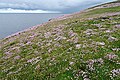 A Carpet of Thrift (Armeria maritima) - geograph.org.uk - 5821949.jpg 640 × 427; 491 KB
-
 A Carpet of Wild Flowers - geograph.org.uk - 5822008.jpg 640 × 427; 405 KB
-
 A Narrow Crack - geograph.org.uk - 5821973.jpg 480 × 640; 460 KB
-
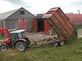
 Baling hay at Birsay.jpg 3 888 × 2 592; 3,09 MB
-
 Bay of Skaill - geograph.org.uk - 1440747.jpg 640 × 412; 44 KB
-
 Bell of Birsay Anderson 1881 Fig 54 scotlandinearlyc00ande 0205.jpg 1 426 × 1 519; 556 KB
-
 Below the Lighthouse - geograph.org.uk - 5821997.jpg 640 × 427; 327 KB
-
 Bere growing in Birsay - geograph.org.uk - 237987.jpg 640 × 425; 155 KB
-
 Birsay - panoramio.jpg 1 936 × 2 592; 1,65 MB
-
 Birsay Bay, Orkney - geograph.org.uk - 4302507.jpg 640 × 360; 57 KB
-
 Birsay Beach - panoramio.jpg 5 760 × 3 840; 21,22 MB
-
 Birsay Coastline - panoramio.jpg 5 760 × 3 840; 20,97 MB
-
 Birsay in summer 2012 (1).JPG 4 752 × 3 168; 4,52 MB
-
 Birsay in summer 2012 (2) (cropped).JPG 4 752 × 2 680; 4,97 MB
-
 Birsay in summer 2012 (2).JPG 4 752 × 3 168; 5,54 MB
-
 Birsay in summer 2012 (3).JPG 4 752 × 3 168; 6,19 MB
-
 Birsay in summer 2012 (4).JPG 4 752 × 3 168; 5,74 MB
-
 Birsay moorland - geograph.org.uk - 515980.jpg 640 × 425; 129 KB
-
 Birsay moorland - geograph.org.uk - 515984.jpg 640 × 425; 148 KB
-

-
 Birsay View of the coast south of the Earl's Palace.jpg 6 000 × 4 000; 13,36 MB
-

-
 Birsay village centre - geograph.org.uk - 954309.jpg 640 × 480; 66 KB
-
 Birsay, a promontory facing north - geograph.org.uk - 2631271.jpg 640 × 480; 77 KB
-
 Birsay, a thin crevice - geograph.org.uk - 2534846.jpg 480 × 640; 96 KB
-
 Birsay, a Westray view - geograph.org.uk - 2587113.jpg 640 × 480; 62 KB
-
 Birsay, causeway to Brough of Birsay - geograph.org.uk - 2534562.jpg 480 × 640; 64 KB
-
 Birsay, cliff face at Brough Head - geograph.org.uk - 2631259.jpg 480 × 640; 93 KB
-
-

-

-
-

-
-

-

-
 Birsay, Viking longhouse - geograph.org.uk - 2631249.jpg 640 × 480; 66 KB
-
 Birsay, Viking settlement - geograph.org.uk - 2631254.jpg 640 × 480; 59 KB
-
 Birsay, walkers on Brough of Birsay - geograph.org.uk - 2534852.jpg 640 × 481; 47 KB
-
 Birsay, within the Viking remains - geograph.org.uk - 2631274.jpg 640 × 480; 67 KB
-
 Bone implements Anderson 1881 Fig 53 scotlandinearlyc00ande 0204.jpg 2 114 × 1 344; 435 KB
-
 Brough Head - geograph.org.uk - 5821960.jpg 640 × 474; 374 KB
-
 Brough of Birsay - geograph.org.uk - 2145056.jpg 3 872 × 2 592; 4,19 MB
-
 Brough of Birsay - geograph.org.uk - 3112613.jpg 1 024 × 768; 297 KB
-
 Brough of Birsay - geograph.org.uk - 3490306.jpg 640 × 424; 111 KB
-
 Brough of Birsay - geograph.org.uk - 3557698.jpg 640 × 394; 246 KB
-
 Brough of Birsay - geograph.org.uk - 5456237.jpg 3 872 × 2 163; 2,12 MB
-
 Brough of Birsay - geograph.org.uk - 5822086.jpg 1 280 × 301; 379 KB
-
 Brough of Birsay Causeway - geograph.org.uk - 4157865.jpg 2 560 × 1 920; 2,28 MB
-
 Brough of Birsay lighthouse, Orkney - geograph.org.uk - 5511874.jpg 800 × 443; 63 KB
-
 Brough of Birsay showing causeway.jpg 3 968 × 2 976; 3,69 MB
-
 Brough of Birsay, view back to Mainland - geograph.org.uk - 3192206.jpg 1 600 × 1 066; 201 KB
-
 Brough of Birsay, view out to sea - geograph.org.uk - 3210836.jpg 1 600 × 1 081; 429 KB
-

-
 Brough Sounds - geograph.org.uk - 3475050.jpg 640 × 424; 75 KB
-
 Brough Sounds - geograph.org.uk - 3490079.jpg 424 × 640; 127 KB
-
 Brough Sounds - geograph.org.uk - 3490104.jpg 640 × 424; 95 KB
-
 Brough Sounds - geograph.org.uk - 3550544.jpg 640 × 427; 356 KB
-
 Brough Sounds - geograph.org.uk - 5398327.jpg 2 560 × 1 920; 977 KB
-
 Brough Sounds, Birsay - geograph.org.uk - 6201228.jpg 1 600 × 1 065; 489 KB
-
 Building on the Brough of Birsay - geograph.org.uk - 5727282.jpg 3 872 × 2 592; 4,75 MB
-
 Causeway over Brough Sounds - geograph.org.uk - 3490129.jpg 424 × 640; 125 KB
-
 Causeway to Brough of Birsay - geograph.org.uk - 3475092.jpg 411 × 640; 96 KB
-
 Causeway to Brough of Birsay - geograph.org.uk - 5398315.jpg 2 560 × 1 920; 775 KB
-
 Cemetery near Birsay in summer 2012.JPG 4 752 × 3 168; 5,26 MB
-
 Church Ruins - geograph.org.uk - 5822059.jpg 640 × 427; 351 KB
-
 Church ruins, Brough of Birsay - geograph.org.uk - 3771190.jpg 1 536 × 864; 469 KB
-
 Clay jar Anderson 1881 Fig 52 scotlandinearlyc00ande 0204.jpg 790 × 1 031; 236 KB
-
 Cleft in the Cliff - geograph.org.uk - 5821967.jpg 467 × 640; 403 KB
-
 Cleft in the Sandstone - geograph.org.uk - 5818362.jpg 640 × 427; 394 KB
-
 Cliffs and Skerries - geograph.org.uk - 5822032.jpg 640 × 427; 361 KB
-
 Cliffs by Brough Head lighthouse - geograph.org.uk - 3771320.jpg 864 × 1 536; 767 KB
-
 Cliffs on Brough of Birsay - geograph.org.uk - 3475079.jpg 640 × 424; 103 KB
-

-

-
 Coasts of the Orkney Island near Birsay in summer 2012 (1).JPG 4 752 × 3 168; 5,65 MB
-
 Coasts of the Orkney Island near Birsay in summer 2012 (2).JPG 4 570 × 2 979; 12,67 MB
-
 Coasts of the Orkney Island near Birsay in summer 2012 (3).JPG 4 752 × 3 168; 5,65 MB
-
 Coasts of the Orkney Island near Birsay in summer 2012 (4).JPG 4 752 × 3 168; 5,87 MB
-
 Coasts of the Orkney Island near Birsay in summer 2012 (5).JPG 4 752 × 3 168; 5,42 MB
-
 Coasts of the Orkney Island near Birsay in summer 2012 (6).JPG 4 752 × 3 168; 5,63 MB
-
 Coasts of the Orkney Island near Birsay in summer 2012 (7).JPG 4 752 × 3 168; 6,59 MB
-
 Coasts of the Orkney Island near Birsay in summer 2012 (8).JPG 4 593 × 2 981; 15,01 MB
-
 Crismo farm, Costa - geograph.org.uk - 513969.jpg 640 × 425; 120 KB
-
 Crossing causeway to Brough of Birsay - geograph.org.uk - 3771105.jpg 1 536 × 864; 487 KB
-
 Cutting silage at Folsetter 3.jpg 2 560 × 1 920; 1,52 MB
-
 Cutting silage at Folsetter 4.jpg 2 560 × 1 920; 1,5 MB
-
 Cutting silage at Folsetter 5.jpg 2 560 × 1 920; 1,61 MB
-

-
 Dumping cut grass at a silo place.jpg 2 560 × 1 920; 1,47 MB
-
 Elders' Corner, Birsay - geograph.org.uk - 516053.jpg 640 × 425; 95 KB
-
 Eroded Dyke - geograph.org.uk - 5818359.jpg 457 × 640; 422 KB
-
 Farmhouse of Newton, Costa - geograph.org.uk - 514431.jpg 640 × 411; 95 KB
-
 Flooded causeway to the Brough of Birsay - geograph.org.uk - 5806684.jpg 1 024 × 574; 139 KB
-
 Fluke Gallery at Lea - geograph.org.uk - 399921.jpg 640 × 440; 163 KB
-
 Foreshore West of Skipi Geo - geograph.org.uk - 488673.jpg 640 × 480; 119 KB
-
 Geo at Whitaloo, Orkney - geograph.org.uk - 85090.jpg 640 × 480; 105 KB
-
 Geo in the Brough of Birsay - geograph.org.uk - 5456190.jpg 3 872 × 2 592; 3,3 MB
-
 Glebeness Skerry at low tide - geograph.org.uk - 513090.jpg 640 × 425; 123 KB
-
 Grass, Brough of Birsay - geograph.org.uk - 2096819.jpg 640 × 428; 132 KB
-
 Grazing at Marwick - geograph.org.uk - 400109.jpg 640 × 373; 108 KB
-
 Gully in the Cliff - geograph.org.uk - 5822025.jpg 461 × 640; 422 KB
-
 Gunner John Victor Bias (6279267493).jpg 511 × 800; 54 KB
-
 High Tide at Brough Sounds - geograph.org.uk - 3475065.jpg 640 × 424; 75 KB
-
 House near Cumlaquoy (geograph 5808264).jpg 1 024 × 561; 149 KB
-
 Hundland Gallery, Birsay - geograph.org.uk - 508620.jpg 640 × 425; 149 KB
-
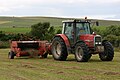
 John Deere 6300 with Trima FEL at Birsay, unloading grass silage.jpg 2 560 × 1 920; 1,44 MB
-
 John Deere 6300 with Trima FEL at Birsay.jpg 2 560 × 1 920; 1,5 MB
-

-
 Just passing by - geograph.org.uk - 3490319.jpg 640 × 446; 67 KB
-
 Knowe of Holland - geograph.org.uk - 399940.jpg 640 × 438; 138 KB
-
 Lesser celandine, Brough of Birsay - geograph.org.uk - 3771364.jpg 1 536 × 864; 646 KB
-

-
 Linkshouse BandB, Birsay - geograph.org.uk - 954293.jpg 640 × 480; 81 KB
-
 Linkshouse BandB, Birsay - geograph.org.uk - 954296.jpg 640 × 480; 71 KB
-
 Loch of Banks, Birsay - geograph.org.uk - 519721.jpg 640 × 425; 168 KB
-
 Loch of Isbister, from the west - geograph.org.uk - 399952.jpg 640 × 439; 140 KB
-
 Lochland Chalets, Birsay - geograph.org.uk - 519718.jpg 640 × 425; 100 KB
-
 Looking to the Brough of Birsay - geograph.org.uk - 5007659.jpg 2 592 × 1 944; 1,28 MB
-
-
 Low Tide at Brough Sounds - geograph.org.uk - 3490150.jpg 640 × 424; 105 KB
-
 Lunch Time - geograph.org.uk - 1423728.jpg 640 × 480; 61 KB
-
 Man's Well - geograph.org.uk - 54215.jpg 640 × 570; 148 KB
-
 Mans Well, Birsay, Orkney - geograph.org.uk - 2525.jpg 432 × 576; 57 KB
-
 Marwick coastline - geograph.org.uk - 510737.jpg 640 × 425; 122 KB
-
 Marwick Head - geograph.org.uk - 488599.jpg 640 × 480; 134 KB
-
 Midhouse farm, Birsay - geograph.org.uk - 513971.jpg 640 × 425; 137 KB
-
 Mill near Birsay in summer 2012 (1).JPG 4 752 × 3 168; 4,07 MB
-
 Mill near Birsay in summer 2012 (2).JPG 4 752 × 3 168; 5,52 MB
-
 Near to Point of Snusan, Birsay - geograph.org.uk - 954973.jpg 640 × 480; 106 KB
-
 North Coast of the Brough of Birsay - geograph.org.uk - 5822003.jpg 640 × 427; 352 KB
-
 Not without getting your feet wet.... - geograph.org.uk - 3487968.jpg 1 440 × 964; 355 KB
-
 Old Red Sandstone - geograph.org.uk - 5822068.jpg 640 × 427; 376 KB
-
 Old Red Sandstone - geograph.org.uk - 5822072.jpg 640 × 427; 383 KB
-
 Orkney, UK - panoramio (10).jpg 2 592 × 1 936; 1,41 MB
-
 Orkney, UK - panoramio (9).jpg 2 592 × 1 936; 1,41 MB
-

-
 Path across Brough Sounds - geograph.org.uk - 3490093.jpg 640 × 424; 88 KB
-
 Path on Brough of Birsay - geograph.org.uk - 3490183.jpg 640 × 424; 102 KB
-
 Path to Skipi Geo - geograph.org.uk - 1446910.jpg 640 × 427; 90 KB
-

-
 Postbox at Birsay - geograph.org.uk - 954342.jpg 480 × 640; 110 KB
-
 Pretty pebble, Brough Sounds - geograph.org.uk - 3771390.jpg 792 × 763; 424 KB
-
 Public toilets at Birsay - geograph.org.uk - 954287.jpg 640 × 480; 76 KB
-
 Remains of buildings - geograph.org.uk - 5398321.jpg 2 560 × 1 920; 3,35 MB
-

-
 River in Birsay in summer 2012.JPG 4 752 × 3 168; 5,73 MB
-
 Road from Marwick Bay - geograph.org.uk - 400105.jpg 640 × 446; 96 KB
-
 Rock Chute - geograph.org.uk - 5822016.jpg 640 × 427; 369 KB
-
 Rock Strata - geograph.org.uk - 5821952.jpg 478 × 640; 341 KB
-
 Rocky Shore by the Point of Buckquoy - geograph.org.uk - 3475073.jpg 424 × 640; 83 KB
-
 Sand Ripples - geograph.org.uk - 5822079.jpg 640 × 427; 354 KB
-
 Sandstone flag foreshore, Brough of Birsay - geograph.org.uk - 3771228.jpg 1 536 × 864; 558 KB
-
 Settlement at the Brough of Birsay - geograph.org.uk - 3490217.jpg 640 × 514; 150 KB
-
 Settlement on Brough of Birsay - geograph.org.uk - 3490248.jpg 640 × 424; 79 KB
-
 Shore of Birsay Bay - geograph.org.uk - 5818347.jpg 640 × 427; 395 KB
-
 Skipi Geo - geograph.org.uk - 2516286.jpg 640 × 434; 75 KB
-
 Soft Sediment Deformation - geograph.org.uk - 5822045.jpg 640 × 480; 388 KB
-

-
 Stane Randa (Stanerandy on OS map) - geograph.org.uk - 236890.jpg 640 × 425; 130 KB
-
 Stane Randa (Stanerandy on OS map) - geograph.org.uk - 236897.jpg 640 × 425; 144 KB
-
 Stone Towers - geograph.org.uk - 5818350.jpg 640 × 427; 401 KB
-
 Synsedimentary Deformation - geograph.org.uk - 5822047.jpg 640 × 480; 467 KB
-
 Telephone box at Birsay - geograph.org.uk - 954270.jpg 640 × 480; 81 KB
-
 Telephone box in Birsay in summer 2012.JPG 4 752 × 3 168; 4,75 MB
-
 The Hundland road, Birsay - geograph.org.uk - 513096.jpg 640 × 425; 108 KB
-
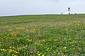
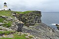
 The Lighthouse on Brough of Birsay - geograph.org.uk - 5456205.jpg 3 872 × 2 145; 2,35 MB
-
 The old house of Durkadale, Birsay - geograph.org.uk - 519739.jpg 640 × 425; 129 KB
-
 The ruins of Hass, Birsay - geograph.org.uk - 519735.jpg 640 × 425; 133 KB
-
 The Whale Head close to Skipi Geo - geograph.org.uk - 5456243.jpg 3 872 × 2 592; 4,13 MB
-

-
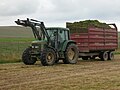
 Valtra 8950 moving and compacting grass silage.jpg 2 560 × 1 920; 1,44 MB
-
 Valtra 8950 moving grass silage 2.jpg 2 560 × 1 920; 1,21 MB
-
 Valtra 8950 moving grass silage.jpg 2 560 × 1 920; 1,38 MB
-
 Valtra tractor.jpg 2 560 × 1 920; 1,36 MB
-
 View from Brough of Birsay - geograph.org.uk - 3490287.jpg 640 × 424; 138 KB
-
 View SE from the Brough of Birsay - geograph.org.uk - 3006419.jpg 900 × 675; 91 KB
-
 View towards Birsay - geograph.org.uk - 1446891.jpg 640 × 428; 93 KB
-
 Viking Settlement - geograph.org.uk - 5822051.jpg 640 × 427; 324 KB
-
 Westside, Birsay - geograph.org.uk - 516047.jpg 640 × 425; 106 KB
-
 Whalebone by Skipi Geo - geograph.org.uk - 488703.jpg 640 × 480; 128 KB
-
 Whalebone from North - geograph.org.uk - 514435.jpg 640 × 425; 144 KB
-

-
 Wooden house at Birsay - geograph.org.uk - 954224.jpg 640 × 480; 51 KB
-
 Yellowbird Gallery - geograph.org.uk - 399914.jpg 640 × 447; 132 KB
-
 Atlantic coastline, Birsay - geograph.org.uk - 510750.jpg 640 × 425; 139 KB
-
 Bay of Skaill - geograph.org.uk - 1446875.jpg 640 × 428; 61 KB
-
 Bay of Skaill and Skara Brae - geograph.org.uk - 504506.jpg 640 × 480; 77 KB
-
 Bay of Skaill, Mainland Orkney - geograph.org.uk - 1457917.jpg 640 × 480; 48 KB
-
 Choin - geograph.org.uk - 488587.jpg 640 × 480; 115 KB
-
 Coast Protection at Skara Brae - geograph.org.uk - 680520.jpg 640 × 427; 80 KB
-
 Derelict Building at Skaill Bay - geograph.org.uk - 680532.jpg 640 × 480; 69 KB
-

-
 Fishermen's Huts at Sand Geo, Marwick - geograph.org.uk - 510760.jpg 640 × 425; 143 KB
-
 Geo near Outshore Point, Marwick, Birsay - geograph.org.uk - 511091.jpg 640 × 425; 141 KB
-
 Glebeness Skerry at high tide - geograph.org.uk - 513091.jpg 640 × 425; 105 KB
-
 Green fields of Birsay - geograph.org.uk - 529370.jpg 640 × 322; 38 KB
-
 House of Glower, Birsay - geograph.org.uk - 510739.jpg 640 × 425; 126 KB
-
 Hundasaetter - geograph.org.uk - 516031.jpg 640 × 425; 144 KB
-
 Langa Ness - geograph.org.uk - 513979.jpg 640 × 425; 138 KB
_-_geograph.org.uk_-_5821949.jpg)


.JPG)
_(cropped).JPG)
.JPG)
.JPG)
.JPG)


.JPG)
.JPG)
.JPG)
.JPG)
.JPG)
.JPG)
.JPG)
.JPG)


.jpg)

.jpg)


.JPG)
.JPG)


.jpg)
.jpg)


_-_geograph.org.uk_-_236890.jpg)
_-_geograph.org.uk_-_236897.jpg)


,_Brough_of_Birsay_-_geograph.org.uk_-_3771196.jpg)


