Category:Bischdorf/Wótšowc
Jump to navigation
Jump to search

human settlement in Germany  | |||||
| Upload media | |||||
| Instance of |
| ||||
|---|---|---|---|---|---|
| Part of |
| ||||
| Location | Lübbenau, Oberspreewald-Lausitz District, Brandenburg, Germany | ||||
| Area |
| ||||
| Elevation above sea level |
| ||||
 | |||||
Subcategories
This category has the following 2 subcategories, out of 2 total.
B
- Bahnhof Bischdorf (3 F)
D
Media in category "Bischdorf/Wótšowc"
The following 3 files are in this category, out of 3 total.
-
 Bischdorf Urmesstischblätter 4149 + 4249-1846.png 800 × 580; 1.14 MB
-
 BISCHDORFKROBERSPREEW nieder.svg 512 × 427; 21 KB
-
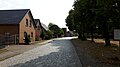 Dorfstraße Bischdorf, Lübbenau.jpg 4,608 × 2,592; 5.02 MB


