Category:Bishops Cannings
Jump to navigation
Jump to search
village and civil parish in Wiltshire, UK  | |||||
| Upload media | |||||
| Instance of | |||||
|---|---|---|---|---|---|
| Location | Wiltshire, South West England, England | ||||
 | |||||
English: Bishops Cannings is a village and civil parish in the Vale of Pewsey in the English county of Wiltshire. The parish is the third largest in Wiltshire, and includes the settlements of Coate, Horton, Bourton and Easton in addition to Bishops Cannings itself. In the Census 2001 the parish had a population of 1,566.
Nederlands: Bishops Cannings is een civil parish in de unitary authority Wiltshire, in het Engelse graafschap Wiltshire. De civil parish telt
Subcategories
This category has the following 5 subcategories, out of 5 total.
Media in category "Bishops Cannings"
The following 200 files are in this category, out of 783 total.
(previous page) (next page)-

-
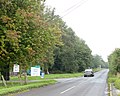
 2010 , A361 heading for Devizes - geograph.org.uk - 2080342.jpg 1,600 × 970; 253 KB
-
 2010 , A361 passing The Firs farm - geograph.org.uk - 2080327.jpg 800 × 434; 73 KB
-
 2010 , Baled straw and The Firs Farm - geograph.org.uk - 2059298.jpg 800 × 560; 157 KB
-
 2010 , Horton Road - geograph.org.uk - 2076099.jpg 800 × 503; 99 KB
-
 2010 , Horton Road heading west - geograph.org.uk - 2078690.jpg 800 × 643; 176 KB
-
 2010 , Rough field off Horton Road - geograph.org.uk - 2076051.jpg 800 × 533; 93 KB
-

-
 2011 , Chandlers Lane and Bishops Cannings - geograph.org.uk - 2707490.jpg 4,188 × 2,804; 3.66 MB
-
 2011 , Horton Road looking east to Horton Bridge - geograph.org.uk - 2678980.jpg 4,171 × 2,746; 4.5 MB
-
 2011 , Horton Road looking west - geograph.org.uk - 2707467.jpg 3,498 × 2,677; 4.13 MB
-
 2011 , Layby on the road out of Horton to the east - geograph.org.uk - 2707605.jpg 3,425 × 2,757; 4.31 MB
-
 2011 , Oilseed rape south of Horton Road - geograph.org.uk - 2707481.jpg 4,705 × 2,109; 5.24 MB
-
 2011 , War of the worlds, Martians have invaded - geograph.org.uk - 2707476.jpg 4,375 × 2,581; 2.9 MB
-
 2012 , A361 heading north east - geograph.org.uk - 2943342.jpg 4,654 × 2,194; 4.26 MB
-
 2012 , A361 two miles out of Devizes - geograph.org.uk - 2943289.jpg 4,605 × 2,599; 4.01 MB
-
 2012 , Across the A361 to a small wood on Roundway Hill - geograph.org.uk - 2943281.jpg 4,745 × 2,603; 4.68 MB
-
 2012 , Easton Farm Cottage, near Bishops Cannings - geograph.org.uk - 2944631.jpg 4,212 × 2,526; 3.79 MB
-
 2012 , Easton Farm, near Bishops Cannings - geograph.org.uk - 2944660.jpg 4,000 × 2,566; 5.19 MB
-
 2012 , Electricity pylons bestriding the Vale of Pewsey - geograph.org.uk - 2949430.jpg 2,353 × 3,142; 2.57 MB
-
 2012 , Lane into Easton Farm - geograph.org.uk - 2944676.jpg 3,588 × 2,740; 4.67 MB
-
 2012 , Lane to Bourton and Bishops Cannings - geograph.org.uk - 2945031.jpg 4,000 × 2,195; 3.6 MB
-
 2012 , Minor road heading to Little Horton - geograph.org.uk - 2949419.jpg 4,037 × 2,663; 3.95 MB
-
 2012 , Minor road to Coate - one mile - geograph.org.uk - 2950543.jpg 4,180 × 2,747; 5.94 MB
-
 2012 , North east near the A361 - geograph.org.uk - 2943326.jpg 4,752 × 2,796; 4.92 MB
-
 2012 , North near Easton Farm - geograph.org.uk - 2943387.jpg 3,757 × 2,564; 4.24 MB
-
 2012 , North west from the bottom of Roughridge Hill - geograph.org.uk - 2947925.jpg 4,000 × 2,148; 3.03 MB
-
 2012 , North west on a byway north of Bourton - geograph.org.uk - 2949330.jpg 3,809 × 2,635; 3.49 MB
-
 2012 , Pylons line up near Coate - geograph.org.uk - 2949460.jpg 4,290 × 2,831; 4.59 MB
-
 2012 , South from a viewpoint near Smallgrain Plantation - geograph.org.uk - 2876727.jpg 4,205 × 2,131; 3.12 MB
-
 2012 , Strip Lynchetts on Roughridge Hill - geograph.org.uk - 2949345.jpg 4,713 × 2,791; 5.83 MB
-
 2012 , Track leading away from Bourton - geograph.org.uk - 2945095.jpg 3,406 × 2,207; 3.29 MB
-
 2012 , View east near Bishops Cannings - geograph.org.uk - 2945055.jpg 4,000 × 2,338; 3.45 MB
-
 2012 , West End passing West End Farm - geograph.org.uk - 2943310.jpg 3,991 × 2,623; 4.8 MB
-
 A Barrow on North Down - geograph.org.uk - 1845800.jpg 1,500 × 1,000; 139 KB
-
 A circular walk around Horton and Bourton (24) (geograph 6545786).jpg 4,171 × 3,129; 3.5 MB
-
 A circular walk around Horton and Bourtons (geograph 6545801).jpg 4,320 × 3,240; 3.34 MB
-
 A circular walk around Horton and Bourtons (geograph 6548973).jpg 4,173 × 3,129; 4.39 MB
-

-

-
 A track crosses the dyke - geograph.org.uk - 5244552.jpg 4,320 × 3,240; 4.97 MB
-
-
 A view of Devizes (1) - geograph.org.uk - 4262690.jpg 640 × 480; 154 KB
-
 A view of Devizes (2) - geograph.org.uk - 4262717.jpg 640 × 480; 186 KB
-
 A361 approaches junction with West End - geograph.org.uk - 4100568.jpg 3,418 × 2,291; 798 KB
-
 A361 descending to West End, Bishops Cannings - geograph.org.uk - 5445179.jpg 1,600 × 726; 442 KB
-
 A361 on North Down - geograph.org.uk - 5445146.jpg 1,600 × 800; 470 KB
-
 A361 passes Shepherd's Shore - geograph.org.uk - 4100593.jpg 3,868 × 2,267; 1.08 MB
-
 A361 road junction - geograph.org.uk - 4582066.jpg 640 × 480; 52 KB
-
 A361 south-west of Shepherd's Shore - geograph.org.uk - 5445171.jpg 1,600 × 727; 489 KB
-
 A361 southbound - geograph.org.uk - 4582070.jpg 640 × 480; 49 KB
-
 A361 southwest of Shepherd's Shore - geograph.org.uk - 4100586.jpg 4,000 × 2,447; 1.6 MB
-
 A361, heading to Avebury - geograph.org.uk - 4259984.jpg 800 × 408; 134 KB
-
 Access track - geograph.org.uk - 5244578.jpg 4,320 × 3,240; 4.16 MB
-
 Across the 180 metre contour - geograph.org.uk - 2951160.jpg 3,648 × 2,736; 1.17 MB
-
 Across the crop (1) - geograph.org.uk - 5247131.jpg 4,320 × 3,240; 3.47 MB
-
 Across the crop (2) - geograph.org.uk - 5247132.jpg 4,320 × 3,240; 3.92 MB
-
 Across the field - geograph.org.uk - 5058164.jpg 4,320 × 3,240; 3.02 MB
-
 Across the field - geograph.org.uk - 5805646.jpg 4,219 × 3,164; 2.73 MB
-
 Advance warning of dual carriageway on A361 - geograph.org.uk - 5445189.jpg 1,600 × 1,200; 763 KB
-

-
 Along the field edge - geograph.org.uk - 5805731.jpg 4,320 × 3,240; 2.97 MB
-
 Alongside the dyke (1) - geograph.org.uk - 5244587.jpg 4,320 × 3,240; 2.78 MB
-
 Alongside the dyke (2) - geograph.org.uk - 5244591.jpg 4,320 × 3,240; 3.69 MB
-
 Anglers fishing on the Kennet ^ Avon canal - geograph.org.uk - 3703253.jpg 1,024 × 768; 148 KB
-
 Anti tank obstacles - geograph.org.uk - 5802575.jpg 4,320 × 3,240; 3.98 MB
-
 Approaching a byway crossing - geograph.org.uk - 5680750.jpg 3,639 × 2,354; 2.41 MB
-
 Approaching Avebury - geograph.org.uk - 3906036.jpg 1,024 × 768; 168 KB
-

-
 Arable land near Baltic Farm - geograph.org.uk - 3100982.jpg 3,648 × 2,736; 3.51 MB
-
 Ascending Roundway Hill - geograph.org.uk - 5802640.jpg 4,320 × 3,240; 2.82 MB
-
 Ascending Stone Pit Hill - geograph.org.uk - 5803721.jpg 4,320 × 3,240; 3.98 MB
-
 Back to back - geograph.org.uk - 5247126.jpg 4,320 × 3,240; 4.52 MB
-
 Baltic Farm (1) - geograph.org.uk - 5244286.jpg 4,320 × 3,240; 2.76 MB
-
 Baltic Farm (2) - geograph.org.uk - 5244544.jpg 4,320 × 3,240; 2.71 MB
-
 Baltic Farm - geograph.org.uk - 4587916.jpg 640 × 480; 67 KB
-
 Baltic Farm - geograph.org.uk - 6199802.jpg 1,024 × 678; 737 KB
-
 Baltic Farm, Bishop's Cannings Down - geograph.org.uk - 5445163.jpg 1,600 × 1,067; 690 KB
-
 Barley field - geograph.org.uk - 6202618.jpg 1,024 × 678; 787 KB
-
 Barley, Easton Down - geograph.org.uk - 4837901.jpg 1,600 × 1,200; 444 KB
-
 Barn and Downs - geograph.org.uk - 4265066.jpg 640 × 480; 167 KB
-
 Barn in Bourton - geograph.org.uk - 5805602.jpg 4,320 × 3,240; 2.16 MB
-
 Barn, village and down - geograph.org.uk - 4265082.jpg 640 × 480; 174 KB
-
 Barrow in the trees (1) - geograph.org.uk - 5242482.jpg 4,320 × 3,240; 3.6 MB
-
 Barrow in the trees (2) - geograph.org.uk - 5242499.jpg 4,320 × 3,240; 4.11 MB
-
 Barrow mound - geograph.org.uk - 5244570.jpg 4,320 × 3,240; 3.64 MB
-
 Barrow on North Down - geograph.org.uk - 1845795.jpg 1,500 × 1,000; 152 KB
-
 Barrows on North Down - geograph.org.uk - 1845829.jpg 1,500 × 1,000; 110 KB
-
 Barrows On North Down - geograph.org.uk - 1916054.jpg 640 × 386; 51 KB
-
 Battle of Roundway Down - geograph.org.uk - 4257137.jpg 640 × 480; 168 KB
-
 Bell Barrow on Easton Down - geograph.org.uk - 5247124.jpg 4,320 × 3,240; 3.33 MB
-
 Bench Mark, Spaniel's Bridge - geograph.org.uk - 2457869.jpg 480 × 640; 87 KB
-
 Bend in the track - geograph.org.uk - 5058933.jpg 4,320 × 3,240; 4.85 MB
-
 Big field - geograph.org.uk - 5064116.jpg 4,320 × 3,240; 3.61 MB
-
 Big House Bishops Cannings - geograph.org.uk - 3344065.jpg 4,528 × 3,163; 1.66 MB
-

-
 Bishops Cannings houses (1) - geograph.org.uk - 5806263.jpg 4,320 × 3,240; 2.43 MB
-
 Bishops Cannings houses (2) - geograph.org.uk - 5806264.jpg 4,320 × 3,240; 2.99 MB
-
 Bishops Cannings houses (3) - geograph.org.uk - 5806266.jpg 4,320 × 3,240; 2.67 MB
-
 Bishops Cannings houses (4) (geograph 5806267).jpg 4,320 × 3,240; 3.37 MB
-
 Bishops Cannings houses (5) - geograph.org.uk - 5806270.jpg 4,320 × 3,240; 3.21 MB
-
 Bishops Cannings housess (geograph 5806294).jpg 4,320 × 3,240; 3.77 MB
-
-
 Bishops Cannings, Chandlers Lane - geograph.org.uk - 1406742.jpg 640 × 480; 82 KB
-
 Bishops Cannings, The Crown Inn - geograph.org.uk - 1406871.jpg 640 × 480; 74 KB
-
 Bishops Cannings, UK - panoramio - IIya Kuzhekin.jpg 4,000 × 2,250; 2.52 MB
-
 Bishops Cannings, UK - panoramio.jpg 4,000 × 2,250; 2.07 MB
-
 Black Pudding Harvest ^ - geograph.org.uk - 1946881.jpg 1,924 × 1,371; 747 KB
-
 Blackwell Farmhouse (geograph 5806301).jpg 4,158 × 3,118; 2.42 MB
-
 Blackwells Farm, Bishops Canning - geograph.org.uk - 1106742.jpg 640 × 480; 110 KB
-
 Boat heading west on the Kennet ^ Avon Canal - geograph.org.uk - 4494060.jpg 1,024 × 768; 148 KB
-

-
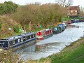
 Boats moored by Devizes Marina - geograph.org.uk - 2609600.jpg 1,280 × 856; 203 KB
-
 Bourton Green Cottages (geograph 5805799).jpg 4,320 × 3,240; 3.77 MB
-
 Bourton Manor Farm - geograph.org.uk - 5805794.jpg 4,177 × 3,131; 1.66 MB
-
 Bourton Manor Farmhouse - geograph.org.uk - 5805793.jpg 4,320 × 3,240; 3.11 MB
-
 Bourton Near Bishops Cannings - geograph.org.uk - 3343961.jpg 4,775 × 3,581; 1.57 MB
-
 Bridge Inn, Horton Bridge - geograph.org.uk - 2608558.jpg 1,280 × 869; 241 KB
-
 Bridleway meet the road - geograph.org.uk - 5804260.jpg 4,320 × 3,240; 2.93 MB
-
 Buildings at Harepath Farm - geograph.org.uk - 4930544.jpg 640 × 427; 65 KB
-
 Buildings on Wansdyke - geograph.org.uk - 6198575.jpg 1,024 × 678; 872 KB
-
 Bus stop serving Beckhampton Buildings by A361 - geograph.org.uk - 5445137.jpg 1,600 × 1,066; 601 KB
-
 Bystone Lane, Coate - geograph.org.uk - 4589217.jpg 640 × 480; 114 KB
-
 Byway and trees - geograph.org.uk - 5243458.jpg 4,320 × 3,240; 3.83 MB
-
 Byway at the base of Morgan's Hill - geograph.org.uk - 2712430.jpg 1,920 × 1,280; 1.48 MB
-
 Byway crossing - geograph.org.uk - 5680700.jpg 3,776 × 2,520; 2.89 MB
-
 Byway heading to Coate - geograph.org.uk - 5652047.jpg 640 × 480; 54 KB
-
 Byway junction (1) - geograph.org.uk - 5243449.jpg 4,320 × 3,240; 3.74 MB
-
 Byway junction (2) - geograph.org.uk - 5243450.jpg 4,320 × 3,240; 4.46 MB
-
 Byway junction (3) - geograph.org.uk - 5243451.jpg 4,320 × 3,240; 4.18 MB
-
 Byway meets track - geograph.org.uk - 5804410.jpg 4,320 × 3,240; 3.32 MB
-
 Byway near Bishops Cannings - geograph.org.uk - 2223424.jpg 640 × 480; 76 KB
-
 Byway on North Down - geograph.org.uk - 3100061.jpg 3,648 × 2,736; 3.21 MB
-
 Byway to Coate - geograph.org.uk - 5652076.jpg 640 × 480; 138 KB
-
 Byway with pot holes - geograph.org.uk - 4257141.jpg 640 × 480; 154 KB
-
 Calstone Down - geograph.org.uk - 3099025.jpg 3,536 × 2,632; 2.6 MB
-
 Cannings Hill Garage, Northfields - geograph.org.uk - 5772959.jpg 2,014 × 1,490; 1.22 MB
-
 Canoeing, Kennet and Avon Canal - geograph.org.uk - 2458371.jpg 640 × 480; 96 KB
-
 Canoeing, Kennet and Avon Canal - geograph.org.uk - 2458379.jpg 640 × 480; 89 KB
-

-
 Canoeists outside Devizes Marina - geograph.org.uk - 3702886.jpg 1,024 × 768; 132 KB
-
 Captain Custard - geograph.org.uk - 2609619.jpg 1,280 × 856; 213 KB
-
 Caravan site - geograph.org.uk - 5058149.jpg 4,223 × 3,167; 2.57 MB
-
 Cattle in the field - geograph.org.uk - 5058917.jpg 4,159 × 3,119; 2.39 MB
-
 Cattle on the move - geograph.org.uk - 4262694.jpg 640 × 480; 177 KB
-
 Chained up - geograph.org.uk - 5803715.jpg 4,320 × 3,240; 3.96 MB
-
 Chandler's Lane heads down to Bishops Cannings - geograph.org.uk - 2951644.jpg 3,648 × 2,736; 1.63 MB
-
 Cherhill Monument - geograph.org.uk - 5243455.jpg 4,320 × 3,240; 2.75 MB
-
 Closed for good^ - geograph.org.uk - 4262897.jpg 539 × 465; 157 KB
-
 Coate - Anti-Tank Blocks - geograph.org.uk - 2832526.jpg 800 × 600; 137 KB
-
 Coate - KennetAnd Avon Canal - geograph.org.uk - 2832539.jpg 800 × 600; 163 KB
-
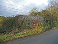 Coate - Pillbox - geograph.org.uk - 2832482.jpg 800 × 600; 217 KB
-
 Coate Lane - geograph.org.uk - 4589549.jpg 640 × 480; 56 KB
-
 Coate village - geograph.org.uk - 4262679.jpg 640 × 480; 198 KB
-
 Colt and mother - geograph.org.uk - 4265068.jpg 640 × 480; 185 KB
-
 Communications hub, Coate - geograph.org.uk - 4589221.jpg 640 × 472; 92 KB
-
 Copse at Furze Knoll - geograph.org.uk - 2712417.jpg 1,280 × 1,920; 1.59 MB
-
 Cottage near Horton Chain Bridge, Wiltshire - geograph-3361157.jpg 4,864 × 3,648; 4.13 MB
-
 Countryside near Bourton - geograph.org.uk - 1916048.jpg 640 × 434; 54 KB
-
 Crown Inn, Bishops Cannings - geograph.org.uk - 4587858.jpg 640 × 480; 98 KB
-
 Cyclists, Morgan's Hill - geograph.org.uk - 1345713.jpg 640 × 352; 73 KB
-
 Devizes houses (61) - geograph.org.uk - 5802598.jpg 4,320 × 3,240; 3.63 MB
-
 Devizes houses (62) - geograph.org.uk - 5802596.jpg 4,320 × 3,240; 3.16 MB
-
 Devizes Marina - geograph.org.uk - 3702878.jpg 1,024 × 615; 93 KB
-
 Devizes Road, Bishop's Cannings - geograph.org.uk - 5087844.jpg 2,014 × 1,490; 850 KB
-
 Devizes Road, Bishop's Cannings - geograph.org.uk - 5107846.jpg 2,048 × 1,536; 1.08 MB
-
 Devizes ways (26) - geograph.org.uk - 4245780.jpg 640 × 480; 166 KB
-
 Disused farm building - geograph.org.uk - 6130143.jpg 1,024 × 768; 201 KB
-
 Disused Pump, Harepath Farm - geograph.org.uk - 3935165.jpg 1,600 × 1,200; 577 KB
-
 Double stile - geograph.org.uk - 5058950.jpg 3,115 × 4,153; 4.09 MB
-
 Down and up on the downs - geograph.org.uk - 5247125.jpg 4,320 × 3,240; 3.42 MB
-
 Downland by Three Barrows - geograph.org.uk - 3924007.jpg 1,024 × 774; 187 KB
-
 Downland view (1) - geograph.org.uk - 3050747.jpg 4,320 × 3,240; 4.68 MB
-
 Downland view (1) - geograph.org.uk - 5242532.jpg 4,320 × 3,240; 3.27 MB
-
 Downland view (1) - geograph.org.uk - 5247128.jpg 3,437 × 2,577; 1.88 MB
-
 Downland view (2) - geograph.org.uk - 3050758.jpg 4,320 × 3,240; 4.69 MB
-
 Downland view (2) - geograph.org.uk - 5242550.jpg 4,023 × 3,017; 2.01 MB
-
 Downland view (2) - geograph.org.uk - 5247129.jpg 4,320 × 3,240; 3.54 MB
-
 Downland view (3) - geograph.org.uk - 5242622.jpg 4,320 × 3,240; 3.3 MB
-
 Downland view (4) - geograph.org.uk - 5243461.jpg 4,320 × 3,240; 4.74 MB
-
 Downland, Bishops Cannings - geograph.org.uk - 928955.jpg 640 × 480; 144 KB
-
 Downland, Bishops Cannings - geograph.org.uk - 928961.jpg 640 × 427; 100 KB
-
 Downland, Bishops Cannings - geograph.org.uk - 928966.jpg 640 × 480; 134 KB
-
 Downland, Bishops Cannings - geograph.org.uk - 928970.jpg 640 × 480; 127 KB
-
 Downland, Bishops Cannings - geograph.org.uk - 928972.jpg 640 × 480; 126 KB
-
 Downland, Bishops Cannings - geograph.org.uk - 928977.jpg 640 × 480; 120 KB
-
 Downland, Bishops Cannings - geograph.org.uk - 928981.jpg 640 × 480; 121 KB
-
 Downland, Bishops Cannings - geograph.org.uk - 928982.jpg 640 × 480; 124 KB
-
 Downland, Bishops Cannings - geograph.org.uk - 928984.jpg 640 × 480; 119 KB
-
 Drive to Easton Farm - geograph.org.uk - 5805616.jpg 4,061 × 3,045; 2.93 MB
-
 Drive, path ^ bicycles - geograph.org.uk - 5806265.jpg 4,320 × 3,240; 2.67 MB
-
 Easton Down - geograph.org.uk - 6198576.jpg 1,024 × 678; 803 KB
-
 Easton Down - geograph.org.uk - 6198582.jpg 1,024 × 678; 755 KB
-
 Easton Down - geograph.org.uk - 6198583.jpg 1,024 × 678; 906 KB
-
 Easton Farm Cottages - geograph.org.uk - 5805648.jpg 4,320 × 3,240; 2.46 MB
-
 Easton Farmhouse - geograph.org.uk - 5805721.jpg 4,320 × 3,240; 2.31 MB
-
 Engineering works - geograph.org.uk - 4261809.jpg 640 × 480; 164 KB
-
 Entrance to Bishops Cannings - geograph.org.uk - 4582283.jpg 640 × 480; 116 KB
-
 Entrance to Coate - geograph.org.uk - 4589192.jpg 640 × 456; 80 KB
-
 Entrance to Horton - geograph.org.uk - 4582299.jpg 640 × 475; 48 KB


_(geograph_6545786).jpg)
.jpg)
.jpg)


_-_geograph.org.uk_-_4262690.jpg)
_-_geograph.org.uk_-_4262717.jpg)


_-_geograph.org.uk_-_5247131.jpg)
_-_geograph.org.uk_-_5247132.jpg)


_-_geograph.org.uk_-_5244587.jpg)
_-_geograph.org.uk_-_5244591.jpg)


_from_the_north_-_geograph.org.uk_-_4494614.jpg)


_-_geograph.org.uk_-_5244286.jpg)
_-_geograph.org.uk_-_5244544.jpg)


_-_geograph.org.uk_-_5242482.jpg)
_-_geograph.org.uk_-_5242499.jpg)


_-_geograph.org.uk_-_5806263.jpg)
_-_geograph.org.uk_-_5806264.jpg)
_-_geograph.org.uk_-_5806266.jpg)
_(geograph_5806267).jpg)
_-_geograph.org.uk_-_5806270.jpg)
.jpg)


.jpg)


.jpg)


_-_geograph.org.uk_-_5243449.jpg)
_-_geograph.org.uk_-_5243450.jpg)
_-_geograph.org.uk_-_5243451.jpg)


_-_geograph.org.uk_-_5802598.jpg)
_-_geograph.org.uk_-_5802596.jpg)


_-_geograph.org.uk_-_4245780.jpg)


_-_geograph.org.uk_-_3050747.jpg)
_-_geograph.org.uk_-_5242532.jpg)
_-_geograph.org.uk_-_5247128.jpg)
_-_geograph.org.uk_-_3050758.jpg)
_-_geograph.org.uk_-_5242550.jpg)
_-_geograph.org.uk_-_5247129.jpg)
_-_geograph.org.uk_-_5242622.jpg)
_-_geograph.org.uk_-_5243461.jpg)


