Category:Bo'ness
Jump to navigation
Jump to search
town in the Falkirk council area of Scotland, UK  | |||||
| Upload media | |||||
| Instance of |
| ||||
|---|---|---|---|---|---|
| Location |
| ||||
| Located in or next to body of water | |||||
| Population |
| ||||
| Area |
| ||||
| official website | |||||
 | |||||
English: Boness, properly Borrowstounness, is a town in the Falkirk of Scotland, lying on a hillside on the south bank of the Firth of Forth. Prior to 1975 the town was in the county of West Lothian. Formerly a centre of heavy industry and coal mining, and a major port, the town is now primarily a commuter town.
Gàidhlig: 'S e baile ann an Alba meadhonach a tha ann an Ceann Fhàil (Seann Bheurla: "Kinneil"; Beurla "Bo'ness/Borrowstounness"). Tha e faisg air Inbhir Ghrainnse.
Italiano: Bo'ness, o più propriamente Borrowstounness (Ceann Fhail in gaelico scozzese), è una città scozzese della contea del Falkirk, situata sulla costa orientale dello stato.
Simple English: Bo'ness (short for Borrowstouness) is a town in the Falkirk council area of Scotland, UK. Bo'ness is well-known for its iron.
Subcategories
This category has the following 20 subcategories, out of 20 total.
B
- Bo'ness Academy (4 F)
- Bo'ness Baptist church (3 F)
- Bo'ness Co-operative Society (6 F)
- Bo'ness Custom House (4 F)
- Bo'ness harbour (11 F)
- Bo'ness Hippodrome (12 F)
- Bo'ness library (2 F)
- Bo'ness Motor Museum (1 F)
- Bo'ness Town Hall (11 F)
C
D
- Dymock's Building (3 F)
F
- Former Hebron Hall, Bo'ness (1 F)
M
T
- Tesco Metro, Bo'ness (3 F)
- The Bridgeness Slab (8 F)
W
- Woodlands care home, Bo'ness (2 F)
Media in category "Bo'ness"
The following 171 files are in this category, out of 171 total.
-
 'Easter Egg Special' steam train - geograph.org.uk - 3938901.jpg 3,378 × 1,900; 5.15 MB
-
 191 Corbiehall , St Mary's Building, Bo'ness - front entrance detail.jpg 2,268 × 4,032; 3.45 MB
-
 191 Corbiehall , St Mary's Building, Bo'ness - landscape.jpg 4,032 × 2,268; 4.13 MB
-
 191 Corbiehall , St Mary's Building, Bo'ness - window detail.jpg 2,268 × 4,032; 3.84 MB
-
 191 Corbiehall , St Mary's Building, Bo'ness.jpg 2,268 × 4,032; 3.19 MB
-
 1920s style cottages - geograph.org.uk - 541697.jpg 640 × 323; 47 KB
-
 193 Corbiehall , St Mary's Building, Bo'ness.jpg 2,268 × 4,032; 3.04 MB
-
 1930s building - geograph.org.uk - 530394.jpg 640 × 469; 70 KB
-
 195 Corbiehall, St Mary's Building, Bo'Ness.jpg 2,268 × 4,032; 3.25 MB
-
 197 Corbiehall, St Mary's Building, Bo'ness.jpg 2,268 × 4,032; 3.25 MB
-
 197 Corbiehall, St Mary's Building, Bo'Ness.jpg 4,032 × 2,268; 3.68 MB
-
 199 Corbiehall, St Mary's Building, Bo'Ness.jpg 2,268 × 4,032; 3.26 MB
-
 A muddy grave - geograph.org.uk - 82330.jpg 480 × 640; 100 KB
-
 Arranging the coals (27025583086).jpg 4,928 × 3,264; 674 KB
-
 Bandstand at town Hall - geograph.org.uk - 550423.jpg 640 × 480; 74 KB
-
 Barony Theatre - geograph.org.uk - 546302.jpg 640 × 480; 63 KB
-
 Beach, Grangepans - geograph.org.uk - 2745400.jpg 640 × 480; 310 KB
-
 Beam Engine housing - geograph.org.uk - 530816.jpg 640 × 480; 97 KB
-
 Bo'Ness (51369943226).jpg 5,689 × 3,917; 4.56 MB
-
 Bo'ness banner 'Easter Egg Special' steam train.jpg 3,374 × 482; 1.77 MB
-
 Bo'ness banner Town Hall.jpg 4,032 × 576; 768 KB
-
 Bo'ness Harbour - geograph.org.uk - 2011345.jpg 640 × 480; 69 KB
-
 Bo'ness Harbour - geograph.org.uk - 2011352.jpg 640 × 480; 80 KB
-
 Bo'ness Harbour - geograph.org.uk - 2497209.jpg 640 × 427; 66 KB
-
 Bo'ness Harbour - geograph.org.uk - 2849040.jpg 3,264 × 2,448; 4.1 MB
-
 Bo'ness Harbour at low tide - geograph.org.uk - 2849057.jpg 3,264 × 2,448; 3.62 MB
-
 Bo'ness harbour entrance - geograph.org.uk - 2011334.jpg 640 × 467; 68 KB
-
 Bo'ness Harbour entrance - geograph.org.uk - 2745403.jpg 640 × 480; 224 KB
-
 Bo'ness Health Centre - geograph.org.uk - 533077.jpg 640 × 480; 87 KB
-
 Bo'ness Hospital.jpg 675 × 420; 154 KB
-
 Bo'ness Public Primary School - geograph.org.uk - 551309.jpg 640 × 347; 56 KB
-
 Bo'ness pubs - geograph.org.uk - 903471.jpg 640 × 415; 88 KB
-
 Bo'ness Roundabout - geograph.org.uk - 423547.jpg 640 × 480; 76 KB
-
 Bo'ness Safety Group Premises - geograph.org.uk - 552436.jpg 640 × 373; 38 KB
-
 Bo'ness sculptures - geograph.org.uk - 82879.jpg 640 × 480; 74 KB
-
 Bo'ness Town Centre, North Street.jpg 3,024 × 4,032; 3.16 MB
-
 Bo'ness Town centre.jpg 3,024 × 4,032; 3.84 MB
-
 Bo'ness Town Hall.jpg 4,032 × 3,024; 3.71 MB
-
 Bo'ness, view over town - geograph.org.uk - 448349.jpg 640 × 430; 96 KB
-
 Bo'ness.jpg 1,024 × 768; 341 KB
-
 Bo-ness Iron.jpg 768 × 1,024; 685 KB
-

-
 Boness harbour entrance. - panoramio.jpg 2,048 × 1,536; 867 KB
-
 Boness harbour with tide out. - panoramio.jpg 3,008 × 2,000; 2.51 MB
-
 Boness harbour. - panoramio - tormentor4555.jpg 2,048 × 1,536; 842 KB
-
 Boness harbour. - panoramio.jpg 2,000 × 3,008; 2.41 MB
-
 Boxing Day, Bo'ness - geograph.org.uk - 3826628.jpg 1,600 × 899; 326 KB
-
 Bridge - geograph.org.uk - 2213611.jpg 3,456 × 2,592; 1.84 MB
-
 Bridgeness Pier to the Forth Bridge - geograph.org.uk - 3213714.jpg 1,024 × 577; 121 KB
-
 Bridgeness Pier, West Lothian - geograph-3213617.jpg 1,024 × 577; 165 KB
-
 Bridgeness Tower, Tower Gardens, Bo'ness (geograph 4088557).jpg 3,090 × 4,634; 3.82 MB
-
 Buddleia Davidii.jpg 2,278 × 1,518; 273 KB
-
 Burned out CO-OP Bakery - geograph.org.uk - 551849.jpg 640 × 480; 83 KB
-
 Business Park - geograph.org.uk - 552426.jpg 640 × 480; 77 KB
-
 Castlehill - geograph.org.uk - 1475736.jpg 640 × 480; 96 KB
-
 Castlehill - geograph.org.uk - 1475757.jpg 640 × 480; 98 KB
-
 Cemetery, Bo'ness - geograph.org.uk - 1473803.jpg 640 × 480; 109 KB
-
 Chance park - geograph.org.uk - 554147.jpg 640 × 480; 55 KB
-
 Cherry trees - geograph.org.uk - 548094.jpg 640 × 480; 105 KB
-
 Circus - geograph.org.uk - 2213616.jpg 3,456 × 2,592; 3.24 MB
-
 Coast at Bo'Ness - geograph.org.uk - 6231639.jpg 5,184 × 3,456; 1.92 MB
-
 Coastal defences at the foreshore - geograph.org.uk - 530140.jpg 640 × 419; 86 KB
-
 Council housing from 1930s - geograph.org.uk - 532047.jpg 640 × 333; 42 KB
-
 Curlew.jpg 1,812 × 1,048; 499 KB
-
 Dalriada House - geograph.org.uk - 548075.jpg 640 × 480; 78 KB
-
 Derelict Factory - geograph.org.uk - 546321.jpg 640 × 344; 40 KB
-
 Dock Buoy - geograph.org.uk - 2213606.jpg 4,000 × 3,000; 4.19 MB
-
 Dock Gates - geograph.org.uk - 2212642.jpg 3,072 × 1,342; 1.24 MB
-
 Dock Gates - geograph.org.uk - 2212713.jpg 640 × 480; 78 KB
-
 Dock, Railway bridge and Grange Terrace - geograph.org.uk - 2213630.jpg 2,940 × 2,205; 2.74 MB
-
 Douglas Park, Bo'ness.jpg 4,032 × 3,024; 3.86 MB
-
 Edinburgh Cemeterys (26454610923).jpg 4,928 × 2,664; 966 KB
-
 End of the East Pier, Bo'ness Harbour - geograph.org.uk - 3287182.jpg 640 × 480; 101 KB
-

-
 Epilobium Angustifolium.jpg 1,429 × 1,320; 171 KB
-
 Farm Shop - geograph.org.uk - 548065.jpg 640 × 480; 62 KB
-
 Fire Station - geograph.org.uk - 546274.jpg 640 × 331; 48 KB
-
 Firth of Forth - geograph.org.uk - 3966541.jpg 640 × 443; 106 KB
-

-
 Firth of Forth View - geograph.org.uk - 3966534.jpg 640 × 466; 109 KB
-

-
 Flower meadow - geograph.org.uk - 548257.jpg 640 × 427; 89 KB
-
 Former Bo'ness Iron Company Offices - geograph.org.uk - 535471.jpg 640 × 480; 62 KB
-
 Forth Replacement Crossing - geograph.org.uk - 3213734.jpg 1,024 × 718; 158 KB
-
 Glebe Park, Bo'ness.jpg 4,032 × 3,024; 3.54 MB
-
 Gorse at the Kinneil Nature Reserve - geograph.org.uk - 4980564.jpg 800 × 716; 201 KB
-
 Grange Primary School - geograph.org.uk - 531382.jpg 640 × 480; 84 KB
-
 Grangemouth Oil Refinery from Kinneil - geograph.org.uk - 2342216.jpg 1,317 × 640; 158 KB
-

-

-
 Grangepans - geograph.org.uk - 2213591.jpg 3,456 × 2,592; 4.58 MB
-
 Grangepans area - geograph.org.uk - 551855.jpg 640 × 480; 54 KB
-
 Grangepans foreshore - geograph.org.uk - 2213597.jpg 4,000 × 3,000; 4.34 MB
-
 Grangepans, Bo'ness - geograph.org.uk - 3213676.jpg 1,024 × 577; 112 KB
-
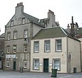
 Grangepans, Bo'ness with Bo'ness Co-operative Society shop.jpg 1,200 × 803; 179 KB
-
 Green heart of the city (27058108545).jpg 4,928 × 3,264; 3.66 MB
-
 Harbour lights - geograph.org.uk - 2849061.jpg 2,448 × 3,264; 2.91 MB
-
 Harrison Hall - geograph.org.uk - 552351.jpg 640 × 364; 48 KB
-
 Harvesting Brussels Sprouts - geograph.org.uk - 84731.jpg 640 × 480; 75 KB
-
 Heading away on the Grangemouth road - geograph.org.uk - 1184881.jpg 640 × 480; 51 KB
-
 Heading towards Bo'ness town centre - geograph.org.uk - 1184889.jpg 640 × 480; 66 KB
-
 Hebron Hall - geograph.org.uk - 551312.jpg 640 × 485; 56 KB
-
 Heron by the shore - geograph.org.uk - 548259.jpg 640 × 427; 76 KB
-
 John Muir Way at Bo'ness - geograph.org.uk - 5085298.jpg 800 × 593; 141 KB
-
 Kinglass Centre - geograph.org.uk - 545965.jpg 640 × 309; 34 KB
-
 Kinneil Colliery Wheel - geograph.org.uk - 423577.jpg 640 × 480; 80 KB
-
 Kinneil foreshore - geograph.org.uk - 2213663.jpg 1,600 × 1,200; 570 KB
-
 Kinneil Foreshore Local Nature Reserve - geograph.org.uk - 4715420.jpg 3,590 × 2,393; 6.92 MB
-
 Kinneil Nature Reserve - geograph.org.uk - 2849049.jpg 3,264 × 2,448; 4.37 MB
-
 Kinneil Nature Reserve, Bo'ness - geograph.org.uk - 328882.jpg 640 × 480; 47 KB
-
 Kinneil School from the south - geograph.org.uk - 567381.jpg 640 × 480; 72 KB
-
 Longannet Power Station - geograph.org.uk - 3598015.jpg 800 × 534; 201 KB
-
 Longannet power station from boness. - panoramio.jpg 2,048 × 1,536; 856 KB
-
 Longannet power station.taken from Boness. - panoramio.jpg 2,048 × 1,536; 853 KB
-
 Longannet View - geograph.org.uk - 2928496.jpg 640 × 442; 87 KB
-
 Low tide at Bo'ness - geograph.org.uk - 82329.jpg 480 × 640; 52 KB
-
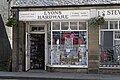 Lyons Hardware (51369184542).jpg 6,063 × 4,039; 6.99 MB
-
 Main Post Office - Bo'ness - geograph.org.uk - 531970.jpg 640 × 354; 54 KB
-
 Main Street Bo'ness - geograph.org.uk - 903476.jpg 640 × 480; 89 KB
-
 Market Square - geograph.org.uk - 541721.jpg 640 × 609; 78 KB
-
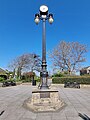 Memorial light, Bo'ness.jpg 3,024 × 4,032; 3.43 MB
-
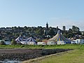 Moscow Circus - geograph.org.uk - 2213624.jpg 3,456 × 2,592; 3.94 MB
-
 Mud in Boness harbour. - panoramio.jpg 2,048 × 1,536; 840 KB
-
 Mud, Bo'ness - geograph.org.uk - 3287171.jpg 640 × 480; 86 KB
-
 Muddy channel at Bo'ness - geograph.org.uk - 2849015.jpg 3,264 × 2,448; 4.68 MB
-
 Muddy channel at Bo'ness - geograph.org.uk - 2849052.jpg 3,264 × 2,448; 3.85 MB
-
 New Bus Shelters - geograph.org.uk - 1626271.jpg 640 × 480; 87 KB
-
 New housing estate on edge of Bo'ness - geograph.org.uk - 77052.jpg 640 × 480; 62 KB
-
 Newton Park.jpg 3,474 × 2,263; 4.32 MB
-
 Newton Park2.jpg 3,552 × 2,368; 3.79 MB
-
 Newtown Park, Bo'ness.jpg 640 × 480; 90 KB
-
 North Street, Bo'ness.jpg 4,032 × 3,024; 3.33 MB
-
 Old building - geograph.org.uk - 903478.jpg 640 × 480; 103 KB
-
 Old St Mary's - weather damage - geograph.org.uk - 552447.jpg 640 × 480; 92 KB
-
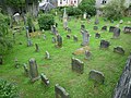 Parish Kirk burial ground, Church Wynd (geograph 2012086).jpg 640 × 480; 114 KB
-
 Pennelton Place common land - geograph.org.uk - 1634737.jpg 640 × 427; 48 KB
-

-
 Police Station - geograph.org.uk - 532015.jpg 640 × 480; 66 KB
-
 Putting up flags for the fair - geograph.org.uk - 548254.jpg 640 × 427; 83 KB
-
 Recreation Centre - geograph.org.uk - 546330.jpg 640 × 480; 48 KB
-
 Register Street - geograph.org.uk - 551835.jpg 640 × 497; 53 KB
-
 Rosa Canina Flower.jpg 2,278 × 1,518; 353 KB
-

-
 Salmon Court - geograph.org.uk - 530382.jpg 640 × 480; 79 KB
-
 Sea Defences - geograph.org.uk - 2213604.jpg 1,798 × 540; 423 KB
-
 Snowy brae - geograph.org.uk - 1634744.jpg 640 × 427; 62 KB
-
 South Street Fountain, Bo'ness.jpg 3,024 × 4,032; 3.87 MB
-
 South Street, Bo'ness.jpg 3,024 × 4,032; 2.61 MB
-
 Starks Brae - geograph.org.uk - 820968.jpg 640 × 480; 125 KB
-
 Steel Bollard West Pier Bo'ness - geograph.org.uk - 3596363.jpg 534 × 800; 244 KB
-
 Swordie Mains - geograph.org.uk - 1065328.jpg 640 × 480; 71 KB
-
 Telegraph pole pile (26624960650).jpg 4,928 × 3,264; 2.76 MB
-
 The Drill Hall - geograph.org.uk - 554154.jpg 640 × 364; 52 KB
-
 The Forth seen from Douglas Park, Bo'ness.jpg 4,032 × 3,024; 3.85 MB
-
 The regeneration at Bo'ness - geograph.org.uk - 2497210.jpg 640 × 427; 47 KB
-
 The ubiquitous supermarket trolley - geograph.org.uk - 2849024.jpg 3,264 × 2,448; 4.37 MB
-
 Thomson Place - geograph.org.uk - 548264.jpg 640 × 480; 64 KB
-
 Tides out at Boness. - panoramio.jpg 2,048 × 1,536; 813 KB
-
 Top of the Flints - geograph.org.uk - 1144317.jpg 640 × 480; 111 KB
-
 Town hall (51370947780).jpg 5,820 × 3,146; 4.82 MB
-
 Trifolium Pratense.jpg 2,278 × 1,518; 274 KB
-
 Tripleurospermum Perforatum.jpg 1,515 × 1,019; 156 KB
-
 Union Street - geograph.org.uk - 904496.jpg 640 × 415; 75 KB
-
 Union Street at Dock Street - geograph.org.uk - 903487.jpg 640 × 460; 101 KB
-
 Victorian drinking fountain - geograph.org.uk - 548994.jpg 398 × 640; 63 KB
-
-
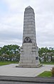 War Memorial - geograph.org.uk - 550446.jpg 408 × 640; 41 KB
-
 Welcome to Bo'ness - geograph.org.uk - 1351703.jpg 640 × 480; 96 KB
-
 West Pier from East Pier - geograph.org.uk - 2849065.jpg 3,264 × 2,448; 3.6 MB
-
 West Pier, Bo'ness Harbour - geograph.org.uk - 2849069.jpg 3,264 × 2,448; 3.67 MB
-
 Worn Stone at Gibson's Wynd - geograph.org.uk - 530324.jpg 480 × 640; 94 KB


.jpg)


.jpg)


.jpg)


.jpg)


.jpg)


.jpg)


.jpg)


.jpg)


.jpg)


