Category:Bonaduz
Zur Navigation springen
Zur Suche springen
Gemeinde in der Schweiz    | |||||
| Medium hochladen | |||||
| Aussprache (Audiodatei) | |||||
|---|---|---|---|---|---|
| Ist ein(e) | |||||
| Ort | |||||
| Liegt am oder im Gewässer | |||||
| Einwohnerzahl |
| ||||
| Fläche |
| ||||
| Höhe über dem Meeresspiegel |
| ||||
| offizielle Website | |||||
 | |||||
Unterkategorien
Es werden 11 von insgesamt 11 Unterkategorien in dieser Kategorie angezeigt:
In Klammern die Anzahl der enthaltenen Kategorien (K), Seiten (S), Dateien (D)
- Alp Sura (7 D)
- Burg Wackenau (12 D)
B
- Bonaduz railway station (8 D)
H
- Hinterrheinbrücke (Reichenau) (16 D)
N
P
- Punt Ruinaulta (15 D)
V
- Versamer Tobelbrücke (1828) (1 D)
- Versamer Tobelbrücke (1897) (20 D)
- Versamer Tobelbrücke (2012) (15 D)
Z
- Plattform Zault (2 D)
Medien in der Kategorie „Bonaduz“
Folgende 103 Dateien sind in dieser Kategorie, von 103 insgesamt.
-
 16 - panoramio.jpg 800 × 600; 295 KB
-
 A13 Bonaduz, map OSM 2022.png 334 × 401; 50 KB
-
 A13-Autobahnbrücke über den Hinterrhein, Bonaduz GR 20170716-jag9889.jpg 4.608 × 3.456; 10,75 MB
-
 Bonaduz wappen.svg 438 × 480; 2 KB
-
 CHE Bonaduz COA.svg 227 × 265; 2 KB
-
 Bonaduz Ansicht.jpg 1.181 × 670; 119 KB
-
 Bonaduz Dorfansicht 001.jpg 1.000 × 667; 652 KB
-
 Bonaduz Dorfansicht 002.jpg 1.000 × 667; 525 KB
-
 Bonaduz Dorfansicht 003.jpg 1.000 × 667; 523 KB
-
 BONADUZ photo intérieure de l'église.jpg 353 × 549; 54 KB
-
 BONADUZ photo orgueKuhn2010.jpg 351 × 540; 58 KB
-
 BONADUZ photo église (extérieur).jpg 351 × 538; 50 KB
-
 Bonaduz und Reichenau Tamins.JPG 2.048 × 1.536; 707 KB
-
 Bonaduz-Versam.jpg 2.560 × 1.920; 2,38 MB
-
 Bonaduz.jpg 3.264 × 2.448; 1,78 MB
-
 Bonaduzerwappen.jpg 873 × 1.056; 103 KB
-
 Calanda und Ringel 02.jpg 2.560 × 1.920; 2,32 MB
-
 CHE Bonaduz Flag.svg 512 × 514; 270 KB
-
 Com L15-0479-0001-0001.tif 4.945 × 3.296; 46,85 MB
-
 Com L15-0479-0001-0002.tif 4.961 × 3.298; 46,98 MB
-
 Com L15-0479-0001-0003.tif 4.961 × 3.320; 47,33 MB
-
 Com L15-0479-0001-0004.tif 4.961 × 3.290; 46,91 MB
-
 Com L15-0479-0001-0005.tif 4.961 × 3.305; 47,06 MB
-
 Com L15-0479-0001-0006.tif 4.961 × 3.297; 47 MB
-
 Com L15-0479-0002-0001.tif 3.317 × 4.961; 47,25 MB
-
 Com L15-0479-0002-0002.tif 4.961 × 3.317; 47,25 MB
-
 Com L15-0479-0002-0003.tif 4.961 × 3.303; 47,05 MB
-
 Com L15-0479-0002-0004.tif 3.331 × 4.961; 47,43 MB
-
 Com L15-0479-0002-0005.tif 4.961 × 3.295; 46,9 MB
-
 Com L15-0479-0002-0006.tif 4.961 × 3.312; 47,15 MB
-
 Com L15-0479-0003-0001.tif 4.961 × 3.315; 47,2 MB
-
 Com L15-0479-0003-0002.tif 3.307 × 4.961; 47,08 MB
-
 Com L15-0479-0003-0003.tif 4.961 × 3.327; 47,37 MB
-
 Com L15-0479-0003-0004.tif 4.961 × 3.300; 47 MB
-
 Com L15-0479-0003-0005.tif 4.953 × 3.290; 46,79 MB
-
 Com L15-0479-0003-0006.tif 4.961 × 3.293; 46,93 MB
-
 Com L15-0479-0003-0007.tif 3.310 × 4.961; 47,14 MB
-
 Com L15-0479-0003-0008.tif 4.961 × 3.305; 47,08 MB
-
 Com L15-0479-0003-0009.tif 4.961 × 3.317; 47,25 MB
-
 Com L15-0479-0004-0001.tif 4.961 × 3.269; 46,56 MB
-
 Com L15-0479-0004-0002.tif 4.961 × 3.305; 47,07 MB
-
 Com L15-0479-0004-0003.tif 4.961 × 3.313; 47,18 MB
-
 Com L15-0479-0005-0001.tif 4.953 × 3.300; 46,95 MB
-
 Com L15-0479-0005-0002.tif 4.961 × 3.307; 47,1 MB
-
 Com L15-0479-0005-0003.tif 4.961 × 3.295; 46,92 MB
-
 Com L15-0479-0005-0004.tif 3.295 × 4.961; 46,93 MB
-
 Com L15-0479-0005-0005.tif 3.284 × 4.961; 46,79 MB
-
 Com L15-0479-0005-0006.tif 3.310 × 4.961; 47,14 MB
-
 Com L15-0479-0005-0007.tif 4.945 × 3.289; 46,7 MB
-
 Com L15-0479-0006-0001.tif 4.961 × 3.327; 47,42 MB
-
 Com L15-0479-0006-0002.tif 3.329 × 4.950; 47,34 MB
-
 Com L15-0479-0007-0001.tif 4.945 × 3.436; 48,76 MB
-
 Com L15-0479-0007-0002.tif 3.248 × 4.961; 46,27 MB
-
 Com L15-0479-0007-0003.tif 3.271 × 4.961; 46,59 MB
-
 Com L15-0479-0007-0004.tif 3.255 × 4.961; 46,36 MB
-
 Com L15-0479-0007-0005.tif 3.245 × 4.961; 46,21 MB
-
 Com L15-0479-0007-0006.tif 4.961 × 3.307; 47,14 MB
-
 Com L15-0479-0007-0007.tif 4.961 × 3.298; 47,01 MB
-
De-Bonaduz.oga 1,4 s; 29 KB
-
 Dorfbrunnen Bonaduz.jpg 5.184 × 3.456; 3,42 MB
-
 ETH-BIB-Bonaduz v. W. aus 300 m-Inlandflüge-LBS MH01-003921.tif 6.291 × 4.291; 77,38 MB
-
 ETH-BIB-Bonaduz, von Südost-Dia 247-08002.tif 3.675 × 2.840; 10,02 MB
-
 ETH-BIB-Bonaduz-LBS H1-010129.tif 6.873 × 4.752; 93,57 MB
-
 ETH-BIB-Bonaduz-LBS H1-019708.tif 6.811 × 4.815; 93,91 MB
-
 ETH-BIB-Bonaduz-LBS H1-019709.tif 6.811 × 4.797; 93,56 MB
-
 ETH-BIB-Bonaduz-LBS H1-019710.tif 6.897 × 4.774; 94,28 MB
-

-
-

-
 ETH-BIB-Helvetische Wurzel-Kippe, Ostnordost, unter Bonaduz, Rhein-aufwärts-Dia 247-07998.tif 3.063 × 3.463; 10,21 MB
-
 ETH-BIB-Reichenau und Bonaduz, vom Kunkelspass-Dia 247-00008.tif 3.579 × 2.600; 8,94 MB
-
 ETH-BIB-Rheintal, Bonaduz, Felsberger Calanda-Inlandflüge-LBS MH05-59-07.tif 3.508 × 2.365; 23,79 MB
-
 ETH-BIB-Rheintal, Bonaduz, Felsberger Calanda-Inlandflüge-LBS MH05-59-08.tif 3.508 × 2.367; 23,81 MB
-
 ETH-BIB-Rhäzüns, Bonaduz-LBS H1-019706.tif 6.773 × 4.797; 93,04 MB
-
 ETH-BIB-Rhäzüns, Bonaduz-LBS H1-019707.tif 6.773 × 4.803; 93,15 MB
-
 ETH-BIB-Ruinaulta, Blick nach Nordost, Chur-LBS H1-018174.tif 6.752 × 4.730; 91,53 MB
-
 ETH-BIB-Ruinaulta, Blick Richtung Ostnordost, Chur-LBS H1-018173.tif 6.806 × 4.726; 92,17 MB
-
 ETH-BIB-Tamins, Reichenau, Bonaduz, Rhäzüns v. 4600 m-Inlandflüge-LBS MH01-003831.tif 6.240 × 4.534; 81,08 MB
-

-
 Flag of Bonaduz.gif 216 × 216; 3 KB
-
 Ge66 412 - panoramio.jpg 800 × 600; 152 KB
-
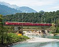
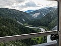
 Glacier-Express zwischen Reichenau-Tamins und Bonaduz.jpg 3.402 × 2.100; 1,96 MB
-
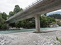 Hauptstrasse-Brücke über den Vorderrhein, Reichenau GR – Bonaduz GR 20170714-jag9889.jpg 4.608 × 3.456; 9,47 MB
-

-
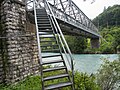
 Hinterrheinsteg Plazzas.jpg 5.200 × 2.926; 6,43 MB
-
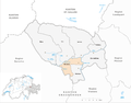
 Karte Gemeinde Bonaduz 2007.png 1.181 × 925; 215 KB
-
 Karte Gemeinde Bonaduz 2009.png 1.476 × 1.155; 374 KB
-
 Karte Gemeinde Bonaduz 2016.png 1.476 × 1.156; 369 KB
-
 Karte Gemeinde Bonaduz.png 1.181 × 923; 177 KB
-
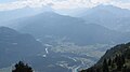
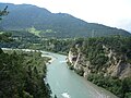
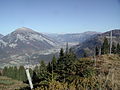 Oberes Rheintal von Bonaduz bis Chur.JPG 2.048 × 1.536; 686 KB
-
 Reichenau-Rhäzüns.jpg 2.592 × 1.456; 699 KB
-
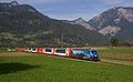
 RhB ABe 8-12 ALLEGRA Bonaduz 2.JPG 2.463 × 768; 1,2 MB
-
 RhB-Brücke über den Hinterrhein, Bonaduz GR – Domat Ems GR 20170716-jag9889.jpg 4.320 × 3.456; 9,37 MB
-
 RhB-Brücke über den Vorderrhein, Tamins GR – Bonaduz GR 20170714-jag9889.jpg 4.608 × 3.456; 10,69 MB
-
 Rhäzüns und Calanda.jpg 2.560 × 1.920; 2,21 MB
-
 Rhäzüns.jpg 3.648 × 2.736; 5,23 MB
-
 Ringelspitz Kunkels Calanda.JPG 2.048 × 1.536; 702 KB
-
 Ruinaulta bei Trin.jpg 3.072 × 2.304; 3,61 MB
-
 Ruinaulta from Versamerstrasse road.jpg 2.997 × 2.248; 3,23 MB
-
 Ruinaulta from Zault Observation Deck.jpg 3.597 × 2.248; 5,81 MB
-
 Vorderrheinbruecke Reichenau 01 11.jpg 1.575 × 1.049; 1,24 MB
-
 Wackenau Lage.jpg 1.299 × 880; 352 KB
-
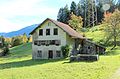 Weihermühle.JPG 4.782 × 3.152; 4,56 MB


.jpg)


