Category:Boningale
Aller à la navigation
Aller à la recherche
village britannique  | |||||
| Téléverser des médias | |||||
| Nature de l’élément | |||||
|---|---|---|---|---|---|
| Lieu | Shropshire, Midlands de l'Ouest, Angleterre | ||||
 | |||||
English: Boningale is a village and civil parish in Shropshire, England. According to the 2001 census the parish had a population of 266. It is just south of Albrighton, and is just west of the county border with Staffordshire. The village is about eight miles west of Wolverhampton in West Midlands, on the A464 road, and ten miles east of Telford.
Sous-catégories
Cette catégorie comprend seulement la sous-catégorie ci-dessous.
C
- St Chad's Church, Boningale (9 F)
Média dans la catégorie « Boningale »
Cette catégorie comprend 115 fichiers, dont les 115 ci-dessous.
-
 "Anyone have the time" - geograph.org.uk - 1870909.jpg 819 × 614 ; 179 kio
-
 'The Old Cottage' at Boningale - geograph.org.uk - 1411833.jpg 640 × 480 ; 122 kio
-
 2014 Pattingham Bells cross country race - geograph.org.uk - 4202597.jpg 857 × 1 142 ; 440 kio
-
 2014 Pattingham Bells cross country race - geograph.org.uk - 4202611.jpg 1 306 × 979 ; 387 kio
-
 2014 Pattingham Bells cross country race - geograph.org.uk - 4202626.jpg 1 142 × 857 ; 484 kio
-
 2014 Pattingham Bells cross country race - geograph.org.uk - 4202635.jpg 1 632 × 1 224 ; 731 kio
-
 A pond no more - geograph.org.uk - 1870919.jpg 640 × 480 ; 188 kio
-
 A41 at County Lane crossroads - geograph.org.uk - 2774195.jpg 640 × 480 ; 58 kio
-
 A41 in Shropshire - geograph.org.uk - 2774196.jpg 640 × 480 ; 53 kio
-
 A41 nearing Kingswood Road junction - geograph.org.uk - 2774213.jpg 640 × 480 ; 51 kio
-
 Albighton Lodge at Patshull Park - geograph.org.uk - 4898047.jpg 1 200 × 1 071 ; 418 kio
-
 Bales and a Dutch barn at Woodhouse Farm - geograph.org.uk - 1870914.jpg 896 × 672 ; 191 kio
-
 Barn conversion at Woodhouse Farm - geograph.org.uk - 377054.jpg 600 × 450 ; 223 kio
-
 Barn near the Horns of Boningale - geograph.org.uk - 4898244.jpg 1 200 × 799 ; 388 kio
-
 Bickley's Rough View - geograph.org.uk - 5303793.jpg 800 × 600 ; 247 kio
-
 Boningale Manor, Boningale - geograph.org.uk - 376987.jpg 600 × 450 ; 292 kio
-
 Boningale Nursery - geograph.org.uk - 894057.jpg 640 × 480 ; 64 kio
-
 Brook in Shropshire, north-east of Patshull Hall - geograph.org.uk - 6078014.jpg 960 × 1 280 ; 1,96 Mio
-
 Burnhill Green Road in Shropshire - geograph.org.uk - 6133982.jpg 1 600 × 900 ; 1,45 Mio
-
 Burnhill Green Road in Shropshire - geograph.org.uk - 6134044.jpg 1 440 × 1 080 ; 1,84 Mio
-
 Burnhill Green Road in Shropshire - geograph.org.uk - 6134167.jpg 1 080 × 1 440 ; 2,02 Mio
-
 Burnhill Green Road in Shropshire - geograph.org.uk - 6134202.jpg 1 440 × 960 ; 1,52 Mio
-
 Burnhill Green Road in Shropshire - geograph.org.uk - 6134236.jpg 1 440 × 1 080 ; 1,9 Mio
-
 Bypassed stretch of the A41 - geograph.org.uk - 1870904.jpg 768 × 576 ; 191 kio
-
 Camp Fire Circle - geograph.org.uk - 1692357.jpg 640 × 480 ; 103 kio
-
 Church Farm House, Boningale - geograph.org.uk - 1411827.jpg 640 × 480 ; 132 kio
-
 Cold and miserable near Boningale - geograph.org.uk - 1036183.jpg 640 × 480 ; 129 kio
-
 County Boundary - geograph.org.uk - 1223352.jpg 600 × 450 ; 325 kio
-
 Driveway in Patshull Park, Shropshire - geograph.org.uk - 6078676.jpg 1 024 × 768 ; 1,09 Mio
-
 Edward VII postbox near Albighton Lodge - geograph.org.uk - 4898045.jpg 799 × 1 200 ; 469 kio
-
 Farm Lane off Rushey Lane - geograph.org.uk - 4898040.jpg 1 200 × 815 ; 498 kio
-
 Farmland in Patshull Park, Shropshire - geograph.org.uk - 6078683.jpg 1 024 × 683 ; 798 kio
-
 Farmland south of Whiston Cross in Shropshire - geograph.org.uk - 6135041.jpg 1 280 × 960 ; 1,61 Mio
-
 Farmland to the north of Pattingham - geograph.org.uk - 5162647.jpg 800 × 600 ; 157 kio
-
 Footbridge over a stream - geograph.org.uk - 1870925.jpg 640 × 480 ; 197 kio
-
 Footpath in Bickley's Rough - geograph.org.uk - 2031430.jpg 640 × 480 ; 169 kio
-
 Footpath towards Albrighton Hall - geograph.org.uk - 1870922.jpg 557 × 742 ; 163 kio
-
 Forest ride in Bickley's Rough - geograph.org.uk - 871598.jpg 640 × 480 ; 135 kio
-
 Golf course in Patshull Park, Shropshire - geograph.org.uk - 6078673.jpg 1 024 × 768 ; 1,05 Mio
-
 Golf Hut - geograph.org.uk - 1692361.jpg 640 × 480 ; 72 kio
-
 Holyhead Road south of Albrighton in Shropshire - geograph.org.uk - 6134885.jpg 1 440 × 960 ; 1,75 Mio
-
 Holyhead Road south of Albrighton in Shropshire - geograph.org.uk - 6134887.jpg 1 600 × 900 ; 1,81 Mio
-
 Holyhead Road south of Albrighton in Shropshire - geograph.org.uk - 6134898.jpg 1 440 × 960 ; 1,68 Mio
-
 Holyhead Road south of Albrighton in Shropshire - geograph.org.uk - 6134916.jpg 1 600 × 900 ; 1,49 Mio
-
 Home Farm at Patshull - geograph.org.uk - 1834740.jpg 860 × 645 ; 163 kio
-
 Horns of Boningale, Boningale - geograph.org.uk - 4898084.jpg 1 200 × 799 ; 325 kio
-
 Horns of Boningale, Boningale - geograph.org.uk - 4898087.jpg 1 200 × 799 ; 368 kio
-
 Horns of Boningale, Boningale - geograph.org.uk - 4898089.jpg 963 × 1 200 ; 352 kio
-
 Irrigation pool near Whiston Hall - geograph.org.uk - 1830536.jpg 860 × 645 ; 159 kio
-

-
 Kingswood, County Lane - geograph.org.uk - 3538267.jpg 1 024 × 768 ; 279 kio
-
 Kingswood, cropland - geograph.org.uk - 3538288.jpg 1 024 × 768 ; 219 kio
-
 Kissing gate on Woodhouse Lane - geograph.org.uk - 4898248.jpg 1 200 × 799 ; 574 kio
-
 Lane junction for Ryton - geograph.org.uk - 3505185.jpg 640 × 480 ; 59 kio
-
 Lane north of the power lines - geograph.org.uk - 3505177.jpg 640 × 480 ; 74 kio
-
 Lane to Boningale in Shropshire - geograph.org.uk - 6078655.jpg 1 440 × 960 ; 1,78 Mio
-
 Lea Hall south of Albrighton in Shropshire - geograph.org.uk - 6134910.jpg 1 440 × 960 ; 1,6 Mio
-
 Lea Hall south of Albrighton in Shropshire - geograph.org.uk - 6134911.jpg 1 280 × 960 ; 1,8 Mio
-
 Little Whiston Farm - geograph.org.uk - 3505180.jpg 640 × 480 ; 69 kio
-
 Narrow lane to Boningale - geograph.org.uk - 748065.jpg 640 × 480 ; 100 kio
-
 Oak tree and a small pond on the county boundary - geograph.org.uk - 1834732.jpg 717 × 538 ; 159 kio
-
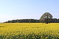 Oil seed rape in Shropshire, north of Burnhill Green - geograph.org.uk - 6134036.jpg 1 440 × 960 ; 1,68 Mio
-
 OS benchmark - Boningale, Parkside Farm - geograph.org.uk - 5535257.jpg 857 × 1 142 ; 607 kio
-
 Pasture and track south of Boningale in Shropshire - geograph.org.uk - 6134923.jpg 1 280 × 1 280 ; 2,06 Mio
-
 Pasture and track south of Boningale in Shropshire - geograph.org.uk - 6134959.jpg 1 600 × 900 ; 1,56 Mio
-
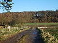
 Patshull Camp Site - geograph.org.uk - 1690576.jpg 640 × 480 ; 85 kio
-
 Patshull Lane - geograph.org.uk - 1692374.jpg 640 × 480 ; 116 kio
-
 Patshull Road south of Albrighton in Shropshire - geograph.org.uk - 6134888.jpg 1 440 × 960 ; 1,55 Mio
-
 Patshull Road south of Albrighton in Shropshire - geograph.org.uk - 6134891.jpg 1 440 × 960 ; 1,68 Mio
-
 Patshull Road south-west of Boningale in Shropshire - geograph.org.uk - 6134964.jpg 1 440 × 960 ; 1,57 Mio
-
 Patshull Road towards Boningale - geograph.org.uk - 4898065.jpg 1 200 × 838 ; 545 kio
-
 Pylon and potato field near Boningale, Shropshire - geograph.org.uk - 6134971.jpg 1 440 × 960 ; 1,64 Mio
-
 Pylon and potato field south of Albrighton in Shropshire - geograph.org.uk - 6134974.jpg 1 080 × 1 440 ; 1,76 Mio
-

-
 Reservoir - pool at Lower Pepperhill - geograph.org.uk - 894142.jpg 640 × 480 ; 52 kio
-
 Road junction at County Lane farm - geograph.org.uk - 4648237.jpg 640 × 487 ; 96 kio
-
 Road to Whiston Cross in Shropshire - geograph.org.uk - 6134212.jpg 1 440 × 1 080 ; 2,59 Mio
-
 Road to Whiston Cross in Shropshire - geograph.org.uk - 6134232.jpg 1 440 × 960 ; 1,53 Mio
-
 Roads and Lea Hall south of Albrighton, Shropshire - geograph.org.uk - 6134902.jpg 1 600 × 800 ; 1,21 Mio
-
 Runners coming into Hawks Well cottage garden - geograph.org.uk - 4202644.jpg 1 142 × 857 ; 395 kio
-
 Rushey Lane - geograph.org.uk - 5305042.jpg 800 × 600 ; 196 kio
-
 Rushey Lane in Shropshire north-west of Patshull Hall - geograph.org.uk - 6134208.jpg 1 440 × 960 ; 1,63 Mio
-
 Rushey Lane near Patshull Hall in Staffordshire - geograph.org.uk - 6135026.jpg 1 440 × 960 ; 1,91 Mio
-
 Rushey Lane north-east of Patshull Hall - geograph.org.uk - 6078142.jpg 960 × 1 280 ; 2,16 Mio
-
 Scott's Bank - geograph.org.uk - 1692365.jpg 640 × 480 ; 92 kio
-
 Shropshire crop fields with pylons near Boningale - geograph.org.uk - 6134992.jpg 1 440 × 960 ; 1,38 Mio
-
 Shropshire cropfields near Bishton Manor - geograph.org.uk - 6135054.jpg 1 920 × 960 ; 2,15 Mio
-
 Shropshire cropfields west of Bishton Manor - geograph.org.uk - 6135045.jpg 1 600 × 900 ; 1,69 Mio
-
 Shropshire farmland and woodland north-east of Patshull Hall - geograph.org.uk - 6078640.jpg 1 600 × 900 ; 1,14 Mio
-
 Shropshire farmland near Boningale - geograph.org.uk - 6134952.jpg 1 600 × 800 ; 1,25 Mio
-
 Shropshire farmland near Boningale - geograph.org.uk - 6134957.jpg 1 440 × 960 ; 1,36 Mio
-
 Shropshire Farmland north of Burnhill Green - geograph.org.uk - 6133979.jpg 1 440 × 960 ; 1,59 Mio
-
 Shropshire farmland north of Patshull Hall - geograph.org.uk - 6135033.jpg 2 000 × 1 000 ; 2,15 Mio
-
 Shropshire farmland south of Boningale - geograph.org.uk - 6078608.jpg 1 920 × 960 ; 1,68 Mio
-
 Shropshire farmland south of Boningale - geograph.org.uk - 6078619.jpg 1 440 × 960 ; 1,35 Mio
-
 Shropshire farmland south of Whiston Cross - geograph.org.uk - 6134219.jpg 1 600 × 900 ; 1,65 Mio
-
 Shropshire farmland south of Whiston Cross - geograph.org.uk - 6134223.jpg 960 × 1 280 ; 1,61 Mio
-
 Shropshire farmland south of Whiston Cross - geograph.org.uk - 6134227.jpg 1 600 × 900 ; 1,63 Mio
-
 Shropshire farmland south of Whiston Cross - geograph.org.uk - 6134241.jpg 1 440 × 1 080 ; 1,76 Mio
-
 Shropshire Lodge on Rushey Lane - geograph.org.uk - 4898041.jpg 1 200 × 799 ; 395 kio
-

-
 Shropshire potato field with pylon, near Boningale - geograph.org.uk - 6134980.jpg 1 440 × 1 080 ; 1,55 Mio
-
 Shropshire woodland north-east of Patshull Hall - geograph.org.uk - 6078161.jpg 1 600 × 900 ; 1,09 Mio
-
 Staffordshire farmland north of Burnhill Green - geograph.org.uk - 6133973.jpg 1 280 × 960 ; 1,5 Mio
-
 The Horns of Boningale - geograph.org.uk - 3706800.jpg 1 600 × 1 064 ; 346 kio
-
 The lane north from Burnhill Green - geograph.org.uk - 3505170.jpg 640 × 480 ; 73 kio
-
 The lane to Home Farm - geograph.org.uk - 1834735.jpg 660 × 881 ; 162 kio
-
 The old pool in the grounds of Whiston Hall - geograph.org.uk - 1830541.jpg 480 × 640 ; 195 kio
-
 The old vicarage at Boningale - geograph.org.uk - 1411834.jpg 640 × 480 ; 126 kio
-
 Trees and cropfield near Boningale, Shropshire - geograph.org.uk - 6134998.jpg 960 × 1 280 ; 1,68 Mio
-
 Upper Pepperhill farm from the south east - geograph.org.uk - 894764.jpg 640 × 480 ; 37 kio
-
 Whiston Hall parkland from the south - geograph.org.uk - 1830543.jpg 942 × 707 ; 159 kio
-
 Woodhouse Lane towards the A41 - geograph.org.uk - 4898249.jpg 1 200 × 799 ; 472 kio
-
 Woodhouse Lane, Parkside - geograph.org.uk - 4898245.jpg 1 200 × 806 ; 535 kio
-
 Ploughed Field Near Patshull - geograph.org.uk - 241899.jpg 640 × 480 ; 62 kio


