Category:Shropshire
Jump to navigation
Jump to search

Ceremonial counties of England: Bedfordshire · Berkshire · Buckinghamshire · Cambridgeshire · Cheshire · Cornwall · Cumbria · Derbyshire · Devon · Dorset · Durham · East Riding of Yorkshire · East Sussex · Essex · Gloucestershire · Greater London · Greater Manchester · Hampshire · Herefordshire · Hertfordshire · Isle of Wight · Kent · Lancashire · Leicestershire · Lincolnshire · Merseyside · Norfolk · North Yorkshire · Northamptonshire · Northumberland · Nottinghamshire · Oxfordshire · Rutland · Shropshire · Somerset · South Yorkshire · Staffordshire · Suffolk · Surrey · Tyne and Wear · Warwickshire · West Midlands · West Sussex · West Yorkshire · Wiltshire · Worcestershire
City-counties: Bristol · City of London
Former historic counties: Cumberland · Huntingdonshire · London · Middlesex · North Riding of Yorkshire · Sussex · West Riding of Yorkshire · Westmorland · Yorkshire
Other former counties: Avon · Cambridgeshire and Isle of Ely · Cleveland · East Suffolk · Hereford and Worcester · Hexhamshire · Humberside · Huntingdon and Peterborough · Isle of Ely · Parts of Holland · Parts of Kesteven · Parts of Lindsey · Soke of Peterborough · West Suffolk
ceremonial county in the United Kingdom | |||||
| Upload media | |||||
| Instance of |
| ||||
|---|---|---|---|---|---|
| Location |
| ||||
| Capital | |||||
| Population |
| ||||
| Area |
| ||||
| Different from | |||||
| Said to be the same as | Shropshire (historic county of England, ceremonial county of England, 1844) | ||||
| official website | |||||
 | |||||


Subcategories
This category has the following 47 subcategories, out of 47 total.
!
- Quality images of Shropshire (25 F)
- Valued images of Shropshire (10 F)
A
C
- Canal locks in Shropshire (39 F)
D
E
F
- Field Studies Council (1 F)
G
- Gallery pages of Shropshire (4 P)
H
I
M
N
- Night in Shropshire (12 F)
P
R
S
- Shropshire Blue (6 F)
T
V
W
Media in category "Shropshire"
The following 200 files are in this category, out of 359 total.
(previous page) (next page)-

-
-
 'The Walls' - geograph.org.uk - 391768.jpg 600 × 450; 232 KB
-
 A 'private' gate into Ellerton Wood - geograph.org.uk - 391714.jpg 427 × 640; 137 KB
-
 A 490 near Marrington Farm - geograph.org.uk - 1036231.jpg 640 × 480; 80 KB
-
 A ford on Poulk Hall Lane - geograph.org.uk - 395457.jpg 640 × 480; 117 KB
-
 ABP abattoir and meat plant - geograph.org.uk - 540124.jpg 640 × 480; 61 KB
-
 Access Lane to Orseddwen - geograph.org.uk - 917032.jpg 640 × 480; 89 KB
-
 Across the valley - geograph.org.uk - 917579.jpg 640 × 480; 113 KB
-
 Adam de Chetwynd.jpg 720 × 713; 54 KB
-
 Albrighton Ironmongers - geograph.org.uk - 1408784.jpg 640 × 480; 123 KB
-
 Artificial Lake at New House Farm - geograph.org.uk - 891685.jpg 640 × 480; 85 KB
-
 AsdaShrewsbury.jpg 640 × 480; 49 KB
-
 B4364 to Bridgnorth - geograph.org.uk - 1038576.jpg 640 × 480; 115 KB
-
 Bale sledge, Burnt House. - geograph.org.uk - 53502.jpg 640 × 480; 66 KB
-
 Beacon Studios.jpg 3,648 × 2,736; 4.04 MB
-
 BeaconRadio NewLogo.PNG 542 × 233; 80 KB
-
 Bear right for NCR 45 - geograph.org.uk - 1441640.jpg 640 × 426; 292 KB
-
 Bee hives - geograph.org.uk - 1260232.jpg 640 × 480; 165 KB
-
 Bockleton Brook - geograph.org.uk - 966247.jpg 640 × 480; 117 KB
-
 Bracken on the Long Mynd - geograph.org.uk - 1108398.jpg 640 × 480; 103 KB
-
 Bridgnorth - Shropshire dot.png 417 × 599; 122 KB
-
 Broken Tree on Clunbury Hill - panoramio.jpg 4,608 × 3,456; 5.53 MB
-
 Cambrian visitor centre - geograph.org.uk - 1393362.jpg 640 × 509; 75 KB
-
 Carding Mill Valley, Shropshire.jpg 2,016 × 1,512; 928 KB
-
 Carex elongata at Brownheath Moss.jpg 1,600 × 1,200; 1,010 KB
-
 Cattle grazing - geograph.org.uk - 793429.jpg 640 × 480; 120 KB
-
 Cattle grazing - geograph.org.uk - 799720.jpg 640 × 480; 119 KB
-
 Chapel near Bedstone - panoramio.jpg 3,456 × 4,608; 5.85 MB
-
 Cheswell manor.jpg 1,940 × 1,200; 1.9 MB
-
 Chetwynd Firs - geograph.org.uk - 1586398.jpg 640 × 480; 94 KB
-

-
 Colours of autumn - panoramio.jpg 4,000 × 3,000; 3.58 MB
-
 County boundary - geograph.org.uk - 795338.jpg 640 × 480; 113 KB
-
 Cross house - panoramio.jpg 2,848 × 2,134; 1.25 MB
-
 Cross house, longden - panoramio.jpg 2,848 × 2,134; 1.29 MB
-
 Crossing the Rabbit Run - geograph.org.uk - 1804407.jpg 922 × 691; 169 KB
-
 Crossroads at Day House - geograph.org.uk - 821185.jpg 640 × 480; 125 KB
-
 Crossroads at Wentnor Prolley Moor - geograph.org.uk - 1221989.jpg 600 × 450; 224 KB
-
 Daffodils next to Travelodge - geograph.org.uk - 1240747.jpg 640 × 479; 115 KB
-
 Danesford Grange Care Home - geograph.org.uk - 1758719.jpg 1,024 × 768; 167 KB
-
 Darby House, Telford - geograph.org.uk - 864342.jpg 640 × 480; 94 KB
-
 Dead tree on the County boundary - geograph.org.uk - 1206543.jpg 457 × 640; 110 KB
-
 Dhustone lane, Clee Hill - geograph.org.uk - 1629548.jpg 640 × 480; 85 KB
-
 Dhustone lane, Clee Hill - geograph.org.uk - 1629594.jpg 640 × 480; 56 KB
-
 Dhustone Railway Bridge - geograph.org.uk - 1607485.jpg 640 × 480; 76 KB
-
 Dindymene-didymograpti-(Whittard-1960).jpg 1,898 × 2,056; 376 KB
-
 Dinham Bridge - geograph.org.uk - 1109762.jpg 640 × 480; 84 KB
-
 Disused Airfield - geograph.org.uk - 138429.jpg 640 × 480; 113 KB
-
 Domestic Greylag Geese - geograph.org.uk - 884468.jpg 640 × 457; 187 KB
-
 Down the track - geograph.org.uk - 917575.jpg 640 × 480; 115 KB
-
 Driveway to Patton House - geograph.org.uk - 832894.jpg 640 × 480; 90 KB
-
 Dudhill, and Hall, Shropshire - geograph.org.uk - 381102.jpg 640 × 528; 138 KB
-
 Dust (452186813).jpg 679 × 1,024; 331 KB
-
 Earls hill looking towards the wrekin - panoramio.jpg 2,848 × 2,134; 1.14 MB
-

-
 Engine house on Shelve Hill - geograph.org.uk - 1566123.jpg 640 × 480; 51 KB
-

-

-
 Escarpment of Abbot's Castle Hill - geograph.org.uk - 783445.jpg 640 × 480; 67 KB
-
 Evening along the B4194 - geograph.org.uk - 1197282.jpg 640 × 480; 55 KB
-
 Fallen fruits - geograph.org.uk - 645164.jpg 640 × 480; 243 KB
-
 Farm buildings - geograph.org.uk - 793867.jpg 640 × 480; 115 KB
-
 Farm buildings near Oakley - geograph.org.uk - 917701.jpg 640 × 480; 77 KB
-
 Farm track - geograph.org.uk - 799722.jpg 640 × 480; 118 KB
-
 Felton Butler roundabout - geograph.org.uk - 2248599.jpg 640 × 480; 61 KB
-
 Fishmore Hall.jpg 640 × 425; 73 KB
-
 Flaxmill Maltings Visitor Centre with former stables, 2019.jpg 5,184 × 3,888; 6.12 MB
-
 Flaxmill Maltings Visitor Centre, 2019.jpg 5,184 × 3,888; 6.29 MB
-
 Fly Tipping. Wooton, Shropshire - geograph.org.uk - 408432.jpg 640 × 487; 138 KB
-
 Forestgarden2.jpg 484 × 657; 55 KB
-
 Frost on bracken - geograph.org.uk - 1110316.jpg 640 × 480; 69 KB
-
 Frozen bridleway near Ryton - geograph.org.uk - 1626923.jpg 640 × 480; 88 KB
-
 Fumaria purpurea.jpg 991 × 1,122; 640 KB
-
 Gags Hill, Shropshire - geograph.org.uk - 403955.jpg 1,440 × 1,080; 1.89 MB
-
 Garden View - Ironbridge - Shropshire - England - 01 (27586260623).jpg 3,648 × 2,736; 6.67 MB
-
 Garden View - Ironbridge - Shropshire - England - 02 (27586115714).jpg 3,648 × 2,736; 6.39 MB
-
 Getting a closer look - geograph.org.uk - 874776.jpg 640 × 480; 213 KB
-
 Grass on Brown Clee.jpg 3,888 × 2,592; 2.5 MB
-
 Grooves - geograph.org.uk - 795295.jpg 480 × 640; 113 KB
-
 Ha-ha in the grounds of Plowden House - geograph.org.uk - 1626996.jpg 640 × 480; 132 KB
-
 Habberley brook from radlith - panoramio.jpg 2,848 × 2,134; 1.67 MB
-

-
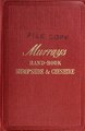 A handbook for residents and travellers in Shropshire and Cheshire (IA handbookforresid00unse 1).pdf 1,118 × 1,716, 281 pages; 23.71 MB
-

-

-
 Hoarfrost on conifer - geograph.org.uk - 1110294.jpg 480 × 640; 121 KB
-
 Homebase Store - geograph.org.uk - 780312.jpg 640 × 480; 48 KB
-
 Horses rounding a turn.jpg 2,916 × 2,352; 1.24 MB
-
 Idsall House.jpg 3,888 × 2,592; 2.19 MB
-

-
 Jeremy Corbyn with David Hallam, in Shropshire, July 2017.png 508 × 506; 444 KB
-
 Lane to High Green - geograph.org.uk - 1111130.jpg 640 × 480; 86 KB
-
 Llwyd Mansion 1604 Oswestry (8689969578).jpg 2,048 × 1,150; 452 KB
-
 Lodge Cottage - geograph.org.uk - 317824.jpg 640 × 480; 127 KB
-
 Londgen village looking north - panoramio.jpg 2,848 × 2,134; 1.18 MB
-
 Lonely tree on earl's hill - panoramio.jpg 2,848 × 2,134; 975 KB
-
 Long Mynd, Shropshire, UK - foal and mother.jpg 3,888 × 2,592; 3.45 MB
-
 Longden Bay Go-cart Racers (4403665737).jpg 599 × 434; 51 KB
-

-

-

-
 Looking south from the Stiperstones - geograph.org.uk - 688963.jpg 640 × 480; 42 KB
-
 Lower Pool - geograph.org.uk - 721527.jpg 640 × 480; 88 KB
-
 Ludlow 1832.jpg 1,064 × 672; 410 KB
-
 Ludlow and Shropshire flooding 2.jpg 950 × 713; 73 KB
-
 Lyth Hill 01.jpg 2,048 × 1,536; 668 KB
-

-
 Malinslee Chapel Ruins - geograph.org.uk - 870904.jpg 640 × 480; 78 KB
-
 Marker post on Hoar Edge - geograph.org.uk - 607144.jpg 640 × 472; 171 KB
-
 Medieval gold finger ring (4).jpg 2,048 × 1,536; 836 KB
-
 Mere - geograph.org.uk - 799725.jpg 640 × 480; 83 KB
-
 Meroden equestris - Flickr - gailhampshire (1).jpg 2,752 × 2,328; 389 KB
-
 Meroden equestris - Flickr - gailhampshire (2).jpg 2,520 × 2,160; 336 KB
-
 Mid section of Shrewsbury Road - geograph.org.uk - 1447613.jpg 640 × 480; 56 KB
-

-
 Middleton Road near Brookhouse Road - geograph.org.uk - 1595779.jpg 640 × 480; 52 KB
-

-
 Milestone just west of Lydbury North - geograph.org.uk - 1006139.jpg 480 × 640; 152 KB
-
 Milestone on B4194 to Bewdley - geograph.org.uk - 775749.jpg 480 × 640; 176 KB
-
 Mine chimney on Resting Hill (close up).jpg 563 × 800; 170 KB
-
 Mineshafts on Clee Hill - geograph.org.uk - 602172.jpg 640 × 480; 267 KB
-
 Minsterley Range. - geograph.org.uk - 623555.jpg 640 × 480; 111 KB
-
 Minsterley Yard Full.jpg 4,032 × 3,024; 3.77 MB
-
 MinsterleyMetrocity.jpg 4,032 × 3,024; 3.15 MB
-
 Minton Hill to the Gliding Station - geograph.org.uk - 807122.jpg 640 × 480; 92 KB
-
 Model aircraft at Crackleybank - geograph.org.uk - 1640645.jpg 640 × 480; 124 KB
-

-
 Morning mist in the Hope Valley (geograph 3210579).jpg 1,024 × 768; 145 KB
-
 MotoX - 253 (452127120).jpg 679 × 1,024; 301 KB
-
 MotoX 1 (453038723).jpg 679 × 1,024; 319 KB
-
 MotoX 106 (453012326).jpg 679 × 1,024; 378 KB
-
 MotoX 47 (452157989).jpg 679 × 1,024; 438 KB
-
 MotoX 74 (456984223).jpg 679 × 1,024; 350 KB
-
 Much Wenlock, Situo en Ŝropŝiro.jpg 249 × 268; 40 KB
-

-
 National Cycleway Route 45 signpost - geograph.org.uk - 1019496.jpg 480 × 640; 155 KB
-
 NATS Relay Station on Clee Burf - geograph.org.uk - 1283305.jpg 480 × 640; 193 KB
-
 NCN Route 81 - turn left here - geograph.org.uk - 1617589.jpg 640 × 480; 115 KB
-
 Nedge Hill reservoir - geograph.org.uk - 1623814.jpg 640 × 480; 93 KB
-
 Never a phone box when you need one^ - geograph.org.uk - 419838.jpg 600 × 450; 211 KB
-

-
 Norton village - geograph.org.uk - 1401249.jpg 480 × 640; 42 KB
-
 O2, Orange, T-Mobile, take your pick. - geograph.org.uk - 757891.jpg 640 × 480; 66 KB
-
 Oakley farm - geograph.org.uk - 917707.jpg 640 × 480; 97 KB
-
 Old Bulldozer - geograph.org.uk - 723592.jpg 640 × 480; 143 KB
-
 Old hay barn - geograph.org.uk - 917662.jpg 640 × 480; 119 KB
-
 Old hen house - geograph.org.uk - 843180.jpg 640 × 480; 120 KB
-
 Old Mine Building - geograph.org.uk - 617950.jpg 640 × 480; 115 KB
-
-
 Oldfields Farm - geograph.org.uk - 793880.jpg 640 × 480; 92 KB
-
 On Shepherd's Rock - geograph.org.uk - 1498558.jpg 480 × 640; 120 KB
-
 Oswestry (Croeswallt) - Shropshire dot.png 417 × 599; 122 KB
-
 Overgrown railway cutting - geograph.org.uk - 795350.jpg 640 × 480; 117 KB
-
 Park Issa Vet Centre - geograph.org.uk - 780303.jpg 640 × 480; 73 KB
-

-
 Pheasant in longden churchyard - panoramio.jpg 2,848 × 2,134; 1.11 MB
-
 Phone box at the back end of Chorley - geograph.org.uk - 1111151.jpg 640 × 480; 66 KB
-
 Plealey lane - panoramio.jpg 2,848 × 2,134; 1.32 MB
-
 Ploughed up parkland - geograph.org.uk - 795260.jpg 640 × 480; 102 KB
-
 Pole Bank toposcope on the Long Mynd - geograph.org.uk - 1712441.jpg 640 × 480; 74 KB
-
 Pond at Whittington Castle - geograph.org.uk - 1525676.jpg 640 × 480; 123 KB
-
 Pond near pontesbury - panoramio.jpg 2,848 × 2,134; 1.13 MB
-
 Potts railway 1866.png 1,525 × 871; 122 KB
-
 Powkesmore Coppice - geograph.org.uk - 494368.jpg 640 × 480; 124 KB
-
 Pumping Station on Nedge Hill - geograph.org.uk - 1291577.jpg 640 × 480; 101 KB
-
 Quarry viewing area - geograph.org.uk - 689342.jpg 640 × 480; 120 KB
-
 Rea Brook - geograph.org.uk - 746764.jpg 539 × 640; 131 KB
-
 Recently trimmed hedge - geograph.org.uk - 400208.jpg 640 × 480; 96 KB
-
 Redcastle1854.jpg 534 × 277; 82 KB
-
 Relay station on Clee Burf - geograph.org.uk - 867512.jpg 640 × 480; 56 KB
-
 Repairs at Northwood Farm - geograph.org.uk - 1441679.jpg 640 × 426; 277 KB
-
 Reservoir on Nedge Hill - geograph.org.uk - 1291570.jpg 640 × 480; 68 KB
-
 Rhydycroesau Village Hall - geograph.org.uk - 974750.jpg 640 × 480; 70 KB
-
 Ripple marks in the Wrekin Quartzite - geograph.org.uk - 1379528.jpg 480 × 640; 102 KB
-
 River Worfe - geograph.org.uk - 720225.jpg 640 × 480; 118 KB
-
 Road junction on B4580 - geograph.org.uk - 1722641.jpg 640 × 480; 86 KB
-
 Road, Wykey - geograph.org.uk - 988713.jpg 640 × 480; 121 KB
-
 Rorrington under cloud - geograph.org.uk - 696203.jpg 640 × 337; 40 KB
-
 Rose Garden at The Manor - geograph.org.uk - 464412.jpg 450 × 600; 281 KB
-
 Rouse-Boughton Terrace, Dhustone. - geograph.org.uk - 1629543.jpg 640 × 480; 57 KB
-
 Sainsbury Supermarket - geograph.org.uk - 780294.jpg 640 × 480; 58 KB
-
 Sale ad for Fishmore Hall 1840.jpg 800 × 852; 246 KB
-

-
 Scots Farm - geograph.org.uk - 1111143.jpg 640 × 480; 62 KB
-
 Severn-valley-england-2002.jpg 640 × 480; 69 KB
-
 Shadows and weed on Rea Brook - geograph.org.uk - 1520240.jpg 429 × 640; 202 KB
-
 Shady path - geograph.org.uk - 917672.jpg 640 × 480; 115 KB
-
 Sheep pens at Lake House Ground - geograph.org.uk - 1594389.jpg 640 × 427; 189 KB
-
 Shrewsbury Road, Church Stretton - geograph.org.uk - 1447595.jpg 640 × 480; 63 KB
-
 Shropshire banner.jpg 5,184 × 741; 2.29 MB
-
 Shropshire flag.jpg 986 × 1,569; 444 KB
-
 Shropshire landscape.png 1,600 × 1,067; 3.08 MB
-
 Shropshire Map.png 4,967 × 4,967; 4.38 MB
-
 Shropshire Union Canal - panoramio.jpg 1,620 × 1,080; 632 KB
-
 Shropshire Union Canal Barn Bridge (Number 37).jpg 5,760 × 3,840; 10.21 MB
-
 Shropshire-countryside.jpg 250 × 333; 25 KB
-
 Shropshire-MitchellsFoldStoneCircle.jpg 6,000 × 4,000; 9.86 MB
-
 Shropshire-Wroxeter.jpg 6,000 × 4,000; 11.41 MB
-
 Shropshireligionminorias.jpg 478 × 360; 24 KB


.jpg)


.jpg)


_-_geograph.org.uk_-_1577754.jpg)


.jpg)
.jpg)


_(page_59_crop).jpg)

.jpg)


.jpg)


.jpg)


.jpg)

.jpg)
.jpg)


.jpg)


.jpg)
.jpg)
.jpg)
.jpg)
.jpg)
.jpg)


_-_Shropshire_dot.png)


.jpg)


.jpg)


