Category:Boothby Graffoe
Jump to navigation
Jump to search
English: Boothby Graffoe (population approx. 400) is a small rural village in Lincolnshire, approximately 11km (7 miles) south of Lincoln, on the A607.
village and civil parish in Lincolnshire, United Kingdom  | |||||
| Upload media | |||||
| Instance of | |||||
|---|---|---|---|---|---|
| Location | North Kesteven, Lincolnshire, East Midlands, England | ||||
 | |||||
Subcategories
This category has the following 2 subcategories, out of 2 total.
A
S
Media in category "Boothby Graffoe"
The following 176 files are in this category, out of 176 total.
-
 "The Kitchen" - geograph.org.uk - 490205.jpg 640 × 480; 72 KB
-
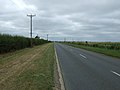
 A607 towards Lincoln - geograph.org.uk - 2829406.jpg 640 × 480; 48 KB
-
-

-
 B1202 eastbound - geograph.org.uk - 5724736.jpg 640 × 480; 48 KB
-
 Bends in Castle lane - geograph.org.uk - 2981239.jpg 1,280 × 853; 263 KB
-
 Black Labrador - geograph.org.uk - 329153.jpg 427 × 640; 123 KB
-
 Boothby Graffoe - brick cottages on Main Street - geograph.org.uk - 3096229.jpg 1,600 × 1,200; 689 KB
-
 Boothby Graffoe - houses at top of Castle Lane - geograph.org.uk - 3096213.jpg 1,600 × 1,181; 548 KB
-
 Boothby Graffoe - lane near Hillside Cottage - geograph.org.uk - 3096224.jpg 1,600 × 1,200; 672 KB
-
 Boothby Graffoe - The Pinfold on Main Street - geograph.org.uk - 3096206.jpg 1,600 × 1,200; 637 KB
-
 Boothby Graffoe - view down Castle Lane - geograph.org.uk - 3096209.jpg 1,600 × 1,200; 668 KB
-
 Boothby Graffoe - view towards Navenby - geograph.org.uk - 3096232.jpg 1,600 × 1,200; 501 KB
-
 Boothby Graffoe Heath - geograph.org.uk - 2624977.jpg 760 × 570; 150 KB
-
 Boothby Graffoe Heath - geograph.org.uk - 95724.jpg 640 × 480; 134 KB
-
 Boothby Graffoe Heath - geograph.org.uk - 95729.jpg 640 × 480; 135 KB
-
 Boothby Graffoe Low Fields - geograph.org.uk - 197320.jpg 640 × 427; 74 KB
-
 Boothby Graffoe Low Fields - geograph.org.uk - 3126730.jpg 3,648 × 2,736; 4.25 MB
-
 Boothby Graffoe Low Fields - geograph.org.uk - 3127830.jpg 3,523 × 2,607; 3.66 MB
-
 Boothby Graffoe Low Fields - geograph.org.uk - 3818124.jpg 800 × 533; 159 KB
-
 Boothby Graffoe Low Fields - geograph.org.uk - 3818132.jpg 800 × 533; 166 KB
-
 Boothby Graffoe, Grantham Road (A607) - geograph.org.uk - 4208835.jpg 640 × 480; 252 KB
-

-

-
 Bridleway off Castle Lane - geograph.org.uk - 3129359.jpg 3,493 × 2,555; 3.34 MB
-
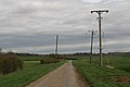
 Broughton Lane - geograph.org.uk - 2708792.jpg 1,280 × 960; 203 KB
-
 Broughton Lane - geograph.org.uk - 5503213.jpg 4,000 × 3,000; 4.58 MB
-
 Broughton Lane heading north - geograph.org.uk - 2907338.jpg 640 × 480; 54 KB
-

-

-
 Cables across Castle Lane and a public footpath along it - geograph.org.uk - 4427245.jpg 1,600 × 1,067; 197 KB
-
 Castle Lane - geograph.org.uk - 1055610.jpg 640 × 427; 62 KB
-
 Castle Lane - geograph.org.uk - 3128200.jpg 3,511 × 2,614; 3.63 MB
-
 Castle Lane - geograph.org.uk - 3130411.jpg 3,521 × 2,619; 3.08 MB
-
 Castle Lane - geograph.org.uk - 3131255.jpg 3,510 × 2,554; 3.02 MB
-
 Castle Lane - geograph.org.uk - 3818127.jpg 800 × 533; 144 KB
-
 Castle Lane - geograph.org.uk - 3818137.jpg 800 × 533; 169 KB
-
 Castle Lane - geograph.org.uk - 5503183.jpg 4,000 × 3,000; 4.61 MB
-
 Castle Lane - geograph.org.uk - 5725707.jpg 640 × 480; 92 KB
-

-
 Castle Lane looking west - geograph.org.uk - 2312835.jpg 1,024 × 768; 159 KB
-
 Castle Lane near Somerton Castle - geograph.org.uk - 2320534.jpg 1,024 × 768; 142 KB
-
 Cereals 2012 - geograph.org.uk - 3005253.jpg 1,920 × 2,560; 1.06 MB
-
 Cereals 2012 - geograph.org.uk - 3005254.jpg 2,560 × 1,920; 1,009 KB
-
 Cereals 2012 - geograph.org.uk - 3005287.jpg 2,560 × 1,920; 1.03 MB
-
 Cereals 2012 Visitor entrance - geograph.org.uk - 3005257.jpg 2,560 × 1,920; 1 MB
-
 Cereals 2012, expensive Stannah lift - geograph.org.uk - 3005309.jpg 2,560 × 1,920; 1.01 MB
-
 Cereals 2012, Wheats from around the world - geograph.org.uk - 3005266.jpg 2,560 × 1,920; 1,000 KB
-
 Cereals, again - geograph.org.uk - 2464749.jpg 640 × 480; 83 KB
-
 Boothby Graffoe - geograph.org.uk - 330580.jpg 640 × 427; 68 KB
-
 Coleby Heath and Boothby Graffoe Heath - geograph.org.uk - 5163588.jpg 1,024 × 768; 227 KB
-
 Cows off Castle Lane - geograph.org.uk - 2982655.jpg 1,280 × 853; 347 KB
-
 Crop field, Boothby Graffoe - geograph.org.uk - 2829400.jpg 640 × 480; 61 KB
-
 Crop sprayer demonstration ring - geograph.org.uk - 2464786.jpg 640 × 480; 139 KB
-
 Crop Trials - geograph.org.uk - 329135.jpg 640 × 427; 90 KB
-
 Cut Mark, Boothby Graffoe, ^8 Blacksmith Lane - geograph.org.uk - 5805954.jpg 1,280 × 960; 350 KB
-
 Cut Mark, Boothby Graffoe, ^8 Blacksmith Lane - geograph.org.uk - 5805957.jpg 1,280 × 800; 179 KB
-
 Ditch off Broughton Lane - geograph.org.uk - 5503206.jpg 4,000 × 3,000; 4.98 MB
-

-
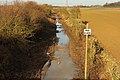
 Drain leading to the River Brant - geograph.org.uk - 5154441.jpg 1,024 × 768; 190 KB
-

-

-
 Entrance to Coleby Straw Plant - geograph.org.uk - 5163633.jpg 1,024 × 768; 155 KB
-
 Ermine House - geograph.org.uk - 2724463.jpg 640 × 427; 150 KB
-
 Ermine House paddock - geograph.org.uk - 2724467.jpg 640 × 427; 137 KB
-
 Ermine Street - geograph.org.uk - 3312560.jpg 2,464 × 1,632; 1.01 MB
-
 Ermine Street - geograph.org.uk - 837498.jpg 640 × 427; 59 KB
-
 Ermine Street - geograph.org.uk - 95593.jpg 640 × 480; 122 KB
-
 Ermine Street - geograph.org.uk - 95604.jpg 640 × 480; 114 KB
-
 Ermine Street - geograph.org.uk - 95607.jpg 640 × 480; 143 KB
-
 Ermine Street by Boothby Graffoe - geograph.org.uk - 2625551.jpg 640 × 480; 210 KB
-

-
 Ermine Street, Roman Road - geograph.org.uk - 5724718.jpg 640 × 480; 43 KB
-
 Ermine Street, Roman Road - geograph.org.uk - 5724727.jpg 640 × 480; 54 KB
-
 Far End (lane) at Boothby Graffoe - geograph.org.uk - 2982711.jpg 1,280 × 853; 509 KB
-
 Far End - geograph.org.uk - 328210.jpg 640 × 427; 90 KB
-
 Far End - geograph.org.uk - 5725703.jpg 640 × 480; 110 KB
-
 Far End, Boothby Graffoe - geograph.org.uk - 328208.jpg 640 × 427; 90 KB
-
 Farm track - geograph.org.uk - 758103.jpg 640 × 480; 76 KB
-
 Farm track and pit - geograph.org.uk - 2312822.jpg 1,024 × 768; 196 KB
-
 Farm track in Boothby Graffoe Low Fields - geograph.org.uk - 2320546.jpg 1,024 × 768; 213 KB
-

-
 Farm track near Somerton Castle - geograph.org.uk - 3131243.jpg 3,648 × 2,736; 3.99 MB
-
 Farm track towards Coleby - geograph.org.uk - 2312864.jpg 1,024 × 768; 185 KB
-
 Farmhouse on Boothby Heath - geograph.org.uk - 1293820.jpg 640 × 426; 65 KB
-
 Farmland , Boothby Graffoe Heath - geograph.org.uk - 3564455.jpg 640 × 480; 75 KB
-

-
 Farmland between Navenby and Boothby Graffoe - geograph.org.uk - 3127843.jpg 3,538 × 2,613; 3.53 MB
-
 Field entrance with a view west of Boothby Graffoe - geograph.org.uk - 3126307.jpg 3,648 × 2,736; 3.72 MB
-
 Field near Coleby - geograph.org.uk - 4655398.jpg 4,269 × 2,272; 4.71 MB
-
-
 Footpath to Coleby (2) - geograph.org.uk - 2320550.jpg 1,024 × 768; 305 KB
-
 Footpath to Coleby (3) - geograph.org.uk - 2320553.jpg 1,024 × 768; 241 KB
-
 Footpath to Coleby - geograph.org.uk - 2312705.jpg 1,024 × 768; 194 KB
-
 Footpath to Coleby - geograph.org.uk - 2312815.jpg 1,024 × 768; 219 KB
-
 Footpath to Coleby - geograph.org.uk - 4655384.jpg 4,789 × 3,142; 5.53 MB
-

-
 Golden Retriever - geograph.org.uk - 329147.jpg 427 × 640; 110 KB
-
 Hard standing west of Boothby Graffoe - geograph.org.uk - 3128190.jpg 3,648 × 2,736; 3.46 MB
-
 Heath Lane (B1202) - geograph.org.uk - 3564448.jpg 640 × 480; 48 KB
-
 Heath Lane (B1202) - geograph.org.uk - 3564457.jpg 640 × 480; 47 KB
-
 Heath Lane (B1202) heading east - geograph.org.uk - 2829412.jpg 640 × 480; 49 KB
-
 Heath Lane - geograph.org.uk - 3011180.jpg 640 × 427; 78 KB
-
 Heath Lane - geograph.org.uk - 3312553.jpg 2,464 × 1,632; 1.05 MB
-
 Heath Lane - geograph.org.uk - 3312569.jpg 2,464 × 1,632; 1.02 MB
-
 Heath Lane - geograph.org.uk - 3312828.jpg 2,464 × 1,632; 1 MB
-
 Hedgeline - geograph.org.uk - 328213.jpg 640 × 427; 76 KB
-

-
 High Dike - geograph.org.uk - 2724488.jpg 640 × 427; 72 KB
-
 High Dike - geograph.org.uk - 968704.jpg 640 × 427; 58 KB
-
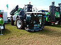
 JCB Fastracs on display at Cereals - geograph.org.uk - 2464764.jpg 640 × 480; 76 KB
-

-

-
 Lincoln Cliff - geograph.org.uk - 327576.jpg 640 × 427; 51 KB
-
 Looking across Broughton Lane from Castle Lane - geograph.org.uk - 5503194.jpg 4,000 × 3,000; 4.81 MB
-
 Main Street - geograph.org.uk - 3128172.jpg 3,553 × 2,680; 3.16 MB
-
 Main Street, Boothby Graffoe - geograph.org.uk - 2983802.jpg 1,280 × 853; 394 KB
-
 Managed verge - geograph.org.uk - 758096.jpg 640 × 480; 106 KB
-
 Manor Farm view - geograph.org.uk - 330588.jpg 640 × 427; 119 KB
-
 Manor Farm, Boothby Graffoe - geograph.org.uk - 2320478.jpg 1,024 × 768; 309 KB
-

-
 New hedge by the B1202 - geograph.org.uk - 4428203.jpg 640 × 427; 50 KB
-
 New Road off Castle Lane - geograph.org.uk - 2982663.jpg 1,280 × 853; 254 KB
-
 Oilseed rape crop off Broughton Lane - geograph.org.uk - 2907336.jpg 640 × 480; 82 KB
-
 Old Telephone Box - geograph.org.uk - 5724750.jpg 640 × 480; 94 KB
-
 Ordnance Survey Cut Mark - geograph.org.uk - 3099180.jpg 3,264 × 2,448; 2.33 MB
-
 Ordnance Survey Cut Mark - geograph.org.uk - 5480121.jpg 640 × 368; 100 KB
-
 Parish Boundary - geograph.org.uk - 330545.jpg 640 × 427; 103 KB
-

-
 Pond by the Viking Way - geograph.org.uk - 2320462.jpg 1,024 × 768; 383 KB
-

-
 Potato field, Boothby Heath Farm - geograph.org.uk - 3564445.jpg 640 × 480; 100 KB
-
 Private Track off Castle Lane - geograph.org.uk - 2982709.jpg 1,280 × 853; 325 KB
-
 Public footpath - geograph.org.uk - 5724756.jpg 640 × 480; 46 KB
-
 Public Footpath off Castle Lane - geograph.org.uk - 2982671.jpg 1,280 × 853; 352 KB
-
 Pylon by A607 north of Boothby Graffoe - geograph.org.uk - 5989451.jpg 1,600 × 1,064; 743 KB
-
 Recycling bag (large) - geograph.org.uk - 2465848.jpg 480 × 640; 75 KB
-
 Red Tractor, Cereals 2012 - geograph.org.uk - 3005303.jpg 2,560 × 1,920; 1.11 MB
-
 Resting combine harvester near Castle Lane - geograph.org.uk - 3129344.jpg 3,473 × 2,527; 3.22 MB
-
 Road junction - geograph.org.uk - 5724741.jpg 640 × 480; 49 KB
-
 Small fields near Manor Farm - geograph.org.uk - 3127819.jpg 3,451 × 2,485; 3.4 MB
-
 Snowdrops and Aconites - geograph.org.uk - 330582.jpg 427 × 640; 104 KB
-

-
 Somerton Castle, aerial 2018 - geograph.org.uk - 5840034.jpg 800 × 533; 91 KB
-
 Somerton Grange moat - geograph.org.uk - 1055621.jpg 640 × 427; 70 KB
-
 Speed Camera on A15 - geograph.org.uk - 403331.jpg 640 × 442; 71 KB
-
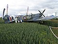
 Spitfire in the wheat - geograph.org.uk - 2465859.jpg 640 × 480; 79 KB
-
 Sponsors flags at the Cereals Event - geograph.org.uk - 2464754.jpg 640 × 480; 75 KB
-

-
 Stubble field near Gray's Buildings - geograph.org.uk - 5163638.jpg 1,024 × 768; 167 KB
-
-

-

-
 The Viking Way approaching Boothby Graffoe from the south - geograph.org.uk - 3639215.jpg 3,776 × 2,520; 4.19 MB
-
 The Viking Way between Coleby and Boothby Graffoe - geograph.org.uk - 3639209.jpg 3,776 × 2,520; 3.57 MB
-
 The Viking Way entering Boothby Graffoe - geograph.org.uk - 2312900.jpg 1,024 × 768; 279 KB
-
 The Viking Way north of Boothby Graffoe - geograph.org.uk - 3126722.jpg 3,648 × 2,736; 3.16 MB
-
 Track to Boothby Graffoe Low Fields - geograph.org.uk - 329050.jpg 640 × 427; 58 KB
-
 Track to Somerton Castle - geograph.org.uk - 2320541.jpg 1,024 × 768; 190 KB
-
 View from Public Footpath - geograph.org.uk - 5724765.jpg 640 × 480; 49 KB
-
 View from Viking Way - geograph.org.uk - 5725711.jpg 640 × 480; 80 KB
-
 View towards Heath House - geograph.org.uk - 5163647.jpg 1,024 × 768; 164 KB
-
 Viking Way symbol - geograph.org.uk - 5725682.jpg 640 × 480; 62 KB
-

-
 Where the path meets the road - geograph.org.uk - 2320467.jpg 1,024 × 768; 182 KB
-
 Boothby Graffoe Low Fields - geograph.org.uk - 59834.jpg 640 × 480; 108 KB
-
 Coleby Heath - geograph.org.uk - 95733.jpg 640 × 480; 152 KB
-
 Coleby Heath - geograph.org.uk - 95735.jpg 640 × 480; 109 KB
-
 Disused railway - geograph.org.uk - 197324.jpg 640 × 427; 69 KB
-
 Footpath - farm track - geograph.org.uk - 419942.jpg 640 × 480; 137 KB
-
 Grays Buildings - geograph.org.uk - 758098.jpg 640 × 480; 74 KB
-
 Looking towards Coleby Lodge Farm - geograph.org.uk - 67211.jpg 640 × 427; 126 KB
-
 Main Street, Boothby Graffoe - geograph.org.uk - 59831.jpg 640 × 480; 111 KB
-
 The Viking Way - geograph.org.uk - 327616.jpg 640 × 427; 83 KB
-
 Viking Way - geograph.org.uk - 327634.jpg 640 × 427; 71 KB
-
 Viking Way - geograph.org.uk - 330559.jpg 427 × 640; 83 KB


_on_a_stormy_April_afternoon_-_geograph.org.uk_-_4428215.jpg)


_-_geograph.org.uk_-_4208835.jpg)


_at_Boothby_Graffoe_-_geograph.org.uk_-_2982711.jpg)


_-_geograph.org.uk_-_2320550.jpg)
_-_geograph.org.uk_-_2320553.jpg)


_-_geograph.org.uk_-_3564448.jpg)
_-_geograph.org.uk_-_3564457.jpg)
_heading_east_-_geograph.org.uk_-_2829412.jpg)


_-_geograph.org.uk_-_2465848.jpg)


