Category:Borough of Swale
Jump to navigation
Jump to search
district and borough in Kent, UK  | |||||
| Upload media | |||||
| Instance of |
| ||||
|---|---|---|---|---|---|
| Location | Kent, South East England, England | ||||
| Capital | |||||
| Legislative body |
| ||||
| Population |
| ||||
| Area |
| ||||
| Different from | |||||
| official website | |||||
 | |||||
Subcategories
This category has the following 44 subcategories, out of 44 total.
- Maps of the Borough of Swale (18 F)
B
D
E
F
G
H
- Halfway Houses, Kent (9 F)
I
L
M
N
O
Q
R
S
T
U
W
- Warden, Kent (72 F)
Media in category "Borough of Swale"
The following 200 files are in this category, out of 829 total.
(previous page) (next page)-
 'Crossing, No Gates' at Kemsley Down Station - geograph.org.uk - 5864787.jpg 1,024 × 768; 287 KB
-

-
 'Melior' approaches Kemsley Down station - geograph.org.uk - 5919022.jpg 4,000 × 3,000; 5.15 MB
-
 30, High Street - geograph.org.uk - 6004783.jpg 2,448 × 3,264; 1.92 MB
-
 35 - 39 High St - geograph.org.uk - 3001124.jpg 640 × 430; 72 KB
-
 A china clay tipper at Kemsley Down station - geograph.org.uk - 5919081.jpg 4,000 × 3,000; 4.85 MB
-
 A former ATS, Crown Quay Lane - geograph.org.uk - 5270368.jpg 3,264 × 2,448; 2.28 MB
-
 A reedy pond - geograph.org.uk - 3013250.jpg 640 × 430; 77 KB
-
 A scene at Kemsley Down station - geograph.org.uk - 5917926.jpg 4,000 × 3,000; 4.94 MB
-
 A249 near Iwade - geograph.org.uk - 3826997.jpg 3,488 × 2,616; 2.16 MB
-
 A249 towards Sheerness - geograph.org.uk - 5776600.jpg 640 × 428; 91 KB
-
 A249, Sheppey Way - geograph.org.uk - 4388134.jpg 640 × 426; 32 KB
-
 A249, Sheppey Way - geograph.org.uk - 4388137.jpg 640 × 426; 39 KB
-
 A249, Sheppey Way - geograph.org.uk - 4388139.jpg 640 × 426; 35 KB
-
 A249, Sheppey Way - geograph.org.uk - 4388141.jpg 640 × 426; 32 KB
-
 A2500 - geograph.org.uk - 4388163.jpg 640 × 426; 36 KB
-
 A2500 Lower Road - geograph.org.uk - 5776709.jpg 640 × 428; 82 KB
-
 Abandoned boat, Milton Creek, Sittingbourne - geograph.org.uk - 3603069.jpg 3,488 × 2,616; 2.18 MB
-
 Access road off Swale Way - geograph.org.uk - 2155684.jpg 640 × 430; 117 KB
-

-
 Addington Road, Sittingbourne - geograph.org.uk - 3603029.jpg 3,488 × 2,616; 2.27 MB
-
 Addington Road, Sittingbourne - geograph.org.uk - 4310042.jpg 2,272 × 1,704; 658 KB
-
 Adelaide Drive, Sittingbourne - geograph.org.uk - 3756700.jpg 3,488 × 2,616; 2.21 MB
-
 Admirals Walk, Minster-on-Sea - geograph.org.uk - 3718967.jpg 3,488 × 2,616; 2.15 MB
-
 Albany Road, Sittingbourne - geograph.org.uk - 3603041.jpg 3,488 × 2,616; 2.15 MB
-
 Albany Road, Sittingbourne - geograph.org.uk - 3603043.jpg 3,488 × 2,616; 2.23 MB
-
 Albany Road, Sittingbourne - geograph.org.uk - 4309873.jpg 2,272 × 1,704; 880 KB
-
 All Saints Road, Murston - geograph.org.uk - 3709676.jpg 3,479 × 2,058; 1.58 MB
-
 An old hedgerow near Tonge Corner Farm - geograph.org.uk - 6244502.jpg 3,869 × 2,901; 2.3 MB
-
 Another lorry load at Gas Road, Sittingbourne - geograph.org.uk - 5863096.jpg 1,024 × 576; 141 KB
-
 Arable land, Little Murston - geograph.org.uk - 3013350.jpg 640 × 430; 67 KB
-
 Arch in the paper mill pipelines, Sittingbourne - geograph.org.uk - 5864588.jpg 1,024 × 769; 310 KB
-
-
 Arthur Street, Sittingbourne - geograph.org.uk - 4310065.jpg 2,272 × 1,704; 749 KB
-
 Asda, Mill Way - geograph.org.uk - 2152306.jpg 640 × 408; 60 KB
-
 Auckland Drive - geograph.org.uk - 2070873.jpg 640 × 480; 70 KB
-
 B Company Headquarters - geograph.org.uk - 3001162.jpg 640 × 430; 58 KB
-
 B2005 Overbridge, A249 - geograph.org.uk - 4388140.jpg 640 × 426; 37 KB
-
 B2005 Swale Way bridge - geograph.org.uk - 6172337.jpg 1,024 × 768; 432 KB
-
 B2005 Swale Way bridge - geograph.org.uk - 6172353.jpg 1,024 × 768; 453 KB
-
 Banner Way, Minster-on-Sea - geograph.org.uk - 3718961.jpg 3,488 × 2,616; 2.22 MB
-
 Baptist Church - geograph.org.uk - 2998249.jpg 640 × 416; 63 KB
-
 Barclays, High St - geograph.org.uk - 2998267.jpg 640 × 433; 75 KB
-
 Barge Way, Coldharbour Marshes - geograph.org.uk - 2155698.jpg 640 × 430; 125 KB
-
 Barge Way, Coldharbour Marshes - geograph.org.uk - 2155712.jpg 640 × 430; 117 KB
-
 Barge Works, Milton Creek Country Park - geograph.org.uk - 2866974.jpg 4,288 × 3,216; 6.68 MB
-
 Barge Wreck, Milton Creek - geograph.org.uk - 2866978.jpg 4,288 × 3,216; 6.86 MB
-
 Barrier across Church Rd - geograph.org.uk - 3010019.jpg 640 × 430; 73 KB
-
 Barrier at end of tarmac lane - geograph.org.uk - 6168734.jpg 1,024 × 684; 341 KB
-
 Barrow Grove, Sittingbourne - geograph.org.uk - 4310020.jpg 2,272 × 1,704; 660 KB
-
 Bassett Road, Sittingbourne - geograph.org.uk - 4310031.jpg 2,272 × 1,704; 738 KB
-
 Batter Profile boards on the Northern Relief Road - geograph.org.uk - 2117197.jpg 3,072 × 2,304; 2.18 MB
-
 Bayford Court, Sittingbourne - geograph.org.uk - 3337145.jpg 4,288 × 3,216; 6.87 MB
-
 Bayford Road, Sittingbourne - geograph.org.uk - 3708120.jpg 3,488 × 2,616; 2.24 MB
-
 Beauty of Bath, Sittingbourne - geograph.org.uk - 4310004.jpg 2,272 × 1,704; 656 KB
-
 Beauvoir Way - geograph.org.uk - 2153224.jpg 640 × 374; 82 KB
-
 Beechwood Avenue, Milton Regis - geograph.org.uk - 4481805.jpg 2,272 × 1,704; 655 KB
-
 Behind the sea wall at former Elmley Ferry - geograph.org.uk - 6168690.jpg 1,024 × 768; 404 KB
-
 Belgrave Road, Halfway - geograph.org.uk - 3718898.jpg 3,488 × 2,616; 2.1 MB
-
 Belmont Road, Halfway - geograph.org.uk - 3718930.jpg 3,488 × 2,616; 2.18 MB
-
 Belmont Road, Sittingbourne - geograph.org.uk - 3603038.jpg 3,488 × 2,616; 2.29 MB
-
 Berkeley Court, Sittingbourne - geograph.org.uk - 4310012.jpg 2,272 × 1,704; 617 KB
-
 Blenheim Road, Sittingbourne - geograph.org.uk - 3698148.jpg 3,488 × 2,616; 2.31 MB
-
 Blocked footpath to Crown Quay, Sittingbourne - geograph.org.uk - 3337093.jpg 4,288 × 3,216; 4.41 MB
-
 Boardwalk in the mud - geograph.org.uk - 1948137.jpg 2,304 × 3,072; 1.66 MB
-
 Boat reclaimed by nature, Milton Creek, Sittingbourne - geograph.org.uk - 3603056.jpg 3,488 × 2,616; 2.16 MB
-
 Boat skeleton, The Swale - geograph.org.uk - 3016135.jpg 640 × 430; 83 KB
-
 Bonham Way - geograph.org.uk - 3003648.jpg 640 × 430; 55 KB
-
 Borden Lane - geograph.org.uk - 5865803.jpg 1,024 × 790; 250 KB
-
 Borden Lane, Chalkwell - geograph.org.uk - 4483409.jpg 2,272 × 1,704; 1.01 MB
-
 Borrow dyke east of Elmley Ferry - geograph.org.uk - 6168708.jpg 1,024 × 768; 453 KB
-
 Bourne Grove, Chalkwell - geograph.org.uk - 4483406.jpg 2,272 × 1,704; 670 KB
-
 Bourne Park Stadium training ground, Sittingbourne - geograph.org.uk - 3337200.jpg 4,288 × 3,216; 4.92 MB
-
 Bourne Performance, Eurolink Way - geograph.org.uk - 3001208.jpg 640 × 430; 72 KB
-
 Bradley Drive, Sittingbourne - geograph.org.uk - 4309923.jpg 2,272 × 1,704; 702 KB
-
 Bramblefield Lane, Grovehurst - geograph.org.uk - 3827014.jpg 3,488 × 2,616; 1.47 MB
-
 Bramblefield Lane, Grovehurst - geograph.org.uk - 3827017.jpg 3,488 × 2,616; 2.15 MB
-
 Bramblefield Lane, Grovehurst - geograph.org.uk - 3827019.jpg 3,488 × 2,616; 2.17 MB
-
 Bramblefield Lane, Howt Green - geograph.org.uk - 3827041.jpg 3,488 × 2,616; 1.64 MB
-
 Branch line to the Isle of Sheppey - geograph.org.uk - 2996382.jpg 640 × 430; 90 KB
-
 Branch line to the Isle of Sheppey - geograph.org.uk - 2996384.jpg 640 × 417; 101 KB
-
 Brenchley House - geograph.org.uk - 3001069.jpg 640 × 558; 90 KB
-
 Brewery Road, Milton Regis - geograph.org.uk - 3592274.jpg 3,488 × 2,616; 2.18 MB
-
 Brickworks, Milton Creek Country Park - geograph.org.uk - 2867038.jpg 4,288 × 3,216; 6.78 MB
-
 Bridge construction works in Milton Creek - geograph.org.uk - 2219312.jpg 3,072 × 2,304; 1.43 MB
-
 Bridleway heading north - geograph.org.uk - 3013340.jpg 640 × 430; 113 KB
-
 Bridleway past the nature reserve - geograph.org.uk - 3013281.jpg 640 × 430; 114 KB
-
 Bridleway to Little Murston - geograph.org.uk - 3013248.jpg 640 × 430; 70 KB
-
 Bridleway to Little Murston - geograph.org.uk - 3013347.jpg 640 × 430; 150 KB
-
 Brisbane Avenue, Sittingbourne - geograph.org.uk - 3756693.jpg 3,488 × 2,616; 2.25 MB
-
 Brisbane Avenue, Sittingbourne - geograph.org.uk - 4949016.jpg 3,001 × 2,251; 1.29 MB
-
 Bugs in Milton Creek Country Park - geograph.org.uk - 3279074.jpg 4,288 × 3,216; 5.35 MB
-
 Building site, Halfway Road - geograph.org.uk - 5276450.jpg 3,264 × 2,448; 4.01 MB
-
 Building site, Power Station Road - geograph.org.uk - 5276462.jpg 3,264 × 2,448; 3.41 MB
-
 Building site, Power Station Road - geograph.org.uk - 5276465.jpg 3,264 × 2,448; 2.53 MB
-
 Building site, Power Station Road - geograph.org.uk - 5276472.jpg 3,264 × 2,448; 2.18 MB
-
 Bungalow on Bell Street, Sittingbourne - geograph.org.uk - 5319797.jpg 2,048 × 1,536; 1.48 MB
-
 Bungalow on London Road, Chalkwell - geograph.org.uk - 5002664.jpg 2,048 × 1,536; 1.5 MB
-
 Bunters, Sittingbourne - geograph.org.uk - 3590423.jpg 3,488 × 2,616; 2.13 MB
-
-
 Burley Road, Sittingbourne - geograph.org.uk - 4310035.jpg 2,272 × 1,704; 724 KB
-
 Business Unit, Dolphin Rd - geograph.org.uk - 3003666.jpg 640 × 430; 48 KB
-
 Byway - geograph.org.uk - 3016107.jpg 640 × 430; 90 KB
-
 Byway heading north - geograph.org.uk - 3016120.jpg 640 × 430; 79 KB
-
 Byway leading to Little Murston - geograph.org.uk - 3708404.jpg 3,488 × 2,616; 2.26 MB
-
 Byway near Little Murston - geograph.org.uk - 3016098.jpg 640 × 430; 108 KB
-
 Byway near Little Murston - geograph.org.uk - 3708414.jpg 3,488 × 2,616; 2.19 MB
-
 Byway near Little Murston - geograph.org.uk - 3708421.jpg 3,488 × 2,616; 2.23 MB
-
 Byway to Little Murston - geograph.org.uk - 3013354.jpg 640 × 430; 122 KB
-
 Byway to The Swale - geograph.org.uk - 4413999.jpg 640 × 480; 140 KB
-
 Byway towards former Elmley Ferry - geograph.org.uk - 6168413.jpg 1,024 × 768; 380 KB
-
 Byway towards former Elmley Ferry - geograph.org.uk - 6168649.jpg 1,024 × 768; 379 KB
-
 Byway towards former Elmley Ferry - geograph.org.uk - 6168723.jpg 1,024 × 768; 585 KB
-
 Calor Gas Centre - geograph.org.uk - 3003566.jpg 640 × 430; 78 KB
-
 Canberra Gardens, Sittingbourne - geograph.org.uk - 3756695.jpg 3,488 × 2,616; 2.25 MB
-
 Canterbury Road at the junction of Swanstree Road - geograph.org.uk - 5005626.jpg 1,990 × 1,454; 730 KB
-
 Canterbury Road, Sittingbourne - geograph.org.uk - 5012534.jpg 2,048 × 1,536; 1.49 MB
-
 Canterbury Road, Snipeshill - geograph.org.uk - 5012485.jpg 2,010 × 1,484; 746 KB
-
 Carousel, Castle Rd - geograph.org.uk - 3003655.jpg 640 × 430; 56 KB
-
-
 Castle Court and Prospect Court - geograph.org.uk - 3003564.jpg 640 × 430; 54 KB
-
 Castle Rd - geograph.org.uk - 3003558.jpg 640 × 430; 67 KB
-
 Castle Road Eurolink - geograph.org.uk - 5579133.jpg 3,264 × 2,448; 1.79 MB
-
 Castle Rough Lane, Kemsley - geograph.org.uk - 4311029.jpg 2,272 × 1,704; 845 KB
-
 Cemetery on Bell Road, Sittingbourne - geograph.org.uk - 5321953.jpg 2,048 × 1,536; 1.06 MB
-
 Central Park Stadium - geograph.org.uk - 3010037.jpg 640 × 430; 42 KB
-
 Central Park Stadium - geograph.org.uk - 3010041.jpg 640 × 430; 50 KB
-
 Central Park Stadium - geograph.org.uk - 3010044.jpg 640 × 430; 66 KB
-
 Chalkwell Rd - geograph.org.uk - 3167056.jpg 640 × 430; 65 KB
-
 Chalkwell Road, Chalkwell - geograph.org.uk - 3756711.jpg 3,488 × 2,616; 2.21 MB
-
 Chalkwell Road, Milton Regis - geograph.org.uk - 3590449.jpg 3,488 × 2,616; 2.24 MB
-
 Chalkwell Road, Milton Regis - geograph.org.uk - 3592215.jpg 3,488 × 2,616; 2.21 MB
-
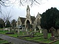 Chapel of Rest, Sittingbourne Cemetery - geograph.org.uk - 4309864.jpg 2,272 × 1,704; 880 KB
-
 Chappel Way, Milton Regis - geograph.org.uk - 4481824.jpg 2,272 × 1,704; 633 KB
-
 Charlotte Street, Milton Regis - geograph.org.uk - 3590444.jpg 3,488 × 2,616; 2.18 MB
-
 Charlotte Street, Milton Regis - geograph.org.uk - 4310909.jpg 2,272 × 1,704; 707 KB
-
 Charlotte Street, Milton Regis - geograph.org.uk - 4310929.jpg 2,272 × 1,704; 682 KB
-
 Cherry Close, Milton Regis - geograph.org.uk - 4481812.jpg 2,272 × 1,704; 703 KB
-
 Children's Play Area, Milton Creek Country Park - geograph.org.uk - 2869224.jpg 4,288 × 3,216; 5.65 MB
-
 Chimneys, St Regis Paper Mill - geograph.org.uk - 2155715.jpg 640 × 430; 109 KB
-
 Church Marshes - geograph.org.uk - 6172298.jpg 1,024 × 768; 494 KB
-
 Church on the High St - geograph.org.uk - 2998260.jpg 430 × 640; 48 KB
-
 Church Rd - geograph.org.uk - 3003685.jpg 640 × 430; 81 KB
-
 Church Rd Industrial Estate - geograph.org.uk - 3010023.jpg 640 × 430; 52 KB
-
 Church Road, Murston - geograph.org.uk - 3708209.jpg 3,488 × 2,616; 1.75 MB
-
 Church Road, Murston - geograph.org.uk - 3708314.jpg 3,488 × 2,616; 2.27 MB
-
 Church Street, Milton Regis - geograph.org.uk - 3590440.jpg 3,488 × 2,616; 2.16 MB
-
 Church Street, Milton Regis - geograph.org.uk - 3592226.jpg 3,488 × 2,616; 2.21 MB
-
 Church Wharf development site (2) - geograph.org.uk - 2867644.jpg 4,288 × 3,216; 4.24 MB
-
 Church Wharf development site - geograph.org.uk - 2867330.jpg 4,288 × 3,216; 5.69 MB
-
 Coldharbour Lane, Kemsley - geograph.org.uk - 4311037.jpg 2,272 × 1,704; 721 KB
-
 Coleman Drive, Kemsley - geograph.org.uk - 4311025.jpg 2,272 × 1,704; 645 KB
-
 College Road - geograph.org.uk - 4869960.jpg 3,822 × 2,548; 3.31 MB
-
 College Road, Sittingbourne - geograph.org.uk - 4310007.jpg 2,272 × 1,704; 770 KB
-
 College Road, Sittingbourne - geograph.org.uk - 4310022.jpg 2,272 × 1,704; 760 KB
-
 Completed wall, Swale Way (B2005) - geograph.org.uk - 6359902.jpg 3,264 × 2,448; 2.43 MB
-
 Concrete and Industry by Milton Creek - geograph.org.uk - 3592306.jpg 3,488 × 2,616; 2.18 MB
-

-
 Concrete pipe rings, Gas Rd - geograph.org.uk - 2152250.jpg 640 × 430; 145 KB
-
 Concrete structures near Milton Creek - geograph.org.uk - 3592303.jpg 3,488 × 2,616; 2.15 MB
-
 Concrete Works, Milton Creek Country Park - geograph.org.uk - 2866972.jpg 4,288 × 3,216; 7.14 MB
-
 Connaught Road, Sittingbourne - geograph.org.uk - 4309884.jpg 2,272 × 1,704; 717 KB
-
 Connaught Road, Sittingbourne - geograph.org.uk - 4309893.jpg 2,272 × 1,704; 671 KB
-
 Construction of a wall, Swale Way (B2005) - geograph.org.uk - 5578295.jpg 3,264 × 2,448; 1.89 MB
-
 Construction sites, Castle Road Eurolink - geograph.org.uk - 5356555.jpg 3,264 × 2,448; 3.78 MB
-
 Cook Lane of Mill Way - geograph.org.uk - 2152276.jpg 640 × 430; 127 KB
-
 Cottages on Chalkwell Road - geograph.org.uk - 6169327.jpg 1,024 × 684; 277 KB
-
 Cow parsley alongside Cromer Road - geograph.org.uk - 4972539.jpg 4,608 × 3,456; 3.31 MB
-
 Cow parsley alongside Highsted Road - geograph.org.uk - 4972532.jpg 4,608 × 3,456; 3.36 MB
-
 Cowper Road, Sittingbourne - geograph.org.uk - 3708154.jpg 3,488 × 2,616; 2.28 MB
-
-
 Crane on the Saxon Shore Way - geograph.org.uk - 2219314.jpg 2,304 × 3,072; 1.62 MB
-
 Cranes on Sittingbourne Northern Relief Road - geograph.org.uk - 2117085.jpg 2,304 × 3,072; 1.38 MB
-
 Crescent Street sign, Sittingbourne - geograph.org.uk - 3592332.jpg 3,488 × 2,616; 2.14 MB
-
 Cross Lane, Milton Regis - geograph.org.uk - 3592271.jpg 3,488 × 2,616; 2.22 MB
-
 Crossroads at Halfway Houses - geograph.org.uk - 3169723.jpg 718 × 538; 93 KB
-
 Crown Quay Industrial Estate, Sittingbourne (2) - geograph.org.uk - 3334047.jpg 4,288 × 3,216; 4.51 MB
-
 Crown Quay Industrial Estate, Sittingbourne (3) - geograph.org.uk - 3334050.jpg 4,288 × 3,216; 6.52 MB
-
 Crown Quay Industrial Estate, Sittingbourne - geograph.org.uk - 3334045.jpg 4,288 × 3,216; 4.91 MB
-
 Crown Road, Milton Regis - geograph.org.uk - 3592224.jpg 3,488 × 2,616; 2.17 MB
-
 Cryalls Lane, Sittingbourne - geograph.org.uk - 3756673.jpg 3,488 × 2,616; 1.51 MB
-
 Cryalls Lane, Sittingbourne - geograph.org.uk - 4949021.jpg 3,264 × 2,448; 1.61 MB
-
 Danley Road, Halfway - geograph.org.uk - 3719142.jpg 3,488 × 2,616; 2.25 MB
-
 Dawn (144266387).jpeg 1,360 × 2,048; 683 KB
-
 Dean Road, Milton Regis - geograph.org.uk - 4481814.jpg 2,272 × 1,704; 590 KB
-
 Demolition site, Sittingbourne - geograph.org.uk - 6169391.jpg 1,024 × 768; 364 KB
-
 Demolition site, Sittingbourne - geograph.org.uk - 6169401.jpg 1,024 × 768; 389 KB
-
 Demolition works on Bell Road - geograph.org.uk - 2479307.jpg 3,072 × 2,304; 1.91 MB
-
 Derby Close, Milton Regis - geograph.org.uk - 4481846.jpg 2,272 × 1,704; 675 KB
-
 Derelict Industrial Site near Halfway - geograph.org.uk - 3719120.jpg 3,488 × 2,616; 1.81 MB
-
 Derelict outbuildings, Neats Court Farm - geograph.org.uk - 3704575.jpg 1,111 × 856; 213 KB
-
 Derelict site in Howt Green - geograph.org.uk - 3827021.jpg 3,488 × 2,616; 1.67 MB
-
 Derelict site in Howt Green - geograph.org.uk - 3827025.jpg 3,488 × 2,616; 1.88 MB
-
 Derelict site, Crown Quay Lane - geograph.org.uk - 5270376.jpg 3,264 × 2,448; 3.73 MB
-
 Derelict site, Crown Quay Lane - geograph.org.uk - 5572726.jpg 3,264 × 2,448; 3.86 MB
-
 Dereliction at Crown Quay - geograph.org.uk - 3019167.jpg 1,024 × 785; 155 KB
-
 Development of logistics hub - geograph.org.uk - 4190286.jpg 640 × 480; 86 KB
-
 Development site, Crown Quay Lane - geograph.org.uk - 6359202.jpg 3,264 × 2,448; 2.67 MB
-
 Development site, Crown Quay Lane - geograph.org.uk - 6359212.jpg 3,264 × 2,448; 3.68 MB
-
 Ditch by byway to former Elmley Ferry - geograph.org.uk - 6168382.jpg 1,024 × 768; 434 KB


_-_geograph.org.uk_-_2867644.jpg)


_-_geograph.org.uk_-_6359902.jpg)


_-_geograph.org.uk_-_5578295.jpg)


_-_geograph.org.uk_-_3334047.jpg)
_-_geograph.org.uk_-_3334050.jpg)


.jpeg)


