Category:Borough of Test Valley
Zur Navigation springen
Zur Suche springen
borough in Hampshire, United Kingdom  | |||||
| Medium hochladen | |||||
| Ist ein(e) |
| ||||
|---|---|---|---|---|---|
| Ort | Hampshire, Südostengland, England | ||||
| Hauptstadt | |||||
| Gesetzgebende Körperschaft |
| ||||
| Einwohnerzahl |
| ||||
| Fläche |
| ||||
| offizielle Website | |||||
 | |||||
Unterkategorien
Es werden 64 von insgesamt 64 Unterkategorien in dieser Kategorie angezeigt:
In Klammern die Anzahl der enthaltenen Kategorien (K), Seiten (S), Dateien (D)
Medien in der Kategorie „Borough of Test Valley“
Folgende 87 Dateien sind in dieser Kategorie, von 87 insgesamt.
-

-

-
-
-

-

-

-

-

-

-
 A27 approaching Shootash - geograph.org.uk - 3922999.jpg 640 × 427; 123 KB
-
 A27 at Embley Lane junction - geograph.org.uk - 3923423.jpg 640 × 451; 111 KB
-
 A27 bridge over the M27 - geograph.org.uk - 2857281.jpg 640 × 430; 40 KB
-
 Ashley's Copse - panoramio (1).jpg 3.872 × 2.592; 4,51 MB
-
 Ashley's Copse - panoramio.jpg 3.872 × 2.592; 4,43 MB
-
 Bakers Drive open space - geograph.org.uk - 1713665.jpg 2.272 × 1.704; 1,69 MB
-
 Bevisbury Camp - panoramio (1).jpg 3.872 × 2.592; 4,88 MB
-
 Bevisbury Camp - panoramio.jpg 3.872 × 2.592; 4,88 MB
-
 Blackhill, cattle grid - geograph.org.uk - 4717469.jpg 1.024 × 768; 227 KB
-
 Blackhill, gate - geograph.org.uk - 4717445.jpg 1.024 × 768; 282 KB
-
 Blackhill, National Park marker - geograph.org.uk - 4717479.jpg 1.024 × 768; 226 KB
-
 BrookFarmHouse.gif 240 × 159; 23 KB
-
 Canada Common Car Park - geograph.org.uk - 4698118.jpg 1.024 × 768; 132 KB
-
 Canada Common, track - geograph.org.uk - 4698135.jpg 1.024 × 768; 173 KB
-
 Canada Common, uneven ground - geograph.org.uk - 4698127.jpg 1.024 × 768; 238 KB
-
 Canada, Holly Bank Farm - geograph.org.uk - 4698165.jpg 1.024 × 768; 201 KB
-
 Canada, Rockingham Arms - geograph.org.uk - 4694995.jpg 1.024 × 680; 171 KB
-
 Caravan and Camp site - geograph.org.uk - 406320.jpg 640 × 480; 145 KB
-
 Chilworth Drove crosses M27 motorway - geograph.org.uk - 1199485.jpg 640 × 426; 165 KB
-
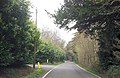
 Crossroads at Sherfield English - geograph.org.uk - 3922965.jpg 640 × 377; 56 KB
-

-
 Danebury Hill Fort entrance - panoramio.jpg 3.072 × 2.304; 2,88 MB
-
 Danebury Hill Fort outer ring - panoramio.jpg 3.072 × 2.304; 3,22 MB
-

-
-
 Eastleigh Works Centenary Open Days 30.jpg 4.000 × 3.000; 1,2 MB
-
 Entrance to Forest Edge Park - geograph.org.uk - 3923383.jpg 640 × 415; 92 KB
-
-
 Fallen tree blocking A36 - geograph.org.uk - 3794373.jpg 640 × 482; 106 KB
-

-
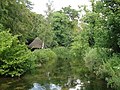 Fishing Hut - panoramio.jpg 2.895 × 2.171; 3,21 MB
-

-
-
 Gardeners Lane approaching A27 - geograph.org.uk - 3923390.jpg 640 × 515; 105 KB
-
 Gardeners Lane at entrance to Luibeg - geograph.org.uk - 3923381.jpg 640 × 477; 114 KB
-
 Gilbert's Nursery, Sherfield English - geograph.org.uk - 3738292.jpg 800 × 450; 203 KB
-
 Green Lane near Farley Mount, Winchester - Timeless Countryside scene - panoramio.jpg 2.736 × 3.648; 4,67 MB
-
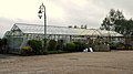
 Greenhouses at B and W Nursery, Plaitford - geograph.org.uk - 740407.jpg 640 × 427; 135 KB
-
 Hatchet Inn from A27 - geograph.org.uk - 3922987.jpg 640 × 468; 82 KB
-
 Houghton Lodge (224441309).jpeg 2.048 × 1.069; 1,24 MB
-
 Houghton Lodge (224442655).jpeg 2.048 × 1.329; 516 KB
-
 Houghton Lodge (224443195).jpeg 2.048 × 1.340; 432 KB
-
 Lee, postbox No. SO51 536 - geograph.org.uk - 1444350.jpg 480 × 640; 121 KB
-
 Manor House - 1.jpg 4.032 × 3.024; 6,32 MB
-
 Manor House - 2.jpg 4.032 × 3.024; 5,99 MB
-
 Manor House - 3.jpg 4.032 × 3.024; 4,92 MB
-
 Mature trees fallen into field at Wellow - geograph.org.uk - 3826322.jpg 640 × 482; 141 KB
-
 Newly fenced footpath - geograph.org.uk - 4393677.jpg 640 × 360; 83 KB
-
 Newton Stacey Ford, on the River Dever (geograph 5890792).jpg 1.024 × 683; 198 KB
-
 Newton Stacey, postbox No. SO20 22 - geograph.org.uk - 1163553.jpg 640 × 480; 125 KB
-
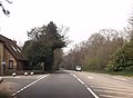
 Newtown Road junction with A27 - geograph.org.uk - 3922995.jpg 640 × 372; 97 KB
-
 Paddocks and fences - geograph.org.uk - 4393663.jpg 640 × 360; 50 KB
-
 Pig farming at Firgo Farm - geograph.org.uk - 344265.jpg 640 × 435; 154 KB
-
 Road Closed - geograph.org.uk - 3794377.jpg 640 × 482; 92 KB
-
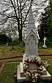
 Seat by the war memorial at East Wellow - geograph.org.uk - 4292971.jpg 640 × 480; 100 KB
-

-

-

-

-

-
 Test Valley UK Local Election 2023.svg 828 × 1.221; 475 KB
-
 The Big House (109125563).jpeg 2.048 × 2.048; 1,55 MB
-
 The Daffodil (109125611).jpeg 2.048 × 2.048; 1,9 MB
-
 The Flower (109125669).jpeg 2.048 × 2.048; 1,49 MB
-
 The Test Way adjacent to Monk's Cottages - geograph.org.uk - 3583587.jpg 640 × 482; 136 KB
-
 Weird tree Danebury Hill Fort - panoramio.jpg 2.626 × 2.129; 3,19 MB
-
 West Wellow Common - geograph.org.uk - 4698194.jpg 1.024 × 768; 212 KB
-
 West Wellow Common, ponies - geograph.org.uk - 4698248.jpg 1.024 × 768; 167 KB
-
 West Wellow Common, seat - geograph.org.uk - 4698225.jpg 1.024 × 768; 202 KB
-
 West Wellow Common, track - geograph.org.uk - 4698204.jpg 1.024 × 768; 204 KB
-
 West Wellow Common, trig point - geograph.org.uk - 4698240.jpg 1.024 × 768; 219 KB
-
 West Wellow, pond - geograph.org.uk - 4698214.jpg 1.024 × 768; 197 KB
-
 West Wellow, Red Rover - geograph.org.uk - 4698269.jpg 1.024 × 768; 173 KB
-
 West Wellow, restricted byway - geograph.org.uk - 4717541.jpg 1.024 × 768; 255 KB
-
 Woodside, Chilworth - geograph.org.uk - 802742.jpg 427 × 640; 187 KB
-
 Meadow Ditches near Mottisfont - geograph.org.uk - 425568.jpg 640 × 480; 130 KB
-
 Meadow near Mottisfont - geograph.org.uk - 425565.jpg 640 × 480; 102 KB
_-_geograph.org.uk_-_4292114.jpg)
_-_geograph.org.uk_-_4292115.jpg)
_-_geograph.org.uk_-_4292116.jpg)
_-_geograph.org.uk_-_4292117.jpg)
_-_geograph.org.uk_-_4293008.jpg)
_-_geograph.org.uk_-_4292972.jpg)
_-_geograph.org.uk_-_4292973.jpg)
_-_geograph.org.uk_-_4292988.jpg)
_-_geograph.org.uk_-_4292992.jpg)
_-_geograph.org.uk_-_4293009.jpg)


.jpg)


.jpg)


.jpeg)
.jpeg)
.jpeg)


.jpg)


.jpeg)
.jpeg)
.jpeg)


