Category:Frenchmoor
Jump to navigation
Jump to search
settlement and civil parish in Test Valley, Hampshire, England  | |||||
| Upload media | |||||
| Instance of | |||||
|---|---|---|---|---|---|
| Location | Test Valley, Hampshire, South East England, England | ||||
| Population |
| ||||
 | |||||
English: Frenchmoor is a settlement and civil parish in the Test Valley district, in the county of Hampshire, England.
Media in category "Frenchmoor"
The following 10 files are in this category, out of 10 total.
-
 Byway near Frenchmoor - geograph.org.uk - 422799.jpg 640 × 480; 196 KB
-
 Dappled Sunlight - geograph.org.uk - 422831.jpg 640 × 480; 186 KB
-
 Drive to Pugs Hole Farm - geograph.org.uk - 422841.jpg 640 × 480; 171 KB
-
 Field of sheep and house - geograph.org.uk - 2719218.jpg 640 × 480; 101 KB
-
 Lower Frenchmoor Copse - geograph.org.uk - 5891503.jpg 1,024 × 683; 314 KB
-
 Mature hedge near Pugs Hole - geograph.org.uk - 422804.jpg 640 × 480; 123 KB
-
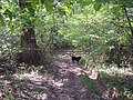
 Path in Lower Frenchmoor Copse - geograph.org.uk - 5891504.jpg 1,024 × 683; 324 KB
-
 View across the Dun Valley - geograph.org.uk - 5891510.jpg 1,024 × 683; 201 KB
-
 Woodland Path - geograph.org.uk - 422810.jpg 640 × 480; 193 KB
-
 Woodland Path in Frenchmoor Woods - geograph.org.uk - 422838.jpg 640 × 480; 181 KB


