Category:Boterstraat 4, Deventer
Jump to navigation
Jump to search
| Object location | | View all coordinates using: OpenStreetMap |
|---|
 | |||||
| Upload media | |||||
| Instance of |
| ||||
|---|---|---|---|---|---|
| Location | Deventer, Overijssel, Netherlands | ||||
| Street address |
| ||||
| Located on street | |||||
| Heritage designation |
| ||||
 | |||||
|
This is a category about rijksmonument number 12471
|
| Address |
|
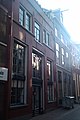
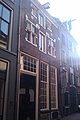
Media in category "Boterstraat 4, Deventer"
The following 5 files are in this category, out of 5 total.
-
 Boterstraat 10 Deventer.jpg 1,712 × 2,560; 1,011 KB
-
 Boterstraat 4-6 Deventer.jpg 1,712 × 2,560; 1.07 MB
-
 Boterstraat 8 Deventer.jpg 1,712 × 2,560; 945 KB
-
 Voorgevels - Deventer - 20055548 - RCE.jpg 807 × 1,200; 211 KB
-
 Voorgevels - Deventer - 20055554 - RCE.jpg 805 × 1,200; 174 KB


