Category:Boulder fields
Salti al navigilo
Salti al serĉilo
Deutsch: Blockmeere - eher im ebenen Gelände - oder Blockhalden - am Hang
English: Boulder fields
Español: Caos —de bloques o de bolos
Français : Chaos de blocs ou Chaos de boules
Čeština: Kamenné moře nebo Suťové pole
a surface covered by angular rocks, a landform result of periglaciation  | |||||
| Alŝuti plurmedion | |||||
| Subaro de | |||||
|---|---|---|---|---|---|
| |||||
Subkategorioj
Ĉi tiu kategorio havas la 14 jenajn subkategoriojn, el 14 entute.
*
- Volcanic bomb fields (7 D)
B
C
- Clusters of glacial erratics (2 D)
G
H
- Hamada (20 D)
I
M
S
- Supraglacial boulder fields (4 D)
Dosieroj en kategorio “Boulder fields”
La jenaj 37 dosieroj estas en ĉi tiu kategorio, el 37 entute.
-
 Boulder fields and clouds - geograph.org.uk - 219291.jpg 600 × 450; 78 KB
-
 Boulders above Coire Scamadal - geograph.org.uk - 217461.jpg 640 × 480; 40 KB
-
 Boulders&trains(byJoeriRömer).jpg 1 920 × 1 280; 1,81 MB
-
 Cannonball Rock field, Jordan.JPG 5 184 × 3 456; 8,71 MB
-
 Chalamain Gap - geograph.org.uk - 262412.jpg 640 × 480; 118 KB
-
 Crater of spatter-and-scoria cone Caldera de los Cuervos on Lanzarote, June 2013 (6).jpg 4 752 × 3 168; 8,66 MB
-
 Défilé de Straiture-Eboulis (4).jpg 2 736 × 3 648; 3,88 MB
-
 Fair Head - geograph.org.uk - 465051.jpg 640 × 427; 261 KB
-
 Glacier's Mouth. Chalati, Svaneti, Georgia.jpg 864 × 648; 632 KB
-
 Harrat al-Sham near Azraq.jpg 6 000 × 4 000; 9,08 MB
-
 Heron Over a River (8034193481).jpg 3 888 × 2 656; 14,22 MB
-
 HighlandSprengisandur.jpg 2 978 × 1 989; 962 KB
-
 Kamenne more Vyhne 2.JPG 1 024 × 768; 162 KB
-
 Keli Lake 09.08.2005 (2).jpg 2 048 × 1 536; 895 KB
-
 Kyrgyz Chuya Landscape.jpg 4 912 × 1 080; 2,63 MB
-
 Lagunas del Trampal.jpg 3 072 × 2 304; 1,44 MB
-
 Les-gorges-du-corong-1.jpg 8 208 × 2 228; 5,02 MB
-
 Nature picture of Bangladesh 06.jpg 5 184 × 3 456; 17,71 MB
-
 Navafría 1976 08.jpg 699 × 1 060; 618 KB
-
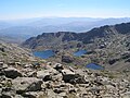
 Nearing the top of the Kelowna Boulderfields.png 4 608 × 3 456; 18,91 MB
-
 Ostrzyca 03.jpg 3 456 × 2 304; 6,09 MB
-
 Quedas-Kalandula 13 fim-da-visita LWS-2011-08 QD37.jpg 4 000 × 3 000; 3,65 MB
-
 Ringing Rock Cross Section.jpg 673 × 241; 43 KB
-
 Rocks on ground pattern.jpg 1 280 × 852; 269 KB
-
 Rragam.jpg 3 648 × 2 736; 6,44 MB
-
 Shore near Jura Forest - geograph.org.uk - 134677.jpg 640 × 480; 205 KB
-
 Spannender Weg durch das Blockmeer - panoramio.jpg 1 800 × 1 350; 636 KB
-
 Stonefree (157409115).jpeg 2 048 × 1 373; 986 KB
-
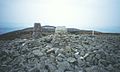 Summit, of Slieve Gullion - geograph.org.uk - 60110.jpg 640 × 385; 52 KB
-
 Tafelberg, Cederberg, South Africa.JPG 3 456 × 2 592; 2,57 MB
-
 Tancoco River.JPG 3 072 × 2 304; 2,94 MB
-
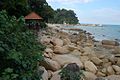 Teluk Cempedak wakaf.jpg 1 000 × 665; 672 KB
-
 Weathering freeze thaw action, Spain.jpg 3 369 × 1 085; 3,51 MB
-
 Zervreilahorn as seen from Furggeltihorn.jpg 4 608 × 3 456; 7,59 MB
-
 Zervreilasee as seen from Furggeltihorn.jpg 4 608 × 3 456; 7,23 MB
-
 Камни. Валуны.jpg 3 264 × 2 448; 2,11 MB
-
 На плато Кукисвумчорр.jpg 960 × 640; 263 KB


.jpg)


.jpg)
.jpg)


.jpg)


.jpg)


.jpeg)


