Category:Bracewell and Brogden
Jump to navigation
Jump to search
English: Bracewell and Brogden is a civil parish in the Borough of Pendle in Lancashire, England. According to the 2001 census it had a population of 238. The parish includes Bracewell (at , historically both were in the West Riding of Yorkshire.
civil parish in the West Craven area of the Borough of Pendle in Lancashire, England  | |||||
| Upload media | |||||
| Instance of | |||||
|---|---|---|---|---|---|
| Location | Pendle, Lancashire, North West England, England | ||||
 | |||||
Media in category "Bracewell and Brogden"
The following 186 files are in this category, out of 186 total.
-
 A bench with a view - geograph.org.uk - 5217981.jpg 6,000 × 4,000; 3.93 MB
-
 A59 near Monk Bridge - geograph.org.uk - 3741377.jpg 640 × 418; 38 KB
-
 A59 towards Clitheroe - geograph.org.uk - 5875616.jpg 640 × 480; 92 KB
-
 A59 towards Clitheroe - geograph.org.uk - 5875618.jpg 640 × 480; 72 KB
-
 A59 towards Skipton - geograph.org.uk - 5872700.jpg 640 × 480; 59 KB
-
 Access Drive to Coverdale - geograph.org.uk - 2762766.jpg 4,320 × 3,240; 3.47 MB
-
 Approaching Duck Pond - geograph.org.uk - 3111560.jpg 800 × 600; 116 KB
-
 Barnoldswick, Folly Cottages - geograph.org.uk - 2352549.jpg 3,456 × 2,304; 4.51 MB
-
 Barnoldswick, Folly Lane - geograph.org.uk - 2352657.jpg 3,456 × 2,304; 4.81 MB
-
 Barnoldswick, Folly Lane - geograph.org.uk - 2352683.jpg 3,456 × 2,304; 5.32 MB
-
 Barnoldswick, Folly Lane - geograph.org.uk - 2352711.jpg 3,456 × 2,304; 5.13 MB
-
 Barnoldswick, Folly Lane - geograph.org.uk - 2352739.jpg 3,456 × 2,304; 5.16 MB
-
 Barnoldswick, Folly Lane - geograph.org.uk - 2352820.jpg 3,456 × 2,304; 4.67 MB
-
 Barnoldswick, Folly Lane - geograph.org.uk - 2352947.jpg 3,456 × 2,304; 4.87 MB
-
 Barnoldswick, Folly Lane - geograph.org.uk - 2353330.jpg 3,456 × 2,304; 4.72 MB
-
 Barnoldswick, Folly Lane and stables - geograph.org.uk - 2352537.jpg 3,456 × 2,304; 5.3 MB
-
 Barnoldswick, Higher Craven View - geograph.org.uk - 2353283.jpg 3,456 × 2,304; 4.92 MB
-
 Barnoldswick, Higher Craven View - geograph.org.uk - 2353307.jpg 3,456 × 2,304; 3.71 MB
-
 Barnoldswick, Higher Craven View - geograph.org.uk - 2353347.jpg 3,456 × 2,304; 4.74 MB
-
 Barnoldswick, Unnamed house on Folly Lane - geograph.org.uk - 2352935.jpg 3,456 × 2,304; 4.1 MB
-
 Benchmark on Standridge Farm gate jamb - geograph.org.uk - 4819471.jpg 683 × 1,024; 216 KB
-
 Beside Big Covert - geograph.org.uk - 2761413.jpg 4,320 × 3,240; 4.63 MB
-
 Bomber Camp, north corner.jpg 4,000 × 2,249; 3.11 MB
-
 Boundary Stone - geograph.org.uk - 2353427.jpg 3,456 × 2,304; 2.97 MB
-
 Bracewell - geograph.org.uk - 4694043.jpg 5,024 × 3,278; 1.54 MB
-
 Bracewell Lane (B6251) - geograph.org.uk - 5872717.jpg 640 × 480; 94 KB
-

-

-
 Bracewell Lane - geograph.org.uk - 3379023.jpg 640 × 480; 193 KB
-

-
-
 Bracewell Lane at Yarlside - geograph.org.uk - 3337941.jpg 640 × 480; 51 KB
-
 Bracewell Lane from Barnoldswick - geograph.org.uk - 4816839.jpg 1,500 × 999; 257 KB
-
 Bracewell Lane, Bracewell - geograph.org.uk - 3378214.jpg 640 × 480; 139 KB
-
 Bracewell Lane, Bracewell - geograph.org.uk - 3379022.jpg 640 × 480; 184 KB
-
 Brogden Lane - geograph.org.uk - 2762604.jpg 4,320 × 3,240; 3.86 MB
-
 Brogden Lane - geograph.org.uk - 3391408.jpg 640 × 480; 147 KB
-
 Brogden Lane - geograph.org.uk - 3391414.jpg 640 × 480; 210 KB
-
 Brogden Lane - geograph.org.uk - 3391431.jpg 640 × 480; 191 KB
-
 Brogden Lane - geograph.org.uk - 3391500.jpg 640 × 480; 121 KB
-
 Brogden Lane - geograph.org.uk - 3391504.jpg 640 × 480; 99 KB
-
 Brogden Lane - geograph.org.uk - 3391508.jpg 640 × 480; 146 KB
-
 Brogden Lane - geograph.org.uk - 4694035.jpg 4,876 × 2,913; 1.85 MB
-
 Brogden Lane - geograph.org.uk - 4694059.jpg 5,184 × 3,456; 1.87 MB
-
 Brogden Lane at Flass House Farm - geograph.org.uk - 3391505.jpg 640 × 480; 130 KB
-
 Brogden Lane at Horrox Farm - geograph.org.uk - 3391420.jpg 640 × 480; 141 KB
-
 Brogden Lane at Lower Clough House Farm - geograph.org.uk - 3391507.jpg 640 × 480; 125 KB
-
 Brogden Lane at Manor House Farm - geograph.org.uk - 3391435.jpg 640 × 480; 157 KB
-
 Brogden Lane beside Kirk Clough - geograph.org.uk - 2762639.jpg 4,320 × 3,240; 4.71 MB
-
 Brogden Lane then Stocks Lane - geograph.org.uk - 3391510.jpg 640 × 480; 157 KB
-
 Continuation of the Pendle Way (geograph 2355194).jpg 3,456 × 2,304; 4.69 MB
-
 Countryside North of Barnoldswick - geograph.org.uk - 2483058.jpg 4,320 × 3,240; 3.4 MB
-
 Croft Gate Plantation - geograph.org.uk - 2483081.jpg 4,320 × 3,240; 3.21 MB
-
 Date stone, Bracewell - geograph.org.uk - 3378217.jpg 640 × 480; 150 KB
-
 Descending towards Big Covert - geograph.org.uk - 2761404.jpg 4,320 × 3,240; 4.5 MB
-
 Driveway to Brogden Hall - geograph.org.uk - 2762645.jpg 4,320 × 3,240; 4.27 MB
-

-
 Duck Pond (Farm) - geograph.org.uk - 2353632.jpg 3,456 × 2,304; 4.02 MB
-
 Duck Pond (Farm) - geograph.org.uk - 2353640.jpg 3,456 × 2,304; 4.28 MB
-
 Duck Pond - geograph.org.uk - 3111571.jpg 800 × 600; 143 KB
-
 Duck Pond Farm with sculpted heads - geograph.org.uk - 2353661.jpg 3,456 × 2,304; 3.71 MB
-
 Earthwork on the hill above Bracewell - geograph.org.uk - 2834347.jpg 1,024 × 685; 174 KB
-
 Elizabeth II postbox on Bracewell Lane, Bracewell - geograph.org.uk - 5872569.jpg 1,282 × 2,198; 706 KB
-
 Farm gate near Star Hall - geograph.org.uk - 2353728.jpg 3,456 × 2,304; 4.02 MB
-
 Farm track down to Star Hall - geograph.org.uk - 3112508.jpg 3,072 × 2,304; 2.33 MB
-
 Farm track off Gisburn Old Road - geograph.org.uk - 5216795.jpg 6,000 × 4,000; 4.28 MB
-
 Female head sculpture at Duck Pond - geograph.org.uk - 2353651.jpg 3,456 × 2,304; 3.47 MB
-
 Field entrance, Street Laithe - geograph.org.uk - 5875619.jpg 640 × 480; 91 KB
-
 Flass House - geograph.org.uk - 4694040.jpg 5,119 × 2,778; 1.62 MB
-
 Flass House Farm in the Mist - geograph.org.uk - 2762669.jpg 4,320 × 3,240; 2.64 MB
-
 Flass House Farm, Brogden - geograph.org.uk - 873041.jpg 640 × 480; 95 KB
-
 Folly Lane - geograph.org.uk - 2265692.jpg 2,592 × 1,944; 1.52 MB
-
 Folly Lane - geograph.org.uk - 2265703.jpg 2,592 × 1,944; 1.67 MB
-
 Folly Lane passing Standridge Farm - geograph.org.uk - 5218887.jpg 6,000 × 4,000; 4.94 MB
-
 Footbridge below Calf House Hill - geograph.org.uk - 2761432.jpg 4,320 × 3,240; 3.77 MB
-
 Footbridge below Walter Hill - geograph.org.uk - 1193345.jpg 640 × 480; 143 KB
-
 Footbridge over Stock Beck - geograph.org.uk - 2483065.jpg 4,320 × 3,240; 3.19 MB
-
 Footpath to Lister Well Road - geograph.org.uk - 2355239.jpg 3,456 × 2,304; 3.64 MB
-
 Footpath to the moor and thence to Duck Pond Farm - geograph.org.uk - 2355203.jpg 3,456 × 2,304; 4.63 MB
-
 Ford at Brogden Hall - geograph.org.uk - 4533946.jpg 3,872 × 2,592; 4.8 MB
-
 Ford at Manor House Farm, Brogden Lane - geograph.org.uk - 3391496.jpg 640 × 480; 152 KB
-
 Gate at top of Folly Lane - geograph.org.uk - 2353624.jpg 3,456 × 2,304; 4.24 MB
-
 Gate onto the open moor - geograph.org.uk - 2353689.jpg 3,456 × 2,304; 4.37 MB
-
 Gisburn Old Road (geograph 3112471).jpg 3,072 × 2,304; 2.3 MB
-
 Gisburn Old Road - geograph.org.uk - 2355216.jpg 3,456 × 2,304; 4.79 MB
-
 Gisburn Road crosses a stream - geograph.org.uk - 3337928.jpg 640 × 480; 38 KB
-
 Grazing near Stock Beck - geograph.org.uk - 5872698.jpg 640 × 480; 73 KB
-
 Grazing north of Barnoldswick - geograph.org.uk - 5872720.jpg 640 × 480; 62 KB
-
 Grazing, Bentha Hill - geograph.org.uk - 5875613.jpg 640 × 480; 78 KB
-
 Grazing, Bracewell - geograph.org.uk - 5872711.jpg 640 × 480; 70 KB
-
 Grouse moor on Weets Hill - geograph.org.uk - 5217998.jpg 6,000 × 4,000; 4.1 MB
-
 Gully on the Flanks of Weet Hill - geograph.org.uk - 2442352.jpg 4,320 × 3,240; 4.62 MB
-
 Higher Clough - geograph.org.uk - 179302.jpg 640 × 480; 155 KB
-
 Hillside above Hill Cloughs Farm - geograph.org.uk - 5218876.jpg 6,000 × 4,000; 3.82 MB
-
 Hillside near Weets House Farm - geograph.org.uk - 5217975.jpg 6,000 × 4,000; 3.62 MB
-
 Hopwood House, Bracewell - geograph.org.uk - 3379014.jpg 640 × 480; 146 KB
-
 Horrox House - geograph.org.uk - 4694062.jpg 5,004 × 2,302; 2 MB
-
 Horrox House and Brogden Lane - geograph.org.uk - 636760.jpg 640 × 558; 95 KB
-
 Horton Bridge - geograph.org.uk - 4638066.jpg 640 × 426; 141 KB
-
 Junction of Yarlside Road and the A59 - geograph.org.uk - 3165314.jpg 640 × 480; 109 KB
-
 Lane on Bentha Hill - geograph.org.uk - 2662506.jpg 4,320 × 3,240; 5.32 MB
-
 Lane Side - geograph.org.uk - 4694033.jpg 4,862 × 3,190; 1.7 MB
-
 Lister Well Road - geograph.org.uk - 154451.jpg 640 × 417; 56 KB
-
 Lister Well Road - geograph.org.uk - 4238083.jpg 1,600 × 1,200; 572 KB
-
 Low Laithe - geograph.org.uk - 2483072.jpg 4,320 × 3,240; 4.29 MB
-
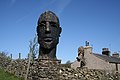 Male sculpted head at Duck Pond - geograph.org.uk - 2353658.jpg 3,456 × 2,304; 3.58 MB
-
 Manor House Farm - geograph.org.uk - 4694063.jpg 5,183 × 2,872; 1.77 MB
-
 Moorland gate - geograph.org.uk - 2353718.jpg 3,456 × 2,304; 4.44 MB
-
 Old Post Office Cottage, Bracewell - geograph.org.uk - 3558255.jpg 1,024 × 768; 488 KB
-
 Old Post Office on Bracewell Lane, Bracewell - geograph.org.uk - 5872572.jpg 3,648 × 2,736; 1.94 MB
-
 On Brogden Lane - geograph.org.uk - 2762660.jpg 4,320 × 3,240; 3.52 MB
-
 On the Footpath between Brogden Hall and Barlick - geograph.org.uk - 2762623.jpg 4,320 × 3,240; 5.58 MB
-
 Ornamental Lake beside Big Covert - geograph.org.uk - 2761439.jpg 4,320 × 3,240; 3.39 MB
-
 Path to Barnoldswick - geograph.org.uk - 5218869.jpg 6,000 × 4,000; 3.34 MB
-
 Path to Weets Hill - geograph.org.uk - 5218872.jpg 6,000 × 4,000; 4.18 MB
-
 Path towards Barnoldswick - geograph.org.uk - 5217991.jpg 6,000 × 4,000; 4.11 MB
-
 Path up to Weets Hill - geograph.org.uk - 5218882.jpg 6,000 × 4,000; 3.56 MB
-
 Peel's House, Gisburn Old Road - geograph.org.uk - 2355243.jpg 3,456 × 2,304; 3.7 MB
-
 Pendle Way descending towards Barnoldswick - geograph.org.uk - 2442374.jpg 4,320 × 3,240; 2.96 MB
-
 Pendle Way leading up Weets Hill - geograph.org.uk - 2442338.jpg 4,320 × 3,240; 4.5 MB
-
 Pendle Way near Standridge Farm - geograph.org.uk - 3111051.jpg 800 × 600; 118 KB
-
 Pennine Bridleway Lane Side (geograph 3591839).jpg 3,743 × 2,421; 2.09 MB
-
 Plastic wrapped bundles - geograph.org.uk - 5464096.jpg 2,000 × 1,333; 1.58 MB
-
 Pond at Peel's House - geograph.org.uk - 2355255.jpg 3,456 × 2,304; 3.68 MB
-
 Raygill, Brogden Lane, Barnoldswick - geograph.org.uk - 3380095.jpg 640 × 480; 152 KB
-
 Rayk at Weets Hill trig. point - geograph.org.uk - 2392742.jpg 1,024 × 768; 183 KB
-
 Road to Crook Carr - geograph.org.uk - 3379026.jpg 640 × 480; 115 KB
-
 Road to Kennel Cottage - geograph.org.uk - 3294766.jpg 640 × 480; 162 KB
-
 Road to Kirk Clough - geograph.org.uk - 3391425.jpg 640 × 480; 196 KB
-
 Road to New House Farm, Brogden Lane - geograph.org.uk - 3391403.jpg 640 × 480; 128 KB
-
 Sandyford Clough Farm - geograph.org.uk - 2355183.jpg 3,456 × 2,304; 4.5 MB
-
 Sandyford Farm - geograph.org.uk - 2353742.jpg 3,456 × 2,304; 3.89 MB
-
 Sandyford Farm - geograph.org.uk - 5217949.jpg 6,000 × 4,000; 3.55 MB
-
 Sandyford, seen from the moor - geograph.org.uk - 2353702.jpg 3,456 × 2,304; 4.18 MB
-
 Sculpture at Duck Pond - geograph.org.uk - 2265648.jpg 2,592 × 1,944; 1.13 MB
-
 South western approach to Barnoldswick - geograph.org.uk - 5220884.jpg 5,776 × 3,851; 3.86 MB
-
 St. Michael's Church. Bracewell - geograph.org.uk - 5872709.jpg 640 × 465; 105 KB
-
 St. Michael's Church. Bracewell - geograph.org.uk - 5872710.jpg 640 × 480; 92 KB
-
 Standridge Farm - geograph.org.uk - 2442393.jpg 4,320 × 3,240; 3.39 MB
-
 Standridge Farm house, Folly Lane - geograph.org.uk - 4819495.jpg 1,024 × 659; 160 KB
-
 Star Hall, Gisburn Old Road - geograph.org.uk - 2355221.jpg 3,456 × 2,304; 4.28 MB
-
 Start of a track to Duck Pond - geograph.org.uk - 4238319.jpg 1,600 × 1,200; 570 KB
-
 Stile into Big Covert - geograph.org.uk - 1193335.jpg 640 × 480; 159 KB
-
 Stile on footpath near Bracewell - geograph.org.uk - 4117023.jpg 1,024 × 768; 201 KB
-
 Stock Beck - geograph.org.uk - 2834390.jpg 1,024 × 685; 232 KB
-
 Stock Beck from Horton Bridge - geograph.org.uk - 2760315.jpg 4,320 × 3,240; 3.55 MB
-
 Stock Beck near Bracewell - geograph.org.uk - 1121641.jpg 640 × 480; 95 KB
-
 Stock Beck upstream from Horton Bridge - geograph.org.uk - 4638120.jpg 3,056 × 4,003; 6.35 MB
-
 Stock Beck upstream of Horton Bridge - geograph.org.uk - 3165317.jpg 640 × 480; 161 KB
-
 The A59 to Gisburn - geograph.org.uk - 4816863.jpg 1,500 × 999; 110 KB
-
 The A59 to Gisburn - geograph.org.uk - 4816865.jpg 1,500 × 999; 129 KB
-
 The B6251 enters Bracewell - geograph.org.uk - 4816845.jpg 1,500 × 999; 212 KB
-
 The B6251 out of Bracewell - geograph.org.uk - 4816854.jpg 1,500 × 999; 186 KB
-
 The B6251 through Bracewell - geograph.org.uk - 4816850.jpg 1,500 × 980; 190 KB
-
 The B6251 to Gisburn - geograph.org.uk - 4816830.jpg 1,500 × 999; 194 KB
-
 The B6251 to Gisburn - geograph.org.uk - 4816860.jpg 1,500 × 999; 242 KB
-
 The end of Esp Lane - geograph.org.uk - 5464094.jpg 2,000 × 1,333; 2.18 MB
-

-
 The Pendle Way leaves Gisburn Old Road - geograph.org.uk - 2265636.jpg 2,592 × 1,944; 1.6 MB
-
 The top of Weets Hill - geograph.org.uk - 5217984.jpg 6,000 × 4,000; 5.75 MB
-
 Track leading to the Pendle Way - geograph.org.uk - 2355444.jpg 3,456 × 2,304; 4.81 MB
-
 Track off Brogden Lane - geograph.org.uk - 3391498.jpg 640 × 480; 104 KB
-
 Track to Pasture House - geograph.org.uk - 870303.jpg 640 × 480; 110 KB
-
 Trees beside Bracewell Lane - geograph.org.uk - 5872703.jpg 640 × 480; 106 KB
-
 Trees beside the A59 - geograph.org.uk - 5875617.jpg 640 × 480; 111 KB
-
 View from Esp Lane - geograph.org.uk - 5464088.jpg 2,000 × 1,333; 2.21 MB
-
 View north from the Pendle Way - geograph.org.uk - 3111088.jpg 800 × 600; 117 KB
-

-
 Village hall, Bracewell - geograph.org.uk - 3379021.jpg 640 × 480; 140 KB
-
 Wall with stile near Stock - geograph.org.uk - 1193318.jpg 640 × 480; 135 KB
-
 Wedacre - geograph.org.uk - 4694058.jpg 5,184 × 3,190; 1.65 MB
-
 Wedacre farm near Gisburn - geograph.org.uk - 4117052.jpg 1,024 × 768; 198 KB
-
 Weets Hill (1) - geograph.org.uk - 3111118.jpg 3,072 × 2,304; 2.39 MB
-
 Weets Hill (2) - geograph.org.uk - 3111134.jpg 3,072 × 2,304; 2.35 MB
-
 Weets Hill (3) - geograph.org.uk - 3111156.jpg 3,072 × 2,304; 2.62 MB
-
 Weets Hill (4) - geograph.org.uk - 3111178.jpg 3,072 × 2,304; 2.4 MB
-
 Weets Hill (5) - geograph.org.uk - 3112267.jpg 800 × 600; 110 KB
-
 Weets Hill (6) - geograph.org.uk - 3112301.jpg 3,072 × 2,304; 2.36 MB
-
 Weets Hill - geograph.org.uk - 3309285.jpg 1,600 × 1,200; 1.02 MB
-
 Weets Hill Trig freshly painted - geograph.org.uk - 856913.jpg 640 × 480; 56 KB
-
 Weets Hill Trig Pillar - geograph.org.uk - 3112235.jpg 3,072 × 2,304; 2.36 MB
-
 A59 near Monk Bridge - geograph.org.uk - 1193305.jpg 640 × 480; 83 KB
-
 Commemorative Stone - geograph.org.uk - 729273.jpg 640 × 480; 130 KB
-
 Duck Pond - geograph.org.uk - 154447.jpg 640 × 419; 52 KB
-
 Folly Lane - geograph.org.uk - 154533.jpg 640 × 418; 61 KB
-
 Horton Lodge, just off A 59 - geograph.org.uk - 60242.jpg 640 × 480; 81 KB


_-_geograph.org.uk_-_5872717.jpg)
_towards_Barnoldswick_-_geograph.org.uk_-_5872705.jpg)
_towards_Barnoldswick_-_geograph.org.uk_-_5872722.jpg)


.jpg)


_-_geograph.org.uk_-_2353632.jpg)
_-_geograph.org.uk_-_2353640.jpg)


.jpg)


.jpg)


_-_geograph.org.uk_-_3111118.jpg)
_-_geograph.org.uk_-_3111134.jpg)
_-_geograph.org.uk_-_3111156.jpg)
_-_geograph.org.uk_-_3111178.jpg)
_-_geograph.org.uk_-_3112267.jpg)
_-_geograph.org.uk_-_3112301.jpg)


