Category:Bretton, Derbyshire
Jump to navigation
Jump to search
English: Bretton, Derbyshire is a hamlet in Derbyshire, England. Set on a ridge with a panoramic view, it has few inhabitants but boasts a pub called the Barrel Inn, and the Bretton youth hostel.
hamlet in Derbyshire, England, UK  | |||||
| Upload media | |||||
| Instance of | |||||
|---|---|---|---|---|---|
| Location | Foolow, Derbyshire Dales, Derbyshire, East Midlands, England | ||||
 | |||||
Subcategories
This category has only the following subcategory.
B
- Barrel Inn, Bretton, Derbyshire (14 F)
Media in category "Bretton, Derbyshire"
The following 46 files are in this category, out of 46 total.
-
 "Shangri-La", Nether Bretton - geograph.org.uk - 3186479.jpg 4,110 × 2,936; 2.69 MB
-
 A view from Bretton Edge (2) - geograph.org.uk - 3334412.jpg 3,648 × 2,736; 4.19 MB
-
 A view from Bretton Edge - geograph.org.uk - 3334408.jpg 3,648 × 2,736; 4.32 MB
-
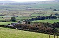
 Abney and Bretton Clough from Nether Bretton.jpg 4,000 × 2,253; 1.77 MB
-
 Across Bretton Clough - geograph.org.uk - 1836383.jpg 640 × 480; 49 KB
-
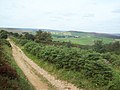
 Along Bretton Ridge - geograph.org.uk - 37863.jpg 640 × 480; 84 KB
-
 Bluebells in Bretton Clough - geograph.org.uk - 1345147.jpg 640 × 480; 76 KB
-

-
 Bretton - Youth Hostel - geograph.org.uk - 989096.jpg 640 × 480; 118 KB
-
 Bretton Clough - geograph.org.uk - 1606979.jpg 640 × 480; 145 KB
-
 Bretton Clough footbridge.jpg 3,000 × 2,250; 3.4 MB
-
 Bretton Edge - geograph.org.uk - 1594955.jpg 640 × 466; 60 KB
-
 Bretton Edge - geograph.org.uk - 4758344.jpg 640 × 426; 60 KB
-
 Bretton Mount - Lane Junction - geograph.org.uk - 980543.jpg 640 × 480; 55 KB
-
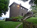
 Bretton Youth Hostel - geograph.org.uk - 91043.jpg 640 × 427; 128 KB
-
 Bretton, United Kingdom (Unsplash).jpg 2,362 × 1,575; 600 KB
-
 Christmas Day, 2013, in Bretton Clough - geograph.org.uk - 3789448.jpg 4,912 × 3,264; 6.56 MB
-
 Coniferous woodland on Bretton Moor - geograph.org.uk - 591733.jpg 640 × 428; 207 KB
-

-

-
 Down to the Barrel Inn - geograph.org.uk - 882322.jpg 640 × 480; 58 KB
-
 Earth and sky at Bretton - geograph.org.uk - 4895997.jpg 4,684 × 3,535; 3.83 MB
-
 Eyam Edge - geograph.org.uk - 1436187.jpg 640 × 480; 42 KB
-
 Footbridge over Bretton Brook - geograph.org.uk - 5745029.jpg 1,600 × 1,200; 945 KB
-
 Gate and stile near Bretton - geograph.org.uk - 591690.jpg 428 × 640; 245 KB
-
 Gate at footpath junction in Bretton Clough - geograph.org.uk - 2324254.jpg 1,024 × 769; 372 KB
-
 Landslips in Bretton Clough - geograph.org.uk - 1350090.jpg 640 × 480; 57 KB
-
 Lane from Bretton to Hucklow Edge - geograph.org.uk - 980521.jpg 640 × 480; 66 KB
-
 Lane junction near Bretton - geograph.org.uk - 3590410.jpg 750 × 563; 93 KB
-
 Lane to Nether Bretton - geograph.org.uk - 980508.jpg 640 × 480; 68 KB
-

-
 Near Bretton Clough - geograph.org.uk - 2051541.jpg 3,296 × 2,472; 1.05 MB
-
 Rabbit warren in Bretton Clough - geograph.org.uk - 2328917.jpg 1,024 × 769; 238 KB
-
 Rib of ground in Bretton Clough - geograph.org.uk - 2846134.jpg 1,500 × 1,125; 1.47 MB
-
 Road junction west of Bretton - geograph.org.uk - 5350571.jpg 1,600 × 1,200; 481 KB
-
 Shepherds Flat Farm - geograph.org.uk - 588580.jpg 640 × 412; 255 KB
-
 The Lane to Nether Bretton. - geograph.org.uk - 4125352.jpg 640 × 480; 69 KB
-
 Track to Nether Bretton - geograph.org.uk - 3590352.jpg 750 × 563; 136 KB
-
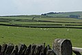 Upland fields near Bretton - geograph.org.uk - 3590375.jpg 750 × 499; 72 KB
-
 Upper Bretton Clough - geograph.org.uk - 2846147.jpg 1,500 × 1,125; 1.19 MB
-
 View from Bretton Edge - geograph.org.uk - 1594965.jpg 640 × 480; 102 KB
-
 View from Nether Bretton to Abney - geograph.org.uk - 3590360.jpg 750 × 563; 81 KB
-
 View north from Nether Bretton Lane - geograph.org.uk - 3186461.jpg 4,118 × 2,942; 2.79 MB
-
 View over Bretton Clough to Abney Grange - geograph.org.uk - 3186496.jpg 4,341 × 2,894; 2.54 MB
-
 Winter scene on Bretton ridge. - geograph.org.uk - 257981.jpg 640 × 480; 106 KB
-
 Youth Hostel, Bretton - geograph.org.uk - 4063670.jpg 3,072 × 2,304; 1.78 MB

_-_geograph.org.uk_-_3334412.jpg)


.jpg)


