Category:Brierley Hill
Jump to navigation
Jump to search
town in the Metropolitan Borough of Dudley, West Midlands, England  | |||||
| Upload media | |||||
| Instance of | |||||
|---|---|---|---|---|---|
| Location | Dudley, West Midlands, England | ||||
 | |||||
Subcategories
This category has the following 6 subcategories, out of 6 total.
B
- Bathams brewery (6 F)
D
- Delph Locks (50 F)
Media in category "Brierley Hill"
The following 189 files are in this category, out of 189 total.
-
 All Steamed Up - geograph.org.uk - 1271011.jpg 640 × 480; 101 KB
-
 Bar 148, Brierley Hill. - geograph.org.uk - 1100321.jpg 640 × 480; 69 KB
-
 Black Brook - geograph.org.uk - 401580.jpg 480 × 640; 194 KB
-
 Blackbrook Bridge - geograph.org.uk - 1093520.jpg 640 × 480; 76 KB
-
 Blackbrook Bridge - geograph.org.uk - 1095018.jpg 640 × 480; 65 KB
-
 Blackbrook Bridge - geograph.org.uk - 1122547.jpg 640 × 428; 93 KB
-
 Blackbrook Road. - geograph.org.uk - 1094989.jpg 640 × 480; 85 KB
-
 Blackbrook Road. - geograph.org.uk - 1094996.jpg 640 × 480; 65 KB
-
 Blackbrook Road. - geograph.org.uk - 1095008.jpg 640 × 480; 55 KB
-
 Blackbrook Valley - geograph.org.uk - 1491557.jpg 640 × 447; 91 KB
-
 Blowers Green Locks - geograph.org.uk - 1093525.jpg 480 × 640; 92 KB
-
 Blowers Green Pumphouse - geograph.org.uk - 1109757.jpg 640 × 480; 55 KB
-
 Brierley Hill - geograph.org.uk - 1622790.jpg 640 × 468; 85 KB
-
 Brierley Hill Christmas (51707816472).jpg 3,680 × 5,520; 2.5 MB
-
 Brierley Hill Christmas lights 2 (51709515985).jpg 3,225 × 4,291; 2.07 MB
-
 Brierley Hill Christmas lights 3 (51708914128).jpg 4,917 × 3,067; 2.44 MB
-
 Brierley Hill Civic Hall - geograph.org.uk - 1275906.jpg 480 × 640; 80 KB
-
 Brierley Hill Fire Station - geograph.org.uk - 1272636.jpg 640 × 480; 60 KB
-
 Brierley Hill lights 3 (51707995267).jpg 3,205 × 4,259; 1.87 MB
-
 Brierley Hill lights 4 (51708814536).jpg 5,520 × 3,409; 2.48 MB
-
 Brierley Hill Market - geograph.org.uk - 1275896.jpg 640 × 480; 89 KB
-
 Brierley Hill Nick - geograph.org.uk - 1275903.jpg 640 × 480; 111 KB
-
 Brierley Hill tour 1 (51414214302).jpg 4,032 × 3,024; 5.54 MB
-
 Brierley Hill tour 2 (51415225398).jpg 4,032 × 3,024; 5.65 MB
-
 Brierley Hill tour 3 (51415225013).jpg 4,032 × 3,024; 6.52 MB
-
 Brierley Hill tour 4 (51415714314).jpg 4,032 × 3,024; 4.08 MB
-
 Brierley Hill Track - geograph.org.uk - 1275871.jpg 640 × 480; 112 KB
-
 Brierley Hill. - geograph.org.uk - 1100429.jpg 640 × 234; 35 KB
-
 Canal and road bridge at Merry Hill - geograph.org.uk - 862376.jpg 640 × 480; 262 KB
-
 Canal Footbridge - geograph.org.uk - 396536.jpg 640 × 480; 113 KB
-
 Delph Road, Brierley Hill - geograph.org.uk - 1512822.jpg 640 × 430; 91 KB
-
 Delph Road, Brierley Hill - geograph.org.uk - 1512830.jpg 640 × 450; 90 KB
-
 Delph Road, Brierley Hill - geograph.org.uk - 1512841.jpg 640 × 407; 92 KB
-
 Delph Road, Brierley Hill - geograph.org.uk - 1512845.jpg 640 × 467; 96 KB
-
 Delph Road, Brierley Hill - geograph.org.uk - 1512851.jpg 640 × 418; 90 KB
-
 Delph Road, Brierley Hill - geograph.org.uk - 1513011.jpg 640 × 416; 95 KB
-
 Delph Road, Brierley Hill - geograph.org.uk - 1513017.jpg 640 × 443; 95 KB
-
 Delph Road, Brierley Hill - geograph.org.uk - 1513023.jpg 640 × 426; 91 KB
-
 Delph Road, Brierley Hill - geograph.org.uk - 1513027.jpg 640 × 431; 90 KB
-
 Delph Road, Brierley Hill - geograph.org.uk - 1513029.jpg 640 × 427; 94 KB
-
 Delph Road, Brierley Hill - geograph.org.uk - 1513036.jpg 640 × 441; 91 KB
-
 Dudley Road, Harts Hill - geograph.org.uk - 1493694.jpg 640 × 415; 89 KB
-
 Flag of Brierley Hill, West Midlands.png 3,000 × 1,800; 86 KB
-
 Gayfield Avenue, Brierley Hill - geograph.org.uk - 1513047.jpg 640 × 442; 95 KB
-
 Heronswood Drive, Brierley Hill - geograph.org.uk - 1513043.jpg 640 × 428; 92 KB
-
 High Street, Brierley Hill. - geograph.org.uk - 1100325.jpg 480 × 640; 81 KB
-
 Hill Street, Brierley Hill - geograph.org.uk - 1512938.jpg 640 × 461; 94 KB
-
 Hill Street, Brierley Hill - geograph.org.uk - 1512949.jpg 640 × 431; 89 KB
-
 Hill Street, Brierley Hill - geograph.org.uk - 1512960.jpg 640 × 427; 88 KB
-
 Hill Street, Brierley Hill - geograph.org.uk - 1512965.jpg 640 × 442; 92 KB
-
 Hill Street, Brierley Hill - geograph.org.uk - 1512968.jpg 640 × 411; 92 KB
-
 Hill Street, Brierley Hill - geograph.org.uk - 1512974.jpg 640 × 423; 97 KB
-
 Hill Street, Brierley Hill - geograph.org.uk - 1513020.jpg 640 × 428; 90 KB
-
 Hurst Business Park, Brierley Hill - geograph.org.uk - 1513379.jpg 640 × 432; 97 KB
-
 Hurst Business Park, Narrowboat Way - geograph.org.uk - 1124191.jpg 640 × 399; 60 KB
-
 Hurst Business Park, Narrowboat Way - geograph.org.uk - 1124199.jpg 640 × 435; 66 KB
-
 Hurst Business Park, Narrowboat Way - geograph.org.uk - 1124207.jpg 640 × 429; 84 KB
-
 Hurst Business Park, Narrowboat Way - geograph.org.uk - 1124214.jpg 640 × 430; 70 KB
-

-
 Hurst Lane, Brierley Hill - geograph.org.uk - 1124276.jpg 640 × 428; 76 KB
-
 Ketley Brick Brierley Hill.jpg 2,531 × 1,291; 459 KB
-
 Level Street, Brierley Hill - geograph.org.uk - 1124286.jpg 640 × 428; 76 KB
-
 Level Street, Brierley Hill - geograph.org.uk - 1493831.jpg 640 × 442; 92 KB
-
 Little Potter Street, Brierley Hill - geograph.org.uk - 1512988.jpg 640 × 435; 89 KB
-
 Little Potter Street, Brierley Hill - geograph.org.uk - 1512995.jpg 640 × 428; 90 KB
-
 Little Potter Street, Brierley Hill - geograph.org.uk - 1513003.jpg 640 × 428; 96 KB
-
 Little Potter Street, Brierley Hill - geograph.org.uk - 1513006.jpg 640 × 444; 94 KB
-
 Lower Derry Street, Brierley Hill - geograph.org.uk - 1512971.jpg 640 × 435; 90 KB
-
 Market Hall, Brierley Hill. - geograph.org.uk - 1100328.jpg 640 × 480; 64 KB
-
 Merry Hill and Pedmore Road - geograph.org.uk - 1115176.jpg 640 × 428; 52 KB
-
 Merry Hill entrance.jpg 1,024 × 683; 123 KB
-
 Mill Street, Brierley Hill - geograph.org.uk - 1513431.jpg 640 × 452; 94 KB
-
 Mill Street, Brierley Hill - geograph.org.uk - 1513436.jpg 640 × 453; 95 KB
-
 Mill Street, Brierley Hill - geograph.org.uk - 1513440.jpg 640 × 434; 94 KB
-
 Mill Street, Brierley Hill - geograph.org.uk - 1513445.jpg 640 × 465; 96 KB
-
 Nine Locks Ridge, Brierley Hill - geograph.org.uk - 1512908.jpg 640 × 444; 96 KB
-
 Original Canal Route. - geograph.org.uk - 168445.jpg 640 × 594; 191 KB
-
 Pedmore Road, Brierley Hill - geograph.org.uk - 1124292.jpg 640 × 428; 66 KB
-
 Pensnett Basin - geograph.org.uk - 1491578.jpg 640 × 428; 90 KB
-
 Pensnett Canal at Pedmore Road - geograph.org.uk - 1351205.jpg 640 × 425; 136 KB
-

-

-
 Rocks Hill, Brierley Hill - geograph.org.uk - 1512881.jpg 640 × 421; 95 KB
-
 Rocks Hill, Brierley Hill - geograph.org.uk - 1512888.jpg 640 × 419; 95 KB
-
 Rocks Hill, Brierley Hill - geograph.org.uk - 1512892.jpg 640 × 428; 93 KB
-
 Rocks Hill, Brierley Hill - geograph.org.uk - 1512899.jpg 640 × 466; 94 KB
-
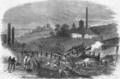 Round Oak railway accident.png 500 × 329; 206 KB
-
 Round oak steel terminal 2.jpg 1,728 × 1,188; 353 KB
-
 Round oak steel terminal5.jpg 1,728 × 1,179; 350 KB
-

-
 TGB Plaxton President 395 on 242.jpg 5,184 × 3,456; 5.08 MB
-
 The Boulevard, Merry Hill - geograph.org.uk - 1443782.jpg 640 × 447; 68 KB
-

-

-

-

-

-

-

-

-
 The road to Dudley - geograph.org.uk - 832916.jpg 640 × 480; 104 KB
-
 The Waterfront at Merry Hill - geograph.org.uk - 862373.jpg 640 × 480; 244 KB
-
 The Waterfront, Brierley Hill - geograph.org.uk - 1493791.jpg 640 × 405; 90 KB
-
 The Waterfront, Brierley Hill - geograph.org.uk - 1493798.jpg 640 × 419; 90 KB
-
 The Waterfront, Brierley Hill - geograph.org.uk - 1493811.jpg 640 × 428; 90 KB
-
 The Waterfront, Brierley Hill - geograph.org.uk - 1493845.jpg 640 × 420; 95 KB
-
 The Waterfront, Brierley Hill - geograph.org.uk - 1513596.jpg 640 × 432; 93 KB
-
 The Waterfront, Brierley Hill - geograph.org.uk - 1513597.jpg 640 × 441; 92 KB
-
 The Waterfront, Brierley Hill. - geograph.org.uk - 1100419.jpg 640 × 300; 51 KB
-

-
 Waterfront East, Brierley Hill - geograph.org.uk - 1513606.jpg 640 × 450; 91 KB
-
 Waterfront East, Brierley Hill - geograph.org.uk - 1513611.jpg 640 × 456; 93 KB
-
 Waterfront East, Brierley Hill - geograph.org.uk - 1513612.jpg 640 × 468; 92 KB
-
 Waterfront View - geograph.org.uk - 1272649.jpg 640 × 480; 74 KB
-
 Waterfront Way, Brierley Hill - geograph.org.uk - 1493750.jpg 640 × 427; 91 KB
-
 Withymoor Village, Brierley Hill - geograph.org.uk - 1512982.jpg 640 × 428; 96 KB
-
 Woodside Community School - geograph.org.uk - 1491961.jpg 640 × 448; 92 KB
-
 Bradford Road, Woodside - geograph.org.uk - 1492967.jpg 640 × 450; 95 KB
-
 Broadlands Drive, Harts Hill - geograph.org.uk - 1493642.jpg 640 × 436; 91 KB
-
 Canal End - geograph.org.uk - 394490.jpg 640 × 480; 149 KB
-
 Canal Street, Harts Hill - geograph.org.uk - 1493663.jpg 640 × 434; 90 KB
-
 Charter Street, Harts Hill - geograph.org.uk - 1493639.jpg 640 × 451; 91 KB
-
 Delph Locks - geograph.org.uk - 168440.jpg 640 × 364; 132 KB
-
 Dudley No 1 Canal - geograph.org.uk - 1510347.jpg 640 × 458; 92 KB
-
 Dudley No 1 Canal - geograph.org.uk - 1510360.jpg 640 × 428; 92 KB
-
 Dudley No 1 Canal - geograph.org.uk - 1510363.jpg 640 × 423; 90 KB
-
 Dudley No 1 Canal - geograph.org.uk - 1510389.jpg 640 × 442; 96 KB
-
 Dudley No 1 Canal - geograph.org.uk - 1510392.jpg 640 × 428; 97 KB
-
 Dudley No 1 Canal - geograph.org.uk - 1511487.jpg 620 × 480; 95 KB
-
 Dudley No 1 Canal - geograph.org.uk - 1511505.jpg 640 × 428; 91 KB
-
 Dudley No 1 Canal - geograph.org.uk - 1511538.jpg 640 × 443; 95 KB
-
 Dudley No 1 Canal - geograph.org.uk - 1511661.jpg 640 × 458; 88 KB
-
 Dudley Road, Harts Hill - geograph.org.uk - 1493671.jpg 640 × 431; 96 KB
-
 Dudley Road, Harts Hill - geograph.org.uk - 1493678.jpg 640 × 430; 88 KB
-
 Dudley Road, Harts Hill - geograph.org.uk - 1493690.jpg 640 × 426; 96 KB
-
 Fens Pool Avenue, Harts Hill - geograph.org.uk - 1493681.jpg 640 × 425; 93 KB
-
 Former Stuart Crystal works - geograph.org.uk - 450161.jpg 640 × 474; 155 KB
-
 Gordon Crescent, Harts Hill - geograph.org.uk - 1493665.jpg 640 × 435; 90 KB
-
 Highgate Road, Woodside - geograph.org.uk - 1117927.jpg 640 × 480; 54 KB
-
 Highgate Road, Woodside - geograph.org.uk - 1491966.jpg 640 × 437; 93 KB
-
 Highgate Road, Woodside - geograph.org.uk - 1491967.jpg 640 × 409; 91 KB
-
 Highgate Road, Woodside. - geograph.org.uk - 1094962.jpg 640 × 480; 71 KB
-
 Holly Hall Road, Woodside - geograph.org.uk - 1491920.jpg 640 × 434; 93 KB
-
 Malvern Crescent, Woodside - geograph.org.uk - 1492970.jpg 640 × 428; 93 KB
-
 Malvern Crescent, Woodside - geograph.org.uk - 1492976.jpg 640 × 427; 92 KB
-
 Merryhill Shopping Centre car park - geograph.org.uk - 15270.jpg 640 × 480; 52 KB
-
 Newland Grove, Woodside - geograph.org.uk - 1491923.jpg 640 × 447; 89 KB
-
 Oakwood Crescent, Woodside - geograph.org.uk - 1492980.jpg 640 × 446; 92 KB
-
 Oakwood Crescent, Woodside - geograph.org.uk - 1492985.jpg 640 × 426; 93 KB
-
 Pear Tree Lane, Woodside - geograph.org.uk - 1512409.jpg 640 × 435; 92 KB
-
 Pear Tree Lane, Woodside. - geograph.org.uk - 1094984.jpg 640 × 480; 57 KB
-
 Pear Tree Lane, Woodside. - geograph.org.uk - 1094986.jpg 640 × 480; 77 KB
-
 Pedmore Road, Woodside - geograph.org.uk - 1094971.jpg 640 × 480; 69 KB
-
 Pedmore Road, Woodside - geograph.org.uk - 1094974.jpg 640 × 480; 77 KB
-
 Pedmore Road, Woodside - geograph.org.uk - 1094982.jpg 640 × 480; 75 KB
-
 Pedmore Road, Woodside - geograph.org.uk - 1512404.jpg 640 × 447; 94 KB
-
 Pedmore Road, Woodside - geograph.org.uk - 1512406.jpg 640 × 431; 89 KB
-

-

-
 Stourbridge Road, Harts Hill - geograph.org.uk - 1493041.jpg 640 × 440; 91 KB
-
 Stourbridge Road, Harts Hill - geograph.org.uk - 1493657.jpg 640 × 462; 89 KB
-
 Stourbridge Road, Woodside - geograph.org.uk - 1493039.jpg 640 × 428; 91 KB
-
 Terrace Street, Harts Hill - geograph.org.uk - 1493654.jpg 640 × 413; 97 KB
-
 Turners Lane, Brierley Hill - geograph.org.uk - 1512836.jpg 640 × 435; 94 KB
-
 Turners Lane, Brierley Hill - geograph.org.uk - 1513052.jpg 640 × 414; 91 KB
-
 Venture Way - geograph.org.uk - 1272517.jpg 640 × 480; 82 KB
-
 Vine Street, Harts Hill - geograph.org.uk - 1493636.jpg 640 × 452; 94 KB
-
 Waterfront East, Brierley Hill - geograph.org.uk - 1513587.jpg 640 × 436; 97 KB
-
 Waterfront East, Brierley Hill - geograph.org.uk - 1513588.jpg 640 × 417; 97 KB
-
 Waterfront East, Brierley Hill - geograph.org.uk - 1513590.jpg 640 × 435; 89 KB
-
 Waterfront East, Brierley Hill - geograph.org.uk - 1513600.jpg 640 × 331; 91 KB
-
 Waterfront East, Brierley Hill - geograph.org.uk - 1513602.jpg 640 × 447; 96 KB
-
 Waterfront East, Brierley Hill - geograph.org.uk - 1513609.jpg 640 × 423; 91 KB
-
 Waterfront Way, Brierley Hill - geograph.org.uk - 1493762.jpg 640 × 470; 94 KB
-
 Waterfront Way, Brierley Hill - geograph.org.uk - 1493768.jpg 640 × 416; 90 KB
-
 Waterfront Way, Brierley Hill - geograph.org.uk - 1493822.jpg 640 × 429; 92 KB
-
 Waterfront West, Brierley Hill - geograph.org.uk - 1493779.jpg 640 × 429; 91 KB
-
 Waterfront, Brierley Hill - geograph.org.uk - 162549.jpg 640 × 480; 79 KB
-
 Waterfront, Brierley Hill - geograph.org.uk - 162553.jpg 640 × 480; 56 KB
-
 Waterfront, Merry Hill - geograph.org.uk - 74401.jpg 640 × 427; 78 KB
-
 Welcome to Chapel St Estate - geograph.org.uk - 1351192.jpg 640 × 425; 109 KB
-
 Wood Street, Woodside - geograph.org.uk - 1491930.jpg 640 × 444; 96 KB
-
 Wood Street, Woodside - geograph.org.uk - 1491936.jpg 640 × 445; 97 KB
-
 Woodside Bridge - geograph.org.uk - 1510633.jpg 640 × 447; 91 KB
-
 Woodside Bridge - geograph.org.uk - 1510641.jpg 640 × 428; 90 KB
-
 Woodside Junction Bridge - geograph.org.uk - 1510623.jpg 640 × 412; 94 KB
-
 Woodside Park - geograph.org.uk - 1492942.jpg 640 × 428; 95 KB
-
 Woodside Park - geograph.org.uk - 1492947.jpg 640 × 428; 92 KB
-
 Woodside Park - geograph.org.uk - 1492950.jpg 640 × 415; 89 KB


.jpg)
.jpg)
.jpg)


.jpg)
.jpg)

.jpg)
.jpg)
.jpg)
.jpg)


