Category:Brink 2 (Zuidvelde)
Jump to navigation
Jump to search
| Object location | | View all coordinates using: OpenStreetMap |
|---|
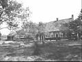
farmhouse in Noordenveld, Netherlands  | |||||
| Upload media | |||||
| Instance of | |||||
|---|---|---|---|---|---|
| Location | Zuidvelde, Noordenveld, Drenthe, Netherlands | ||||
| Street address |
| ||||
| Located on street |
| ||||
| Heritage designation |
| ||||
 | |||||
|
This is a category about rijksmonument number 30815
|
| Address |
|
Media in category "Brink 2 (Zuidvelde)"
The following 24 files are in this category, out of 24 total.
-
 Achter- en zijgevel nr. F 1043-8 - Zuidvelde - 20445139 - RCE.jpg 1,200 × 900; 101 KB
-
 Achter- en zijgevels nr. F 272-35 - Zuidvelde - 20445122 - RCE.jpg 1,200 × 900; 151 KB
-
 Achtergevels en erf nr. F 272-34 - Zuidvelde - 20445121 - RCE.jpg 1,200 × 900; 149 KB
-
 Achtergevels nr. F 142-31 - Zuidvelde - 20445120 - RCE.jpg 1,200 × 900; 123 KB
-
 Achtergevels nr. F 4347-1 - Zuidvelde - 20445118 - RCE.jpg 1,200 × 900; 99 KB
-
 Achtergevels nr. L 118 - Zuidvelde - 20445126 - RCE.jpg 1,200 × 900; 129 KB
-
 Brink 2 (noordzijde).jpg 4,608 × 3,456; 3.24 MB
-
 Brink 2 (oostzijde).jpg 4,608 × 3,456; 3.19 MB
-

-
 Detail metselwerk en muuranker nr. F 4347-5 - Zuidvelde - 20445140 - RCE.jpg 1,200 × 900; 145 KB
-
 Detail muuranker en metselwerk nr. F 4347-4 - Zuidvelde - 20445131 - RCE.jpg 1,200 × 900; 153 KB
-
 Exterieur - Zuidvelde - 20225833 - RCE.jpg 1,200 × 952; 290 KB
-

-

-
 Voordeur nr. F 4347-11 - Zuidvelde - 20445143 - RCE.jpg 1,200 × 900; 149 KB
-
 Voordeur nr. F 576-32 - Zuidvelde - 20445141 - RCE.jpg 1,200 × 900; 84 KB
-
 Voorgevel en schuurtje nr. F 1043-10 - Zuidvelde - 20445128 - RCE.jpg 1,200 × 900; 177 KB
-
 Voorgevel nr. F 4347-8 - Zuidvelde - 20445127 - RCE.jpg 1,200 × 900; 137 KB
-
 Zij- en voorgevel nr. F 4347-7 - Zuidvelde - 20445145 - RCE.jpg 1,200 × 900; 150 KB
-

-
 Zijgevel en bakhuis nr. F 4347-10 - Zuidvelde - 20445144 - RCE.jpg 1,200 × 900; 136 KB
-
 Zijgevel nr. F 142-30 - Zuidvelde - 20445119 - RCE.jpg 1,200 × 900; 157 KB
-
 Zijgevel nr. F 272-36 - Zuidvelde - 20445123 - RCE.jpg 1,200 × 900; 143 KB
-
 Zijgevels nr. F 4347-12 - Zuidvelde - 20445142 - RCE.jpg 1,200 × 900; 180 KB


.jpg)
.jpg)


