Category:Brompton, Scarborough
Jump to navigation
Jump to search
civil parish in Scarborough, North Yorkshire, England, UK .jpg) | |||||
| Upload media | |||||
| Instance of | |||||
|---|---|---|---|---|---|
| Location | Scarborough, North Yorkshire, Yorkshire and the Humber, England | ||||
| Different from | |||||
 | |||||
Subcategories
This category has the following 2 subcategories, out of 2 total.
B
S
Media in category "Brompton, Scarborough"
The following 192 files are in this category, out of 192 total.
-
 'Dolly Walk' - geograph.org.uk - 427712.jpg 640 × 360; 86 KB
-
 A170 through Brompton-by-Sawdon - geograph.org.uk - 5881651.jpg 1,024 × 683; 173 KB
-
 Access track to Rye Topping Farm - geograph.org.uk - 5586407.jpg 5,152 × 3,864; 6.37 MB
-
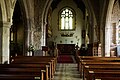
 All Saints Church, Brompton-by-Sawdon - geograph.org.uk - 6216594.jpg 1,600 × 1,065; 761 KB
-
 All Saints Church, Brompton-by-Sawdon - geograph.org.uk - 6216737.jpg 1,186 × 1,600; 445 KB
-
 All Saints Church, Brompton-by-Sawdon - geograph.org.uk - 6216740.jpg 1,065 × 1,600; 416 KB
-
 All Saints Church, Brompton-by-Sawdon - geograph.org.uk - 6216744.jpg 1,065 × 1,600; 425 KB
-
 All Saints Church, Brompton-by-Sawdon - geograph.org.uk - 6216748.jpg 1,153 × 1,600; 801 KB
-
 All Saints Church, Brompton-by-Sawdon - geograph.org.uk - 6216749.jpg 950 × 1,600; 602 KB
-
 All Saints Church, Brompton-by-Sawdon - geograph.org.uk - 6216752.jpg 1,600 × 1,065; 461 KB
-
 All Saints Church, Brompton-by-Sawdon - geograph.org.uk - 6216795.jpg 969 × 1,600; 756 KB
-
 All Saints Church, Brompton-by-Sawdon - geograph.org.uk - 6216797.jpg 1,600 × 1,065; 419 KB
-
 All Saints Church, Brompton-by-Sawdon - geograph.org.uk - 6216801.jpg 1,071 × 1,600; 633 KB
-
 All Saints Church, Brompton-by-Sawdon - geograph.org.uk - 6216807.jpg 965 × 1,600; 626 KB
-
 All Saints Church, Brompton-by-Sawdon - geograph.org.uk - 6216809.jpg 1,032 × 1,600; 671 KB
-
 All Saints Church, Brompton-by-Sawdon - geograph.org.uk - 6216810.jpg 1,600 × 1,065; 492 KB
-
 All Saints Church, Brompton-by-Sawdon - geograph.org.uk - 6217290.jpg 1,065 × 1,600; 628 KB
-
 All Saints' Church, Brompton - geograph.org.uk - 4424184.jpg 1,024 × 667; 345 KB
-
 Amusing notice in a church porch - geograph.org.uk - 4763185.jpg 640 × 480; 35 KB
-
 Approaching the kink in a straight road - geograph.org.uk - 4868741.jpg 4,063 × 3,120; 3.63 MB
-
 Awaiting Transport - geograph.org.uk - 1808527.jpg 4,000 × 3,000; 3.22 MB
-
 Beef cattle in Sawdon Dale - geograph.org.uk - 4184113.jpg 4,608 × 3,456; 4.3 MB
-
 Belties and Heelan' Coos - geograph.org.uk - 3530224.jpg 3,461 × 2,389; 2.8 MB
-
 Black Sike Lane - geograph.org.uk - 6325135.jpg 2,048 × 1,536; 1,016 KB
-
 Brick Building, Wykeham Forest - geograph.org.uk - 3102576.jpg 640 × 427; 263 KB
-

-
 Bridleway to Halleykeld Spring - geograph.org.uk - 1193437.jpg 480 × 640; 181 KB
-
 Broad Gate - geograph.org.uk - 5756977.jpg 2,048 × 1,536; 939 KB
-
 Brompton Almshouses - geograph.org.uk - 1364495.jpg 640 × 480; 88 KB
-
 Brompton Beck - geograph.org.uk - 1067640.jpg 640 × 480; 95 KB
-
 Brompton Beck - geograph.org.uk - 2496344.jpg 640 × 480; 213 KB
-
 Brompton Beck - geograph.org.uk - 3846181.jpg 3,240 × 4,320; 2.96 MB
-
 Brompton Beck - geograph.org.uk - 5387852.jpg 1,024 × 768; 220 KB
-
 Brompton Beck, western arm - geograph.org.uk - 4117059.jpg 1,200 × 1,600; 665 KB
-
 Brompton Carr Lane - geograph.org.uk - 5676874.jpg 4,745 × 2,669; 5.23 MB
-
 Brompton Cemetery - geograph.org.uk - 1379809.jpg 640 × 480; 105 KB
-
 Brompton Chapel - geograph.org.uk - 1364099.jpg 480 × 640; 50 KB
-
 Brompton Cottages - geograph.org.uk - 1067641.jpg 640 × 482; 63 KB
-
 Brompton Cricket Club - geograph.org.uk - 3530265.jpg 4,608 × 3,456; 6.44 MB
-
 Brompton Cricket Club field and pavilion - geograph.org.uk - 4868734.jpg 4,608 × 3,456; 4.86 MB
-
 Brompton Ings - geograph.org.uk - 6325136.jpg 2,048 × 1,536; 910 KB
-
 Brompton Ings 2 - geograph.org.uk - 6325140.jpg 2,048 × 1,536; 865 KB
-
 Brompton Ings powerlines - geograph.org.uk - 6325147.jpg 2,048 × 1,536; 876 KB
-
 Brompton Ings Road at Brompton Bridge - geograph.org.uk - 6217375.jpg 1,600 × 1,048; 545 KB
-
 Brompton Ings Road towards Sherburn - geograph.org.uk - 6217298.jpg 1,600 × 1,092; 536 KB
-
 Brompton Ings Road towards Sherburn - geograph.org.uk - 6217302.jpg 1,600 × 1,026; 482 KB
-
 Brompton Ings Road towards Sherburn - geograph.org.uk - 6217308.jpg 1,600 × 1,102; 468 KB
-
 Brompton Ings Road towards Sherburn - geograph.org.uk - 6217310.jpg 1,600 × 1,062; 458 KB
-
 Brompton Ings Road towards Sherburn - geograph.org.uk - 6217372.jpg 1,600 × 1,072; 579 KB
-
 Brompton ponds - geograph.org.uk - 3352067.jpg 1,024 × 768; 356 KB
-
 Brompton Ponds - geograph.org.uk - 428681.jpg 640 × 359; 65 KB
-
 Brompton Postbox - geograph.org.uk - 1364457.jpg 640 × 488; 119 KB
-
 Brompton primary school - geograph.org.uk - 3846177.jpg 3,982 × 2,160; 1.53 MB
-
 Brompton village war memorial - geograph.org.uk - 4588298.jpg 1,057 × 1,600; 1.17 MB
-
 Brompton, Scarborough UK parish locator map.svg 1,425 × 1,037; 4.3 MB
-
 Bus shelter to the west of Brompton - geograph.org.uk - 4588279.jpg 1,195 × 1,600; 1.2 MB
-
 Business for sale in Brompton - geograph.org.uk - 4588289.jpg 1,600 × 1,067; 1.09 MB
-
 But Horses Can't Read^ - geograph.org.uk - 1193454.jpg 640 × 480; 173 KB
-
 Carr Farm - geograph.org.uk - 1379808.jpg 640 × 480; 77 KB
-
 Carr Farm, Brompton - geograph.org.uk - 1364502.jpg 640 × 480; 83 KB
-
 Carr Farm, Brompton-by-Sawdon - geograph.org.uk - 6216589.jpg 1,600 × 1,065; 617 KB
-

-
 Church Lane - geograph.org.uk - 422569.jpg 640 × 360; 69 KB
-
 Church Lane, Brompton - geograph.org.uk - 3952118.jpg 640 × 480; 165 KB
-
 Cockmoor Road - geograph.org.uk - 5756981.jpg 2,048 × 1,536; 1.32 MB
-
 Cockmoor Road at Brandy Slack - geograph.org.uk - 3102512.jpg 640 × 427; 219 KB
-
 Cockmoor Road heading north - geograph.org.uk - 1988820.jpg 640 × 480; 84 KB
-
 Cockmoor Road heading north into Wykeham Forest - geograph.org.uk - 5071805.jpg 4,608 × 3,456; 5.68 MB
-
 Corner of Church Lane and a bench mark - geograph.org.uk - 2495655.jpg 640 × 480; 203 KB
-
 Corner on Sawdon Balk (track) - geograph.org.uk - 4184377.jpg 4,608 × 3,456; 5.67 MB
-
 Cote Head Farmhouse - geograph.org.uk - 1388607.jpg 640 × 480; 86 KB
-
 Cottages, Brompton - geograph.org.uk - 4117064.jpg 1,600 × 1,200; 623 KB
-

-

-
 Detail of plaque to Sir George Cayley - geograph.org.uk - 3835328.jpg 1,983 × 2,197; 1.2 MB
-
 Dike at Brompton Ings - geograph.org.uk - 1178796.jpg 640 × 480; 82 KB
-
 Drive to Phoenix House Farm - geograph.org.uk - 4385520.jpg 1,024 × 683; 191 KB
-
 Ebberston Moor (gas) Well site - geograph.org.uk - 3676575.jpg 1,024 × 910; 636 KB
-
 Ebberston Moor Gas Well - geograph.org.uk - 3676581.jpg 1,024 × 768; 496 KB
-
 Entering a double bend - geograph.org.uk - 4868746.jpg 4,458 × 3,248; 3.29 MB
-
 Entering Brompton on Brompton Ings Road - geograph.org.uk - 4868728.jpg 4,516 × 3,330; 6.01 MB
-
 Entrance to tree nursery - geograph.org.uk - 4045062.jpg 2,256 × 1,496; 677 KB
-
 Entrance to tree nursery - geograph.org.uk - 4433988.jpg 2,609 × 1,864; 925 KB
-
 Farm Buildings, Mount Pleasant Farm - geograph.org.uk - 1988741.jpg 640 × 480; 76 KB
-
 Farm road off Brompton Carr Lane - geograph.org.uk - 6216582.jpg 1,600 × 1,065; 558 KB
-
 Farm track - geograph.org.uk - 4385507.jpg 1,024 × 683; 241 KB
-
 Farmland near Granary Farm - geograph.org.uk - 1988809.jpg 640 × 480; 56 KB
-
 Farmland near Mount Pleasant Farm - geograph.org.uk - 1988748.jpg 640 × 480; 80 KB
-
 Farmland, Brompton Ings - geograph.org.uk - 1379816.jpg 640 × 480; 62 KB
-
 Field near Park Farm - geograph.org.uk - 3102513.jpg 640 × 427; 203 KB
-
 Field near Park Farm - geograph.org.uk - 3102548.jpg 640 × 427; 191 KB
-
 Fields off Cockmoor Road - geograph.org.uk - 1988816.jpg 640 × 480; 49 KB
-
 Floating vegetation, Brompton ponds - geograph.org.uk - 3352069.jpg 1,024 × 768; 353 KB
-

-
 Footbridge over Brompton Beck - geograph.org.uk - 4117077.jpg 1,600 × 1,187; 867 KB
-
 Footpath by the ponds at Brompton by Sawdon - geograph.org.uk - 5387844.jpg 1,024 × 768; 230 KB
-
 Forest Ride, above Troutsdale Low Hall - geograph.org.uk - 3103493.jpg 427 × 640; 267 KB
-
 Forest Ride, Wykeham Forest - geograph.org.uk - 3116675.jpg 427 × 640; 256 KB
-
 Forest track above Troutsdale - geograph.org.uk - 3453409.jpg 3,240 × 4,320; 2.78 MB
-
 Forest track, Troutsdale Brow - geograph.org.uk - 3453404.jpg 3,240 × 4,320; 3.58 MB
-
 Forestry road near Wykeham Nurseries - geograph.org.uk - 1988831.jpg 640 × 480; 91 KB
-
 Glaves ^ Sons butchers shop - geograph.org.uk - 3846178.jpg 2,878 × 2,160; 1.04 MB
-
 Golf Course behind Geasea Cottages. - geograph.org.uk - 1388617.jpg 640 × 480; 61 KB
-
 Halleykeld Spring - geograph.org.uk - 1193416.jpg 640 × 360; 131 KB
-
 Hedgerow and Farmland - geograph.org.uk - 1379811.jpg 640 × 480; 85 KB
-
 High Street, Brompton - geograph.org.uk - 3835325.jpg 2,196 × 1,464; 908 KB
-
 High Street, Brompton-by-Sawdon - geograph.org.uk - 5337282.jpg 4,676 × 3,040; 4.58 MB
-
 Hoar frost - on trees - geograph.org.uk - 3323434.jpg 3,264 × 2,448; 1.18 MB
-
 Hoar frost - on trees and landscape - geograph.org.uk - 3323443.jpg 3,264 × 2,448; 1.53 MB
-
 Hungate, Brompton - geograph.org.uk - 3952105.jpg 2,437 × 1,749; 492 KB
-
 Ings Lane - geograph.org.uk - 430777.jpg 640 × 360; 107 KB
-
 Ings lane, Brompton - geograph.org.uk - 3952088.jpg 640 × 480; 165 KB
-
 Looking over Sawdon Dale - geograph.org.uk - 4184394.jpg 4,608 × 3,456; 5.02 MB
-
 Malpas, Brompton - geograph.org.uk - 3846180.jpg 2,768 × 3,359; 1.61 MB
-
 Mellow, yellow stone and pantiles - geograph.org.uk - 3352086.jpg 1,024 × 768; 362 KB
-
 Mill Pond or Fish Pond^ - geograph.org.uk - 3846182.jpg 3,240 × 4,320; 2.62 MB
-
 Minor Road Towards Sherburn - geograph.org.uk - 1379810.jpg 640 × 480; 75 KB
-
 Minor Road Towards Sherburn - geograph.org.uk - 1379814.jpg 640 × 480; 63 KB
-
 Minor road, Wykeham Forest - geograph.org.uk - 1988846.jpg 640 × 480; 83 KB
-
 Moor Lane - geograph.org.uk - 5756983.jpg 2,048 × 1,536; 1.7 MB
-
 Moor Lane near Granary Farm - geograph.org.uk - 1988805.jpg 640 × 480; 112 KB
-
 Mount Pleasant Farm - geograph.org.uk - 1161027.jpg 640 × 409; 100 KB
-
 Oil Seed Rape field near Sawdon - geograph.org.uk - 2923328.jpg 1,024 × 768; 327 KB
-
 Old bridge over Brompton Beck - geograph.org.uk - 2496337.jpg 640 × 480; 154 KB
-
 Path to Raptor Viewpoint, Wykeham Forest - geograph.org.uk - 1194254.jpg 480 × 640; 110 KB
-
 Plantation near Park Farm - geograph.org.uk - 3102552.jpg 640 × 427; 273 KB
-
 Ploughing near Thorn Dikes - geograph.org.uk - 6062480.jpg 1,600 × 900; 414 KB
-
 Possible fracking site^ - geograph.org.uk - 5757008.jpg 2,048 × 1,536; 1.06 MB
-
 Power lines crossing Brompton Ings Road - geograph.org.uk - 4868752.jpg 4,566 × 3,400; 3.72 MB
-

-

-
 Road through Wykeham Forest - geograph.org.uk - 4322950.jpg 1,024 × 683; 529 KB
-
 Road to Lowfield Farm - geograph.org.uk - 3530236.jpg 3,072 × 2,304; 2.74 MB
-
 Rye Topping - geograph.org.uk - 5388064.jpg 1,024 × 768; 133 KB
-
 Sawdon Balk - geograph.org.uk - 5954675.jpg 2,048 × 1,536; 1.07 MB
-
 Sawdon Beck - geograph.org.uk - 3103514.jpg 427 × 640; 266 KB
-
 Sawdon dale - geograph.org.uk - 3103501.jpg 640 × 427; 269 KB
-
 Shadow Heights Entrance - geograph.org.uk - 1336118.jpg 640 × 480; 75 KB
-
 Sheltering Sheep - geograph.org.uk - 512746.jpg 640 × 480; 96 KB
-
 Sign at access road to Basin Howe Farm - geograph.org.uk - 5069438.jpg 4,608 × 3,456; 4.3 MB
-
 Stubble and Straw Field - geograph.org.uk - 512728.jpg 640 × 480; 103 KB
-
 Stubble Field - geograph.org.uk - 3102543.jpg 640 × 427; 240 KB
-
 The Anvil Inn - geograph.org.uk - 1160749.jpg 640 × 390; 61 KB
-
 The Brompton Forge - geograph.org.uk - 4613866.jpg 1,600 × 1,067; 1.09 MB
-
 The Butts - geograph.org.uk - 5954701.jpg 2,048 × 1,536; 1.09 MB
-
 The Butts, Brompton - geograph.org.uk - 3952094.jpg 2,457 × 1,489; 507 KB
-

-
 The old butchers shop - geograph.org.uk - 3352089.jpg 1,024 × 768; 302 KB
-
 The River Derwent - geograph.org.uk - 1379815.jpg 640 × 480; 86 KB
-
 The Three Tremblers - geograph.org.uk - 3102566.jpg 640 × 427; 270 KB
-
 Three Tremblers Tumuli, Wykeham Forest - geograph.org.uk - 2456256.jpg 2,736 × 3,648; 4.71 MB
-
 Tilling the soil - geograph.org.uk - 4433982.jpg 2,459 × 1,757; 841 KB
-
 To Raptor Viewpoint - geograph.org.uk - 1336112.jpg 640 × 480; 107 KB
-
 Track from Sawdon to Wood Gate - geograph.org.uk - 1808554.jpg 4,000 × 3,000; 3.74 MB
-
 Track in Wykeham Forest - geograph.org.uk - 5756985.jpg 2,048 × 1,536; 1.68 MB
-
 Track into forestry from Cockmoor Road - geograph.org.uk - 5071803.jpg 4,608 × 3,456; 5.25 MB
-
 Track Junction, Troutsdale Brow - geograph.org.uk - 3102536.jpg 427 × 640; 268 KB
-
 Track to Phoenix House Farm - geograph.org.uk - 1379813.jpg 640 × 480; 86 KB
-
 Track to Rye Topping Farm - geograph.org.uk - 1379812.jpg 640 × 480; 72 KB
-
 Track, Troutsdale Brow - geograph.org.uk - 3102538.jpg 427 × 640; 272 KB
-
 Tranquil waters, Brompton ponds - geograph.org.uk - 3352075.jpg 1,024 × 768; 390 KB
-
 Tree Nursery - geograph.org.uk - 3102516.jpg 427 × 640; 279 KB
-
 Tree Nursery - geograph.org.uk - 3102562.jpg 427 × 640; 231 KB
-
 Tree Nursery - geograph.org.uk - 3676593.jpg 1,024 × 768; 494 KB
-
 Tree nursery Cockmoor Road - geograph.org.uk - 4045060.jpg 2,256 × 1,496; 724 KB
-
 Troutsdale Brow Plantation - geograph.org.uk - 5757010.jpg 2,048 × 1,536; 1,016 KB
-
 Troutsdale Brow Plantation from Trouts Dale - geograph.org.uk - 1808428.jpg 4,000 × 3,000; 2.45 MB
-
 Troutsdale view - geograph.org.uk - 3428801.jpg 4,320 × 3,240; 2.2 MB
-
 Tumulus - geograph.org.uk - 3102518.jpg 640 × 427; 258 KB
-
 Tumulus on Troutsdale Brow - geograph.org.uk - 3453397.jpg 4,320 × 3,240; 2.8 MB
-
 Tumulus Troutsdale Brow - geograph.org.uk - 4434013.jpg 2,611 × 1,865; 915 KB
-
 Tumulus, Wykeham Forest. - geograph.org.uk - 2456236.jpg 3,648 × 2,736; 4.4 MB
-

-
 View from the Raptor Viewing Point - geograph.org.uk - 4323000.jpg 1,024 × 683; 349 KB
-
 View from Wood Gate - geograph.org.uk - 5954671.jpg 2,048 × 1,536; 1.05 MB
-
 Village Notice Board - geograph.org.uk - 3103499.jpg 640 × 427; 209 KB
-
 Village Pump - geograph.org.uk - 1067639.jpg 480 × 640; 110 KB
-
 War Memorial High Street, Brompton-by-Sawdon - geograph.org.uk - 6217294.jpg 1,600 × 1,065; 731 KB
-
 Wood Gate (Track) - geograph.org.uk - 1388624.jpg 640 × 480; 68 KB
-
 Wood Gate - geograph.org.uk - 3102540.jpg 640 × 427; 247 KB
-
 Wood Gate - geograph.org.uk - 3102546.jpg 427 × 640; 246 KB
-
 Wood Gate - geograph.org.uk - 5954673.jpg 2,048 × 1,536; 1,018 KB
-

-
 Woodgate (track) heading north - geograph.org.uk - 1988786.jpg 640 × 480; 88 KB
-
 Woodgate (track) heading north - geograph.org.uk - 1988802.jpg 640 × 480; 130 KB
-
 Woodgate - geograph.org.uk - 5756979.jpg 2,048 × 1,536; 1.36 MB
-
 Woodland junction at the bottom of Sawdon Brow - geograph.org.uk - 4184406.jpg 4,608 × 3,456; 5.31 MB
-
 Wykeham Nurseries (forestry) - geograph.org.uk - 1988827.jpg 640 × 480; 46 KB
-
 Young trees, Wykeham Nurseries - geograph.org.uk - 1988839.jpg 640 × 480; 57 KB
-
 Brompton Beck - geograph.org.uk - 428560.jpg 640 × 359; 92 KB
-
 Sheep Wash - geograph.org.uk - 427836.jpg 640 × 360; 104 KB
-
 Sheep Wash - geograph.org.uk - 427839.jpg 640 × 360; 84 KB


_-_geograph.org.uk_-_4184377.jpg)


_Well_site_-_geograph.org.uk_-_3676575.jpg)


_-_geograph.org.uk_-_1388624.jpg)


_heading_north_-_geograph.org.uk_-_1988786.jpg)
_heading_north_-_geograph.org.uk_-_1988802.jpg)


_-_geograph.org.uk_-_1988827.jpg)


