Category:Brooke, Norfolk
Jump to navigation
Jump to search
English: Brooke is a village and civil parish in the South Norfolk district of Norfolk, England, about 7 miles south of Norwich and roughly equidistant from Norwich and Bungay. According to the 2001 census it had a population of 1,242 in 554 households.
village in Norfolk, England, United Kingdom  | |||||
| Upload media | |||||
| Instance of | |||||
|---|---|---|---|---|---|
| Location | South Norfolk, Norfolk, East of England, England | ||||
| Area |
| ||||
| Said to be the same as | Brooke (Wikimedia duplicated page, civil parish) | ||||
 | |||||
Subcategories
This category has the following 12 subcategories, out of 12 total.
B
- Brooke Village Sign, Norfolk (6 F)
- Brooke War Memorial, Norfolk (8 F)
C
E
- Environs of Brooke, Norfolk (6 F)
F
- Footpaths in Brooke, Norfolk (5 F)
I
- Brooke Industrial Park (2 F)
N
P
- Pubs in Brooke, Norfolk (9 F)
S
Media in category "Brooke, Norfolk"
The following 200 files are in this category, out of 212 total.
(previous page) (next page)-
 4 Norwich Road Postbox - geograph.org.uk - 3683188.jpg 2,131 × 2,845; 1.51 MB
-
 4 Norwich Road Postbox - geograph.org.uk - 3683209.jpg 2,206 × 2,944; 1.47 MB
-
 B1332 Bungay Road ^ Wellbeck Farm Postbox - geograph.org.uk - 2687607.jpg 3,072 × 2,304; 1.35 MB
-
 B1332 Bungay Road, Howe - geograph.org.uk - 2688206.jpg 2,640 × 1,980; 980 KB
-
 B1332 Bungay Road, Howe - geograph.org.uk - 2688210.jpg 2,640 × 1,980; 776 KB
-
 B1332 Norwich Road, Brooke - geograph.org.uk - 2688220.jpg 3,072 × 2,304; 1.52 MB
-
 B1332 Norwich Road, Brooke - geograph.org.uk - 3039095.jpg 3,072 × 2,304; 1.34 MB
-
 B1332 Norwich Road, Brooke - geograph.org.uk - 3413909.jpg 3,072 × 2,304; 1.33 MB
-
 B1332 Norwich Road, Brooke - geograph.org.uk - 3414766.jpg 3,072 × 2,304; 1.21 MB
-
 B1332 Norwich Road, Brooke - geograph.org.uk - 3474878.jpg 3,072 × 2,304; 1.25 MB
-
 B1332 Norwich Road, Brooke - geograph.org.uk - 3626769.jpg 3,072 × 2,304; 1.36 MB
-
 B1332 Norwich Road, Brooke - geograph.org.uk - 3637623.jpg 3,072 × 2,304; 1.46 MB
-
 B1332 Norwich Road, Brooke - geograph.org.uk - 3637639.jpg 3,072 × 2,304; 1.44 MB
-
 B1332 Norwich Road, Brooke - geograph.org.uk - 4163011.jpg 3,030 × 2,276; 742 KB
-
 B1332 Norwich Road, Brooke - geograph.org.uk - 4854233.jpg 3,072 × 2,304; 1.82 MB
-
 B1332 Norwich Road, Kirstead - geograph.org.uk - 3474882.jpg 3,072 × 2,304; 1.26 MB
-
 B1332 Norwich Road, Kirstead - geograph.org.uk - 3878200.jpg 3,072 × 2,304; 1.31 MB
-
 B1332, Norwich Road south of Brooke - geograph.org.uk - 4347850.jpg 640 × 480; 176 KB
-
 Brooke Bowling Green - geograph.org.uk - 2688185.jpg 3,072 × 2,304; 1.4 MB
-
 Brooke Bowling Green - geograph.org.uk - 2688193.jpg 3,072 × 2,304; 1.52 MB
-
 Brooke Bowls Club ^ Green - geograph.org.uk - 2688192.jpg 3,072 × 2,304; 1.29 MB
-
 Brooke Garage - geograph.org.uk - 3683197.jpg 3,072 × 2,304; 1.43 MB
-
 Brooke Garage - geograph.org.uk - 3683212.jpg 3,072 × 2,304; 1.39 MB
-
 Brooke Garage - geograph.org.uk - 3683235.jpg 2,178 × 1,672; 483 KB
-
 Brooke Gardens, Brooke - geograph.org.uk - 3758730.jpg 3,072 × 1,897; 1.08 MB
-
 Brooke Industrial Park - geograph.org.uk - 3038004.jpg 3,072 × 2,304; 1.26 MB
-
 Brooke Industrial Park - geograph.org.uk - 3038012.jpg 3,072 × 2,304; 1.24 MB
-
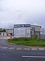 Brooke Industrial Park sign - geograph.org.uk - 3038007.jpg 2,304 × 3,072; 1.27 MB
-
 Brooke Industrial Park sign - geograph.org.uk - 3038015.jpg 3,072 × 2,304; 1.4 MB
-
 Brooke Post Office ^ 4 Norwich Road Postbox - geograph.org.uk - 3683189.jpg 2,983 × 2,241; 1.4 MB
-
 Brooke Telephone Box - geograph.org.uk - 3683231.jpg 2,304 × 3,072; 1.5 MB
-
 Brooke Telephone Exchange - geograph.org.uk - 3474874.jpg 3,072 × 2,304; 1.44 MB
-
 Brooke Tennis Courts - geograph.org.uk - 2688198.jpg 3,072 × 2,304; 1.43 MB
-
 Brooke Village Hall - geograph.org.uk - 2688179.jpg 3,072 × 2,304; 1.32 MB
-
 Brooke Village Hall sign - geograph.org.uk - 2688190.jpg 2,304 × 3,072; 1.49 MB
-
 Brooke Village Name sign - geograph.org.uk - 4162944.jpg 2,241 × 2,992; 1.31 MB
-
 Brooke Village Notice Board - geograph.org.uk - 3038997.jpg 2,304 × 3,072; 1.55 MB
-
 Brooke Village Playing Field - geograph.org.uk - 2688183.jpg 3,072 × 2,304; 1.32 MB
-
 Brooke village pond - geograph.org.uk - 4406313.jpg 2,592 × 1,944; 2.74 MB
-
 Brooke Wood beyond Backwood Lane - geograph.org.uk - 4347767.jpg 640 × 480; 234 KB
-
 Bungalows in Old Hall Garden - geograph.org.uk - 4491899.jpg 640 × 480; 388 KB
-
 Chapelfield Veterinary Clinic - geograph.org.uk - 3626758.jpg 3,072 × 2,304; 1.64 MB
-
 Chapelfield Veterinary Clinic sign - geograph.org.uk - 3626753.jpg 3,011 × 2,262; 1.4 MB
-
 Church Road sign - geograph.org.uk - 3474888.jpg 3,072 × 2,304; 1.53 MB
-
 Church Road, Kirstead - geograph.org.uk - 3474981.jpg 3,072 × 2,304; 1.22 MB
-
 Crop field east of Green Lane - geograph.org.uk - 4332291.jpg 640 × 480; 170 KB
-
 Curly Tail Farm - geograph.org.uk - 4347802.jpg 640 × 480; 230 KB
-
 Dove Lane, Howe - geograph.org.uk - 3037978.jpg 3,072 × 2,304; 1.2 MB
-
 Dove Lane, Howe - geograph.org.uk - 3625376.jpg 3,072 × 2,304; 1.38 MB
-
 Edward Seago Place sign - geograph.org.uk - 4163008.jpg 2,989 × 2,243; 998 KB
-
 Edward Seago Place, Brooke - geograph.org.uk - 4163007.jpg 2,983 × 2,241; 777 KB
-
 Entering Brooke on the B1332 Norwich Road - geograph.org.uk - 4162942.jpg 3,072 × 2,304; 2.07 MB
-
 Entering Kirstead on the B1332 Norwich Road - geograph.org.uk - 3878185.jpg 2,989 × 2,240; 2.01 MB
-
 Entrance Lane - geograph.org.uk - 3039089.jpg 3,072 × 2,304; 1.24 MB
-
 Entrance Lane sign - geograph.org.uk - 3039024.jpg 2,930 × 2,194; 2 MB
-
 Entrance Lane, Brooke - geograph.org.uk - 3039022.jpg 3,072 × 2,304; 1.69 MB
-
 Entrance to Chapelfield Veterinary Clinic - geograph.org.uk - 3626756.jpg 3,072 × 2,304; 1.61 MB
-
 Entrance to High Green Gardens, Brooke - geograph.org.uk - 4347831.jpg 640 × 480; 206 KB
-
 Entrance to Old House Farm - geograph.org.uk - 1582642.jpg 640 × 480; 131 KB
-
 Entrance to sewage works - geograph.org.uk - 1451440.jpg 640 × 480; 127 KB
-
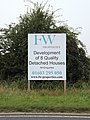 F W properties sign off the B1332 Norwich Road - geograph.org.uk - 4162971.jpg 2,304 × 3,072; 1.93 MB
-
 Farm bridge over Well Beck - geograph.org.uk - 6074444.jpg 800 × 587; 172 KB
-
 Farm bridge over Well Beck - geograph.org.uk - 6074446.jpg 800 × 574; 147 KB
-
 Farm implement beside Green Lane - geograph.org.uk - 4332295.jpg 640 × 480; 287 KB
-
 Farm track crossing Green Lane - geograph.org.uk - 4332281.jpg 640 × 480; 200 KB
-
 Farm track south of Littlebeck Lane - geograph.org.uk - 1582634.jpg 640 × 480; 143 KB
-

-
 Field entrance of Woodton Road - geograph.org.uk - 4347795.jpg 640 × 480; 182 KB
-
 Field west of Green Lane - geograph.org.uk - 4332299.jpg 640 × 480; 223 KB
-
 Field ^ F W Properties sign - geograph.org.uk - 4162988.jpg 3,072 × 2,304; 1.82 MB
-
 Field ^ Loddon Young Farmers display - geograph.org.uk - 4162978.jpg 2,936 × 2,261; 1.01 MB
-
-
 Fields east of Green Lane - geograph.org.uk - 4332292.jpg 640 × 480; 146 KB
-
 Fields off the B1332 Norwich Road - geograph.org.uk - 4162994.jpg 3,072 × 2,304; 1,003 KB
-
 Fields off the B1332 Norwich Road - geograph.org.uk - 4162998.jpg 3,072 × 2,304; 1.15 MB
-
 Fields west of Green Lane - geograph.org.uk - 4332285.jpg 640 × 480; 184 KB
-
 Firebreak in Brooke Wood - geograph.org.uk - 4347792.jpg 640 × 480; 190 KB
-
 Flowering shrubs beside the path - geograph.org.uk - 2349882.jpg 640 × 480; 341 KB
-
 Footpath from Howe to High Green - geograph.org.uk - 1582939.jpg 640 × 480; 223 KB
-
 Footpath marker by Culyer's Grove - geograph.org.uk - 1582933.jpg 640 × 517; 230 KB
-
 Footpath to Brooke - geograph.org.uk - 2349884.jpg 640 × 480; 333 KB
-
 Footpath to Howe - geograph.org.uk - 1582885.jpg 513 × 640; 180 KB
-
 Footpath to Norwich Road - geograph.org.uk - 1582378.jpg 640 × 480; 128 KB
-
 Georgian Cottage, Brooke - geograph.org.uk - 4406309.jpg 2,534 × 1,890; 1.63 MB
-
 Hedge beside the footpath - geograph.org.uk - 1582860.jpg 640 × 480; 173 KB
-
 High Green approaching Brooke Wood - geograph.org.uk - 1582835.jpg 640 × 480; 120 KB
-
 High Green sign - geograph.org.uk - 3413916.jpg 3,072 × 2,304; 1.42 MB
-
 High Green, Brooke - geograph.org.uk - 3413919.jpg 3,072 × 2,304; 1.37 MB
-
 High Green, Brooke - geograph.org.uk - 3413934.jpg 3,072 × 2,304; 1.48 MB
-
 High Lees Farm in Kirstead Green - geograph.org.uk - 1582345.jpg 640 × 480; 149 KB
-
 Hillside Farm, Brooke - geograph.org.uk - 160873.jpg 640 × 480; 99 KB
-
 Honeypot Lane, Brooke - geograph.org.uk - 3626075.jpg 3,072 × 2,304; 1.4 MB
-
 Honeypot Lane, Brooke - geograph.org.uk - 3626082.jpg 3,072 × 2,304; 1.34 MB
-
 House in the woods - geograph.org.uk - 4347853.jpg 640 × 480; 207 KB
-
 Houses across the field off Howe Lane - geograph.org.uk - 5956376.jpg 2,592 × 1,944; 2.83 MB
-
 Houses in Old Hall Garden, Brooke - geograph.org.uk - 4491924.jpg 640 × 480; 320 KB
-
 Howard's Lane - geograph.org.uk - 4406318.jpg 2,592 × 1,944; 2.01 MB
-
 Howe Lane sign - geograph.org.uk - 2688211.jpg 3,072 × 2,304; 1.56 MB
-
 Howe Lane sign - geograph.org.uk - 3582159.jpg 3,072 × 2,304; 1.67 MB
-
 Howe Lane, Howe - geograph.org.uk - 2688208.jpg 2,640 × 1,980; 827 KB
-
 Howe Lane, Howe - geograph.org.uk - 3582171.jpg 3,072 × 2,304; 1.48 MB
-
 Howe Lane, Howe - geograph.org.uk - 3583841.jpg 3,072 × 2,304; 1.42 MB
-
 Hunstead Lane sign - geograph.org.uk - 3758738.jpg 3,072 × 2,304; 1.91 MB
-
 Hunstead Lane, Brooke - geograph.org.uk - 3758739.jpg 3,072 × 2,146; 1.17 MB
-
 Ivy leaves on a tree trunk - geograph.org.uk - 2349888.jpg 480 × 640; 225 KB
-
 Junction of Church Road and Norwich Road, Kirstead - geograph.org.uk - 6198796.jpg 4,032 × 2,268; 5.94 MB
-
 Junction on Dove Lane and Norwich Road (B1332) - geograph.org.uk - 3151576.jpg 3,264 × 2,448; 2.13 MB
-
 Kirstead Church sign - geograph.org.uk - 3474983.jpg 2,304 × 3,072; 1.65 MB
-
 Kirstead Village Name sign - geograph.org.uk - 3878186.jpg 3,028 × 2,269; 1.46 MB
-
 Lake east of Brooke - geograph.org.uk - 2349893.jpg 640 × 480; 279 KB
-
 Layby off the B1332 Norwich Road - geograph.org.uk - 4162939.jpg 3,072 × 2,304; 1.66 MB
-
 Layby off the B1332 Norwich Road - geograph.org.uk - 4162983.jpg 3,072 × 2,304; 1,009 KB
-
 Littlebeck Farm, Littlebeck Lane - geograph.org.uk - 4347854.jpg 640 × 480; 200 KB
-
 Littlebeck Lane - geograph.org.uk - 4347856.jpg 640 × 480; 167 KB
-
 Littlebeck Lane sign - geograph.org.uk - 3474986.jpg 3,072 × 2,304; 1.43 MB
-
 Littlebeck Lane sign - geograph.org.uk - 3878204.jpg 3,072 × 2,304; 1.48 MB
-
 Littlebeck Lane, Kirstead - geograph.org.uk - 3878210.jpg 2,952 × 2,212; 1.25 MB
-
 Littlebeck Lane, Kirstead - geograph.org.uk - 3878230.jpg 2,816 × 2,110; 1.48 MB
-
 Littlebeck Lane, Kirstead - geograph.org.uk - 3878236.jpg 3,072 × 2,304; 965 KB
-
 Littlebeck Road by Littlebeck Farm - geograph.org.uk - 1582615.jpg 640 × 480; 185 KB
-
 Loddon Young Farmers display - geograph.org.uk - 4162982.jpg 2,965 × 2,228; 1.26 MB
-
 Manure heap in field west of Green Lane - geograph.org.uk - 4332300.jpg 640 × 480; 200 KB
-
 Manure heap in winter cereal crop field - geograph.org.uk - 4332301.jpg 640 × 480; 200 KB
-

-

-
 Mill Lane, Brooke - geograph.org.uk - 3626090.jpg 3,072 × 2,304; 1.32 MB
-
 Mill Road, Brooke - geograph.org.uk - 3878309.jpg 2,941 × 2,088; 1.09 MB
-
-
 Narrow path along a hedge - geograph.org.uk - 2349880.jpg 640 × 480; 343 KB
-
 North Lodge, Brooke - geograph.org.uk - 4491938.jpg 640 × 480; 324 KB
-
 North Lodge, Brooke - geograph.org.uk - 4491940.jpg 640 × 528; 395 KB
-
 North Lodge, Brooke - geograph.org.uk - 4491942.jpg 640 × 563; 413 KB
-
 Old Barn near Brooke - geograph.org.uk - 1576523.jpg 640 × 480; 43 KB
-
 Old Hall Garden, Brooke - geograph.org.uk - 4491900.jpg 640 × 480; 272 KB
-
 Old House Farm (farmhouse) - geograph.org.uk - 1582646.jpg 640 × 480; 117 KB
-
 Old railway carriage - geograph.org.uk - 1338061.jpg 640 × 480; 137 KB
-
 Old Railway Carriage - geograph.org.uk - 1571009.jpg 640 × 480; 145 KB
-
 On the edge of Brooke Wood - geograph.org.uk - 4239953.jpg 640 × 480; 298 KB
-
 Other route with public access - geograph.org.uk - 1582636.jpg 549 × 640; 163 KB
-
-
 Path to Seething - geograph.org.uk - 2349885.jpg 480 × 640; 332 KB
-
-
 Pond east of Brooke - geograph.org.uk - 2349901.jpg 640 × 480; 322 KB
-
 Pond east of Brooke - geograph.org.uk - 2349906.jpg 640 × 480; 307 KB
-
 Pond east of Brooke - geograph.org.uk - 2349908.jpg 480 × 640; 309 KB
-

-

-
-
-
 Public footpath from Brooke to Seething - geograph.org.uk - 2349877.jpg 640 × 480; 340 KB
-
 Public footpath to Howe - geograph.org.uk - 1582854.jpg 640 × 480; 139 KB
-
 Puddles on Mill Lane - geograph.org.uk - 1582641.jpg 480 × 640; 166 KB
-
 Road south of Brooke Wood - geograph.org.uk - 4347788.jpg 640 × 480; 188 KB
-
 Road south of Brooke Wood - geograph.org.uk - 4347790.jpg 640 × 480; 201 KB
-
 Roadsign on The Street - geograph.org.uk - 3039012.jpg 2,304 × 3,072; 1.51 MB
-
 Roadsign on Woodton Road - geograph.org.uk - 3878428.jpg 1,935 × 2,623; 1.4 MB
-
 Roadsigns on High Green - geograph.org.uk - 3413928.jpg 2,304 × 3,072; 1.3 MB
-
 Roadsigns on the B1332 Norwich Road - geograph.org.uk - 2689574.jpg 3,072 × 2,304; 1.51 MB
-
 Roadsigns on the B1332 Norwich Road - geograph.org.uk - 3583845.jpg 3,072 × 2,304; 1.67 MB
-
 Roadsigns on the B1332 Norwich Road - geograph.org.uk - 4854240.jpg 2,928 × 2,196; 2.64 MB
-
 Roadsigns on Woodton Road - geograph.org.uk - 3878363.jpg 2,304 × 3,072; 1.66 MB
-
 Rush hour in Brooke - geograph.org.uk - 5068639.jpg 640 × 480; 62 KB
-
 Section of wall of Brooke Hall - geograph.org.uk - 4491928.jpg 640 × 488; 318 KB
-
 Sewage works beside Dove Lane - geograph.org.uk - 1451448.jpg 511 × 600; 131 KB
-
 Sewage works beside Dove Lane - geograph.org.uk - 1451451.jpg 640 × 480; 153 KB
-
 Shed at High Green Farm - geograph.org.uk - 1582813.jpg 640 × 480; 74 KB
-
 Sheds by Old House Farm - geograph.org.uk - 1582645.jpg 640 × 480; 95 KB
-
 Shooting party in Brooke Wood - geograph.org.uk - 4239941.jpg 640 × 580; 311 KB
-
 Signpost in Brooke - geograph.org.uk - 4406311.jpg 2,592 × 1,944; 2.52 MB
-
 Signs on farm barn - geograph.org.uk - 1582832.jpg 640 × 480; 143 KB
-
 St Margret's Church War Memorial - geograph.org.uk - 1576591.jpg 480 × 640; 111 KB
-

-
 The eastern edge of Culyer's Grove - geograph.org.uk - 1582906.jpg 538 × 640; 237 KB
-
 The entrance to Wellbeck Farm - geograph.org.uk - 2687625.jpg 3,072 × 2,304; 1.23 MB
-
 The green beside The Street in Brooke - geograph.org.uk - 1570460.jpg 640 × 457; 165 KB
-
 The Mere's, Brooke - geograph.org.uk - 3038991.jpg 3,072 × 2,304; 1.62 MB
-
 The Mere's, Brooke - geograph.org.uk - 3039027.jpg 3,072 × 2,304; 1.62 MB
-
 The rear of Brooke Village Hall ^ Car Park - geograph.org.uk - 2688180.jpg 3,072 × 2,304; 1.27 MB
-
 The start of a footpath - geograph.org.uk - 1582420.jpg 640 × 480; 117 KB
-
 The Street sign ^ Fire Hydrant - geograph.org.uk - 3039004.jpg 3,072 × 2,304; 1.49 MB
-
 The Street, Brooke - geograph.org.uk - 3038920.jpg 3,072 × 2,304; 1.25 MB
-
 The Street, Brooke - geograph.org.uk - 3038923.jpg 3,072 × 2,304; 1.38 MB
-
 The Street, Brooke - geograph.org.uk - 3038994.jpg 3,072 × 2,304; 1.39 MB
-
 The Street, Brooke - geograph.org.uk - 3039009.jpg 3,072 × 2,304; 1.3 MB
-
 The Street, Brooke - geograph.org.uk - 3413901.jpg 3,072 × 2,304; 1.48 MB
-
 The Street, Brooke - geograph.org.uk - 3413904.jpg 3,072 × 2,304; 1.37 MB
-
 The Street, Brooke - geograph.org.uk - 3758729.jpg 3,072 × 2,105; 1.39 MB
-
 The Street, Brooke - geograph.org.uk - 3878157.jpg 3,072 × 2,304; 1.16 MB
-
 The Street, Brooke - geograph.org.uk - 4854227.jpg 3,072 × 2,188; 3.14 MB
-
 The Street, Brooke - geograph.org.uk - 5068650.jpg 640 × 480; 78 KB
-
 The Street, Brooke - geograph.org.uk - 6268707.jpg 4,032 × 2,268; 5.76 MB
-
 The Street, Telephone Box ^ Royal Mail Dump Box - geograph.org.uk - 3039000.jpg 3,072 × 2,304; 1.31 MB
-
 Track across field east of Brooke Wood - geograph.org.uk - 1582851.jpg 640 × 463; 126 KB
-
 Track past High Green Farm - geograph.org.uk - 1582841.jpg 640 × 480; 82 KB
-
 Track to a sewage pumping station - geograph.org.uk - 6074468.jpg 800 × 570; 214 KB
-

-
 View across the lake east of Brooke - geograph.org.uk - 2349897.jpg 640 × 480; 276 KB
-
 View into Brooke Wood from Backwood Lane - geograph.org.uk - 4239952.jpg 640 × 480; 270 KB
-
 View west along Littlebeck Road - geograph.org.uk - 1582616.jpg 640 × 480; 173 KB
-
 Walking makes thirsty - geograph.org.uk - 1582874.jpg 640 × 452; 132 KB


_-_geograph.org.uk_-_3151576.jpg)


_-_geograph.org.uk_-_1582646.jpg)


