Category:Brown County, Wisconsin
Salti al navigilo
Salti al serĉilo
Counties of Wisconsin: Adams · Ashland · Barron · Bayfield · Brown · Buffalo · Burnett · Calumet · Chippewa · Clark · Columbia · Crawford · Dane · Dodge · Door · Douglas · Dunn · Eau Claire · Florence · Fond du Lac · Forest · Grant · Green · Green Lake · Iowa · Iron · Jackson · Jefferson · Juneau · Kenosha · Kewaunee · La Crosse · Lafayette · Langlade · Lincoln · Manitowoc · Marathon · Marinette · Marquette · Menominee · Milwaukee · Monroe · Oconto · Oneida · Outagamie · Ozaukee · Pepin · Pierce · Polk · Portage · Price · Racine · Richland · Rock · Rusk · Sauk · Sawyer · Shawano · Sheboygan · St. Croix · Taylor · Trempealeau · Vernon · Vilas · Walworth · Washburn · Washington · Waukesha · Waupaca · Waushara · Winnebago · Wood
Kantono en la usona subŝtato Viskonsino   | |||||
| Alŝuti plurmedion | |||||
| Estas | |||||
|---|---|---|---|---|---|
| Nomita laŭ | |||||
| Loko | Viskonsino, Usono | ||||
| Ĉefurbo | |||||
| Oficiala lingvo | |||||
| Dato de fondo aŭ kreo |
| ||||
| Loĝantaro |
| ||||
| Areo |
| ||||
| Alia ol | |||||
| oficiala retejo | |||||
 | |||||
English: Media related to Brown County, Wisconsin, a county in Wisconsin, United States.
Subkategorioj
Ĉi tiu kategorio havas la 14 jenajn subkategoriojn, el 14 entute.
Dosieroj en kategorio “Brown County, Wisconsin”
La jenaj 71 dosieroj estas en ĉi tiu kategorio, el 71 entute.
-
 1971 shoreland uses in Marinette, Oconto, Brown, Kewaunee, and Door counties.png 2 079 × 901; 961 KB
-
 21 Gun Roadhouse 4344 Lime Kiln Rd, Green Bay, WI 54311 (2).jpg 4 032 × 3 024; 1,71 MB
-
 21 Gun Roadhouse 4344 Lime Kiln Rd, Green Bay, WI 54311 (4).jpg 4 032 × 3 024; 2,66 MB
-
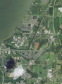
 Aerial view of Dyckesville and vicinity in Kewaunee and Brown counties, Wisconsin 2020.png 9 305 × 12 742; 232,29 MB
-
 Aerial view of Long Tail Point in Brown County, Wisconsin 2020.png 9 470 × 12 577; 200,38 MB
-
 Aerial view of the University of Wisconsin–Green Bay and vicinity in Brown County 2020.png 9 340 × 12 754; 215,77 MB
-
 Askeaton Wisconsin Looking East.jpg 4 482 × 1 677; 2,16 MB
-
 Askeaton Wisconsin Looking West.jpg 2 592 × 1 728; 1,85 MB
-
 ATC 138-Kilovolt Line - panoramio (1).jpg 3 629 × 3 150; 2,56 MB
-
 ATC High-Voltage Transmission Line - panoramio.jpg 4 608 × 3 456; 8,1 MB
-
 ATC Power Line - panoramio (7).jpg 4 608 × 3 456; 6,88 MB
-
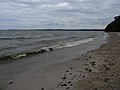 Beach on the shore of Green Bay Bay Shore County Park Brown County Wisconsin.jpg 4 000 × 3 000; 2,52 MB
-
 BelGioioso Cheese Inc 4200 Main St, Green Bay, WI 54311 (6) (923) 863-2123.jpg 1 086 × 473; 192 KB
-
 BrownCountyWisconsinBarnFarmlandSpringWIS96.jpg 1 936 × 1 288; 1,06 MB
-
 Camping World™ RV Sales - panoramio.jpg 4 608 × 3 456; 8,39 MB
-
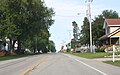
 ChampionWisconsinDowntown.jpg 1 930 × 1 258; 867 KB
-
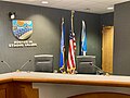 De Pere City Council Chambers.jpg 4 032 × 3 024; 2,69 MB
-
 De Pere High School.jpg 700 × 525; 229 KB
-
 Door Peninsula is flanked by Green Bay and Lake Michigan.jpg 4 928 × 3 280; 1,29 MB
-
 Dyckesville exit and County P overpass in the Town of Green Bay Wisconsin.jpg 3 600 × 2 400; 2,87 MB
-
-
 FontenoyWisconsinDowntown.jpg 3 888 × 2 592; 2,95 MB
-
 History of Brown County, Wisconsin, past and present (1913) (14578254568).jpg 1 964 × 1 424; 379 KB
-
 HollandWisconsinBrownCounty1.jpg 2 304 × 1 728; 769 KB
-
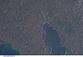 ISS026-E-5276 - View of Wisconsin.jpg 4 256 × 2 913; 1,06 MB
-
 ISS054-E-8026.jpg 3 712 × 5 568; 4,62 MB
-
 Jean Nicolet commerative plaque at Red Banks WI from 1909.jpg 3 456 × 2 304; 2,69 MB
-
 Jean Nicolet.jpg 814 × 430; 59 KB
-
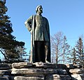 JeanNicolet.jpg 2 304 × 2 172; 935 KB
-
 LarkWisconsinDowntown1.jpg 3 880 × 2 420; 2,56 MB
-
 LarkWisconsinDowntown2.jpg 3 888 × 2 592; 3,3 MB
-
 Ledgeview Wisconsin Town Hall Sign.jpg 2 880 × 2 160; 1,8 MB
-
 Little Rapids Wisconsin CTH D.jpg 619 × 393; 65 KB
-
 Little Rapids Wisconsin Sign.jpg 640 × 480; 77 KB
-
 Long Tail Point Light.jpg 363 × 398; 42 KB
-
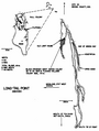 Long-Tail Point Brown County Wisconsin 1976.png 718 × 953; 136 KB
-
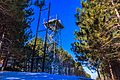 Lookout Tower at Reforestation Camp.jpg 4 693 × 3 118; 1,73 MB
-
 Menards® De Pere - panoramio.jpg 4 512 × 2 520; 4,57 MB
-
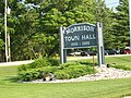 MorrisonWisconsinOldTownHallSign.jpg 2 304 × 1 728; 865 KB
-
 NewFrankenWisconsinDowntown.jpg 1 936 × 1 288; 1,09 MB
-
 NewFrankenWisconsinSign.jpg 1 936 × 1 288; 792 KB
-
 PolandWisconsinEastWIS29.jpg 1 936 × 1 288; 1,31 MB
-
 PolandWisconsinOverview.jpg 1 936 × 1 202; 729 KB
-
 Red Banks Wisconsin Looking East.jpg 2 336 × 1 352; 1,57 MB
-
 Red Banks Wisconsin Looking south.jpg 3 456 × 2 304; 3,96 MB
-
 Sensiba - panoramio.jpg 3 152 × 4 856; 7,26 MB
-

-
 Sturgeon Bay airboat deploys DVIDS1113799.jpg 1 963 × 1 428; 921 KB
-
 Tchampion wisconsin wi.jpg 526 × 400; 10 KB
-
 TornadoDamageGreenleafWisconsin2010.jpg 1 936 × 1 288; 1,61 MB
-
 Town of Scott Tower - panoramio.jpg 3 648 × 2 736; 2,28 MB
-
 Trail adjacent to the escarpment Bay Shore County Park Brown County Wisconsin.jpg 4 000 × 3 000; 5,21 MB
-
 Trail to Green Bay in Bay Shore County Park.jpg 4 000 × 3 000; 4,15 MB
-
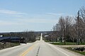
 US Route 141 Southern terminus looking north at I43 overpass.jpg 2 584 × 1 280; 938 KB
-
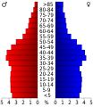 USA Brown County, Wisconsin age pyramid.svg 520 × 600; 7 KB
-
-
-
-

-

-

-
-

-
-

-

-

-
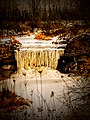
 Wequiock Falls Wisconsin (142732371).jpeg 2 048 × 1 365; 1,28 MB
-

-
 WIS29WIS32.jpg 2 304 × 1 655; 600 KB
-
 Wisconsin Ledge AVA Vineyard Brown County.jpg 1 670 × 1 092; 1,07 MB

.jpg)
.jpg)


.jpg)
.jpg)

_(923)_863-2123.jpg)


.jpg)

_(14578254568).jpg)


.jpeg)
_and_Van_Lieshout_Road_(background)_in_the_town_of_Scott,_Brown_County,_Wisconsin,_July_29,_2005.jpg)

