Category:Broxton, Cheshire
Aller à la navigation
Aller à la recherche
English: Broxton is a village and civil parish in the unitary authority of Cheshire West and Chester and the ceremonial county of Cheshire, England. The village is 11 miles south of Chester, and only 10 miles east of Wrexham in Wales. According to the 2001 Census it had a population of 390.
village britannique  | |||||
| Téléverser des médias | |||||
| Nature de l’élément | |||||
|---|---|---|---|---|---|
| Lieu | Cheshire West and Chester, Cheshire, Angleterre du Nord-Ouest, Angleterre | ||||
| Population |
| ||||
| Réputé identique à | Broxton (page en doublon, paroisse civile) | ||||
 | |||||
Sous-catégories
Cette catégorie comprend 2 sous-catégories, dont les 2 ci-dessous.
B
- Broxton Old Hall (4 F)
Média dans la catégorie « Broxton, Cheshire »
Cette catégorie comprend 114 fichiers, dont les 114 ci-dessous.
-
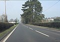
 A41 near Meadow Bank Farm - geograph.org.uk - 4263598.jpg 640 × 480 ; 53 kio
-
 A41 north of Duckington - geograph.org.uk - 2874871.jpg 639 × 454 ; 109 kio
-
 A41 south of Broxton - geograph.org.uk - 2874877.jpg 639 × 447 ; 149 kio
-
 A41 south of Broxton - geograph.org.uk - 2874889.jpg 638 × 452 ; 141 kio
-
 A41 south of Oak Farm - geograph.org.uk - 2874875.jpg 639 × 454 ; 134 kio
-
 A41 south of roundabout at Broxton - geograph.org.uk - 3930276.jpg 640 × 514 ; 83 kio
-
 A41 southbound near Oak Farm - geograph.org.uk - 4263595.jpg 640 × 481 ; 26 kio
-
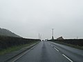
 A41 towards Chester - geograph.org.uk - 6143684.jpg 800 × 600 ; 125 kio
-
 A534 at Fullers Moor - geograph.org.uk - 3930305.jpg 640 × 361 ; 63 kio
-

-
 A534- Hill Lane junction - geograph.org.uk - 4263585.jpg 640 × 480 ; 66 kio
-
 A534-Old Coach Road junction - geograph.org.uk - 4263590.jpg 640 × 480 ; 77 kio
-
 Approaching Broxton Roundabout on the A41 - geograph.org.uk - 6143810.jpg 800 × 600 ; 153 kio
-
 Avenue gate - geograph.org.uk - 5825005.jpg 5 865 × 3 749 ; 5,78 Mio
-
 Barnhill's of Broxton - geograph.org.uk - 3527388.jpg 4 000 × 3 000 ; 2,28 Mio
-
 Barnhill's of Broxton - geograph.org.uk - 3527448.jpg 4 280 × 3 275 ; 2,07 Mio
-
 Bolesworth Hill Road - geograph.org.uk - 3136492.jpg 4 000 × 3 000 ; 3,36 Mio
-
 Bolesworth Hill Road - geograph.org.uk - 3136572.jpg 4 000 × 3 000 ; 2,79 Mio
-
 Brown Knoll Methodist Church - geograph.org.uk - 5809227.jpg 5 184 × 3 888 ; 4,03 Mio
-
 Brown Knowl Church.jpg 1 200 × 759 ; 386 kio
-
 Brown Knowl from Bickerton Hill - geograph.org.uk - 5075707.jpg 1 024 × 678 ; 241 kio
-
 Brown Knowl Methodist Church - geograph.org.uk - 1830113.jpg 640 × 405 ; 132 kio
-
 Brown Knowl Methodist Church - geograph.org.uk - 3138144.jpg 5 184 × 3 456 ; 2,42 Mio
-
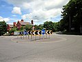
 Broxton - Roundabout.jpg 640 × 427 ; 148 kio
-
 Broxton Car Park and Picnic Area - geograph.org.uk - 3527419.jpg 4 000 × 3 000 ; 2,88 Mio
-
 Broxton from Bickerton Hill 2008.jpg 5 065 × 1 314 ; 1,11 Mio
-
 Broxton Hall Farm - geograph.org.uk - 5825949.jpg 6 032 × 4 014 ; 3,66 Mio
-
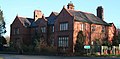
 Broxton Hall Hotel - geograph.org.uk - 3203311.jpg 640 × 415 ; 128 kio
-
 Broxton Old Hall - geograph.org.uk - 2857574.jpg 3 264 × 2 448 ; 4,28 Mio
-
 Broxton Old Hall Lodge - geograph.org.uk - 3136282.jpg 4 000 × 3 000 ; 1,99 Mio
-
 Broxton Police Station - geograph.org.uk - 1112087.jpg 640 × 393 ; 70 kio
-
 Broxton Police Station - geograph.org.uk - 1112095.jpg 640 × 313 ; 49 kio
-
 Broxton railway station 1925811 e88f294b.jpg 640 × 395 ; 123 kio
-
 Broxton Road (A534) towards Wrexham - geograph.org.uk - 6143826.jpg 800 × 600 ; 141 kio
-
 Broxton Roundabout where the A41 and A534 cross - geograph.org.uk - 5224475.jpg 4 000 × 3 000 ; 2,93 Mio
-
 Broxton roundabout, A41 - geograph.org.uk - 2874878.jpg 638 × 445 ; 174 kio
-
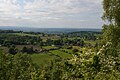
 Cheshire countryside - geograph.org.uk - 5817231.jpg 7 295 × 3 897 ; 7,82 Mio
-
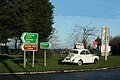
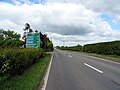 Chester 10 Miles - geograph.org.uk - 6143834.jpg 800 × 600 ; 99 kio
-
 Coach Road junction with Barnhill Road - geograph.org.uk - 3930282.jpg 640 × 373 ; 91 kio
-
 Cottages in Cheshire - geograph.org.uk - 5825953.jpg 6 032 × 4 014 ; 3,98 Mio
-
 Crop field near Oak Farm - geograph.org.uk - 6143802.jpg 800 × 600 ; 123 kio
-
 Downhill on Bolesworth Road - geograph.org.uk - 5192125.jpg 640 × 480 ; 120 kio
-
 Entering Broxton - geograph.org.uk - 6143687.jpg 800 × 505 ; 93 kio
-
 Entrance to Bolesworth Hill Farm - geograph.org.uk - 3136628.jpg 4 000 × 3 000 ; 2,95 Mio
-
 Entrance to Harthill Fisheries - geograph.org.uk - 3136551.jpg 4 000 × 3 000 ; 2,57 Mio
-
 Entrance to Meadow Bank from A41 - geograph.org.uk - 3929341.jpg 640 × 334 ; 39 kio
-
 Farm track and woodland, Duckington - geograph.org.uk - 6143686.jpg 800 × 600 ; 131 kio
-
 Farm track off Whitchurch Road (A41) - geograph.org.uk - 6143804.jpg 800 × 600 ; 204 kio
-
 Farm track off Whitchurch Road (A41) - geograph.org.uk - 6143815.jpg 800 × 600 ; 141 kio
-
 Farmland near Broxton Wood - geograph.org.uk - 6143796.jpg 800 × 560 ; 139 kio
-
 Farmland towards Oaklea Plantation - geograph.org.uk - 5192122.jpg 640 × 480 ; 58 kio
-
 Field entrance off the A41 - geograph.org.uk - 6143683.jpg 800 × 600 ; 128 kio
-
 Field west of Whitchurch Road (A41) - geograph.org.uk - 6143806.jpg 800 × 600 ; 147 kio
-
 Fields off Salter's Lane - geograph.org.uk - 2862307.jpg 3 264 × 2 448 ; 5,28 Mio
-
 Footpath off Bolesworth Road - geograph.org.uk - 5192109.jpg 640 × 480 ; 105 kio
-
 Footpath off the A41 - geograph.org.uk - 6143799.jpg 800 × 550 ; 101 kio
-
 Former County Police building, Broxton - geograph.org.uk - 6143830.jpg 640 × 395 ; 79 kio
-
 Gatehouse - geograph.org.uk - 5817252.jpg 6 032 × 4 014 ; 3,78 Mio
-
 Grassland, Broxton - geograph.org.uk - 6143814.jpg 800 × 600 ; 164 kio
-
 Hall Lane near Duckington - geograph.org.uk - 3136297.jpg 4 000 × 3 000 ; 2,28 Mio
-
 Hill Lane crossroads with Nantwich Road - geograph.org.uk - 3930293.jpg 640 × 469 ; 84 kio
-

-
 House in Cheshire - geograph.org.uk - 5825038.jpg 6 032 × 4 014 ; 3,79 Mio
-
 Ice-cream van at Bolesworth - geograph.org.uk - 5437018.jpg 4 032 × 3 024 ; 2,81 Mio
-
 Is this the fate of all cars? - geograph.org.uk - 1112133.jpg 640 × 427 ; 71 kio
-
 Is this Wind in the Willows? - geograph.org.uk - 1112136.jpg 427 × 640 ; 77 kio
-
 Keeping horses - geograph.org.uk - 5817234.jpg 6 032 × 4 014 ; 3,96 Mio
-
 Lane Junction near Harthill - geograph.org.uk - 3136640.jpg 4 000 × 3 000 ; 2,77 Mio
-
 Looking over Cheshire - geograph.org.uk - 5827977.jpg 9 040 × 3 955 ; 7,41 Mio
-
 Meadow Bank from the A41 - geograph.org.uk - 2874872.jpg 639 × 449 ; 142 kio
-
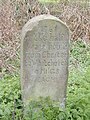 Milestone on Old Coach Road - geograph.org.uk - 108059.jpg 480 × 640 ; 152 kio
-
 Newly sown field at Broxton - geograph.org.uk - 2857578.jpg 3 264 × 2 448 ; 4,5 Mio
-
 Northwards from Bickerton Hill - geograph.org.uk - 5075700.jpg 1 024 × 678 ; 246 kio
-
 Not Toad Hall! - geograph.org.uk - 1112141.jpg 640 × 382 ; 73 kio
-
 Old Coach Road - geograph.org.uk - 5825954.jpg 6 032 × 4 014 ; 5,17 Mio
-
 Old Coach Road near Duckington - geograph.org.uk - 3136232.jpg 4 000 × 3 000 ; 2,52 Mio
-
 Old Coach Road, Broxton - geograph.org.uk - 3136403.jpg 4 000 × 3 000 ; 3,55 Mio
-
 Old Coach Road, Broxton - geograph.org.uk - 3136420.jpg 4 000 × 3 000 ; 3,2 Mio
-
 One Upmanship - geograph.org.uk - 1112145.jpg 483 × 640 ; 94 kio
-
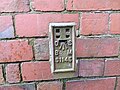 Ordnance Survey Flush Bracket S1145 - geograph.org.uk - 5224465.jpg 4 000 × 3 000 ; 3,4 Mio
-
 Ordnance Survey Flush Bracket S1146 - geograph.org.uk - 5224452.jpg 4 000 × 3 000 ; 2,92 Mio
-
 Paddock at Broxton Hall Farm - geograph.org.uk - 2857569.jpg 3 264 × 2 448 ; 4,6 Mio
-
 Padge Lane near Fuller's Moor - geograph.org.uk - 3136503.jpg 4 000 × 3 000 ; 4,2 Mio
-
 Panorama of Cheshire - geograph.org.uk - 5817237.jpg 23 761 × 2 000 ; 7,59 Mio
-
 Parkland, Bolesworth Castle - geograph.org.uk - 5192120.jpg 640 × 480 ; 67 kio
-
 Route confirmatory sign, A41 - geograph.org.uk - 2874882.jpg 638 × 449 ; 145 kio
-
 Salter's Lane (A534), Fuller's Moor - geograph.org.uk - 5192816.jpg 640 × 480 ; 82 kio
-
 Sandstone Cutting on Bolesworth Hill Road - geograph.org.uk - 3136617.jpg 4 000 × 3 000 ; 3,69 Mio
-
 Service station, Broxton - geograph.org.uk - 6143822.jpg 800 × 449 ; 93 kio
-
 Sign for the Egerton Arms, Broxton - geograph.org.uk - 6143818.jpg 589 × 800 ; 80 kio
-
 The A534 (Nantwich Road) near Broxton - geograph.org.uk - 3136386.jpg 4 000 × 3 000 ; 3,14 Mio
-
 The A534 - geograph.org.uk - 5827979.jpg 6 032 × 4 014 ; 5,15 Mio
-
 The Broxton Roundabout - geograph.org.uk - 3527353.jpg 4 000 × 3 000 ; 2,28 Mio
-
 The Durham Heifer, Broxton - geograph.org.uk - 3136376.jpg 5 280 × 3 525 ; 1,96 Mio
-
 The Egerton Arms, Broxton - geograph.org.uk - 3527325.jpg 4 000 × 3 000 ; 2,2 Mio
-
 The Egerton Arms, Broxton - geograph.org.uk - 6143817.jpg 800 × 520 ; 101 kio
-
 The Old Chester to Whitchurch Railway - geograph.org.uk - 3527292.jpg 4 000 × 3 000 ; 2,68 Mio
-
 The Old Coach Road - geograph.org.uk - 5817242.jpg 6 032 × 4 014 ; 5,47 Mio
-
 The Old Police Houses, Broxton - geograph.org.uk - 3527513.jpg 4 110 × 3 291 ; 2,18 Mio
-
 The Sandstone - geograph.org.uk - 2857605.jpg 3 264 × 2 448 ; 3,45 Mio
-
 The Sandstone public house, Fuller's Moor - geograph.org.uk - 5192147.jpg 640 × 480 ; 58 kio
-
 The Sandstone public house, Fuller's Moor - geograph.org.uk - 5192822.jpg 640 × 480 ; 68 kio
-
 Track to Oak Farm, Broxton - geograph.org.uk - 4490374.jpg 1 600 × 1 200 ; 1,65 Mio
-
 View down to Brown Knowl from the Sandstone Trail - geograph.org.uk - 4995930.jpg 1 600 × 1 064 ; 602 kio
-
 View off Maiden Castle towards Brown Knowl - geograph.org.uk - 4995913.jpg 1 600 × 1 064 ; 554 kio
-
 Wakeboarding on Bolesworth Lake - geograph.org.uk - 5437012.jpg 4 032 × 3 024 ; 3,18 Mio
-
 Wall of the Old Coach Road - geograph.org.uk - 5817246.jpg 6 032 × 4 014 ; 6,28 Mio
-
 Whitchurch Road (A41) towards Chester - geograph.org.uk - 6143800.jpg 800 × 600 ; 100 kio
-
 Whitchurch Road (A41) towards Chester - geograph.org.uk - 6143807.jpg 800 × 600 ; 129 kio
-
 Withy Lane, Broxton - geograph.org.uk - 3136476.jpg 4 000 × 3 000 ; 4,07 Mio
-
 Woodside from the A41 - geograph.org.uk - 3929327.jpg 640 × 356 ; 39 kio
-
 Barnhill Road - geograph.org.uk - 159860.jpg 640 × 480 ; 156 kio
-
 Coach Road - geograph.org.uk - 134400.jpg 640 × 480 ; 160 kio
-
 Egerton Arms. - geograph.org.uk - 107459.jpg 640 × 480 ; 102 kio


_towards_Wrexham_-_geograph.org.uk_-_6143826.jpg)


_-_geograph.org.uk_-_6143804.jpg)
_-_geograph.org.uk_-_6143815.jpg)


_-_geograph.org.uk_-_6143806.jpg)


,_Fuller%27s_Moor_-_geograph.org.uk_-_5192816.jpg)


_near_Broxton_-_geograph.org.uk_-_3136386.jpg)


_towards_Chester_-_geograph.org.uk_-_6143800.jpg)
_towards_Chester_-_geograph.org.uk_-_6143807.jpg)


