Category:Brunnsteinhöhle
Jump to navigation
Jump to search
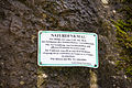
Deutsch: Die Brunnsteinhöhle (HFA-Katasternummer: C 10) ist eine Karsthöhle bei Streitberg. Sie ist als Bodendenkmal D-4-6133-0118 ausgewiesen.
| Object location | | View all coordinates using: OpenStreetMap |
|---|
Media in category "Brunnsteinhöhle"
The following 13 files are in this category, out of 13 total.
-
 Brunnsteinhöhle 01.jpg 5,022 × 3,349; 3.35 MB
-
 Brunnsteinhöhle 02.jpg 5,184 × 3,456; 3.64 MB
-
 Brunnsteinhöhle 03.jpg 5,184 × 3,456; 3.75 MB
-
 Brunnsteinhöhle 04.jpg 5,184 × 3,456; 3.64 MB
-
 Brunnsteinhöhle 05.jpg 5,184 × 3,456; 4.14 MB
-
 Brunnsteinhöhle 06.jpg 5,184 × 3,456; 3.5 MB
-
 Brunnsteinhöhle 07.jpg 3,456 × 5,184; 3.2 MB
-
 Brunnsteinhöhle 08.jpg 5,184 × 3,456; 3.3 MB
-
 Brunnsteinhöhle 09.jpg 5,184 × 3,456; 3.55 MB
-
 Brunnsteinhöhle 10.jpg 5,184 × 3,456; 3.93 MB
-
 Brunnsteinhöhle 11.jpg 3,456 × 5,184; 4.59 MB
-
 Brunnsteinhöhle Panorama 01.jpg 21,217 × 4,705; 21.2 MB
-
 Die Merkwürdigkeiten der Gegend um Muggendorf (Rosenmüller) - 04.jpg 3,027 × 2,464; 8.17 MB


_-_04.jpg)