Category:Brusselstraat, Breda
Jump to navigation
Jump to search
| Camera location | | View all coordinates using: OpenStreetMap |
|---|
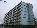
Nederlands: Afbeeldingen van de Brusselstraat, Breda in de wijk Biesdonk een onderdeel van het stadsdeel de Hoge Vucht in het noorden van Breda in de provincie Noord-Brabant in het zuiden van Nederland. De Brusselstraat begint bij de kruising met de straat de Hamdijk, Breda en loopt tot de Roeselarestraat, Breda tot nabij het Winkelcentrum Hoge Vucht. Halverwege de Brusselstraat bevindt zich aan beide zijde een bushalte.
street in Breda, the Netherlands | |||||
| Upload media | |||||
| Instance of | |||||
|---|---|---|---|---|---|
| Location | Breda, North Brabant, Netherlands | ||||
| Street address |
| ||||
 | |||||
Media in category "Brusselstraat, Breda"
The following 15 files are in this category, out of 15 total.
-
 Brusselstraat Breda DSCF4782.jpg 4,000 × 3,000; 4.74 MB
-
 Brusselstraat Breda DSCF4783.jpg 4,000 × 3,000; 4.81 MB
-
 Brusselstraat Breda DSCF4784.jpg 4,000 × 3,000; 4.84 MB
-
 Brusselstraat Breda DSCF4785.jpg 4,000 × 3,000; 4.84 MB
-
 Brusselstraat Breda DSCF4788.jpg 4,000 × 3,000; 4.76 MB
-
 Brusselstraat Breda DSCF4789.jpg 4,000 × 3,000; 4.43 MB
-
 Brusselstraat, Breda DSCF4769.jpg 4,000 × 3,000; 4.87 MB
-
 Brusselstraat, Breda DSCF4770.jpg 4,000 × 3,000; 4.72 MB
-
 Brusselstraat, Breda DSCF4790.jpg 4,000 × 3,000; 4.63 MB
-
 Brusselstraat, Breda DSCF4791.jpg 4,000 × 3,000; 4.63 MB
-
 Brusselstraat, Breda DSCF4793.jpg 4,000 × 3,000; 4.49 MB
-
 Flat Biesdonk DSCF4766.jpg 4,000 × 3,000; 4.5 MB
-
 Flat Biesdonk DSCF4781.jpg 4,000 × 3,000; 4.49 MB
-
 Flat Biesdonk DSCF4787.jpg 4,000 × 3,000; 4.47 MB
-
 Woningen DSCF4786.jpg 4,000 × 3,000; 4.85 MB


