Category:Buckden, North Yorkshire
Aller à la navigation
Aller à la recherche
localité britannique du comté anglais de North Yorkshire Dec2006.jpg) | |||||
| Téléverser des médias | |||||
| Nature de l’élément | |||||
|---|---|---|---|---|---|
| Se trouve dans l'aire protégée | |||||
| Lieu | Craven, Yorkshire du Nord, Yorkshire-et-Humber, Angleterre | ||||
| Réputé identique à | Buckden (page en doublon, paroisse civile) | ||||
 | |||||

Sous-catégories
Cette catégorie comprend 9 sous-catégories, dont les 9 ci-dessous.
Média dans la catégorie « Buckden, North Yorkshire »
Cette catégorie comprend 1 575 fichiers, dont les 200 ci-dessous.
(page précédente) (page suivante)-
 A "U" shaped wall, presumably built as a shelter for sheep - geograph.org.uk - 1933254.jpg 4 592 × 3 056 ; 5,44 Mio
-
 A bend in Stubbing Lane - geograph.org.uk - 3062258.jpg 1 024 × 683 ; 130 kio
-
 A bit of orphan drystone wall - geograph.org.uk - 4637677.jpg 6 000 × 4 000 ; 4,24 Mio
-
 A boundary stone - geograph.org.uk - 1527788.jpg 640 × 426 ; 82 kio
-

-
 A cairn viewpoint above Todd's Wood - looking East - geograph.org.uk - 1933213.jpg 4 592 × 3 056 ; 4,61 Mio
-
 A Depleted Cray Tarn - geograph.org.uk - 3005455.jpg 4 320 × 3 240 ; 4,45 Mio
-
 A footbridge on The Dales Way - geograph.org.uk - 2038188.jpg 4 592 × 3 056 ; 5,78 Mio
-
 A footbridge provides the exit to Rais Wood - geograph.org.uk - 1933294.jpg 4 592 × 3 056 ; 6,39 Mio
-
 A gated footbridge at Crook Gill - geograph.org.uk - 1932921.jpg 4 592 × 3 056 ; 6,33 Mio
-
 A kink in the wall - geograph.org.uk - 1527753.jpg 640 × 426 ; 95 kio
-
 A leveret on the hillside above Buckden - geograph.org.uk - 1352441.jpg 640 × 426 ; 77 kio
-
 A Nosey Sheep. - geograph.org.uk - 264964.jpg 640 × 480 ; 93 kio
-
 A route down, escort in attendance - geograph.org.uk - 1352451.jpg 640 × 426 ; 104 kio
-
 A ruined cottage, overtaken by nature - geograph.org.uk - 1525665.jpg 640 × 480 ; 135 kio
-
 A ruined wall and a path - geograph.org.uk - 2037294.jpg 4 592 × 3 056 ; 3,84 Mio
-
 A sheep pen in disrepair - geograph.org.uk - 1933330.jpg 4 592 × 3 056 ; 4,62 Mio
-
 A tad chilly for Romans - geograph.org.uk - 1723697.jpg 3 264 × 2 448 ; 1,88 Mio
-
 A thistle - geograph.org.uk - 1933281.jpg 4 592 × 3 056 ; 2,6 Mio
-
 A view back to Wharfedale. - geograph.org.uk - 1706465.jpg 480 × 640 ; 77 kio
-
 Above Deepdale Gill - geograph.org.uk - 3578180.jpg 4 320 × 3 240 ; 3,85 Mio
-
 Above Oughtershaw Moss (1) - geograph.org.uk - 4675789.jpg 1 600 × 1 067 ; 595 kio
-
 Above Oughtershaw Moss (2) - geograph.org.uk - 4675791.jpg 1 600 × 1 067 ; 540 kio
-
 Above Oughtershaw Tarn - geograph.org.uk - 4575166.jpg 4 608 × 3 456 ; 3,46 Mio
-
 Above Redmire - geograph.org.uk - 2294531.jpg 2 560 × 1 920 ; 1,8 Mio
-
 After the hay crop - geograph.org.uk - 4078562.jpg 1 600 × 1 200 ; 539 kio
-
 Alongside the River Wharfe, north of Buckden - geograph.org.uk - 4760521.jpg 3 776 × 2 520 ; 4,12 Mio
-
 An old Telegraph Office sign at Buckden - geograph.org.uk - 3760071.jpg 1 024 × 681 ; 143 kio
-
 An open gate and more buttercups - geograph.org.uk - 1932875.jpg 4 592 × 3 056 ; 5,01 Mio
-
 An unusual sight on Buckden Causeway Moss - geograph.org.uk - 3581605.jpg 4 000 × 3 000 ; 3,18 Mio
-
 Ancient lane at Buckden - geograph.org.uk - 4066432.jpg 1 600 × 1 200 ; 563 kio
-
 Angels' Fingers over Buckden - geograph.org.uk - 3028916.jpg 2 048 × 1 536 ; 814 kio
-
 Another track runs parallel to the path at this point - geograph.org.uk - 1933355.jpg 4 592 × 3 056 ; 5,26 Mio
-
 Approach to Yockenthwaite - geograph.org.uk - 4265235.jpg 640 × 480 ; 109 kio
-
 Approaching Buckden Bridge - geograph.org.uk - 3087133.jpg 640 × 480 ; 105 kio
-
 Approaching Buckden on the Dales Way from Hummberhome (12th February 2013) 001.JPG 3 872 × 2 176 ; 3,11 Mio
-
 Approaching Buckden on the Dales Way from Hummberhome (12th February 2013) 002.JPG 3 872 × 2 176 ; 2,64 Mio
-
 Approaching Buckden on the Dales Way from Hummberhome (12th February 2013) 003.JPG 3 872 × 2 176 ; 2,25 Mio
-
 Approaching Buckden on the path along Buckden Rake - geograph.org.uk - 6004614.jpg 1 600 × 1 036 ; 580 kio
-
 Approaching Cray, 1999 - geograph.org.uk - 5576851.jpg 1 918 × 1 166 ; 379 kio
-
 Approaching Hubberholme - geograph.org.uk - 4078532.jpg 1 600 × 1 173 ; 472 kio
-
 Approaching Hubberholme from the west - geograph.org.uk - 4631540.jpg 2 048 × 1 536 ; 1,18 Mio
-
 Arriving at Buckden - geograph.org.uk - 2847371.jpg 3 072 × 2 304 ; 1,09 Mio
-
 Ascent of Horse Head - geograph.org.uk - 4265240.jpg 640 × 480 ; 63 kio
-
 Ascent of Horse Head - geograph.org.uk - 4265243.jpg 640 × 480 ; 65 kio
-
 At the top of the cliff above Todd's Wood - geograph.org.uk - 1933158.jpg 4 592 × 3 056 ; 7,04 Mio
-
 Awaiting the cycle race at Cray - geograph.org.uk - 6281167.jpg 1 024 × 768 ; 116 kio
-
 B6160 below Eshber Wood - geograph.org.uk - 3060755.jpg 1 024 × 683 ; 244 kio
-
 B6160 entering Buckden - geograph.org.uk - 3082945.jpg 640 × 380 ; 65 kio
-
 B6160 south near Hubberholme - geograph.org.uk - 3082942.jpg 640 × 454 ; 88 kio
-
 Balanced stone in the River Wharfe - geograph.org.uk - 2650886.jpg 2 000 × 1 460 ; 970 kio
-
 Barn above Wharfedale - geograph.org.uk - 4058220.jpg 4 320 × 3 240 ; 4,78 Mio
-
 Barn below Scar House - geograph.org.uk - 2727329.jpg 1 500 × 1 125 ; 1,75 Mio
-
 Barn beside B6160 south of Buckden - geograph.org.uk - 3061467.jpg 1 024 × 683 ; 194 kio
-
 Barn beside the Dales Way at Birk Wood - geograph.org.uk - 2847385.jpg 3 072 × 2 304 ; 1,35 Mio
-
 Barn beside the Wharfe - geograph.org.uk - 2017341.jpg 640 × 480 ; 145 kio
-
 Barn in Meadow - geograph.org.uk - 4265228.jpg 640 × 480 ; 75 kio
-
 Barn in Raisgill - geograph.org.uk - 3062118.jpg 1 024 × 683 ; 179 kio
-
 Barn near Crook Gill - geograph.org.uk - 2007007.jpg 2 048 × 1 536 ; 1 022 kio
-
 Barn near Grange Farm - geograph.org.uk - 4078545.jpg 1 600 × 1 200 ; 497 kio
-
 Barn on Dubb's Lane - geograph.org.uk - 4760565.jpg 3 776 × 2 520 ; 4,1 Mio
-
 Barn on east side of B6160 - geograph.org.uk - 3061260.jpg 1 024 × 683 ; 191 kio
-
 Barn on the B6160 - geograph.org.uk - 2023985.jpg 640 × 480 ; 117 kio
-
 Barn on west side of B6160, Buckden - geograph.org.uk - 3062034.jpg 1 024 × 683 ; 202 kio
-
 Beck downstream of the bridleway ford - geograph.org.uk - 3538464.jpg 1 024 × 768 ; 178 kio
-
 Beck upstream of the bridleway ford - geograph.org.uk - 3538465.jpg 1 024 × 768 ; 190 kio
-
 Bee on orchid, Langstrothdale - geograph.org.uk - 5458381.jpg 540 × 720 ; 111 kio
-
 Bench mark, the old chapel, Oughtershaw - geograph.org.uk - 5542183.jpg 1 280 × 1 280 ; 527 kio
-
 Benchmark on B6160 wall below Eshber Wood - geograph.org.uk - 3060745.jpg 1 024 × 683 ; 327 kio
-
 Benchmark on base of Town Head Barn - geograph.org.uk - 3060872.jpg 683 × 1 024 ; 357 kio
-
 Benchmark on boulder beside Buckden Wood Lane - geograph.org.uk - 3061057.jpg 1 024 × 683 ; 307 kio
-
 Benchmark on boulder beside Langstrothdale road - geograph.org.uk - 3062674.jpg 683 × 1 024 ; 256 kio
-
 Benchmark on boulder in Langstrothdale at High Bank - geograph.org.uk - 2984207.jpg 683 × 1 024 ; 304 kio
-
 Benchmark on boulder opposite junction with Dales Way - geograph.org.uk - 2982032.jpg 683 × 1 024 ; 273 kio
-
 Benchmark on building at High Green Field - geograph.org.uk - 2984130.jpg 683 × 1 024 ; 231 kio
-
 Benchmark on dilapidated barn on Thatch Barn Field - geograph.org.uk - 2981894.jpg 683 × 1 024 ; 308 kio
-
 Benchmark on east side of B6160 - geograph.org.uk - 3061244.jpg 683 × 1 024 ; 271 kio
-
 Benchmark on end of forestry track bridge parapet - geograph.org.uk - 2982192.jpg 683 × 1 024 ; 303 kio
-
 Benchmark on Far Barn - geograph.org.uk - 2981923.jpg 683 × 1 024 ; 252 kio
-
 Benchmark on fence post at Long Slack Gate - geograph.org.uk - 2980991.jpg 683 × 1 024 ; 271 kio
-
 Benchmark on High Haw Garth Barn - geograph.org.uk - 3062027.jpg 683 × 1 024 ; 282 kio
-
 Benchmark on outcrop near Snipe Cave - geograph.org.uk - 2981886.jpg 683 × 1 024 ; 311 kio
-

-
 Benchmark on Raisgill barn - geograph.org.uk - 3062095.jpg 683 × 1 024 ; 303 kio
-
 Benchmark on roadside wall above Nethergill - geograph.org.uk - 2981974.jpg 683 × 1 024 ; 295 kio
-
 Benchmark on rock beside road in Langstrothdale - geograph.org.uk - 2984457.jpg 683 × 1 024 ; 271 kio
-
 Benchmark on rock beside roadside wall at West Dale - geograph.org.uk - 2982121.jpg 683 × 1 024 ; 316 kio
-
 Benchmark on rock in bank of River Wharfe - geograph.org.uk - 2982262.jpg 683 × 1 024 ; 276 kio
-
 Benchmark on St Michael's Church - geograph.org.uk - 3061211.jpg 683 × 1 024 ; 296 kio
-
 Benchmark on stone at base of wall, Stubbing Lane - geograph.org.uk - 3062247.jpg 1 024 × 683 ; 350 kio
-
 Benchmark on stone by wall of Buckden Wood Lane - geograph.org.uk - 3060954.jpg 1 024 × 683 ; 309 kio
-
 Benchmark on stone in wall at West Calf Close - geograph.org.uk - 2981507.jpg 683 × 1 024 ; 305 kio
-
 Benchmark on stone in wall near Nethergill - geograph.org.uk - 2981951.jpg 683 × 1 024 ; 323 kio
-
 Benchmark on the Lydia Wilson Woodd Memorial Hall - geograph.org.uk - 2981549.jpg 683 × 1 024 ; 315 kio
-
 Benchmark on top of bridge parapet above Low Bank - geograph.org.uk - 2981582.jpg 683 × 1 024 ; 298 kio
-
 Benchmark on wall at barn entrance, Raisgill - geograph.org.uk - 3062281.jpg 683 × 1 024 ; 279 kio
-
 Benchmark on wall at gateway near Hazle Bank Gill - geograph.org.uk - 2981426.jpg 683 × 1 024 ; 357 kio
-
 Benchmark on wall in Langstrothdale near Deepdale - geograph.org.uk - 3062742.jpg 683 × 1 024 ; 318 kio
-
 Benchmark on wall stone on North side of Stubbing Lane - geograph.org.uk - 3062183.jpg 683 × 1 024 ; 270 kio
-
 Benchmark on wall stone on road beside River Wharfe - geograph.org.uk - 3062057.jpg 1 024 × 683 ; 301 kio
-
 Benchmark on West Close Barn, Stubbing Lane - geograph.org.uk - 3062209.jpg 683 × 1 024 ; 302 kio
-
 Benchmark on west parapet of Deepdale Bridge - geograph.org.uk - 2982276.jpg 683 × 1 024 ; 280 kio
-
 Benchmarked stone in wall of Oughtershaw Road - geograph.org.uk - 2981301.jpg 683 × 1 024 ; 306 kio
-
 Bends near Eshber Wood - geograph.org.uk - 3082953.jpg 640 × 449 ; 62 kio
-
 Beside Oughtershaw Road - geograph.org.uk - 5497178.jpg 1 024 × 683 ; 315 kio
-
 Between Raydale and Oughtershaw Beck - geograph.org.uk - 3580604.jpg 4 320 × 3 240 ; 4,02 Mio
-
 Birks Fell - geograph.org.uk - 2037382.jpg 2 816 × 2 112 ; 2,95 Mio
-
 Birks Fell - geograph.org.uk - 3340146.jpg 2 592 × 1 944 ; 1,76 Mio
-
 Birks Fell - geograph.org.uk - 5782736.jpg 1 600 × 1 200 ; 668 kio
-
 Birks Fell Cave - geograph.org.uk - 272968.jpg 480 × 640 ; 105 kio
-
 Birks Fell Summit - geograph.org.uk - 4599134.jpg 800 × 449 ; 121 kio
-
 Birks Tarn - geograph.org.uk - 2729511.jpg 1 500 × 885 ; 993 kio
-
 Birks Tarn - geograph.org.uk - 4626813.jpg 2 048 × 1 536 ; 924 kio
-
 Birks Tarn - geograph.org.uk - 5793655.jpg 720 × 540 ; 111 kio
-
 Birks Tarn - geograph.org.uk - 5794219.jpg 720 × 540 ; 133 kio
-
 Birks Wood - geograph.org.uk - 2741143.jpg 4 320 × 3 240 ; 4,05 Mio
-
 Blanket bog at Horse Head - geograph.org.uk - 3538442.jpg 1 024 × 768 ; 114 kio
-
 Blanket bog on the ridgetop west of Little Fell - geograph.org.uk - 3538402.jpg 1 024 × 768 ; 126 kio
-
 Blue marker post on Birks Fell - geograph.org.uk - 3729929.jpg 640 × 480 ; 120 kio
-
 Bog cotton and blanket bog - geograph.org.uk - 3538448.jpg 968 × 581 ; 109 kio
-
 Bog on Buckden Pike - geograph.org.uk - 4639490.jpg 6 000 × 4 000 ; 7,38 Mio
-
 Boundary Fence on Sugar Loaf - geograph.org.uk - 3268280.jpg 4 320 × 3 240 ; 4,22 Mio
-
 Boundary stone on Buckden Pike - geograph.org.uk - 2872923.jpg 3 072 × 2 304 ; 1,39 Mio
-
 Boundary Stone On Buckden Pike. - geograph.org.uk - 410664.jpg 640 × 480 ; 318 kio
-
 Boundary wall down the fellside - geograph.org.uk - 5385355.jpg 4 320 × 3 240 ; 2,59 Mio
-
 Boundary Wall on Cocklee Fell - geograph.org.uk - 4675272.jpg 1 600 × 1 067 ; 389 kio
-
 Bouther Gill - geograph.org.uk - 3268332.jpg 4 320 × 3 240 ; 3,67 Mio
-
 Bridge Across Oughtershaw Beck - geograph.org.uk - 4086730.jpg 2 560 × 1 920 ; 2,93 Mio
-
 Bridge and Signpost (Cow Pasture) - geograph.org.uk - 672784.jpg 640 × 480 ; 109 kio
-
 Bridge at Yockenthwaite - geograph.org.uk - 4265236.jpg 640 × 480 ; 68 kio
-
 Bridge by New House - geograph.org.uk - 5497215.jpg 1 024 × 683 ; 376 kio
-
 Bridge carrying Dubb's Lane over Kirk Gill - geograph.org.uk - 3537174.jpg 1 024 × 768 ; 205 kio
-
 Bridge over Cow Close Gill - geograph.org.uk - 5840599.jpg 1 024 × 683 ; 221 kio
-
 Bridge over Cray Gill - geograph.org.uk - 6281144.jpg 1 024 × 768 ; 430 kio
-
 Bridge over the River Wharfe by Buckden - geograph.org.uk - 4637416.jpg 6 000 × 4 000 ; 4,31 Mio
-
 Bridge over the Wharfe - geograph.org.uk - 2024049.jpg 640 × 480 ; 271 kio
-
 Bridle Path at Buckden - geograph.org.uk - 4074638.jpg 1 600 × 1 200 ; 641 kio
-
 Bridlepath to Rakes Wood - geograph.org.uk - 3201859.jpg 1 500 × 1 000 ; 220 kio
-
 Bridleway descending to Buckden - geograph.org.uk - 4640331.jpg 6 000 × 4 000 ; 4,29 Mio
-
 Bridleway to Cray - geograph.org.uk - 1723709.jpg 3 264 × 2 448 ; 1,97 Mio
-
 Bruised Sky above Cow Close - geograph.org.uk - 2005837.jpg 2 724 × 2 108 ; 2,15 Mio
-
 Buckden - geograph.org.uk - 2023978.jpg 640 × 480 ; 132 kio
-
 Buckden - geograph.org.uk - 2891897.jpg 3 811 × 2 131 ; 1,24 Mio
-
 Buckden - geograph.org.uk - 2980015.jpg 1 600 × 1 200 ; 360 kio
-
 Buckden - geograph.org.uk - 3509451.jpg 1 024 × 680 ; 264 kio
-
 Buckden - geograph.org.uk - 383989.jpg 540 × 392 ; 123 kio
-
 Buckden - geograph.org.uk - 5482670.jpg 640 × 480 ; 62 kio
-
 Buckden and Nab End - geograph.org.uk - 3509455.jpg 1 024 × 680 ; 280 kio
-

-
 Buckden Beck - geograph.org.uk - 2152863.jpg 640 × 480 ; 92 kio
-
 Buckden Bridge - geograph.org.uk - 4639884.jpg 2 048 × 1 536 ; 1,56 Mio
-
 Buckden Causeway Moss - geograph.org.uk - 4689268.jpg 6 000 × 4 000 ; 3,95 Mio
-
 Buckden from the Dales Way (12th February 2013).JPG 3 872 × 2 176 ; 2,75 Mio
-
 Buckden from the north - geograph.org.uk - 1723717.jpg 3 264 × 2 448 ; 2,08 Mio
-
 Buckden Gavel - geograph.org.uk - 502518.jpg 640 × 440 ; 174 kio
-
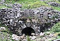
 Buckden Lead Mine (dis) - geograph.org.uk - 1352408.jpg 640 × 426 ; 116 kio
-
 Buckden lead mine - geograph.org.uk - 5750221.jpg 640 × 480 ; 126 kio
-
 Buckden Levels - geograph.org.uk - 1352415.jpg 640 × 426 ; 93 kio
-
 Buckden levels - spoil tip - geograph.org.uk - 1352397.jpg 640 × 426 ; 113 kio
-
 Buckden Out Moor - geograph.org.uk - 1352390.jpg 640 × 426 ; 72 kio
-
 Buckden Out Moor - geograph.org.uk - 4639571.jpg 6 000 × 4 000 ; 4,93 Mio
-
 Buckden out Moor - panoramio (2).jpg 2 816 × 1 584 ; 933 kio
-
 Buckden out Moor - panoramio (3).jpg 2 816 × 1 584 ; 595 kio
-
 Buckden out Moor - panoramio (4).jpg 2 816 × 1 584 ; 969 kio
-
 Buckden picnic area - geograph.org.uk - 1723727.jpg 3 021 × 2 203 ; 2,14 Mio
-
 Buckden Pike - geograph.org.uk - 125072.jpg 640 × 253 ; 35 kio
-
 Buckden Pike - geograph.org.uk - 4717029.jpg 4 176 × 2 784 ; 5,17 Mio
-
 Buckden Pike from Buckden Rake - geograph.org.uk - 5482669.jpg 640 × 480 ; 53 kio
-
 Buckden Rake - geograph.org.uk - 1351603.jpg 640 × 426 ; 61 kio
-
 Buckden Rake - geograph.org.uk - 2295697.jpg 2 560 × 1 920 ; 1,55 Mio
-
 Buckden Rake - geograph.org.uk - 3536902.jpg 1 024 × 768 ; 156 kio
-
 Buckden Rake - geograph.org.uk - 4265210.jpg 480 × 640 ; 72 kio
-
 Buckden Rake - geograph.org.uk - 4640296.jpg 6 000 × 4 000 ; 4,18 Mio
-
 Buckden Rake - geograph.org.uk - 4640327.jpg 6 000 × 4 000 ; 4,52 Mio
-
 Buckden Rake - geograph.org.uk - 5750237.jpg 640 × 480 ; 70 kio
-
 Buckden Rake towards Buckden - geograph.org.uk - 3759981.jpg 1 024 × 681 ; 299 kio
-
 Buckden Rake towards Buckden - geograph.org.uk - 3759986.jpg 1 024 × 681 ; 248 kio
-
 Buckden Rake towards Buckden - geograph.org.uk - 3759988.jpg 1 024 × 681 ; 273 kio
-
 Buckden Rake, looking down towards Buckden - geograph.org.uk - 3536897.jpg 1 024 × 768 ; 186 kio
-
 Buckden seen across the Wharfe - geograph.org.uk - 2023976.jpg 640 × 480 ; 145 kio
-
 Buckden Village - geograph.org.uk - 1365987.jpg 640 × 396 ; 49 kio
-
 Buckden village green - geograph.org.uk - 4553116.jpg 1 024 × 596 ; 564 kio
-
 Buckden Village Institute - geograph.org.uk - 4639881.jpg 2 048 × 1 536 ; 1,17 Mio
-
 Buckden village store - geograph.org.uk - 4639848.jpg 2 048 × 1 536 ; 1,31 Mio
-
 Buckden Village Stores - geograph.org.uk - 5542522.jpg 1 280 × 853 ; 347 kio
-
 Buckden Village Stores - geograph.org.uk - 6031944.jpg 2 273 × 1 279 ; 1,38 Mio
-
 Buckden welcomes the Tour de France^ - geograph.org.uk - 4074623.jpg 1 600 × 1 200 ; 532 kio
-
 Buckden Wood Lane (B6160) - geograph.org.uk - 3060989.jpg 1 024 × 683 ; 217 kio
-
 Buckden Wood Lane (B6160) - geograph.org.uk - 3061063.jpg 1 024 × 683 ; 172 kio
-
 Buckden, 'A Pennine Journey' track - geograph.org.uk - 6233657.jpg 6 298 × 4 198 ; 6,56 Mio
-
 Buckden, Dubbs Lane bridge - geograph.org.uk - 6233650.jpg 6 542 × 4 361 ; 7,75 Mio
-
 Buckden, Dubbs Lane, National Trust sign - geograph.org.uk - 6233660.jpg 6 528 × 4 352 ; 7,71 Mio
-
 Buckden, Yorkshire. View south along the B6160 - geograph.org.uk - 2769702.jpg 3 264 × 2 448 ; 1,79 Mio
-
 BuckdenVillageStores(ChrisHeaton)Dec2006.jpg 640 × 480 ; 88 kio
-

-

-

-

-

-


_-_geograph.org.uk_-_4675789.jpg)
_-_geograph.org.uk_-_4675791.jpg)


_001.JPG)
_002.JPG)
_003.JPG)


_-_geograph.org.uk_-_672784.jpg)


.JPG)


_-_geograph.org.uk_-_1352408.jpg)


.jpg)
.jpg)
.jpg)


_-_geograph.org.uk_-_3060989.jpg)
_-_geograph.org.uk_-_3061063.jpg)


_-_geograph.org.uk_-_4670078.jpg)
_-_geograph.org.uk_-_4670128.jpg)
_-_geograph.org.uk_-_4673615.jpg)
_-_geograph.org.uk_-_4673618.jpg)
_-_geograph.org.uk_-_4674278.jpg)
_-_geograph.org.uk_-_4674280.jpg)