Category:Buckley, Flintshire
Jump to navigation
Jump to search
town and community in Flintshire, Wales   | |||||
| Upload media | |||||
| Instance of | |||||
|---|---|---|---|---|---|
| Location | Flintshire, Wales | ||||
| Population |
| ||||
| Area |
| ||||
 | |||||
Buckley, Flintshire, Wales.
Subcategories
This category has the following 7 subcategories, out of 7 total.
B
- Buckley Cricket Club (3 F)
- Buckley railway station (42 F)
C
- Coronation Gardens, Buckley (7 F)
F
- Fireworks in Buckley, 2019 (320 F)
S
Media in category "Buckley, Flintshire"
The following 149 files are in this category, out of 149 total.
-
 "Merry Christmas Buckley" - geograph.org.uk - 5997251.jpg 1,600 × 1,200; 207 KB
-
 "Nadolig Llawen Bwcle" - geograph.org.uk - 5997254.jpg 1,600 × 1,203; 210 KB
-
 2010 Wales Flintshire Community Buckley map.svg 512 × 568; 494 KB
-
 2024 Wales Flintshire Community Buckley map.svg 512 × 568; 394 KB
-
 A494 Mold Road - geograph.org.uk - 2762918.jpg 640 × 480; 57 KB
-
 A5118 at Padeswood village boundary - geograph.org.uk - 4353289.jpg 640 × 427; 46 KB
-

-
 A549 at Mill Lane junction - geograph.org.uk - 4351936.jpg 640 × 427; 58 KB
-
 A549 Brunswick Road, Buckley 1.JPG 3,648 × 2,736; 3.52 MB
-
 A549 Brunswick Road, Buckley 2.JPG 3,648 × 2,736; 3.51 MB
-
 A549 Chester Road, Buckley 1.JPG 3,648 × 2,736; 3.6 MB
-
 A549 Mold Road, Buckley 1.JPG 3,648 × 2,736; 3.67 MB
-
 A55 - Burntwood Road overbridge - geograph.org.uk - 2252247.jpg 640 × 480; 44 KB
-
 All Saints Church, Buckley - geograph.org.uk - 137226.jpg 640 × 446; 71 KB
-
 Alltami - geograph.org.uk - 2161021.jpg 640 × 480; 66 KB
-
 Alyn and Deeside district council coat of arms, Buckley - DSCF1123.JPG 3,000 × 4,000; 2.85 MB
-

-
 Argoed School - geograph.org.uk - 109136.jpg 640 × 480; 65 KB
-
 Bank Lane Field - geograph.org.uk - 1093442.jpg 640 × 424; 45 KB
-
 Bench mark in Liverpool Road, Buckley - geograph.org.uk - 5954693.jpg 1,199 × 1,600; 489 KB
-
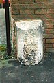
 Bench mark on ^54 Mold Road, Buckley - geograph.org.uk - 5928116.jpg 1,202 × 1,600; 418 KB
-
 Bernard Tschumi at GSAPP.jpg 3,872 × 2,592; 1.89 MB
-
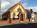
 Bistre Methodist chapel, Buckley - geograph.org.uk - 1068217.jpg 640 × 427; 46 KB
-
 Black Lion - geograph.org.uk - 2431266.jpg 640 × 480; 173 KB
-
 Borderlands line passes under the A549 at Buckley - DSCF1275.jpg 4,000 × 3,000; 2.86 MB
-
 Brunswick Road shopping area, Buckley.JPG 3,648 × 2,736; 3.59 MB
-
 Brunswick Road, Buckley - geograph.org.uk - 2431242.jpg 640 × 480; 210 KB
-
 Brunswick Road, Buckley 1.JPG 3,648 × 2,736; 3.59 MB
-

-
 Bryn Methodist Church, Alltami - geograph.org.uk - 203569.jpg 640 × 479; 88 KB
-
 BTFC 2-0 Brickfield Rangers.jpg 2,712 × 2,034; 402 KB
-
 Buckley - geograph.org.uk - 137229.jpg 567 × 640; 62 KB
-
 Buckley Christian Centre - geograph.org.uk - 137233.jpg 559 × 640; 92 KB
-
 Buckley Cross Methodist Church - geograph.org.uk - 2431287.jpg 640 × 480; 206 KB
-
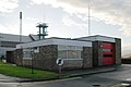
 Buckley Fire Station - geograph.org.uk - 2431239.jpg 640 × 480; 163 KB
-
 Buckley Library and Swimming Baths - geograph.org.uk - 2431279.jpg 640 × 480; 213 KB
-
 Buckley link road plaque - DSCF1122.JPG 4,000 × 3,000; 2.8 MB
-
 Buckley old fire station - geograph.org.uk - 607214.jpg 640 × 427; 203 KB
-
 Buckley Police Station - geograph.org.uk - 2431274.jpg 640 × 480; 174 KB
-
 Buckley railway station, Flintshire - geograph.org.uk - 3440672.jpg 1,024 × 768; 199 KB
-
 Buckley sign 1.JPG 2,736 × 3,648; 3.34 MB
-
 Buckley sign on the A549 - DSCF1285.JPG 3,000 × 4,000; 2.88 MB
-
 Buckley sign on the A549 - DSCF1286.JPG 3,000 × 4,000; 2.83 MB
-
 Buckley Society sign in Liverpool Road, Buckley - geograph.org.uk - 5954713.jpg 1,199 × 1,600; 326 KB
-
 Buckley Station - geograph.org.uk - 2431145.jpg 640 × 480; 213 KB
-
 Buckley Station - geograph.org.uk - 2431152.jpg 640 × 480; 196 KB
-

-
 Buckley town council building.JPG 3,648 × 2,736; 3.39 MB
-
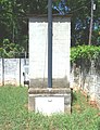
 Buckley War Memorial - geograph.org.uk - 2431372.jpg 640 × 480; 203 KB
-
 Buckley War Memorial - geograph.org.uk - 2431375.jpg 480 × 640; 185 KB
-
 Burntwood community village green, Flintshire (1).JPG 4,320 × 3,240; 5.41 MB
-

-
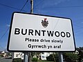
 Burntwood sign, Flintshire (1).JPG 3,240 × 4,320; 4.15 MB
-
 Burntwood sign, Flintshire (2).JPG 4,320 × 3,240; 2.6 MB
-
 Closed gardens, Buckley.JPG 3,648 × 2,736; 3.59 MB
-
 Colorado National Guard (8574483935).jpg 4,256 × 2,832; 2.14 MB
-

-

-
 Council Offices, Brunswick Road - geograph.org.uk - 2431261.jpg 640 × 480; 194 KB
-
 Deeside Truck Services - geograph.org.uk - 1586868.jpg 640 × 435; 42 KB
-
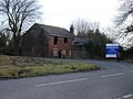
 Derelict shop, Buckley - DSCF1273.JPG 4,000 × 3,000; 2.9 MB
-
 Downtown Buckley - geograph.org.uk - 196349.jpg 640 × 480; 80 KB
-

-
 Ebenezer Baptist Church, Buckley.JPG 3,648 × 2,736; 3.47 MB
-
 Emmanuel Church, Bistre - geograph.org.uk - 134148.jpg 640 × 426; 137 KB
-
 Flintshire UK community map (Buckley).png 1,177 × 1,305; 229 KB
-
 Footbridge over narrow stream - geograph.org.uk - 3621287.jpg 1,600 × 1,200; 912 KB
-
 Footpath from the A5118 by Padeswood Hall - geograph.org.uk - 3619625.jpg 1,024 × 768; 297 KB
-
 Footpath through fields - geograph.org.uk - 3621300.jpg 1,600 × 1,200; 541 KB
-
 Former railway bridge, Liverpool Road, Buckley - geograph.org.uk - 5954709.jpg 1,600 × 1,200; 505 KB
-
 Former Wesleyan Chapel, Mold Road - geograph.org.uk - 1221476.jpg 640 × 480; 76 KB
-
 Indoor shopping centre, Buckley.JPG 3,648 × 2,736; 3.64 MB
-
 Lloyds Hill, Burntwood, Flintshire (1).JPG 4,320 × 3,240; 3.43 MB
-
 Mold Road looking west - geograph.org.uk - 2762916.jpg 640 × 464; 57 KB
-
 OK Diner at Northop - night time - geograph.org.uk - 4217033.jpg 640 × 480; 57 KB
-

-
 Old Milestone by the A549 in Buckley - geograph.org.uk - 6102750.jpg 757 × 1,169; 236 KB
-
-
 Overgrown footpath - geograph.org.uk - 3619646.jpg 1,600 × 1,200; 808 KB
-
 P1010010 (7294061736).jpg 3,000 × 4,000; 1.89 MB
-
 P1010011 (7294061920).jpg 4,000 × 3,000; 1.71 MB
-
 P1010012 (7294062140).jpg 4,000 × 3,000; 1.56 MB
-
 P1010013 (7294062438).jpg 2,606 × 3,406; 1.46 MB
-
 P1010014 (7294062898).jpg 3,000 × 4,000; 943 KB
-
 P1010015 (7294062648).jpg 3,000 × 4,000; 1.01 MB
-
 P1010016 (7294063106).jpg 4,000 × 3,000; 1.49 MB
-
 Paddock by Spon Farm - geograph.org.uk - 3622999.jpg 800 × 600; 175 KB
-
 Padeswood cement plant - geograph.org.uk - 1318232.jpg 640 × 474; 84 KB
-
 Padeswood cement plant, 1977 - geograph.org.uk - 2979618.jpg 2,000 × 1,216; 540 KB
-
 Public Library and Swimming Baths - geograph.org.uk - 2431256.jpg 640 × 480; 181 KB
-
 Public library and swimming baths building, Buckley.JPG 2,736 × 3,648; 3.51 MB
-
 Railway line running from Wrexham to Bidston - geograph.org.uk - 3623065.jpg 1,600 × 1,200; 716 KB
-
 Servicemen & women memorial, Buckley - DSCF1246.JPG 3,000 × 4,000; 2.92 MB
-
 Servicemen & women memorial, Buckley - DSCF1247.JPG 3,000 × 4,000; 2.81 MB
-
 Spencer Industrial Estate Sign, Buckley, Flintshire (1).JPG 4,320 × 3,240; 4.05 MB
-
 Springfield Drive at Daleside - geograph.org.uk - 4351937.jpg 640 × 480; 54 KB
-
 St. Matthew's Parish Church, Buckley - geograph.org.uk - 134163.jpg 640 × 426; 74 KB
-
 Station Road, Buckley 1.JPG 3,648 × 2,736; 3.56 MB
-
 Station Road, Buckley 2.JPG 3,648 × 2,736; 3.64 MB
-
 Stile for footpaths through a grazing field - geograph.org.uk - 3623026.jpg 1,024 × 768; 200 KB
-
 The A55 near Ewloe Green - geograph.org.uk - 1586874.jpg 640 × 479; 71 KB
-
 The Black Horse - geograph.org.uk - 2431269.jpg 640 × 480; 186 KB
-
 The Black Horse, Buckley.JPG 3,648 × 2,736; 3.57 MB
-
 The Black Lion, Buckley.JPG 2,736 × 3,648; 3.58 MB
-
 The Blue Anchor, Buckley.JPG 3,648 × 2,736; 3.55 MB
-
 The Blue Bell pub, Buckley.JPG 3,648 × 2,736; 3.54 MB
-
 The Cross Keys pub, Buckley.JPG 3,648 × 2,736; 3.57 MB
-
 The Good Shepherd, Drury - geograph.org.uk - 134165.jpg 640 × 426; 85 KB
-
 The Shamrock pub, Buckley.JPG 3,648 × 2,736; 3.62 MB
-
 The White Lion - geograph.org.uk - 1221468.jpg 640 × 480; 59 KB
-
 The White Lion, Buckley.JPG 3,648 × 2,736; 3.55 MB
-
 Traffic Lights at Alltami - geograph.org.uk - 202367.jpg 640 × 480; 83 KB
-
 Unmarked butcher's shop, Buckley.JPG 2,736 × 3,648; 3.47 MB
-
 Victorian Postbox at Padeswood - geograph.org.uk - 468625.jpg 480 × 640; 165 KB
-
 Bistre Farm, Padeswood - geograph.org.uk - 693783.jpg 640 × 480; 87 KB
-
 Bridge at Llong - geograph.org.uk - 384755.jpg 640 × 480; 256 KB
-
 Bridge over the River Alun at Llong - geograph.org.uk - 694022.jpg 640 × 480; 91 KB
-
 Bridleway to Llong - geograph.org.uk - 693954.jpg 480 × 640; 139 KB
-
 Buckley fire station - geograph.org.uk - 607216.jpg 640 × 427; 189 KB
-
 Buckley roofs - geograph.org.uk - 693930.jpg 640 × 480; 68 KB
-
 Cement works Padeswood - geograph.org.uk - 37569.jpg 512 × 384; 36 KB
-
 Derelict house at Buckley Mountain - geograph.org.uk - 109147.jpg 640 × 480; 107 KB
-
 Entrance to Old Padeswood Golf Course - geograph.org.uk - 469012.jpg 640 × 480; 125 KB
-
 Footbridge near Bryn Faigas Farm, Buckley - geograph.org.uk - 693936.jpg 640 × 480; 144 KB
-
 Little donkey - geograph.org.uk - 693776.jpg 640 × 480; 96 KB
-
 Little Emperor, Buckley - geograph.org.uk - 693926.jpg 640 × 480; 59 KB
-
 Llys-y-Nant, Buckley - geograph.org.uk - 693929.jpg 640 × 480; 62 KB
-
 Mast north of Llong - geograph.org.uk - 693951.jpg 480 × 640; 97 KB
-
 Meg's Lane, Buckley - geograph.org.uk - 693788.jpg 640 × 480; 58 KB
-
 Muddly bridleway - geograph.org.uk - 693955.jpg 480 × 640; 148 KB
-
 Nosey donkey - geograph.org.uk - 693779.jpg 480 × 640; 64 KB
-
 Old Padeswood Golf Club - geograph.org.uk - 693772.jpg 640 × 480; 59 KB
-
 Old Padeswood Golf Course - geograph.org.uk - 469010.jpg 640 × 480; 126 KB
-
 Old Stile and Footpath on Station Lane - geograph.org.uk - 468475.jpg 480 × 640; 197 KB
-
 Padeswood Railway Bridge - geograph.org.uk - 468482.jpg 640 × 480; 139 KB
-
 Padeswood Railway Bridge - geograph.org.uk - 468640.jpg 640 × 480; 169 KB
-
 Padeswood Railway Bridge - geograph.org.uk - 468805.jpg 640 × 480; 146 KB
-

-
 Plas Ifan, Alltami - geograph.org.uk - 203574.jpg 640 × 368; 53 KB
-
 St John the Baptist, Pentrobin - geograph.org.uk - 629184.jpg 640 × 480; 71 KB
-
 Station Lane, Padeswood - geograph.org.uk - 468825.jpg 640 × 480; 224 KB
-
 Telecommunications mast near Llong - geograph.org.uk - 693947.jpg 480 × 640; 52 KB
-
 The A494 at Alltami - geograph.org.uk - 61245.jpg 640 × 480; 94 KB
-
 The first tee - geograph.org.uk - 693770.jpg 640 × 480; 76 KB
-
 The Old Bridge Inn - geograph.org.uk - 468818.jpg 640 × 480; 118 KB
-
 The Old Grand Stand Public House - geograph.org.uk - 468839.jpg 640 × 480; 177 KB
-

-
 View West from Padeswood Railway Bridge - geograph.org.uk - 468651.jpg 640 × 480; 134 KB
-
 Welcome to Padeswood Works - geograph.org.uk - 208780.jpg 640 × 480; 138 KB


.JPG)

.JPG)
.JPG)

.jpg)


.png)


.JPG)


.jpg)
.jpg)
.jpg)
.jpg)
.jpg)
.jpg)
.jpg)


.JPG)


