Category:Buckton, East Riding of Yorkshire
Jump to navigation
Jump to search
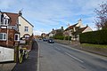
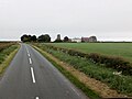
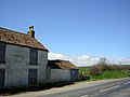
English: Buckton is a village, which is part of the civil parish of Bempton in the East Riding of Yorkshire, England. It is near the North Sea coast, and about 4 miles (6.4 km) north of Bridlington. It lies on the B1229 road.
village in East Riding of Yorkshire, England  | |||||
| Upload media | |||||
| Instance of | |||||
|---|---|---|---|---|---|
| Location | Bempton, East Riding of Yorkshire, Yorkshire and the Humber, England | ||||
| Different from | |||||
 | |||||
Media in category "Buckton, East Riding of Yorkshire"
The following 79 files are in this category, out of 79 total.
-
 Boulder clay slip on Buckton's chalk cliffs, - geograph.org.uk - 3536152.jpg 1,024 × 768; 150 KB
-
 Buckton - geograph.org.uk - 4456675.jpg 640 × 428; 88 KB
-
 Buckton Barn - geograph.org.uk - 1213427.jpg 640 × 480; 60 KB
-
 Buckton Cliff and Filey Bay - geograph.org.uk - 2761229.jpg 3,264 × 2,448; 2.01 MB
-
 Buckton Cliff Edge - geograph.org.uk - 2761219.jpg 3,264 × 2,448; 1.97 MB
-
 Buckton Cliff Triangulation Pillar - geograph.org.uk - 249825.jpg 640 × 492; 136 KB
-
 Buckton Cliffs - geograph.org.uk - 3536126.jpg 1,024 × 768; 123 KB
-
 Buckton Duck Pond - geograph.org.uk - 1208791.jpg 640 × 480; 93 KB
-
 Buckton duck pond - geograph.org.uk - 3991793.jpg 2,000 × 1,500; 1.08 MB
-
 Buckton Duck Pond - geograph.org.uk - 4482600.jpg 640 × 480; 76 KB
-
 Buckton Duck Pond.jpg 640 × 480; 121 KB
-
 Buckton information board - geograph.org.uk - 3991799.jpg 3,225 × 2,370; 2.41 MB
-
 Buckton Mill, Buckton.jpg 640 × 480; 80 KB
-
 Buckton Mill, East Riding-geograph.org-3554421.jpg 3,187 × 2,382; 2.31 MB
-
 Buckton Pond - geograph.org.uk - 2761146.jpg 3,264 × 2,448; 1.86 MB
-
 Buckton village street - geograph.org.uk - 2761097.jpg 3,264 × 2,448; 1.39 MB
-
 Building at Buckton Hall - geograph.org.uk - 249823.jpg 640 × 480; 85 KB
-
 Buildings at Grange Holme Farm, Buckton - geograph.org.uk - 3014701.jpg 1,024 × 768; 115 KB
-
 Bungalow Farm near Buckton Hall - geograph.org.uk - 1208830.jpg 640 × 480; 62 KB
-
 Earthworks north of Buckton (2) - geograph.org.uk - 2761199.jpg 3,264 × 2,448; 1.66 MB
-
 Earthworks north of Buckton - geograph.org.uk - 2761160.jpg 3,264 × 2,448; 1.86 MB
-
 Earthworks, Buckton - geograph.org.uk - 2148197.jpg 2,000 × 1,500; 939 KB
-
 East and North Yorkshire - geograph.org.uk - 835256.jpg 640 × 313; 188 KB
-
 End of Hoddy Cows Lane - geograph.org.uk - 1208824.jpg 640 × 480; 83 KB
-
 Entering Buckton - geograph.org.uk - 2498857.jpg 800 × 600; 186 KB
-
 Entering Buckton on the B1229 - geograph.org.uk - 2870291.jpg 640 × 480; 55 KB
-
 Farmland near Buckton - geograph.org.uk - 2858784.jpg 640 × 480; 38 KB
-
 Farmland near Buckton - geograph.org.uk - 2870256.jpg 640 × 480; 45 KB
-
 Farmland near Buckton - geograph.org.uk - 4456676.jpg 640 × 428; 82 KB
-
 Geese on Duck's Pond - geograph.org.uk - 1208792.jpg 640 × 480; 85 KB
-
 Green Fields - geograph.org.uk - 294288.jpg 640 × 480; 123 KB
-
 Grindale Road - geograph.org.uk - 1208813.jpg 640 × 480; 88 KB
-
 Grindale Road - geograph.org.uk - 1213430.jpg 640 × 480; 72 KB
-
 Grindale Road - geograph.org.uk - 294292.jpg 640 × 480; 110 KB
-
 Grindale Road Heading to the A165 - geograph.org.uk - 1208818.jpg 640 × 480; 61 KB
-
 Grindale Road towards A165 - geograph.org.uk - 294298.jpg 640 × 480; 122 KB
-
 Headland Way - geograph.org.uk - 3210141.jpg 1,068 × 712; 276 KB
-
 High Huntow Farm - geograph.org.uk - 1213444.jpg 640 × 480; 78 KB
-
 High Huntow Farmhouse - geograph.org.uk - 1213445.jpg 640 × 441; 71 KB
-
 Historic Railway Sign - geograph.org.uk - 1208787.jpg 640 × 480; 124 KB
-
 Hoddy Cows Lane - geograph.org.uk - 1208822.jpg 640 × 480; 141 KB
-
 Hoddy Cows Lane - geograph.org.uk - 511223.jpg 640 × 480; 159 KB
-
 Hoddy Cows Lane - geograph.org.uk - 511237.jpg 640 × 480; 140 KB
-
 Hoddy Cows Lane, Buckton - geograph.org.uk - 2148190.jpg 2,000 × 1,467; 1.08 MB
-
 Holiday cottages, Buckton - geograph.org.uk - 3503043.jpg 1,600 × 1,200; 585 KB
-
 Level crossing at Buckton - geograph.org.uk - 3554466.jpg 4,596 × 3,438; 5.38 MB
-
 Level Crossing Buckton.jpg 640 × 480; 76 KB
-
 Linear earthwork near the duck pond, Buckton - geograph.org.uk - 2148185.jpg 2,000 × 1,500; 925 KB
-
 Main Street, Buckton - geograph.org.uk - 3014659.jpg 1,024 × 768; 136 KB
-
 Main Street, Buckton - geograph.org.uk - 3014677.jpg 1,024 × 768; 127 KB
-
 Main Street, Buckton - geograph.org.uk - 3554500.jpg 3,703 × 2,686; 3.19 MB
-
 Mud and Puddles - geograph.org.uk - 294385.jpg 640 × 480; 88 KB
-
 New houses on Main Street, Buckton - geograph.org.uk - 3014708.jpg 1,024 × 768; 123 KB
-
 O.S. Trig Point - geograph.org.uk - 1210894.jpg 640 × 480; 91 KB
-
 O.S. Trig. Point, Buckton Cliffs - geograph.org.uk - 770236.jpg 480 × 640; 223 KB
-
 Over the hill to Hoddy Cows Lane - geograph.org.uk - 835302.jpg 640 × 480; 246 KB
-
 Phone box in farmyard Buckton - geograph.org.uk - 4497643.jpg 1,024 × 726; 192 KB
-
 Pond off Hoddy Cows Lane - geograph.org.uk - 1208826.jpg 640 × 480; 75 KB
-
 Produce for sale, Buckton Gate Farm - geograph.org.uk - 2858845.jpg 640 × 480; 91 KB
-
 Prospect Villa, Main Street, Buckton - geograph.org.uk - 3014671.jpg 842 × 768; 142 KB
-
 Pump Lane Buckton - geograph.org.uk - 2761101.jpg 3,264 × 2,448; 1.66 MB
-
 Pump Lane Buckton - geograph.org.uk - 4497645.jpg 1,024 × 661; 121 KB
-
 Railway embankment near Buckton - geograph.org.uk - 2858805.jpg 640 × 480; 70 KB
-
 Railway Embankment near Grindale Road - geograph.org.uk - 1208816.jpg 640 × 480; 109 KB
-
 Railway house, Buckton - geograph.org.uk - 2858859.jpg 640 × 480; 71 KB
-
 Richard Burton Art Centre and tea room, Buckton - geograph.org.uk - 3503038.jpg 1,600 × 1,200; 493 KB
-

-
 Speeton Moor - geograph.org.uk - 835240.jpg 640 × 383; 206 KB
-
 Speeton Moor from above Buckton Cliffs - geograph.org.uk - 835279.jpg 480 × 640; 278 KB
-
 Straw Bales - geograph.org.uk - 294382.jpg 640 × 480; 150 KB
-
 The Headland Way - geograph.org.uk - 835273.jpg 640 × 298; 167 KB
-
 The view from Hoddy Cows Lane - geograph.org.uk - 511229.jpg 640 × 480; 133 KB
-
 Traditional Farm Building - geograph.org.uk - 1208788.jpg 640 × 480; 102 KB
-
 View from Speeton Gate - geograph.org.uk - 299577.jpg 640 × 480; 73 KB
-
 Wheat field near Buckton - geograph.org.uk - 1915408.jpg 640 × 430; 92 KB
-
 Wheat fields near Buckton - geograph.org.uk - 1915398.jpg 640 × 430; 101 KB
-
 White House Farm Buckton - geograph.org.uk - 249822.jpg 640 × 480; 73 KB
-
 White House Farm Buckton Gate - geograph.org.uk - 2761110.jpg 3,264 × 2,448; 1.44 MB
-
 White House Farm, Buckton - geograph.org.uk - 2870293.jpg 640 × 480; 46 KB


_-_geograph.org.uk_-_2761199.jpg)


