Category:Buckton and Coxall
Aller à la navigation
Aller à la recherche
civil parish in north Herefordshire, England | |||||
| Téléverser des médias | |||||
| Nature de l’élément | |||||
|---|---|---|---|---|---|
| Lieu | Herefordshire, Midlands de l'Ouest, Angleterre | ||||
 | |||||
Polski: Buckton and Coxall – gmina ( civil parish) w Anglii, w hrabstwie Herefordshire. Leży 37 km na północ od miasta Hereford i 214 km na północny zachód od Londynu.

Sous-catégories
Cette catégorie comprend 3 sous-catégories, dont les 3 ci-dessous.
Média dans la catégorie « Buckton and Coxall »
Cette catégorie comprend 89 fichiers, dont les 89 ci-dessous.
-
 Adleymoor Common - geograph.org.uk - 5217861.jpg 800 × 534 ; 192 kio
-
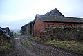
 Barn, Buckton Park Farm - geograph.org.uk - 2343844.jpg 640 × 430 ; 46 kio
-
 Barn, Upper Buckton - geograph.org.uk - 2346519.jpg 640 × 430 ; 55 kio
-
 Barn, Upper Buckton - geograph.org.uk - 2346528.jpg 640 × 430 ; 52 kio
-
 Big old barn - geograph.org.uk - 5039949.jpg 640 × 480 ; 64 kio
-
 Buckton (1295085).jpg 1 000 × 711 ; 72 kio
-
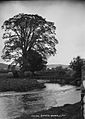
 Buckton bridge (1294738).jpg 1 000 × 712 ; 169 kio
-
 Buckton Park Farm - geograph.org.uk - 2343847.jpg 640 × 430 ; 64 kio
-
 Buckton Park Farm - geograph.org.uk - 2345103.jpg 640 × 430 ; 72 kio
-
 Byway off the Herefordshire Way - geograph.org.uk - 2345116.jpg 640 × 430 ; 43 kio
-

-
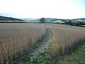 Corn field with footpath across it - geograph.org.uk - 3600098.jpg 640 × 480 ; 75 kio
-
 Countryside near Buckton Park - geograph.org.uk - 2343842.jpg 640 × 430 ; 44 kio
-
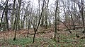
 Coxall Knoll Wood - geograph.org.uk - 2378068.jpg 640 × 430 ; 94 kio
-
 Coxall Knoll Wood - geograph.org.uk - 2378070.jpg 640 × 430 ; 95 kio
-
 Coxall Knoll Wood - geograph.org.uk - 2378073.jpg 640 × 430 ; 89 kio
-
 Coxall Knoll Woods - geograph.org.uk - 2351951.jpg 640 × 430 ; 48 kio
-
 Farmhouse, Buckton Park Farm - geograph.org.uk - 2343843.jpg 640 × 430 ; 37 kio
-
 Farmhouse, Upper Buckton - geograph.org.uk - 2346522.jpg 640 × 430 ; 82 kio
-
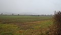
 Farmland and hedge - geograph.org.uk - 2345110.jpg 640 × 430 ; 52 kio
-
 Farmland near Buckton - geograph.org.uk - 2345109.jpg 640 × 376 ; 45 kio
-
 Farmland near Buckton - geograph.org.uk - 2345113.jpg 640 × 430 ; 51 kio
-
 Farmland, Buckton Park Farm - geograph.org.uk - 2345106.jpg 640 × 430 ; 53 kio
-
 Field by the lane to Buckton - geograph.org.uk - 2347537.jpg 640 × 430 ; 82 kio
-
 Field near the River Teme - geograph.org.uk - 2347540.jpg 640 × 430 ; 70 kio
-
 Footbridge over the stream at Adley Moor - geograph.org.uk - 5039877.jpg 640 × 480 ; 139 kio
-
 Footpath across the fields - geograph.org.uk - 5039917.jpg 640 × 480 ; 51 kio
-
 Footpath signpost, Herefordshire Way - geograph.org.uk - 2345114.jpg 640 × 430 ; 42 kio
-
 Hay Barn, Upper Buckton - geograph.org.uk - 2346520.jpg 640 × 430 ; 79 kio
-
 Herefordshire Way - geograph.org.uk - 2347555.jpg 640 × 430 ; 87 kio
-
 Herefordshire Way crosses Pember's Ditch - geograph.org.uk - 2343760.jpg 640 × 430 ; 107 kio
-
 Herefordshire way follows a shallow ditch - geograph.org.uk - 2343834.jpg 640 × 430 ; 53 kio
-
 Herefordshire Way leaves the road at Buckton - geograph.org.uk - 2345335.jpg 640 × 430 ; 74 kio
-
 Herefordshire Way to Buckton - geograph.org.uk - 2345111.jpg 640 × 430 ; 37 kio
-
 Herefordshire Way to Buckton Park - geograph.org.uk - 2345105.jpg 640 × 430 ; 56 kio
-
 House and Coxall Knoll Wood - geograph.org.uk - 2378081.jpg 640 × 430 ; 65 kio
-
 House at Adley Moor - geograph.org.uk - 5039848.jpg 640 × 480 ; 113 kio
-
 House at Buckton - geograph.org.uk - 2345337.jpg 640 × 430 ; 72 kio
-
 House by Coxall Knoll Wood - geograph.org.uk - 2378086.jpg 640 × 430 ; 68 kio
-
 House in Buckton - geograph.org.uk - 2345357.jpg 640 × 430 ; 61 kio
-
 House in Buckton - geograph.org.uk - 2345365.jpg 640 × 430 ; 45 kio
-
 House in Buckton - geograph.org.uk - 2346516.jpg 640 × 430 ; 78 kio
-
 House on the edge of Coxall Knoll Wood - geograph.org.uk - 2378079.jpg 640 × 430 ; 68 kio
-
 Houses, Buckton - geograph.org.uk - 2346525.jpg 640 × 430 ; 83 kio
-
 Lane from Coxall - geograph.org.uk - 2347553.jpg 640 × 430 ; 109 kio
-
 Lane heading west from Buckton - geograph.org.uk - 2346536.jpg 640 × 430 ; 71 kio
-
 Lane in the Teme valley west of Buckton - geograph.org.uk - 2346535.jpg 640 × 430 ; 59 kio
-
 Lane junction, Buckton - geograph.org.uk - 2345347.jpg 640 × 430 ; 71 kio
-
 Lane to Bucknell - geograph.org.uk - 2351929.jpg 640 × 430 ; 76 kio
-
 Lane to Buckton - geograph.org.uk - 2347542.jpg 640 × 430 ; 49 kio
-
 Lane to Coxall - geograph.org.uk - 2347550.jpg 640 × 430 ; 52 kio
-
 Lane west of Buckton - geograph.org.uk - 2346533.jpg 640 × 430 ; 59 kio
-
 Lane west of Buckton - geograph.org.uk - 2347529.jpg 640 × 430 ; 50 kio
-
 Large barn - geograph.org.uk - 5039957.jpg 640 × 480 ; 67 kio
-
 Lower Buckton - geograph.org.uk - 2345362.jpg 640 × 430 ; 84 kio
-
 Meadows near Leintwardine - geograph.org.uk - 3600029.jpg 640 × 480 ; 64 kio
-
 Old goods wagon at Adley Moor - geograph.org.uk - 5039861.jpg 640 × 480 ; 146 kio
-
 Old sunken way - geograph.org.uk - 5039939.jpg 640 × 480 ; 121 kio
-
 On Adleymoor Common - geograph.org.uk - 5038279.jpg 640 × 480 ; 73 kio
-

-
 Orchard near Buckton - geograph.org.uk - 3600061.jpg 640 × 480 ; 102 kio
-
 Part of Adley Moor in August - geograph.org.uk - 3600111.jpg 640 × 480 ; 76 kio
-
 Path through the corn - geograph.org.uk - 5039928.jpg 640 × 480 ; 86 kio
-
 Pember's Ditch - geograph.org.uk - 2343763.jpg 640 × 430 ; 124 kio
-
 Road sign south of Coxall - geograph.org.uk - 2347546.jpg 640 × 430 ; 63 kio
-

-
 Shallow ditch near Buckton Park - geograph.org.uk - 2343836.jpg 640 × 430 ; 55 kio
-
 Shallow water filled ditch - geograph.org.uk - 2343840.jpg 640 × 430 ; 84 kio
-
 Sheep by the Herefordshire Way - geograph.org.uk - 2343832.jpg 640 × 430 ; 54 kio
-
 Sheep feeders near Buckton - geograph.org.uk - 2347528.jpg 640 × 430 ; 68 kio
-
 Sheep near Buckton Park - geograph.org.uk - 2343839.jpg 640 × 430 ; 48 kio
-
 Stone Barn, Lower Buckton - geograph.org.uk - 2345367.jpg 640 × 430 ; 57 kio
-
 Teme Valley sunset - geograph.org.uk - 1808286.jpg 2 016 × 1 512 ; 774 kio
-
 The Herefordshire Way - geograph.org.uk - 2345107.jpg 640 × 430 ; 47 kio
-
 Top Meadow House, Buckton - geograph.org.uk - 2345341.jpg 640 × 430 ; 84 kio
-
 Track heading north from Buckton - geograph.org.uk - 2346531.jpg 640 × 430 ; 86 kio
-
 Track into Coxall Knoll Wood - geograph.org.uk - 2378063.jpg 640 × 430 ; 114 kio
-
 Tree in a field near Buckton - geograph.org.uk - 2347531.jpg 640 × 430 ; 44 kio
-
 Trees by the River Teme - geograph.org.uk - 2347525.jpg 640 × 430 ; 64 kio
-
 View from Buckton bridge (1294872).jpg 1 000 × 1 402 ; 217 kio
-
 View towards Coxall Knoll - geograph.org.uk - 2347533.jpg 640 × 430 ; 46 kio
-
 Walking to Adleymoor Common - geograph.org.uk - 5038271.jpg 640 × 480 ; 72 kio
-
 Waterlogged field - geograph.org.uk - 6417561.jpg 3 939 × 2 934 ; 1,08 Mio
-
 Weatherboarded Cottage, Buckton - geograph.org.uk - 2345352.jpg 640 × 430 ; 73 kio
-
 Weymore - geograph.org.uk - 3151309.jpg 640 × 360 ; 190 kio
-
 Windpump, Buckton - geograph.org.uk - 2345346.jpg 640 × 430 ; 100 kio
-
 Woodland, Coxall Knoll - geograph.org.uk - 3151314.jpg 640 × 360 ; 257 kio
-
 Woodland, Coxall Knoll - geograph.org.uk - 3151319.jpg 640 × 360 ; 290 kio
-
 Pheasant feeder, Buckton - geograph.org.uk - 639946.jpg 480 × 640 ; 123 kio


.jpg)
.jpg)


.jpg)


