Category:Herefordshire
Jump to navigation
Jump to search
Ceremonial counties of England: Bedfordshire · Berkshire · Buckinghamshire · Cambridgeshire · Cheshire · Cornwall · Cumbria · Derbyshire · Devon · Dorset · Durham · East Riding of Yorkshire · East Sussex · Essex · Gloucestershire · Greater London · Greater Manchester · Hampshire · Herefordshire · Hertfordshire · Isle of Wight · Kent · Lancashire · Leicestershire · Lincolnshire · Merseyside · Norfolk · North Yorkshire · Northamptonshire · Northumberland · Nottinghamshire · Oxfordshire · Rutland · Shropshire · Somerset · South Yorkshire · Staffordshire · Suffolk · Surrey · Tyne and Wear · Warwickshire · West Midlands · West Sussex · West Yorkshire · Wiltshire · Worcestershire
City-counties: Bristol · City of London
Former historic counties: Cumberland · Huntingdonshire · London · Middlesex · North Riding of Yorkshire · Sussex · West Riding of Yorkshire · Westmorland · Yorkshire
Other former counties: Avon · Cambridgeshire and Isle of Ely · Cleveland · East Suffolk · Hereford and Worcester · Hexhamshire · Humberside · Huntingdon and Peterborough · Isle of Ely · Parts of Holland · Parts of Kesteven · Parts of Lindsey · Soke of Peterborough · West Suffolk

Afrikaans: Herefordshire (uitgespreek /ˈhɛrɨfərdʃər/) is 'n graafskap in westelike Engeland, in die Verenigde Koninkryk. Die graafskap sluit in die stede en dorpe van Hereford, Leominster en Ledbury. Herefordshire het 'n bevolking van 183 600 in 2011 gehad, en dus is die 45ste grootste graafskap in die land. (→Herefordshire)
Ænglisc: Herefordscīr is Bryttisce scīr on Englum. Hēo is sēo āne Englisce scīr sēo ligþ eallenga bewestan Sæferne. (→Herefordscīr)
العربية: هيرفوردشير هي مقاطعة إنجليزية تاريخية تقع في منطقة غرب الوسط. لها حدود مع شروبشير في الشمال، وسترشير في الشرق، غلوسترشير في الجنوب الشرقي، ومقاطعات ويلز جوينت في الجنوب الغربي وبوويز في الغرب. مدينة هيريفورد بها كاتدرائية وهو عاصمة مقاطعة؛ التي يبلغ عدد سكانها حوالي 50،000 نسمة وهو أيضا أكبر مدنها. (→هيرفوردشير)
Беларуская: Херэфардшыр — унітарная адзінка і цырыманіяльнае графства на захадзе Англіі. (→Графства Херэфардшыр)
Български: Херефордшър е историческо, административно неметрополно и церемониално графство в регион Уест Мидландс, което е унитарна (самоуправляваща се) единица. Граничи с Шропшър, Устършър, Глостършър и Уелс. (→Херефордшър)
Brezhoneg: Ur gontelezh istorel hag un amaezerezh unvan eus Bro-Saoz eo Herefordshire (/ˈhɛrɨfərdʃər/; skivet Herefs. pe Hfds. alies), stok ouzh Kembre. Emañ e rannbarzh Kornôg Midlands. Hereford eo ar gêr vrasañ hag ar benngêr anezhi, hag ur 55,800 o chom enni. (→Herefordshire)
Català: Herefordshire és un comtat d' Anglaterra que limita amb els comtats de Shropshire al nord, Worcestershire a l'est, Gloucestershire al sud-est i els comtats gal·lesos de Gwent al sud-est i Powys a l'oest. (→Herefordshire)
Čeština: Herefordshire je ceremoniální a tradiční hrabství v Anglii. Administrativním centrem je město Hereford. (→Herefordshire)
Cymraeg: Sir yng ngorllewin canolbarth Lloegr, ar y ffin â Chymru, yw Swydd Henffordd (Saesneg: Herefordshire). Dinas Henffordd yw ei chanolfan ac mae'n ffinio gyda Sir Amwythig i'r gogledd, Gwent i'r de-orllewin a Phowys i'r gorllewin. Mae gan dinas Henffordd boblogaeth o oddeutu 55,800 ond mae'r sir ei hun yn denau iawn ei phoblogaeth gyda dwysedd poblogaeth o 82/km² (212/mi sg). Mae llawer o'r sir yn dir amaethyddol a cheir canran uchel yn dir tyfu ffrwythau (seidr a ballu) a gwartheg Henffordd. (→Swydd Henffordd)
Dansk: Herefordshire (officielt: County of Herefordshire) er et grevskab i England. Det ligger i regionen Vest-Midlands. Det grænser op mod Shropshire, Worcestershire og Gloucestershire samt op mod de walisiske grevskaber Gwent og Powys. (→Herefordshire)
Deutsch: Herefordshire ist eine Grafschaft in der Region West Midlands in England. Herefordshire grenzt an die Grafschaften Shropshire im Norden, Worcestershire im Osten, Gloucestershire im Südosten und an die walisischen Grafschaften Gwent im Südwesten und Powys im Westen. (→Herefordshire)
English: Herefordshire (; abbreviated Herefs. or Hfds.) is a historic English county in the West Midlands. It is a ceremonial county and a unitary non-metropolitan county and district, also named in legislation as the County of Herefordshire and governed by Herefordshire Council. It borders the English ceremonial counties of Shropshire to the north, Worcestershire to the east, Gloucestershire to the south-east, and the Welsh preserved counties of Gwent to the south-west and Powys to the west. The Welsh unitary county covering the part of Gwent next to Herefordshire is Monmouthshire. (→Herefordshire)
Esperanto: Herefordshire estas unuara instanco en la angla regiono West Midlands. Laŭ stato de la jaro 1997, en la teritorio vivis 166 000 loĝantoj. Ĝi kovras areon de 2 162 kvadrataj kilometroj. (→Herefordshire)
Español: Herefordshire es una autoridad unitaria localizada en la región de las West Midlands, en Inglaterra, Reino Unido. Limita al norte con el condado de Shropshire, al este con Worcestershire, al sudeste con el de Gloucestershire, al oeste con los condados galeses de Gwent y Powys. (→Herefordshire)
Eesti: Herefordshire ( kõmri keeles Swydd Henffordd) on ajalooline krahvkond ja tervikomavalitsus Inglismaal. Piirneb läänes Walesiga. (→Herefordshire)
Euskara: Herefordshire Ingalaterrako konderria da, Erresuma Batuan.Mendebaldeko Midlandsko eskualdean dago. Mugakide hauek ditu: iparraldean Shropshire, ekialdean Worcestershire, hego-ekialdean Gloucestershire, mendebaldean Galesko Gwent eta hego-mendebaldean Galesko Powys. (→Herefordshire)
فارسی: E06000019 (GSS) (→هرفوردشر)
Suomi: Herefordshire on vanha kreivikunta ja yhden tason hallintoyksikkö Englannissa West Midlandsin alueella lähellä Walesin rajaa. Se on maaseutua joka tunnetaan lähinnä siiderintuotannostaan. Sitä ei pidä sekoittaa Hertfordshiren kreivikuntaan lähellä Lontoota. Vuonna 2001 alueella eli 174 871 asukasta. (→Herefordshire)
Français : Le Herefordshire (prononcé /ˈhɛrɪfərdʃir/) est un ancien comté anglais devenu autorité unitaire depuis 1998. Le comté d'Herefordshire avait fusionné avec celui du Worcestershire pour former l'éphémère comté de Hereford and Worcester (1974-1998). (→Herefordshire)
Frysk: Herefordshire is in unitary authority yn de Ingelske regio West Midlands en telt 174.871 ynwenners. It oerflak berint 2179,7 km2. (→Herefordshire)
Gaeilge: Is contae i Sasana é Herefordshire atá suite in iarthar na tíre. Is é Hereford príomhbhaile an chontae. (→Herefordshire)
Gaelg: She coontae jesh-chliaghtagh as reiragh ayns Mean-çheerey Heear Hostyn eh Herefordshire. T'eh çhemmit liorish Shropshire da'n twoaie, Worcestershire da'n çhiar, Gloucestershire da'n çhiar yiass, Gwent da'n çheear yiass, as Powys da'n çheear. (→Herefordshire)
客家語/Hak-kâ-ngî:', Yîn-koet Sî Midlands Khî-vet ke khiùn. Cham-thi 2,180 phìn-fông kûng-lî, yû 183,600 ngìn-khiéu (2011-ngièn). (→Herefordshire)
עברית: הרפורדשייר (ב אנגלית: Herefordshire) הוא מחוז היסטורי הממוקם באזור מערב המידלנדס באנגליה. הוא גובל בשרופשייר מצפון, ווסטרשייר ממזרח, גלוסטרשייר מדרום-מזרח, ובויילס ממערב. בירת המחוז היא העיר הרפורד. (→הרפורדשייר)
Magyar: Herefordshire (kiejtése: /ˈhɛrɨfərdʃər/) Anglia egyik ceremoniális megyéje és egyben egységes hatósága (unitary authority) a West Midlands régióban. Északről Shropshire, keletről Worcestershire, délkeletről Gloucestershire, délnyugatról és nyugatról pedig Wales Monmouthshire és Powys elsődleges területével (principal area) határos. Közigazgatási székhelye Hereford. (→Herefordshire)
Bahasa Indonesia: Herefordshire merupakan sebuah county di Inggris yang memiliki luas wilayah 2.180 km² dan populasi 178.800 jiwa (2005). Ibu kotanya ialah Hereford. (→Herefordshire)
Íslenska: Herefordshire er sýsla á Vestur-Englandi á Bretlandi. Höfuðborg Herefordshire er Hereford. (→Herefordshire)
Italiano: L'Herefordshire (pronuncia )) è una contea dell' Inghilterra nella regione delle Midlands Occidentali. Dal 1974 al 1998 è stata unita alla contea di Worcestershire. (→Herefordshire)
日本語: ヘレフォードシャー (Herefordshire) は イングランド、ウェスト・ミッドランズの典礼カウンティで単一自治体 (Unitary Authority)。州庁所在地はヘレフォード。 (→ヘレフォードシャー)
Latina: Herefordiensis comitatus, vulgo Herefordshire, est comitatus Angliae, cuius caput est urbs Herefordia. (→Herefordiensis comitatus)
Lëtzebuergesch: Herefordshire (net ze verwiessele mat Hertfordshire) ass eng Grofschaft vun der Kategorie Unitary Authority am Weste vun England. (→Herefordshire)
Lietuvių: Herefordšyras – istorinė grafystė Vakarų Midlandso regione, Anglijoje. Šiaurėje ribojasi su Šropšyru, rytuose su Vusteršyru, pietryčiuose su Glosteršyru bei su Velsu vakaruose. Administracinis centras bei didžiausias grafystės miestas – Herefordas. Grafystė kaimiško tipo, rečiausiai apgyvendinta Anglijoje. Gyventojai užsiima žemės ūkiu. Auginami obuoliai ir kriaušės, iš kurių daromas sidras, veisiami herefordai. (→Herefordšyras)
Latviešu: Herefordšīra ir ceremoniālā grāfiste un vienotā pašvaldība Anglijas rietumos. Izveidota 1998. gada 1. aprīlī sadalot nemetropoles Herefordas un Vusteras grāfisti Hereforšīras un Vusteršīras grāfistēs. Grāfiste atrodas Rietummidlendas reģionā. Administratīvais centrs un lielākā pilsēta ir Hereforda. (→Herefordšīra)
Mirandés: Herefordshire ye un cundado de la zona oeste de Anglaterra. Ye ua outoridade unitaira, zeignada por Cundado de Herefordshire. (→Herefordshire)
Nederlands: Herefordshire is een unitary authority in de Engelse regio West Midlands en telt 174.871 inwoners. De oppervlakte bedraagt 2179,7 km2. (→Herefordshire)
Norsk nynorsk: Herefordshire er eit historisk og seremonielt grevskap i Vest-Midlands i England. Han er òg ei sameint styresmakt kalla County of Herefordshire. Det grensar til dei engelske seremonielle grevskapa Shropshire i nord, Worcestershire i aust, Gloucestershire i søraust og i Wales til dei bevarte grevskapa Gwent i sørvest og Powys i vest. Administrasjonsbyen er Hereford som med kring 50 000 innbyggjarar òg er den største byen i grevskapet. (→Herefordshire)
Norsk bokmål: Herefordshire er et grevskap i England. Det ligger i regionen Vest-Midlands, og grenser mot Shropshire, Worcestershire og Gloucestershire, samt de walisiske grevskapene Gwent og Powys. (→Herefordshire)
Polski: Herefordshire – hrabstwo ceremonialne i jednolita jednostka administracyjna (unitary authority) w zachodniej Anglii, w regionie West Midlands, położone przy granicy z Walią. Jest to jedno z hrabstw historycznych, a jego początki sięgają średniowiecza. W 1974 roku zostało połączone wraz z sąsiednim Worcestershire w hrabstwo Hereford and Worcester, które funkcjonowało do 1998 roku, gdy hrabstwa ponownie rozdzielono. (→Herefordshire)
Português: Herefordshire é um condado da zona oeste de Inglaterra. É uma autoridade unitária, designada por Condado de Herefordshire. (→Herefordshire)
Scots: Herefordshire is a historic an ceremonial county in the Wast Midlands region o Ingland. For Eurostat purposes it is a NUTS 3 region (code UKG11) an is ane o three coonties that comprise the "Herefordshire, Worcestershire an Gloucestershire" NUTS 2 region. It an aw forms a unitary destrict kent as the Coonty o Herefordshire. It borders the Inglis ceremonial coonties o Shropshire to the north, Worcestershire tae the east, Gloucestershire tae the sooth-east, an the Welsh preservit coonties o Gwent tae the sooth-wast an Powys tae the wast. Hereford is a cathedral ceety an is the coonty toun; wi a population o approximately 55,800 inhabitants it is an aw the lairgest settlement. (→Herefordshire)
Simple English: Herefordshire (known as County of Herefordshire) is a county in the West Midlands region of England. It borders the English counties of Shropshire to the north, Worcestershire to the east, Gloucestershire to the south east and the Welsh counties of Gwent to the south west and Powys to the west. It is not to be confused with Hertfordshire, a county north of London. (→Herefordshire)
Slovenčina: Herefordshire je jednostupňový celok (ako taký formálne aj gróftsvo), ceremoniálne grófstvo a tradičné grófstvo v Anglicku. (→Herefordshire)
Svenska: Herefordshire är ett grevskap och en enhetskommun (unitary authority) i regionen Västra Midlands i England. Huvudort är Hereford. Det gränsar till de engelska grevskapen Shropshire i norr, Worcestershire i öster och Gloucestershire i sydost, samt de walesiska grevskapen Monmouthshire och Powys i väster. (→Herefordshire)
ไทย: เฮริฟอร์ดเชอร์ หรือ เฮริฟอร์ดเชียร์ (, ฟังเสียง) เป็น มณฑลในอังกฤษในสหราชอาณาจักร ที่ตั้งอยู่ทางภาคมิดแลนด์สตะวันตกของอังกฤษโดยมีเฮริฟอร์ดซึ่งเป็นเมืองมหาวิหารเป็นเมืองหลวง (→เฮริฟอร์ดเชอร์)
Türkçe: Herefordshire, Birleşik Krallık İngiltere ülkesinin Batı Midlands bölgesinde tarihsel bir kontluk, bir törensel kontluk ve 1996da çıkarılan bir kanunsal kararname ile 1998'den itibaren bir tek-seviyeli metropoliten olmayan yerel idare bölgesidir. Merkezi kontlukta en büyük nüfuslu yerleşke (2001'de tahmini ile 55.700 kişi) ve bir katedral şehri olan "Hereford" şehrindedir. Hereford Kontluğunun toplam yüzölçümü 2.180 km² dir. (→Herefordshire)
اردو: ہیرفورڈشائر ( لاطینی: Herefordshire) English کا ایک رہائشی علاقہ جو مغربی مڈلینڈز میں واقع ہے۔ (→ہیرفورڈشائر)
Tiếng Việt: Herefordshire Herefordshire là một hạt lễ nghi trong khu vực West Midlands của Anh. Hạt có diện tích km², dân số người. Thủ phủ hạt đóng ở. Đối với mục đích của Eurostat nó là một vùng NUTs 3 quả hạch (mã UKG11) và là một trong ba hạt bao gồm vùng NUTS1 "Herefordshire, Worcestershire và Gloucestershire". Nó cũng hình thành một khu vực đơn nhất được gọi là quận Herefordshire. Giáp các quận nghi lễ Anh Shropshire phía bắc, Worcestershire về phía đông, Gloucestershire phía đông nam, và các hạt của Wales Gwent phía tây nam và Powys về phía tây. Hereford là một thành phố nhà thờ chính tòa của hạt, với dân số khoảng 55.800 người, nó cũng là khu định cư lớn nhất. (→Herefordshire)
ייִדיש: הערעפֿארדשיר איז א גראפנשאפט אין דעם מערב מידלאנדס ראיאן פון ענגלאנד. הערעפֿארדשיר גרענעצט די ענגלישע גראפנשאפטן שראפשיר צו צפון, וואוסטערשיר צו מזרח און גלאסטערשיר צו דרום־מזרח, און די וועלשישע גראפנשאפטן גווענט צו דרום־מערב און פאוויס צו מערב. הערעפֿארדשיר באדעקט א שטח פון 2,180 קוואדראט ק"מ. (→הערעפארדשיר)
閩南語 / Bân-lâm-gú:Herefordshire sī Eng-lân se-pō͘ ê chi̍t-ê kūn, kap Wales sio-oá, kūn-tī sī Hereford. (→Herefordshire)
ceremonial county, and unitary non-metropolitan county and district, in England     | |||||
| Upload media | |||||
| Instance of |
| ||||
|---|---|---|---|---|---|
| Location | West Midlands, England | ||||
| Capital | |||||
| Legislative body |
| ||||
| Population |
| ||||
| Area |
| ||||
| Replaces | |||||
| Different from | |||||
| Said to be the same as | Herefordshire (historic county of England, ceremonial county of England, 1844) | ||||
| official website | |||||
 | |||||
Subcategories
This category has the following 41 subcategories, out of 41 total.
*
A
B
- Boundary stones in Herefordshire (11 F)
C
F
G
H
- Earthworks in Herefordshire (6 F)
I
M
N
- Night in Herefordshire (2 F)
P
- Piers in Herefordshire (2 F)
S
T
V
W
- Water wells in Herefordshire (3 F)
Media in category "Herefordshire"
The following 45 files are in this category, out of 45 total.
-
 Brockhampton Church, Herefordshire.jpg 1,742 × 2,065; 1.28 MB
-
-
 Cross in shady woodland - geograph.org.uk - 955338.jpg 480 × 640; 194 KB
-
 Frozen puddle - geograph.org.uk - 1152251.jpg 640 × 480; 157 KB
-
 Herefordshire - Cottage on Bringsty Common (50898077913).jpg 3,741 × 2,491; 12.76 MB
-
 Herefordshire Flag.jpg 1,161 × 735; 404 KB
-
 Herefordshire Map.png 4,967 × 4,967; 4.27 MB
-
 Herefordshire UK ward map 2023.svg 627 × 796; 1.07 MB
-
 Hom House, Hom Green - geograph.org.uk - 955357.jpg 640 × 480; 184 KB
-
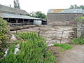
 Hope End Farm - the lower yard - geograph.org.uk - 830818.jpg 640 × 480; 114 KB
-
 Information board - geograph.org.uk - 1117546.jpg 640 × 480; 220 KB
-
 N122 w1150 — Herefordshire Pomona, vol. 2, plate XLV.jpg 769 × 1,024; 208 KB
-
 Noble Chafer Frass (46627114695).jpg 3,334 × 2,209; 6.83 MB
-

-
 October bloom at Inglestone^ - geograph.org.uk - 1004475.jpg 640 × 426; 68 KB
-
 Orchard nr Church House Farm - geograph.org.uk - 818892.jpg 640 × 424; 98 KB
-
 Plaque in Welsh '‘Karka Dy ddiwedd’, trans. 'Be mindful of your end', and dated 1754.jpg 4,032 × 3,024; 1.96 MB
-
 Radway Bridge Garden Centre - geograph.org.uk - 968399.jpg 640 × 371; 62 KB
-
 River Arrow Tributary Bridge So 4754 5734.jpg 4,608 × 3,456; 2.67 MB
-
 River Wye at Breinton.jpg 4,896 × 3,672; 5.96 MB
-
 Roadside sign - geograph.org.uk - 1059084.jpg 640 × 480; 129 KB
-
 Sails removed - geograph.org.uk - 1619831.jpg 640 × 430; 107 KB
-
 Semi-frozen pond, Frogmore - geograph.org.uk - 1116398.jpg 640 × 480; 154 KB
-
 Shock Supply Company Limited.jpg 4,093 × 3,444; 1.66 MB
-
 Snowdrops in the snow - geograph.org.uk - 1156406.jpg 640 × 395; 146 KB
-
 Statue of Lance Corporal Alan Leonard Lewis VC 01.jpg 2,448 × 3,264; 1.35 MB
-
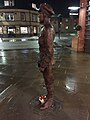 Statue of Lance Corporal Alan Leonard Lewis VC 02.jpg 2,448 × 3,264; 1.56 MB
-
 Statue of Lance Corporal Alan Leonard Lewis VC 04.jpg 2,448 × 3,264; 1.34 MB
-
 Stepping on egg shells - geograph.org.uk - 1460403.jpg 460 × 640; 157 KB
-
 Suspension bridge over the River Wye (16678846983).jpg 3,696 × 2,448; 2.34 MB
-
 Symonds Yat view point Cafe - geograph.org.uk - 1319412.jpg 640 × 428; 107 KB
-
 The Car Centre, Whitestone - geograph.org.uk - 968370.jpg 640 × 480; 82 KB
-
 The Cottage, Newtown.jpg 4,608 × 3,456; 2.81 MB
-
 Tree planting, Brockhampton - geograph.org.uk - 1187524.jpg 480 × 640; 165 KB
-
 Unharvested wheat crop - geograph.org.uk - 974396.jpg 640 × 480; 209 KB
-

-
 Upper Trewen - geograph.org.uk - 1397822.jpg 640 × 480; 240 KB
-
 Victorian Postbox, Ham Green - geograph.org.uk - 869850.jpg 427 × 640; 307 KB
-
 View across a tranquil Wye - geograph.org.uk - 980310.jpg 640 × 480; 198 KB
-
 View to Huntsham Hill - geograph.org.uk - 980342.jpg 640 × 480; 227 KB
-
 View to Lyndor Cottages - geograph.org.uk - 1274777.jpg 640 × 480; 218 KB
-
 Walkers on Little Mountain - geograph.org.uk - 1657094.jpg 640 × 480; 232 KB
-
 Winter walkers 1 - geograph.org.uk - 1657045.jpg 640 × 480; 206 KB
-
 Wooded hills of the Brockhampton estate - geograph.org.uk - 1019146.jpg 640 × 480; 110 KB
-
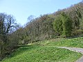 Wooded side of Dinmore Hill - geograph.org.uk - 1248385.jpg 640 × 480; 129 KB


.jpg)


.jpg)


.jpg)


