Category:Bunclody
Перейти к навигации
Перейти к поиску
Deutsch: Bunclody ( irisch: Bun Clóidí; dt.: „Tal(sohle), Ende des Clody“) ist eine Stadt auf der Grenze der Countys Carlow und Wexford im Südosten der Republik Irland.
English: Bunclody is a small town located on the River Slaney, on the border between counties Wexford and Carlow, Ireland. The R746 regional road intersects the N80 in the centre of the town. It is a picturesque town near the foot of Mount Leinster. Most of the town is situated in County Wexford. A small area at the north end of town is located in County Carlow.
Esperanto: Bunclody ( irlanda Bun Clóidí) estas urbeto ĉe la limo de la graflandoj Wexford kaj Carlow, en la provinco de Leinster, Irlando. Laŭ la censo de 2006, la loĝantaro estas 1,863. Ĝia plej granda parto situas en graflando Wexford.
Français : Bunclody-Carrickduff (Bun Clóidí / Carraig Dubh en irlandais) est une ville du comté de Carlow et de Wexford en République d'Irlande.
Nederlands: Bunclody is een plaats in het Ierse graafschap Wexford. De plaats telt ca. 2300 inwoners en ligt aan de Slaney.
посёлок в Ирландии  | |||||
| Медиафайл | |||||
| Это частный случай понятия | |||||
|---|---|---|---|---|---|
| Местонахождение | Уэксфорд, Ленстер, Ирландия | ||||
| Численность населения |
| ||||
| Высота над уровнем моря |
| ||||
 | |||||
Файлы в категории «Bunclody»
Показано 34 файла из 34, находящихся в данной категории.
-
 Barker's Rd - geograph.org.uk - 6054503.jpg 1024 × 681; 170 КБ
-
 Bunclody 1798 memorial.jpg 4320 × 3240; 5,54 МБ
-
 Bunclody Memorial - geograph.org.uk - 6054473.jpg 1024 × 681; 231 КБ
-
 Bunclody, County Wexford, Ireland.jpg 2407 × 3317; 6,21 МБ
-
 Classroom at St. Mary's Convent, Newtownbarry, Co. Wexford (1897).jpg 827 × 641; 230 КБ
-
 Deerpark New, Co. Carlow, Ireland - panoramio.jpg 2816 × 2112; 1,35 МБ
-
 Eurospar and Bunclody Post Office - geograph.org.uk - 6054380.jpg 1024 × 681; 169 КБ
-
 Floodplain of River Slaney - geograph.org.uk - 6054482.jpg 1024 × 681; 131 КБ
-
 Holy Trinity Church - geograph.org.uk - 6054398.jpg 1024 × 681; 197 КБ
-
 IMG Bunclody0289w.jpg 2592 × 1944; 1,46 МБ
-
 Main Street, Bunclody - geograph.org.uk - 3516607.jpg 640 × 427; 278 КБ
-
 Main Street, Bunclody - geograph.org.uk - 5250130.jpg 2240 × 1488; 1,51 МБ
-
 Mall Bar - geograph.org.uk - 6054465.jpg 1024 × 681; 161 КБ
-
 O'Leary's - geograph.org.uk - 6054438.jpg 1024 × 680; 160 КБ
-
 Pharmacy, Main St - geograph.org.uk - 6054458.jpg 1024 × 681; 196 КБ
-
 R746 - geograph.org.uk - 6054490.jpg 1024 × 681; 197 КБ
-
 R746, Bunclody - geograph.org.uk - 6054366.jpg 1024 × 995; 220 КБ
-
 R746, Bunclody - geograph.org.uk - 6054371.jpg 1024 × 736; 208 КБ
-
 R746, N80 junction - geograph.org.uk - 6054464.jpg 1024 × 681; 135 КБ
-
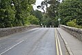 R746, Slaney Bridge - geograph.org.uk - 6054468.jpg 1024 × 681; 220 КБ
-
 Redmond Bar - geograph.org.uk - 6054403.jpg 1024 × 681; 181 КБ
-
 River Nore - panoramio.jpg 2816 × 2112; 1,01 МБ
-
 River Slaney - geograph.org.uk - 6054476.jpg 1024 × 681; 197 КБ
-
 River Slaney - geograph.org.uk - 6054486.jpg 1024 × 681; 199 КБ
-
 Row of shops - geograph.org.uk - 6054386.jpg 1024 × 681; 178 КБ
-
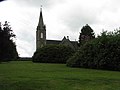 Saint Marys, Bunclody - geograph.org.uk - 469512.jpg 640 × 480; 42 КБ
-
 St. Marys Convent, Newtownbarry, Co. Wexford (5925681926).jpg 827 × 628; 250 КБ
-
 Stream in Bunclody - geograph.org.uk - 6054395.jpg 1024 × 681; 201 КБ
-
 Stream, Main St - geograph.org.uk - 6054405.jpg 1024 × 681; 199 КБ
-
 Sugar ^ Spice - geograph.org.uk - 6054402.jpg 1024 × 681; 189 КБ
-
 The Irish proclaimation - geograph.org.uk - 6054460.jpg 681 × 1024; 241 КБ
-
 The main crossroads in Bunclody - geograph.org.uk - 3516602.jpg 640 × 640; 380 КБ
-
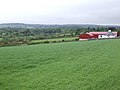 Red barns - geograph.org.uk - 444925.jpg 640 × 480; 77 КБ
-
 Rural view south of Bunclody - geograph.org.uk - 444932.jpg 640 × 480; 101 КБ


.jpg)


.jpg)


