Category:Burg Kropfenstein
Vai alla navigazione
Vai alla ricerca
| Posizione del soggetto | | Mappa di tutte le coordinate: OpenStreetMap |
|---|
| Carica un file multimediale | |||||
| Istanza di | |||||
|---|---|---|---|---|---|
| Luogo | |||||
| Designazione del patrimonio | |||||
| Data di fondazione o creazione |
| ||||
 | |||||
|
Questa è una categoria riguardante un bene culturale d'importanza nazionale in Svizzera con numero PBC 3419
|
Note that the image indicated as the "Kropfenstein Wappen" is the coat of arms of the family Mötteli von Rappenstein, which owned/married into families that owned nearby castles, Neuenberg and Rappenstein near Landquart in the Canton of Graubunden, Switzerland. This family also owned/married into families owning Schloss Arbon, Sulzberg (Möttelischloss), Altstetten (Prestegg), Güttingen (Moosberg), Hüttingen, Pfyn, Alt-Regensburg, Memmingen, Wellenberg, Weinfelden, Roggwil, and Bürglen, as well as castles in Germany, Italy, in Spain and France, from about 1320 to about 1600.
File nella categoria "Burg Kropfenstein"
Questa categoria contiene 57 file, indicati di seguito, su un totale di 57.
-
GB19BurgKropfenstein01.jpg 3 000 × 4 000; 4,34 MB
-
GB19BurgKropfenstein02.jpg 3 000 × 4 000; 3,83 MB
-
GB19BurgKropfenstein03.jpg 3 000 × 4 000; 3,94 MB
-
GB19BurgKropfenstein04.jpg 3 000 × 4 000; 3,57 MB
-
GB19BurgKropfenstein05.jpg 3 000 × 4 000; 3,86 MB
-
GB19BurgKropfenstein06.jpg 3 000 × 4 000; 4,9 MB
-
GB19BurgKropfenstein07.jpg 3 000 × 4 000; 4,98 MB
-
GB19BurgKropfenstein08.jpg 3 000 × 4 000; 4,18 MB
-
Kropfenstein Balkenrest.jpg 2 592 × 1 944; 1,4 MB
-
Kropfenstein DJIa.JPG 5 472 × 3 078; 6,86 MB
-
Kropfenstein DJIb.JPG 5 472 × 3 078; 6,82 MB
-
Kropfenstein DJIc.JPG 5 472 × 3 078; 6,79 MB
-
Kropfenstein DJId.JPG 5 472 × 3 078; 6,85 MB
-
Kropfenstein Eingang.jpg 1 200 × 1 600; 846 KB
-
Kropfenstein innen.jpg 1 600 × 1 200; 749 KB
-
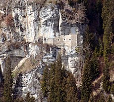
Kropfenstein Lage.jpg 1 272 × 1 144; 285 KB
-
Kropfenstein Ost.jpg 916 × 1 222; 228 KB
-
Kropfenstein Plan.jpg 893 × 336; 47 KB
-
Kropfenstein Wappen.jpg 406 × 389; 50 KB
-
Kropfenstein Zeichnung.jpg 341 × 500; 67 KB
-
Kropfenstein Zugang.jpg 916 × 1 222; 265 KB
-
Ruïne Burg Kropfenstein (Casti Grotta) 23-09-2022. (actm.) 01.jpg 3 456 × 5 184; 11,61 MB
-
Ruïne Burg Kropfenstein (Casti Grotta) 23-09-2022. (actm.) 02.jpg 4 607 × 3 028; 15,64 MB
-
Ruïne Burg Kropfenstein (Casti Grotta) 23-09-2022. (actm.) 03.jpg 4 257 × 3 304; 15,56 MB
-
Ruïne Burg Kropfenstein (Casti Grotta) 23-09-2022. (actm.) 04.jpg 4 216 × 3 162; 13,86 MB
-
Ruïne Burg Kropfenstein (Casti Grotta) 23-09-2022. (actm.) 05.jpg 4 837 × 3 225; 15,05 MB
-
Ruïne Burg Kropfenstein (Casti Grotta) 23-09-2022. (actm.) 06.jpg 3 163 × 4 744; 16,24 MB
-
Ruïne Burg Kropfenstein (Casti Grotta) 23-09-2022. (actm.) 07.jpg 3 456 × 5 184; 17,41 MB
-
Ruïne Burg Kropfenstein (Casti Grotta) 23-09-2022. (actm.) 08.jpg 3 456 × 5 184; 19,49 MB
-
Ruïne Burg Kropfenstein (Casti Grotta) 23-09-2022. (actm.) 09.jpg 3 456 × 3 456; 13,67 MB
-
Ruïne Burg Kropfenstein (Casti Grotta) 23-09-2022. (actm.) 10.jpg 3 309 × 4 964; 11,21 MB
-
Ruïne Burg Kropfenstein (Casti Grotta) 23-09-2022. (actm.) 11.jpg 3 373 × 4 497; 19,26 MB
-
Ruïne Burg Kropfenstein (Casti Grotta) 23-09-2022. (actm.) 12.jpg 3 180 × 4 240; 15,91 MB
-
Ruïne Burg Kropfenstein (Casti Grotta) 23-09-2022. (actm.) 13.jpg 4 598 × 2 583; 15,07 MB
-
Ruïne Burg Kropfenstein (Casti Grotta) 23-09-2022. (actm.) 14.jpg 4 255 × 3 349; 17,35 MB
-
Ruïne Burg Kropfenstein (Casti Grotta) 23-09-2022. (actm.) 15.jpg 3 828 × 3 429; 14,7 MB
-
Ruïne Burg Kropfenstein (Casti Grotta) 23-09-2022. (actm.) 16.jpg 4 608 × 3 456; 17,59 MB
-
Ruïne Burg Kropfenstein (Casti Grotta) 23-09-2022. (d.j.b). 01.jpg 4 001 × 3 201; 12,48 MB
-
Ruïne Burg Kropfenstein (Casti Grotta) 23-09-2022. (d.j.b). 02.jpg 5 184 × 3 456; 18,1 MB
-
Ruïne Burg Kropfenstein (Casti Grotta) 23-09-2022. (d.j.b). 03.jpg 3 456 × 5 184; 16,08 MB
-
Ruïne Burg Kropfenstein (Casti Grotta) 23-09-2022. (d.j.b). 04.jpg 3 456 × 5 184; 15,59 MB
-
Ruïne Burg Kropfenstein (Casti Grotta) 23-09-2022. (d.j.b). 05.jpg 3 456 × 5 184; 16,14 MB
-
Ruïne Burg Kropfenstein (Casti Grotta)-.jpg 3 456 × 5 184; 22,36 MB
-
Waltensburg-Vuorz railway station. 22-09-2022. (actm.) 01.jpg 2 132 × 1 706; 4,52 MB
-
Waltensburg-Vuorz railway station. 22-09-2022. (actm.) 02.jpg 5 184 × 2 524; 14,62 MB
-
Waltensburg-Vuorz. Ruïne Burg Kropfenstein (Casti Grotta) (actm) 01.jpg 4 889 × 2 929; 12,98 MB
-
Waltensburg-Vuorz. Ruïne Burg Kropfenstein (Casti Grotta) (actm) 02.jpg 3 456 × 4 854; 13,99 MB
-
Waltensburg-Vuorz. Ruïne Burg Kropfenstein (Casti Grotta) (actm) 03.jpg 3 200 × 5 024; 12,42 MB
-
Waltensburg-Vuorz. Ruïne Burg Kropfenstein (Casti Grotta) (actm) 04.jpg 3 141 × 5 062; 15,89 MB
-
Waltensburg-Vuorz. Ruïne Burg Kropfenstein (Casti Grotta) (actm) 05.jpg 3 341 × 5 118; 14,68 MB
-
Waltensburg-Vuorz. Ruïne Burg Kropfenstein (Casti Grotta) (actm) 06.jpg 4 829 × 3 271; 14,82 MB
-
Waltensburg-Vuorz. Ruïne Burg Kropfenstein (Casti Grotta) (actm) 07.jpg 3 269 × 4 903; 13,33 MB
-
Waltensburg-Vuorz. Ruïne Burg Kropfenstein (Casti Grotta) (d.j.b.) 01.jpg 4 798 × 3 323; 12,48 MB
-
Waltensburg-Vuorz. Ruïne Burg Kropfenstein (Casti Grotta) (d.j.b.) 02.jpg 4 933 × 3 036; 8,62 MB
-
Waltensburg-Vuorz. Ruïne Burg Kropfenstein (Casti Grotta) (d.j.b.) 03.jpg 4 633 × 3 283; 13,41 MB
-
Waltensburg-Vuorz. Ruïne Burg Kropfenstein (Casti Grotta) (d.j.b.) 04.jpg 3 456 × 5 184; 16,06 MB
-
Waltensburg-Vuorz. Ruïne Burg Kropfenstein (Casti Grotta) (d.j.b.) 05.jpg 3 395 × 5 093; 9,65 MB


