Category:Burgplatz (Luxembourg)
Jump to navigation
Jump to search
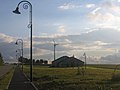
English: The Burgplatz is the second highest point in Luxembourg (559 m altitude).
| Object location | | View all coordinates using: OpenStreetMap |
|---|
Hill in the commune of Troisvierges, Luxembourg  | |||||
| Upload media | |||||
| Instance of | |||||
|---|---|---|---|---|---|
| Location | Troisvierges, Canton of Clervaux, Luxembourg | ||||
| Mountain range |
| ||||
| Elevation above sea level |
| ||||
 | |||||
Subcategories
This category has the following 3 subcategories, out of 3 total.
B
C
- Château d'eau Huldange (5 F)
Media in category "Burgplatz (Luxembourg)"
The following 18 files are in this category, out of 18 total.
-
 Buergplaz Huldang.jpg 1,957 × 1,203; 349 KB
-
 Buurgplaatz.jpg 2,592 × 1,944; 848 KB
-
 BuurgplatzSignBoard.jpg 800 × 600; 116 KB
-
 BuurgplatzStoneAndTower.jpg 1,200 × 900; 370 KB
-
 Huldange, Buergplaz (100).jpg 4,926 × 3,284; 2.39 MB
-
 Huldange, Buergplaz (101).jpg 3,391 × 2,543; 1.64 MB
-
 Huldange, Buergplaz (102).jpg 3,210 × 2,407; 1.49 MB
-
 Huldange, Buergplaz (103).jpg 3,648 × 2,736; 3.05 MB
-
 Huldange, Buergplaz (104).jpg 3,529 × 2,647; 3.55 MB
-
 Huldange, Buergplaz (105).jpg 3,527 × 2,645; 1.92 MB
-
 Huldange, Buergplaz (106).jpg 3,565 × 2,675; 2.22 MB
-
 Huldange, Buergplaz (110).jpg 3,555 × 2,667; 2.33 MB
-
 Huldange, Buergplaz (111).jpg 3,565 × 2,675; 2.75 MB
-
 Huldange, Buergplaz (112).jpg 3,763 × 2,117; 4.18 MB
-
 Huldange, Buergplaz (113).jpg 3,849 × 2,165; 3.86 MB
-
 Wasserturm Huldange 01.jpg 1,760 × 2,672; 4.91 MB
-
 Water tower Buergplaz Huldange Luxembourg.jpg 2,336 × 3,504; 1.06 MB
-
 Water tower Buergplaz Panneau Huldange Luxembourg.jpg 3,504 × 2,336; 1.04 MB


.jpg)
.jpg)
.jpg)
.jpg)
.jpg)
.jpg)
.jpg)
.jpg)
.jpg)
.jpg)
.jpg)


