Category:Burley Gate
Jump to navigation
Jump to search
hamlet in Herefordshire, England, UK | |||||
| Upload media | |||||
| Instance of | |||||
|---|---|---|---|---|---|
| Location |
| ||||
 | |||||
English: Burley Gate is a hamlet in Herefordshire, England. It is located just northeast of the junction between the A465 road and the A417 road. A Tudor cottage is located in the centre of the hamlet and a primary school in the western part. Ullingswick and Moreton Jeffries lies to the north and northeast respectively, Hill Hampton to the west, Ocle Pychard to the southwest and Much Cowarne to the southeast.

Media in category "Burley Gate"
The following 15 files are in this category, out of 15 total.
-
 A465 'S'-Bend, Burley Gate - geograph.org.uk - 1356014.jpg 640 × 480; 171 KB
-
 Approaching Burley Gate - geograph.org.uk - 1356024.jpg 640 × 480; 237 KB
-
 Black-and-white at Burley Gate - geograph.org.uk - 1356033.jpg 640 × 481; 239 KB
-
 Burley Gate - geograph.org.uk - 147345.jpg 640 × 479; 69 KB
-
 Burley Gate - Lane To Much Cowarne - geograph.org.uk - 1356018.jpg 640 × 480; 202 KB
-
 Burley Gate and the road to Much Cowarne - geograph.org.uk - 3103357.jpg 4,000 × 3,000; 3.8 MB
-
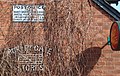 Burley Gate P.O. (3375732327).jpg 2,830 × 1,782; 4.36 MB
-
 Burley Gate Post Office - geograph.org.uk - 1356012.jpg 640 × 480; 190 KB
-
 Burley Gate post office - geograph.org.uk - 1356035.jpg 640 × 480; 279 KB
-
 Edge of Cowarne Wood - geograph.org.uk - 4279057.jpg 800 × 451; 194 KB
-
 Edge of Cowarne Wood - geograph.org.uk - 4279061.jpg 800 × 451; 192 KB
-
 Lane into Burley Gate - geograph.org.uk - 4637047.jpg 1,200 × 800; 522 KB
-
 Old finger-post sign - geograph.org.uk - 1356028.jpg 480 × 640; 268 KB
-
 Pasture land south of Burley Gate - geograph.org.uk - 1356017.jpg 640 × 480; 244 KB
-
 Road Junction, Burley Gate - geograph.org.uk - 1355995.jpg 640 × 480; 135 KB


.jpg)


