Category:Burmarsh, Kent
Vai alla navigazione
Vai alla ricerca
English: Burmarsh is a village and civil parish in the Folkestone and Hythe District of Kent, England. The village is located three miles (4.8 km) west of Hythe on the Romney Marsh. (→Burmarsh)
Español: Burmarsh es una parroquia civil y un pueblo del distrito de Folkestone and Hythe, en el condado de Kent (Inglaterra). (→Burmarsh)
Nederlands: Burmarsh is een plaats en civil parish in het bestuurlijke gebied Folkestone and Hythe, in het Engelse graafschap Kent. (→Burmarsh)
Polski: Burmarsh – wieś i civil parish w Anglii, w Kent, w dystrykcie Folkestone and Hythe. W 2011 civil parish liczyła 330 mieszkańców. Burmarsh jest wspomniana w Domesday Book (1086) jako Borchemeres/Burwarmaresc. (→Burmarsh)

village and civil parish in Kent, United Kingdom  | |||||
| Carica un file multimediale | |||||
| Istanza di | |||||
|---|---|---|---|---|---|
| Luogo | Folkestone and Hythe, Kent, Sud Est dell'Inghilterra, Inghilterra | ||||
| Considerato essere uguale a | Burmarsh (pagina Wikimedia duplicata, parrocchia civile dell'Inghilterra) | ||||
 | |||||
Sottocategorie
Questa categoria contiene le 3 sottocategorie indicate di seguito, su un totale di 3.
File nella categoria "Burmarsh, Kent"
Questa categoria contiene 200 file, indicati di seguito, su un totale di 454.
(pagina precedente) (pagina successiva)-
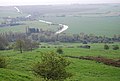
 A distant view of Burmarsh - geograph.org.uk - 1815401.jpg 816 × 612; 100 KB
-
 A drain by Donkey Street - geograph.org.uk - 4767330.jpg 640 × 426; 52 KB
-
 A lonesome sheep - geograph.org.uk - 4767327.jpg 640 × 426; 41 KB
-
 A lot of stubble - geograph.org.uk - 4792410.jpg 640 × 426; 46 KB
-
 A sea of wheat - geograph.org.uk - 4767311.jpg 640 × 426; 53 KB
-
 A sea of wheat - geograph.org.uk - 4767313.jpg 640 × 426; 51 KB
-
 A sea of wheat - geograph.org.uk - 4783900.jpg 640 × 426; 67 KB
-
 A sea of wheat - geograph.org.uk - 4783970.jpg 640 × 426; 54 KB
-
 A sea of wheat - geograph.org.uk - 4783995.jpg 640 × 426; 67 KB
-
 A young arable crop - geograph.org.uk - 4789445.jpg 640 × 419; 56 KB
-
 Aldergate Bridge - geograph.org.uk - 2118904.jpg 3 072 × 2 304; 2,84 MB
-
 Aldergate Lane - geograph.org.uk - 3554156.jpg 1 024 × 768; 249 KB
-
 Aldergate Lane - geograph.org.uk - 3554160.jpg 1 024 × 768; 323 KB
-
 Aldergate Lane - geograph.org.uk - 4993533.jpg 4 608 × 3 456; 3,34 MB
-
 Aldergate Lane off Lower Wall Road - geograph.org.uk - 2610072.jpg 640 × 480; 144 KB
-
 Aldergate Road - geograph.org.uk - 2118947.jpg 3 072 × 2 304; 2,96 MB
-
 Alongside Burmarsh Road - geograph.org.uk - 2674846.jpg 4 000 × 3 000; 4,06 MB
-

-
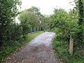
 Approaching Burmarsh along Church Road - geograph.org.uk - 1816821.jpg 816 × 612; 144 KB
-
 Approaching Willop Bridge on the RHDR - geograph.org.uk - 5779055.jpg 4 385 × 3 288; 4,01 MB
-
 Arable by Donkey Street - geograph.org.uk - 4774184.jpg 640 × 426; 43 KB
-
 Arable field, Romney Marsh - geograph.org.uk - 4223916.jpg 640 × 480; 160 KB
-
 Arable fields, Romney Marsh - geograph.org.uk - 4223892.jpg 640 × 480; 164 KB
-
 Arable land - geograph.org.uk - 4774199.jpg 640 × 426; 44 KB
-
 Arable land - geograph.org.uk - 4774247.jpg 640 × 426; 48 KB
-
 Barns by Tame Lane - geograph.org.uk - 4223900.jpg 640 × 480; 112 KB
-
 Bend in Chapel Lane - geograph.org.uk - 3197259.jpg 2 256 × 1 496; 893 KB
-
 Bend, Donkey Street - geograph.org.uk - 4767333.jpg 640 × 426; 59 KB
-
 Bend, Donkey Street - geograph.org.uk - 4767337.jpg 640 × 426; 72 KB
-
 Bend, Donkey Street - geograph.org.uk - 4767344.jpg 640 × 426; 57 KB
-
 Bend, Eastbridge Rd - geograph.org.uk - 4789470.jpg 640 × 426; 75 KB
-
 Bend, field drain - geograph.org.uk - 4792364.jpg 640 × 426; 68 KB
-
 Black Cat, Burmarsh, Kent (15891210380).jpg 7 360 × 4 912; 10,31 MB
-
 Botolph's Bridge - geograph.org.uk - 4928428.jpg 4 000 × 3 000; 2,84 MB
-
 Botolph's Bridge Road bridge over Canal Cutting - geograph.org.uk - 2122284.jpg 3 072 × 2 304; 1,55 MB
-
 Bridge Cottage - geograph.org.uk - 2127343.jpg 3 072 × 2 304; 2,16 MB
-
 Bridge Cottage - geograph.org.uk - 4774262.jpg 640 × 363; 44 KB
-
 Bridge over Hurst Sewer - geograph.org.uk - 5327950.jpg 640 × 480; 156 KB
-
 Bridge to Chapel Cottage Farm - geograph.org.uk - 2171879.jpg 3 072 × 2 304; 1,58 MB
-
 Burmarsh Church Room - geograph.org.uk - 2127362.jpg 3 072 × 2 304; 1,55 MB
-
 Burmarsh crossing - geograph.org.uk - 427239.jpg 640 × 480; 243 KB
-
 Burmarsh Village Sign - geograph.org.uk - 4783936.jpg 426 × 640; 61 KB
-
 Burmarsh, Kent - Map Dating 1945.png 432 × 320; 247 KB
-
 Canal Cutting - geograph.org.uk - 4056009.jpg 640 × 430; 68 KB
-
 Canal Cutting - geograph.org.uk - 4745169.jpg 640 × 480; 52 KB
-
 Canal Cutting - geograph.org.uk - 4767302.jpg 640 × 426; 54 KB
-
 Canal Cutting - geograph.org.uk - 4767303.jpg 640 × 426; 39 KB
-
 Canal Cutting - looking towards the former sea cliffs - geograph.org.uk - 2122302.jpg 3 072 × 2 304; 1,7 MB
-
 Canal Cutting as seen from Botolph's Bridge - geograph.org.uk - 2122385.jpg 3 072 × 2 304; 1,54 MB
-
 Canal Cutting from Botolph's Bridge - geograph.org.uk - 2674994.jpg 4 000 × 3 000; 4,14 MB
-
 Canal Cutting near Botolph's Bridge - geograph.org.uk - 2674987.jpg 4 000 × 3 000; 4,11 MB
-
 Chapel Cottage Farm - geograph.org.uk - 2171825.jpg 3 072 × 2 304; 1,45 MB
-
 Chapel Cottage Farm - geograph.org.uk - 4789480.jpg 640 × 426; 59 KB
-
 Chapel Cottage Farm - geograph.org.uk - 4789482.jpg 640 × 426; 79 KB
-
 Chapel Farm - geograph.org.uk - 5327981.jpg 640 × 428; 89 KB
-
 Church Hall, Burmarsh - geograph.org.uk - 4783917.jpg 640 × 426; 73 KB
-
 Church Rd - geograph.org.uk - 4783922.jpg 640 × 426; 64 KB
-
 Church Road - geograph.org.uk - 2171944.jpg 3 072 × 2 304; 1,58 MB
-
 Church Road bridge over Hoorne's Sewer - geograph.org.uk - 2171989.jpg 3 072 × 2 304; 1,73 MB
-

-
 Cottage near Organswick Farm - geograph.org.uk - 4789450.jpg 640 × 426; 108 KB
-
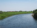 Cows and River - geograph.org.uk - 1857817.jpg 1 024 × 768; 160 KB
-
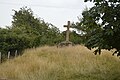
 Cross near Chapel Cottage Farm - geograph.org.uk - 2171849.jpg 3 072 × 2 304; 2,11 MB
-
 Cross, Chapel Cottage Farm - geograph.org.uk - 4789477.jpg 640 × 426; 85 KB
-
 Cross, Chapel Cottage Farm - geograph.org.uk - 4789478.jpg 640 × 426; 78 KB
-
 Cyclists, Donkey Street - geograph.org.uk - 4767348.jpg 640 × 426; 60 KB
-
 Daleacres Caravan Park (2) - geograph.org.uk - 2123355.jpg 3 072 × 2 304; 2,91 MB
-
 Daleacres Caravan Park - geograph.org.uk - 2123348.jpg 3 072 × 2 304; 1,86 MB
-
 Dam by the Royal Military Canal - geograph.org.uk - 4060423.jpg 640 × 430; 67 KB
-
 Derelict building on Lower Wall Road - geograph.org.uk - 6352458.jpg 5 456 × 3 632; 3,29 MB
-
 Derelict cottage - geograph.org.uk - 4774235.jpg 640 × 426; 119 KB
-
 Distant sheepfold, Romney Marsh - geograph.org.uk - 4223911.jpg 640 × 480; 112 KB
-
 Donkey Street - geograph.org.uk - 1977976.jpg 1 024 × 768; 202 KB
-
 Donkey Street - geograph.org.uk - 4767317.jpg 640 × 426; 46 KB
-
 Donkey Street - geograph.org.uk - 4767320.jpg 640 × 426; 82 KB
-
 Donkey Street - geograph.org.uk - 4767322.jpg 640 × 426; 84 KB
-
 Donkey Street - geograph.org.uk - 4767326.jpg 640 × 426; 83 KB
-
 Donkey Street - geograph.org.uk - 4767334.jpg 640 × 426; 76 KB
-
 Donkey Street - geograph.org.uk - 4767342.jpg 640 × 426; 48 KB
-
 Donkey Street - geograph.org.uk - 4767349.jpg 640 × 426; 49 KB
-
 Donkey Street - geograph.org.uk - 4774189.jpg 640 × 426; 51 KB
-
 Donkey Street - geograph.org.uk - 4774194.jpg 640 × 426; 62 KB
-
 Donkey street - geograph.org.uk - 4774198.jpg 640 × 426; 49 KB
-
 Donkey Street - geograph.org.uk - 4774201.jpg 640 × 426; 53 KB
-
 Donkey Street - geograph.org.uk - 4774208.jpg 640 × 426; 53 KB
-
 Donkey Street - geograph.org.uk - 4774213.jpg 640 × 426; 67 KB
-
 Donkey Street - geograph.org.uk - 4774216.jpg 640 × 426; 50 KB
-
 Donkey Street - geograph.org.uk - 4774229.jpg 640 × 426; 61 KB
-
 Donkey Street - geograph.org.uk - 4774244.jpg 640 × 426; 67 KB
-
 Donkey Street - geograph.org.uk - 4774249.jpg 640 × 426; 69 KB
-
 Donkey Street - geograph.org.uk - 4774250.jpg 640 × 426; 74 KB
-
 Donkey Street - geograph.org.uk - 4774254.jpg 640 × 426; 74 KB
-
 Donkey Street from Lower Wall Road - geograph.org.uk - 6353719.jpg 5 456 × 3 632; 2,93 MB
-
 Donkey Street near Burmarsh - geograph.org.uk - 2674863.jpg 4 000 × 3 000; 4,34 MB
-
 Donkey Street near Eaton Farm - geograph.org.uk - 4774219.jpg 640 × 426; 58 KB
-
 Donkey Street, Romney Marsh and the old cliff line - geograph.org.uk - 2674923.jpg 4 000 × 3 000; 4,18 MB
-
 Drain by Thorndike Road, Burmarsh - geograph.org.uk - 4223654.jpg 640 × 480; 183 KB
-
 Drain junction near Chapel Cottage Farm - geograph.org.uk - 2171779.jpg 3 072 × 2 304; 1,77 MB
-
 Drain near Organswick Farm - geograph.org.uk - 4789439.jpg 640 × 426; 78 KB
-
 Drain near Organswick Farm - geograph.org.uk - 4789440.jpg 640 × 426; 64 KB
-
 Drain off Lower Wall Road - geograph.org.uk - 3275513.jpg 2 464 × 1 632; 1,03 MB
-
 Drain off Lower Wall Road - geograph.org.uk - 6352423.jpg 5 456 × 3 632; 1,87 MB
-
 Drainage Channel - geograph.org.uk - 1857850.jpg 1 024 × 768; 169 KB
-
 Drainage Channel - geograph.org.uk - 1858113.jpg 1 024 × 768; 223 KB
-
 Drainage channel beside Lower Wall Road - geograph.org.uk - 2127430.jpg 3 072 × 2 304; 1,99 MB
-
 Drainage Channel in Burmarsh - geograph.org.uk - 2127350.jpg 3 072 × 2 304; 2,32 MB
-
 Drainage Channel in Romney Marshes - geograph.org.uk - 2127427.jpg 3 072 × 2 304; 2,49 MB
-
 Drainage channel in the Romney Marshes - geograph.org.uk - 2127396.jpg 3 072 × 2 304; 2,25 MB
-
 Drainage channel near Burmarsh - geograph.org.uk - 2127368.jpg 3 072 × 2 304; 1,72 MB
-
 Drainage Channel near Chapel Cottage Farm - geograph.org.uk - 2171782.jpg 3 072 × 2 304; 1,65 MB
-
 Drainage channel near Daleacres Caravan Park - geograph.org.uk - 2123372.jpg 3 072 × 2 304; 1,84 MB
-
 Drainage channel near Lower Wall House - geograph.org.uk - 2127412.jpg 3 072 × 2 304; 1,48 MB
-
 Drainage Dyke off Church Road - geograph.org.uk - 1857912.jpg 1 024 × 768; 286 KB
-

-
 Dymchurch - 2008 - geograph.org.uk - 3459366.jpg 2 272 × 1 704; 720 KB
-
 Dymchurch - 2008 - geograph.org.uk - 3459367.jpg 2 272 × 1 704; 584 KB
-
 Dymchurch - 2008 - geograph.org.uk - 3459368.jpg 2 272 × 1 704; 680 KB
-
 Dymchurch - 2008 - geograph.org.uk - 3459370.jpg 2 272 × 1 704; 576 KB
-
 Dymchurch - geograph.org.uk - 2794026.jpg 3 648 × 2 736; 1,21 MB
-
 Dymchurch - geograph.org.uk - 2794027.jpg 3 648 × 2 736; 809 KB
-
 Dymchurch - geograph.org.uk - 2794031.jpg 3 648 × 2 736; 3,5 MB
-
 Eastbridge Rd - geograph.org.uk - 4789460.jpg 640 × 426; 60 KB
-
 Eastbridge Rd - geograph.org.uk - 4789461.jpg 640 × 426; 70 KB
-
 Eastbridge Rd - geograph.org.uk - 4789464.jpg 640 × 426; 70 KB
-
 Eastbridge Rd - geograph.org.uk - 4789472.jpg 640 × 426; 67 KB
-
 Eastbridge Rd, Chapel Cottage Farm - geograph.org.uk - 4789475.jpg 640 × 426; 66 KB
-
 Eastbridge Road - geograph.org.uk - 1944347.jpg 1 024 × 768; 185 KB
-
 Eastbridge Sewer - geograph.org.uk - 2088522.jpg 3 072 × 2 304; 2,08 MB
-
 End of the farm track - geograph.org.uk - 4789459.jpg 640 × 426; 62 KB
-
 Extensive stubble - geograph.org.uk - 4792417.jpg 640 × 426; 43 KB
-
 Extensive wheat - geograph.org.uk - 4783947.jpg 640 × 426; 51 KB
-
 Extensive wheat - geograph.org.uk - 4783972.jpg 640 × 426; 47 KB
-
 Extensive wheat - geograph.org.uk - 4784007.jpg 640 × 426; 59 KB
-
 Extensive wheat - geograph.org.uk - 4784012.jpg 640 × 426; 46 KB
-
 Extensive wheat - geograph.org.uk - 4784032.jpg 640 × 426; 71 KB
-
 Extensive wheat - geograph.org.uk - 4789471.jpg 640 × 426; 43 KB
-
 Farm Cottage - geograph.org.uk - 2172135.jpg 3 072 × 2 304; 2,24 MB
-
 Farm in the distance - geograph.org.uk - 4792415.jpg 640 × 426; 47 KB
-
 Farm track - geograph.org.uk - 4789447.jpg 640 × 426; 86 KB
-
 Farm track - geograph.org.uk - 4789452.jpg 640 × 426; 74 KB
-
 Farm track - geograph.org.uk - 4789454.jpg 640 × 426; 80 KB
-
 Farm track leading to Church Road - geograph.org.uk - 6352419.jpg 5 456 × 3 632; 1,93 MB
-
 Farm track to Chapel Cottage Farm - geograph.org.uk - 2171785.jpg 3 072 × 2 304; 1,82 MB
-
 Farm track to Orgarswick Farm - geograph.org.uk - 2172034.jpg 3 072 × 2 304; 2,1 MB
-
 Farm track, Romney Marsh - geograph.org.uk - 4223883.jpg 640 × 480; 134 KB
-
 Farm track, Romney Marsh - geograph.org.uk - 4223930.jpg 640 × 480; 144 KB
-
 Farmhouse at Sherlock's Bridge south of Bonnington, Kent - geograph.org.uk - 2303134.jpg 1 600 × 1 200; 402 KB
-

-
 Farmland north of Key Barn Farm - geograph.org.uk - 3569608.jpg 1 024 × 614; 99 KB
-
 Farmland, Chapel Cottage Farm - geograph.org.uk - 4789481.jpg 640 × 426; 66 KB
-
 Farmland, Romney Marshes - geograph.org.uk - 4789453.jpg 640 × 426; 56 KB
-
 Farmland, Romney Marshes - geograph.org.uk - 4789455.jpg 640 × 426; 57 KB
-
 Fence near Lower Wall Road - geograph.org.uk - 3391531.jpg 4 000 × 3 000; 4,5 MB
-
 Field and field boundary - geograph.org.uk - 4774258.jpg 640 × 426; 56 KB
-
 Field ditch, Chapel Cottage Farm - geograph.org.uk - 4792365.jpg 640 × 426; 46 KB
-
 Field drain - geograph.org.uk - 4767354.jpg 640 × 426; 89 KB
-
 Field drain - geograph.org.uk - 4774223.jpg 640 × 426; 46 KB
-
 Field drain - geograph.org.uk - 4789451.jpg 640 × 426; 65 KB
-
 Field drain - geograph.org.uk - 4789456.jpg 640 × 426; 67 KB
-
 Field drain - geograph.org.uk - 4792389.jpg 640 × 426; 76 KB
-
 Field drain - geograph.org.uk - 4792413.jpg 640 × 387; 47 KB
-
 Field drain - geograph.org.uk - 4792418.jpg 640 × 426; 47 KB
-
 Field near Tame Lane - geograph.org.uk - 2171964.jpg 3 072 × 1 728; 1,32 MB
-
 Field of Sheep near Burmarsh - geograph.org.uk - 1857915.jpg 7 209 × 2 435; 5,74 MB
-
 Field off Lower Wall Road - geograph.org.uk - 1857841.jpg 1 600 × 679; 299 KB
-
 Field off Lower Wall Road - geograph.org.uk - 1857861.jpg 1 024 × 683; 196 KB
-
 Flat around here^ - geograph.org.uk - 4774192.jpg 640 × 426; 34 KB
-
 Flat around here^ - geograph.org.uk - 4792368.jpg 640 × 426; 64 KB
-
 Flat barley - geograph.org.uk - 4774207.jpg 640 × 426; 47 KB
-
 Flat farmland - geograph.org.uk - 4789448.jpg 640 × 426; 56 KB
-
 Flat farmland by the Royal Military Canal - geograph.org.uk - 5820326.jpg 1 024 × 681; 172 KB
-
 Flat farmland, Romney Marshes - geograph.org.uk - 4789458.jpg 640 × 426; 64 KB
-
 Flat field - geograph.org.uk - 4792373.jpg 640 × 395; 59 KB
-
 Flat field - geograph.org.uk - 4792384.jpg 640 × 387; 58 KB
-
 Flat field - geograph.org.uk - 4792423.jpg 640 × 426; 52 KB
-
 Flat grassland - geograph.org.uk - 4767341.jpg 640 × 426; 47 KB
-
 Flat grassland - geograph.org.uk - 4774190.jpg 640 × 379; 35 KB
-
 Flat grassland - geograph.org.uk - 4774203.jpg 640 × 426; 38 KB
-
 Flat grassland - geograph.org.uk - 4774204.jpg 640 × 426; 33 KB
-
 Flat grassland - geograph.org.uk - 4774210.jpg 640 × 412; 33 KB
-
 Flat grassland - geograph.org.uk - 4774222.jpg 640 × 426; 34 KB
-
 Flat pasture - geograph.org.uk - 4767350.jpg 640 × 416; 32 KB
-
 Flat^ - geograph.org.uk - 4767347.jpg 640 × 426; 39 KB
-
 Follow the footpath - geograph.org.uk - 4792395.jpg 640 × 401; 56 KB
-
 Footbridge and footpath junction near Chapel Cottage Farm - geograph.org.uk - 2171772.jpg 3 072 × 2 304; 1,39 MB
-
 Footbridge in Romney Marshes - geograph.org.uk - 2127388.jpg 3 072 × 1 728; 1,12 MB
-
 Footbridge in Romney Marshes - geograph.org.uk - 2127393.jpg 3 072 × 2 304; 2,63 MB
-
 Footbridge in the wheat - geograph.org.uk - 4783980.jpg 640 × 426; 63 KB
-
 Footbridge on footpath HM170 - geograph.org.uk - 4223871.jpg 640 × 480; 167 KB
-
 Footbridge on the marshes - geograph.org.uk - 4792383.jpg 640 × 397; 39 KB
-
 Footbridge over a drainage channel - geograph.org.uk - 2123379.jpg 3 072 × 2 304; 2,99 MB
-
 Footbridge over the Hoorne's Sewer - geograph.org.uk - 2123367.jpg 3 072 × 2 304; 2,8 MB
-
 Footbridge, Eastbridge Sewer - geograph.org.uk - 4792424.jpg 640 × 426; 71 KB
-
 Footpath along field drain - geograph.org.uk - 4792371.jpg 640 × 401; 57 KB
-
 Footpath at the edge of Burmarsh - geograph.org.uk - 4783902.jpg 640 × 426; 97 KB
-
 Footpath crosses Church Road - geograph.org.uk - 2171977.jpg 3 072 × 2 304; 1,32 MB
-
 Footpath crosses East Bridge Road - geograph.org.uk - 2171929.jpg 3 072 × 2 304; 1,59 MB
-
 Footpath from Burmarsh Road - geograph.org.uk - 2674853.jpg 4 000 × 3 000; 3,89 MB
-
 Footpath heading south - geograph.org.uk - 4792409.jpg 640 × 426; 60 KB
-
 Footpath off Donkey Street - geograph.org.uk - 4767352.jpg 640 × 426; 65 KB


.jpg)


_-_geograph.org.uk_-_3925522.jpg)


_-_geograph.org.uk_-_2123355.jpg)


