Category:Burnsall
Vai alla navigazione
Vai alla ricerca
Villaggio inglese  | |||||
| Carica un file multimediale | |||||
| Istanza di | |||||
|---|---|---|---|---|---|
| Luogo | Craven, North Yorkshire, Yorkshire e Humber, Inghilterra | ||||
 | |||||
Sottocategorie
Questa categoria contiene le 9 sottocategorie indicate di seguito, su un totale di 9.
B
- Burnsall Book of Remembrance (1 F)
- Burnsall Bridge (63 F)
- Burnsall Classic Fell Race (3 F)
- Burnsall Methodist Chapel (6 F)
- Burnsall Old Grammar School (9 F)
- Burnsall War Memorial (5 F)
H
R
- The Red Lion, Burnsall (9 F)
W
File nella categoria "Burnsall"
Questa categoria contiene 200 file, indicati di seguito, su un totale di 312.
(pagina precedente) (pagina successiva)-

-
 A silver birch with Simon's Seat beyond - geograph.org.uk - 1822032.jpg 4 592 × 3 056; 4,52 MB
-
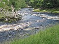
 A small rapid near Loup Scar - geograph.org.uk - 4183833.jpg 640 × 430; 113 KB
-
 A small reservoir near the head of Gill Beck - geograph.org.uk - 4364530.jpg 3 776 × 2 520; 3,91 MB
-
 A small unnamed reservoir - geograph.org.uk - 1772857.jpg 1 600 × 1 200; 666 KB
-
 A wild flower - geograph.org.uk - 1858106.jpg 4 592 × 3 056; 2,85 MB
-
 Above Loup Scar - geograph.org.uk - 4870960.jpg 2 048 × 1 536; 713 KB
-
 Air Scar Crags - geograph.org.uk - 1822118.jpg 4 592 × 3 056; 5,47 MB
-
 An unnamed top, just labelled "cairn" by the OS - geograph.org.uk - 1822150.jpg 4 592 × 3 056; 7,05 MB
-
 Approaching Loup Scar - geograph.org.uk - 5300359.jpg 5 152 × 3 864; 7,52 MB
-
 Approaching Loup Scar from Burnsall - geograph.org.uk - 5130222.jpg 5 152 × 3 864; 7,75 MB
-
 Approaching the Red Lion Inn, Burnsall - geograph.org.uk - 6384036.jpg 5 184 × 3 456; 5,16 MB
-
 Approaching the Thorpe Fell Lunch Hut - geograph.org.uk - 6089630.jpg 5 184 × 3 456; 6,33 MB
-
 B6160 entering Burnsall - geograph.org.uk - 4605176.jpg 1 600 × 961; 1 014 KB
-
 B6160 from Burnsall - geograph.org.uk - 4594202.jpg 1 024 × 682; 221 KB
-
 B6160 south of Burnsall - geograph.org.uk - 5417875.jpg 640 × 481; 68 KB
-
 B6160 towards Burnsall - geograph.org.uk - 2465680.jpg 1 600 × 1 200; 506 KB
-
 Badger Lane - geograph.org.uk - 1858120.jpg 1 600 × 1 200; 846 KB
-
 Barden Moor - geograph.org.uk - 5301530.jpg 5 152 × 3 864; 6,92 MB
-
 Bend in the River Wharfe at Loup Scar, Burnsall - geograph.org.uk - 4892423.jpg 2 048 × 1 536; 1,02 MB
-

-
 Black clouds over Mill Bridge - geograph.org.uk - 3658203.jpg 4 608 × 3 072; 6,8 MB
-
 Bolton Croft to Air Scar Crags - geograph.org.uk - 5130301.jpg 5 152 × 3 864; 7,73 MB
-
 Boundary stone on Barden Moor - geograph.org.uk - 4364537.jpg 3 776 × 2 520; 4,09 MB
-
 Boundary stone on Barden Moor - geograph.org.uk - 4364542.jpg 2 520 × 3 776; 3,34 MB
-
 Boundary stone on Barden Moor - geograph.org.uk - 4365778.jpg 3 776 × 2 520; 3,9 MB
-
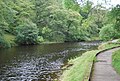
 Bridge & chapel, Burnsall.jpg 2 592 × 1 944; 2,12 MB
-
 Bridge House - geograph.org.uk - 4183934.jpg 640 × 430; 65 KB
-
 Bridge liability marker post - geograph.org.uk - 4892600.jpg 1 464 × 1 872; 625 KB
-
 Bridleway to Hebden via stepping stones - geograph.org.uk - 1858112.jpg 4 592 × 3 056; 7,64 MB
-
 Bridleway to the River Wharfe near Burnsall - geograph.org.uk - 3759012.jpg 1 024 × 681; 389 KB
-
 Bunker's Hill - geograph.org.uk - 5129098.jpg 5 152 × 3 864; 7,49 MB
-
 Bunker's Hill, Burnsall - geograph.org.uk - 4396439.jpg 480 × 640; 115 KB
-
 Burnsall - geograph.org.uk - 1554698.jpg 640 × 480; 99 KB
-
 Burnsall - geograph.org.uk - 1554701.jpg 640 × 480; 116 KB
-
 Burnsall - geograph.org.uk - 1554703.jpg 640 × 480; 87 KB
-
 Burnsall - geograph.org.uk - 1822764.jpg 4 592 × 3 056; 6,33 MB
-
 Burnsall across the Wharfe - geograph.org.uk - 501864.jpg 640 × 478; 174 KB
-
 Burnsall Bridge - geograph.org.uk - 6384043.jpg 5 184 × 3 456; 6,25 MB
-
 Burnsall car park - geograph.org.uk - 6280044.jpg 1 024 × 768; 243 KB
-
 Burnsall Cottages - geograph.org.uk - 1060705.jpg 640 × 427; 87 KB
-
 Burnsall from Skuff Road - geograph.org.uk - 2505171.jpg 631 × 640; 71 KB
-
 Burnsall from Skuff Road - geograph.org.uk - 3657986.jpg 4 608 × 3 072; 7,17 MB
-
 Burnsall from Skull Road - geograph.org.uk - 5579267.jpg 640 × 480; 203 KB
-
 Burnsall Green to Hartlington - geograph.org.uk - 5129097.jpg 5 152 × 3 864; 7,27 MB
-
 Burnsall in Wharfedale, Burnsall & Thorpe Fell, wsw, 3 miles.jpg 2 525 × 1 941; 4,13 MB
-
 Burnsall primary school - geograph.org.uk - 6339985.jpg 4 160 × 3 036; 2,76 MB
-
 Burnsall seen from the bridge - geograph.org.uk - 6383065.jpg 2 000 × 1 311; 1,4 MB
-
 Burnsall sunrise, planes of focus.jpg 2 561 × 1 941; 2,01 MB
-
 Burnsall Village - geograph.org.uk - 2969644.jpg 640 × 480; 126 KB
-
 Burnsall Village - geograph.org.uk - 2969645.jpg 640 × 480; 147 KB
-
 Burnsall Village from the Barden Road - geograph.org.uk - 946841.jpg 640 × 480; 107 KB
-
 Burnsall village green - geograph.org.uk - 4639080.jpg 3 648 × 2 736; 4,8 MB
-
 Burnsall war memorial... - geograph.org.uk - 6339996.jpg 3 985 × 4 955; 4,67 MB
-
 Burnsall Water Treatment Works - geograph.org.uk - 2309894.jpg 4 320 × 3 240; 3,12 MB
-
 Burnsall, Entering a large section of woodland on the B6160 - geograph.org.uk - 6231411.jpg 6 467 × 4 311; 7,76 MB
-
 Burnsall, the River Wharfe and Thorpe Fell - geograph.org.uk - 1724730.jpg 2 048 × 1 536; 913 KB
-
 Burnsall, to Skuff Road - geograph.org.uk - 4406009.jpg 3 648 × 2 736; 4,81 MB
-
 Burnsall, towards Appletreewick - geograph.org.uk - 4406021.jpg 3 648 × 2 736; 4,38 MB
-
 Burnsall, Yorkshire Dales - geograph.org.uk - 71080.jpg 640 × 424; 74 KB
-
 Burnsall-river, bridge, chapel, church, fell.jpg 3 460 × 1 562; 6,36 MB
-
 Bus Stop, Burnsall Bridge - geograph.org.uk - 4594173.jpg 1 024 × 682; 213 KB
-
 Busk Ridding Lathe - geograph.org.uk - 2309903.jpg 4 320 × 3 240; 3,09 MB
-
 Byra Bank - geograph.org.uk - 5301580.jpg 5 152 × 3 864; 7,2 MB
-
 Cairn near Numberstones End which is visible on the right - geograph.org.uk - 1822230.jpg 4 592 × 3 056; 6,63 MB
-
 Cairn on Air Scar Crags? - geograph.org.uk - 1822184.jpg 4 592 × 3 056; 6,41 MB
-
 Cairn on an unnamed top en route to Numberstones End - geograph.org.uk - 1822203.jpg 2 816 × 2 112; 2,35 MB
-
 Cast Iron Road Sign in Burnsall - geograph.org.uk - 6163966.jpg 4 608 × 2 539; 1,9 MB
-
 Chimney and remains of boiler house on Barden Moor - geograph.org.uk - 2129520.jpg 1 600 × 1 198; 508 KB
-
 Chimney and Ruins on Burnsall and Thorpe Fell - geograph.org.uk - 3947457.jpg 4 000 × 3 000; 2,42 MB
-
 Chimney on Barden Moor - geograph.org.uk - 29493.jpg 640 × 415; 57 KB
-
 Church Lane, Burnsall - geograph.org.uk - 4892585.jpg 1 986 × 1 452; 1,14 MB
-
 Cottage in Burnsall - geograph.org.uk - 4183877.jpg 640 × 430; 92 KB
-
 Crossing Reservoir Outlet at Gill Beck Head - geograph.org.uk - 6090377.jpg 5 184 × 3 456; 5,4 MB
-
 Dales Way and River Wharfe - geograph.org.uk - 4183861.jpg 640 × 430; 112 KB
-
 Dales Way and River Wharfe - geograph.org.uk - 4194816.jpg 640 × 430; 63 KB
-
 Dales Way approaching Burnsall - geograph.org.uk - 409395.jpg 640 × 480; 73 KB
-
 Dales Way between Ilkley and Grassington (6th October 2019) 011.jpg 5 152 × 3 864; 7,43 MB
-
 Dales Way crosses Sandbed Beck - geograph.org.uk - 4177218.jpg 640 × 430; 129 KB
-
 Dales Way to Burnsall - geograph.org.uk - 4396314.jpg 3 648 × 2 736; 4,73 MB
-

-

-

-

-

-

-

-

-

-

-

-

-

-

-

-

-

-
-
-
-

-

-
 Derelict area alongside Hippings Lane, Burnsall - geograph.org.uk - 4892398.jpg 2 048 × 1 536; 1,13 MB
-
 Devonshire Fell Hotel Burnsall - geograph.org.uk - 426655.jpg 640 × 480; 62 KB
-
 Drainage Culvert - geograph.org.uk - 748045.jpg 640 × 426; 99 KB
-
 Farm buildings at Sheep Creep - geograph.org.uk - 2967947.jpg 800 × 600; 164 KB
-
 Farm track off the B6160 - geograph.org.uk - 2465678.jpg 1 600 × 1 200; 482 KB
-
 Gateway to Upland Pastures above Burnsall - geograph.org.uk - 2309909.jpg 4 320 × 3 240; 3,26 MB
-
 Geese on Barden-Thorpe moor - geograph.org.uk - 1232417.jpg 640 × 480; 82 KB
-
 Gill Beck Head - geograph.org.uk - 2129539.jpg 1 600 × 1 198; 512 KB
-
 Glimpse of the River Wharfe, from Skuff Road - geograph.org.uk - 3657995.jpg 4 608 × 3 072; 6,38 MB
-

-
 Greens, blues and yellows, in the Yorkshire Dales - geograph.org.uk - 3658016.jpg 3 229 × 2 335; 3,34 MB
-
 Gulls at reservoir at Gill Beck. - geograph.org.uk - 172861.jpg 640 × 480; 57 KB
-

-
 Heber Plantation and Garrelgum - geograph.org.uk - 4872210.jpg 2 048 × 1 536; 751 KB
-
 Hesker Gill - geograph.org.uk - 4679924.jpg 640 × 480; 98 KB
-
 High Bank to Hebden - geograph.org.uk - 4639132.jpg 3 648 × 2 736; 4,7 MB
-
 High Banks Plantation - geograph.org.uk - 4637500.jpg 3 648 × 2 736; 4,72 MB
-
 High Banks Plantation - geograph.org.uk - 5130242.jpg 5 152 × 3 864; 7,15 MB
-
 High Banks, Hebden - geograph.org.uk - 4637488.jpg 3 648 × 2 736; 4,76 MB
-
 High Resting Stones, Barden Moor - geograph.org.uk - 4365780.jpg 3 776 × 2 520; 4 MB
-
 Hippings Lane, Burnsall - geograph.org.uk - 4892429.jpg 2 048 × 1 536; 1,33 MB
-
 Houses facing the green, Burnsall - geograph.org.uk - 6383063.jpg 2 000 × 1 331; 3,05 MB
-
 In Burnsall - geograph.org.uk - 6384038.jpg 5 184 × 3 456; 6,22 MB
-
 Island in the River Wharfe - geograph.org.uk - 4183878.jpg 640 × 430; 95 KB
-
 Island in the River Wharfe - geograph.org.uk - 4183898.jpg 640 × 430; 124 KB
-

-
 Kail Hill, west - geograph.org.uk - 4784626.jpg 3 648 × 2 736; 5,1 MB
-
 Kail over Burnsall, depth planes.jpg 2 589 × 1 896; 1,06 MB
-
 Lambs in plastic macs - geograph.org.uk - 140943.jpg 640 × 339; 96 KB
-
 Limekiln near Burnsall - geograph.org.uk - 1157745.jpg 480 × 640; 85 KB
-
 Looking east to Simons Seat - geograph.org.uk - 426669.jpg 640 × 480; 38 KB
-
 Looking towards Rowan Tree crag - geograph.org.uk - 1772849.jpg 2 816 × 2 112; 2,87 MB
-
 Loup Scar (1) - geograph.org.uk - 4396391.jpg 3 648 × 2 736; 4,7 MB
-
 Loup Scar (2) - geograph.org.uk - 4396395.jpg 2 736 × 3 648; 4,87 MB
-
 Loup Scar (3) - geograph.org.uk - 4396403.jpg 3 648 × 2 736; 4,75 MB
-
 Loup Scar (4) - geograph.org.uk - 4396411.jpg 3 648 × 2 736; 4,94 MB
-
 Loup Scar (5) - geograph.org.uk - 4396421.jpg 3 648 × 2 736; 4,92 MB
-
 Loup Scar (Hebden end) - geograph.org.uk - 5130227.jpg 5 152 × 3 864; 7,5 MB
-
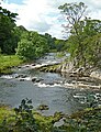
 Loup Scar - geograph.org.uk - 2469359.jpg 2 272 × 1 704; 2,6 MB
-
 Loup Scar - geograph.org.uk - 4183834.jpg 640 × 430; 113 KB
-
 Loup Scar - geograph.org.uk - 4183844.jpg 640 × 430; 133 KB
-
 Loup Scar - geograph.org.uk - 4343703.jpg 4 320 × 3 240; 3,58 MB
-
 Loup Scar - geograph.org.uk - 4637510.jpg 3 648 × 2 736; 4,89 MB
-
 Loup Scar - geograph.org.uk - 4870953.jpg 2 048 × 1 536; 700 KB
-
 Loup Scar - geograph.org.uk - 501876.jpg 640 × 478; 158 KB
-
 Loup Scar - geograph.org.uk - 5120801.jpg 5 184 × 3 888; 6,83 MB
-
 Loup Scar - geograph.org.uk - 5130261.jpg 5 152 × 3 864; 7,79 MB
-
 Loup Scar - geograph.org.uk - 5462294.jpg 800 × 600; 207 KB
-
 Loup Scar - geograph.org.uk - 5462320.jpg 800 × 600; 195 KB
-
 Loup Scar and the River Wharfe - geograph.org.uk - 1724577.jpg 1 600 × 1 200; 560 KB
-
 Loup Scar basin - geograph.org.uk - 4637517.jpg 2 736 × 3 648; 5,22 MB
-
 Loup Scar from the Dales Way - geograph.org.uk - 2848007.jpg 3 072 × 2 304; 1,46 MB
-
 Loup Scar to Wilfred Scar - geograph.org.uk - 4637526.jpg 2 736 × 3 648; 5,14 MB
-
 Loup Scar to Wilfrid Scar - geograph.org.uk - 5300363.jpg 2 440 × 1 830; 1,05 MB
-
 Loup Scar, Burnsall end - geograph.org.uk - 4637538.jpg 3 648 × 2 736; 5,14 MB
-
 Loup Scar, Near Burnsall - geograph.org.uk - 1263079.jpg 640 × 480; 119 KB
-
 Loup scar. - geograph.org.uk - 4727742.jpg 640 × 410; 81 KB
-
 Mill Lane, Burnsall - geograph.org.uk - 4892578.jpg 2 048 × 1 536; 1,15 MB
-
 Numberstones End - geograph.org.uk - 4406094.jpg 3 648 × 2 736; 4,79 MB
-
 Numberstones End to the Fell - geograph.org.uk - 5130279.jpg 5 152 × 3 864; 7,5 MB
-

-
 One of a pair of silver birch trees - geograph.org.uk - 1822021.jpg 4 592 × 3 056; 4,15 MB
-
 Ordnance Survey Cut Mark - geograph.org.uk - 3034415.jpg 3 264 × 2 448; 3,13 MB
-
 Ordnance Survey Cut Mark - geograph.org.uk - 3034416.jpg 3 264 × 2 448; 3,13 MB
-
 Ordnance Survey Sheet SE 06 Grassington, Published 1952.jpg 7 384 × 7 526; 5,36 MB
-
 Parson's Well to Wilfrid Scar - geograph.org.uk - 5300368.jpg 5 152 × 3 864; 7,64 MB
-
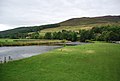
 Pastures west of Burnsall - geograph.org.uk - 409404.jpg 640 × 480; 56 KB
-
 Path-side Cairn at Numberstones End - geograph.org.uk - 3947465.jpg 4 000 × 3 000; 4,77 MB
-
 Playing in the River Wharfe - geograph.org.uk - 4194801.jpg 640 × 430; 77 KB
-
 Primroses - geograph.org.uk - 1858104.jpg 4 592 × 3 056; 3,03 MB
-
 Restored chimney on Thorpe Fell - geograph.org.uk - 4364527.jpg 3 776 × 2 520; 4,25 MB
-
 River Wharfe - geograph.org.uk - 2322720.jpg 3 072 × 2 304; 1,36 MB
-
 River Wharfe - geograph.org.uk - 2442678.jpg 1 600 × 1 063; 513 KB
-
 River Wharfe - geograph.org.uk - 2469353.jpg 2 272 × 1 704; 2,28 MB
-
 River Wharfe - geograph.org.uk - 4177220.jpg 640 × 430; 101 KB
-
 River Wharfe - geograph.org.uk - 4177223.jpg 640 × 430; 99 KB
-
 River Wharfe - geograph.org.uk - 4183823.jpg 640 × 430; 62 KB
-
 River Wharfe - geograph.org.uk - 4183827.jpg 640 × 430; 116 KB
-
 River Wharfe - geograph.org.uk - 4183856.jpg 640 × 430; 97 KB
-
 River Wharfe - geograph.org.uk - 4183863.jpg 640 × 430; 96 KB
-
 River Wharfe - geograph.org.uk - 4183901.jpg 640 × 430; 111 KB
-
 River Wharfe - geograph.org.uk - 4183909.jpg 640 × 430; 120 KB
-
 River Wharfe - geograph.org.uk - 4183937.jpg 640 × 430; 77 KB
-
 River Wharfe - geograph.org.uk - 4194804.jpg 640 × 430; 54 KB
-
 River Wharfe - geograph.org.uk - 4194827.jpg 640 × 430; 95 KB
-
 River Wharfe - geograph.org.uk - 4194828.jpg 640 × 430; 90 KB
-
 River Wharfe - Loup Scar - geograph.org.uk - 3035198.jpg 3 264 × 2 448; 2,92 MB
-
 River Wharfe and Dales Way - geograph.org.uk - 4183859.jpg 640 × 430; 113 KB
-
 River Wharfe at Burnsall - geograph.org.uk - 4183925.jpg 640 × 430; 60 KB
-
 River Wharfe at Burnsall, Y Dales. - geograph.org.uk - 43940.jpg 640 × 480; 70 KB
-
 River Wharfe at Loup Scar - geograph.org.uk - 5301555.jpg 5 152 × 3 864; 7,76 MB
-
 River Wharfe at Loup Scar - geograph.org.uk - 5864862.jpg 1 600 × 1 200; 742 KB
-
 River Wharfe at Loup Scar - geograph.org.uk - 747943.jpg 640 × 426; 101 KB
-
 River Wharfe at Loup Scar Gorge - geograph.org.uk - 388029.jpg 600 × 400; 96 KB
-

-
 River Wharfe from Burnsall Bridge - geograph.org.uk - 3947477.jpg 4 000 × 3 000; 2,66 MB
-
 River Wharfe near Burnsall.jpg 3 000 × 3 906; 10,27 MB
-
 River Wharfe near Loup Scar - geograph.org.uk - 4183830.jpg 640 × 430; 91 KB


_011.jpg)


_-_geograph.org.uk_-_4178407.jpg)
_-_geograph.org.uk_-_4178410.jpg)
_-_geograph.org.uk_-_4178921.jpg)
_-_geograph.org.uk_-_4178924.jpg)
_-_geograph.org.uk_-_4178931.jpg)
_-_geograph.org.uk_-_4178975.jpg)
_-_geograph.org.uk_-_4178979.jpg)
_-_geograph.org.uk_-_4178993.jpg)
_-_geograph.org.uk_-_4178988.jpg)
_-_geograph.org.uk_-_4179362.jpg)
_-_geograph.org.uk_-_4179363.jpg)
_-_geograph.org.uk_-_4179366.jpg)
_-_geograph.org.uk_-_4179367.jpg)
_-_geograph.org.uk_-_4179368.jpg)
_-_geograph.org.uk_-_4179448.jpg)
_-_geograph.org.uk_-_4178338.jpg)
_-_geograph.org.uk_-_4178372.jpg)
_-_geograph.org.uk_-_4178378.jpg)
_-_geograph.org.uk_-_4178379.jpg)
_-_geograph.org.uk_-_4178383.jpg)
_-_geograph.org.uk_-_4178393.jpg)
_-_geograph.org.uk_-_4178400.jpg)


_-_geograph.org.uk_-_4396391.jpg)
_-_geograph.org.uk_-_4396395.jpg)
_-_geograph.org.uk_-_4396403.jpg)
_-_geograph.org.uk_-_4396411.jpg)
_-_geograph.org.uk_-_4396421.jpg)
_-_geograph.org.uk_-_5130227.jpg)


