Category:Byers Green
Jump to navigation
Jump to search
English: Byers Green is a village in County Durham, in England. It is situated to the north of Bishop Auckland, between Willington and Spennymoor, and a short distance from the River Wear.
village in County Durham, United Kingdom  | |||||
| Upload media | |||||
| Instance of |
| ||||
|---|---|---|---|---|---|
| Location | Spennymoor, County Durham, North East England, England | ||||
 | |||||
Subcategories
This category has the following 4 subcategories, out of 4 total.
Media in category "Byers Green"
The following 19 files are in this category, out of 19 total.
-
 Agricultural machinery at Tudhoe - geograph.org.uk - 245819.jpg 640 × 480; 71 KB
-
 Auckland Way - geograph.org.uk - 341265.jpg 480 × 640; 118 KB
-
 Auckland Way - geograph.org.uk - 341274.jpg 640 × 480; 96 KB
-
 Byers Green Old Hall view.jpg 4,320 × 3,240; 4.49 MB
-

-
 Footpath through meadow - geograph.org.uk - 1374009.jpg 640 × 480; 70 KB
-
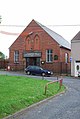 Methodist Church - Byers Green - geograph.org.uk - 476314.jpg 430 × 640; 85 KB
-
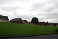 The green at Byers Green.jpg 640 × 430; 27 KB
-
 Byers Green - geograph.org.uk - 476317.jpg 640 × 430; 45 KB
-
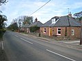
 Byers Green High Street - geograph.org.uk - 476349.jpg 430 × 640; 65 KB
-
 Byers Green Junction - geograph.org.uk - 341259.jpg 640 × 480; 98 KB
-
 Highside House - geograph.org.uk - 476304.jpg 640 × 430; 32 KB
-
 Junction on Long Lane - geograph.org.uk - 476355.jpg 640 × 430; 26 KB
-
 Long Lane - geograph.org.uk - 476302.jpg 430 × 640; 77 KB
-
 New Town, near Spennymoor - geograph.org.uk - 404598.jpg 640 × 480; 59 KB
-
 North Street - Byers Green - geograph.org.uk - 476323.jpg 640 × 430; 52 KB
-

-
 Vinovium Cottage - geograph.org.uk - 299032.jpg 640 × 384; 99 KB
-
 Wayside pond on the Auckland Way - geograph.org.uk - 341268.jpg 640 × 480; 120 KB


