Category:Caldor Fire
Jump to navigation
Jump to search
2021 wildfire in El Dorado County, California  | |||||
| Upload media | |||||
| Instance of | |||||
|---|---|---|---|---|---|
| Location | El Dorado County, California, Pacific States Region | ||||
| Start time |
| ||||
| Area |
| ||||
| Number of injured |
| ||||
 | |||||
Media in category "Caldor Fire"
The following 23 files are in this category, out of 23 total.
-
 2021 Caldor Fire burning operations.jpg 3,024 × 4,032; 2.79 MB
-
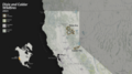
 2021 Caldor Fire map.png 1,750 × 1,200; 4.03 MB
-
 Cafires vir 2021231 lrg.jpg 2,836 × 2,480; 3.9 MB
-
 Caldor amo 2021242 lrg.jpg 2,422 × 1,615; 2.11 MB
-
 Caldor Fire - 51484398604.jpg 1,280 × 853; 423 KB
-
 Caldor Fire 1.jpg 4,032 × 2,268; 4.14 MB
-
 Caldor Fire Burn Scar (MODIS 2021-09-02).jpg 1,609 × 1,218; 305 KB
-
 Caldor Fire on 2021-09-11.jpg 4,176 × 2,784; 3.88 MB
-
 Caldor Fire with heavy smoke plumes, California, USA - August 22nd, 2021 (51398592047).jpg 9,930 × 5,028; 19.39 MB
-

-

-

-

-

-
 Caldor Fire, California, USA - August 17th, 2021 (51386545436).jpg 9,930 × 5,028; 16.54 MB
-
 California fires captured by the Copernicus Sentinel-2 mission ESA23460629.jpeg 1,920 × 1,920; 2.15 MB
-
 Spread of the Caldor fire, NASA.jpg 1,024 × 576; 372 KB
-
 The smoke cloud from California’s Caldor Fire (Copernicus).jpg 4,000 × 2,540; 10.97 MB
-
 Tracking the Spread of the Caldor and Dixie Fires (SVS5088 - 4k fires both-01).png 16,000 × 9,000; 17.25 MB
-
 Tracking the Spread of the Caldor and Dixie Fires (SVS5088 - Caldor fire 2021 4000).tiff 3,840 × 2,160; 63.28 MB
-
 Tracking the Spread of the Caldor and Dixie Fires (SVS5088 - Caldor fire 2021 6540).tiff 3,840 × 2,160; 63.28 MB
-
Tracking the Spread of the Caldor and Dixie Fires (SVS5088 - Tracking the Caldor and Dixie Fires).webm 2 min 26 s, 1,920 × 1,080; 66.44 MB
-
 Truckee River during Caldor fire.jpg 1,800 × 4,000; 2.01 MB


.jpg)

.jpg)
.jpg)
.jpg)
.jpg)
.jpg)
.jpg)
.jpg)


.jpg)

.png)