Category:California State Route 14
Aller à la navigation
Aller à la recherche
 | nombre : | (quatorze) |
|---|---|---|
| State highways in California : | 1 · 2 · 3 · 4 · 7 · 9 · 10 · 11 · 12 · 13 · 14 · 15 · 16 · 17 · 18 · 19 · 20 · 22 · 23 · 24 · 25 · 26 · 27 · 28 · 29 · 30 · 32 · 33 · 34 |
autoroute américaine de l'état de Californie   | |||||
| Téléverser des médias | |||||
| Nature de l’élément | |||||
|---|---|---|---|---|---|
| Lieu |
| ||||
| Réseau de transport |
| ||||
| Propriétaire | |||||
| Maintenance assurée par | |||||
| Date de fondation ou de création |
| ||||
| Longueur |
| ||||
| Extrémité | |||||
 | |||||
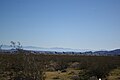
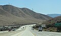
English: Media related to California State Route 14, a state highway in northern Los Angeles County and eastern Kern County in southern California, United States.
- A major north—south route across the western Mojave Desert, including the Antelope Valley.
- Runs from the northern San Fernando Valley (Newhall Pass) northward to the junction with Highway 395 (China Lake area), continuing the Sierra Highway.
Sous-catégories
Cette catégorie comprend 5 sous-catégories, dont les 5 ci-dessous.
Pages dans la catégorie « California State Route 14 »
Cette catégorie comprend seulement la page ci-dessous.
Média dans la catégorie « California State Route 14 »
Cette catégorie comprend 18 fichiers, dont les 18 ci-dessous.
-
 California State Route 14.svg 1 152 × 640 ; 437 kio
-
 Newhall Pass Interchange.png 1 134 × 2 707 ; 8,05 Mio
-
 Aerospace Valley marker 2133.JPG 2 048 × 1 536 ; 737 kio
-
 Antelope Valley Freeway and California Aqueduct.jpg 1 512 × 2 297 ; 2,54 Mio
-
 CA14-US395.JPG 3 008 × 2 000 ; 1,45 Mio
-
 California 14 1957.svg 601 × 625 ; 23 kio
-
 California 14.svg 385 × 401 ; 10 kio
-
 California 14U.svg 449 × 401 ; 11 kio
-
 Canyon Country, Santa Clarita.jpg 4 032 × 2 520 ; 3,56 Mio
-
 Escondido Summit Approach.jpg 5 392 × 3 235 ; 3,31 Mio
-
 Indian Wells across SR14 2016-04-17.jpg 4 435 × 2 957 ; 3,03 Mio
-
 Mojaveairport.jpg 3 008 × 2 000 ; 2,16 Mio
-
 On the way to Death Valley - По дороге в Долину Смерти - panoramio.jpg 1 366 × 1 046 ; 364 kio
-
 Sierra Highway.jpg 3 045 × 1 727 ; 4,07 Mio
-
 Soledad Pass2014.jpg 3 648 × 2 119 ; 1,2 Mio
-
 Tehachapiwindfarm.jpg 3 008 × 2 000 ; 2,11 Mio
-
 USGS - 1971 San Fernando earthquake - Collapse of Newhall Pass interchange.jpg 1 400 × 1 400 ; 2,02 Mio
-
 Sierra Highway.svg 576 × 672 ; 1,77 Mio


