Category:Cape Wrath
Naar navigatie springen
Naar zoeken springen
northwestern extreme point of mainland Great Britain  | |||||
| Media uploaden | |||||
| Is een | |||||
|---|---|---|---|---|---|
| Locatie |
| ||||
| Gelegen in of aan waterlichaam | |||||
 | |||||
English: Cape Wrath (Scottish Gaelic: Am Parbh, known as An Carbh in Lewis) is a cape in Sutherland, Highland, in northern Scotland. It is the most northwesterly point on the island of Great Britain.
Nederlands: Cape Wrath (Schots-Gaelisch: Am Parbh) is het noordwestelijkste punt van het Britse vasteland. Het is een afgelegen kaap in het noorden van Schotland in het historisch graafschap Sutherland.
Ondercategorieën
Deze categorie bevat de volgende 6 subcategorieën, van de 6 in totaal.
C
- Cape Wrath Firing Range (9 B)
- Cape Wrath Lighthouse (29 B)
E
- Exercise Heiktila (2 B)
K
- Kearvaig beach (13 B)
- Keoldale (13 B)
- Kyle of Durness (65 B)
Media in categorie "Cape Wrath"
Deze categorie bevat de volgende 80 bestanden, van in totaal 80.
-
 105mm Light Guns Firing MOD 45149215.jpg 3.832 × 2.428; 1,03 MB
-
 Admiralty Chart No 1954 Butt of Lewis to Noup Head, Published 1958.jpg 9.840 × 6.819; 17,54 MB
-

-
 Admiralty Chart No 1954 Thurso Bay to the North Minch, Scotland, Published 1896.jpg 15.014 × 8.532; 11,09 MB
-
 Admiralty Chart No 219 Western approaches to the Orkneys and Shetlands, Published 1941.jpg 16.267 × 11.165; 41,68 MB
-
 Admiralty Chart No 2386 Scotland N. Coast Cape Wrath to the Flannan Isles, Published 1898.jpg 12.886 × 8.358; 13,85 MB
-
 Am Bauchaille - geograph.org.uk - 1805862.jpg 720 × 423; 74 kB
-

-
 Boggy Pond - geograph.org.uk - 821360.jpg 640 × 427; 234 kB
-
-
 Cape Wrath - geograph.org.uk - 878355.jpg 506 × 348; 69 kB
-
-

-
 Cape Wrath Foghorn - geograph.org.uk - 821700.jpg 427 × 640; 257 kB
-
 Cape Wrath Lodge, Kyle of Durness. - geograph.org.uk - 1389199.jpg 640 × 480; 50 kB
-
 Cape Wrath minibus - geograph.org.uk - 892290.jpg 640 × 480; 74 kB
-
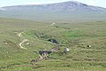
 Cape Wrath road - geograph.org.uk - 887732.jpg 640 × 499; 91 kB
-
 Cape Wrath road sign - geograph.org.uk - 993281.jpg 640 × 480; 61 kB
-
 Cape Wrath sea cliffs and Kearvaig - geograph.org.uk - 2976660.jpg 800 × 530; 92 kB
-
 Cape Wrath, inlet, about a half-mile SW of lighthouse - geograph.org.uk - 4761542.jpg 2.348 × 1.574; 4,16 MB
-
 Cape Wrath, Scotland - geograph.org.uk - 729351.jpg 427 × 640; 106 kB
-
 Cape Wrath, Scotland - geograph.org.uk - 729358.jpg 432 × 640; 108 kB
-
 Change of Rock Type - geograph.org.uk - 821683.jpg 640 × 427; 275 kB
-
 Cliff-edge by Cape Wrath - geograph.org.uk - 931667.jpg 640 × 480; 48 kB
-
 Cliffs East of Cape Wrath - geograph.org.uk - 931672.jpg 640 × 480; 44 kB
-
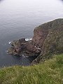
 Cliffs near Cape Wrath - geograph.org.uk - 76107.jpg 1.985 × 1.489; 860 kB
-
 Cliffs, east of Cape Wrath - geograph.org.uk - 782954.jpg 424 × 640; 57 kB
-
 Cnoc a' Gheodha Ruaidh - geograph.org.uk - 816013.jpg 640 × 480; 143 kB
-
 Coast south of Cape Wrath - geograph.org.uk - 816130.jpg 640 × 480; 151 kB
-
 Cul an Fhraochaidh - geograph.org.uk - 816145.jpg 640 × 480; 145 kB
-
 Daill - geograph.org.uk - 821755.jpg 640 × 416; 254 kB
-
 Dykes at Cape Wrath - geograph.org.uk - 821695.jpg 640 × 427; 256 kB
-
 Ferry across the Kyle of Durness - geograph.org.uk - 931682.jpg 640 × 480; 63 kB
-

-

-
 Ferry House and Kyle of Durness - geograph.org.uk - 821875.jpg 640 × 427; 219 kB
-
 Geodha an Fhuarain - geograph.org.uk - 821643.jpg 640 × 411; 247 kB
-
 Geological sketches, at home and abroad (1882) (14596061847).jpg 3.486 × 2.208; 1.006 kB
-
 HMS King Edward VII (1903) sinking on 6 January 1916.jpg 796 × 478; 115 kB
-

-

-
 Keoldale Kyle of Durness geograph-3192869-by-Ben-Brooksbank.jpg 1.517 × 795; 445 kB
-
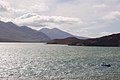
 Kyle of Durness - geograph.org.uk - 821852.jpg 640 × 332; 167 kB
-
 Kyle of Durness - geograph.org.uk - 821862.jpg 640 × 427; 236 kB
-
 Kyle of Durness - geograph.org.uk - 821867.jpg 640 × 427; 208 kB
-
 Kyle of Durness - geograph.org.uk - 887738.jpg 640 × 348; 69 kB
-
 Kyle of Durness and Faraid Head - geograph.org.uk - 821858.jpg 640 × 336; 163 kB
-
 Kyle of Durness.jpg 640 × 480; 48 kB
-
 Looking East from Cape Wrath - geograph.org.uk - 821701.jpg 640 × 412; 223 kB
-
 Looking south-east from Cape Wrath - geograph.org.uk - 863291.jpg 640 × 434; 45 kB
-
 Military post on way to ranges - geograph.org.uk - 497425.jpg 640 × 480; 86 kB
-
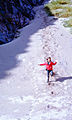
 Near Cape Wrath - geograph.org.uk - 53349.jpg 640 × 418; 76 kB
-

-
 One foot in the Atlantic - geograph.org.uk - 538963.jpg 640 × 427; 113 kB
-
 Ordnance Survey One-Inch Sheet 9 Cape Wrath, Published 1947.jpg 10.541 × 12.892; 12,96 MB
-
 Ordnance Survey One-Inch Sheet 9 Cape Wrath, Published 1959.jpg 8.235 × 9.879; 8,24 MB
-
 Ordnance Survey Quarter-inch sheet 2 North West Scotland, published 1962.jpg 9.632 × 8.933; 7,42 MB
-
 Ordnance Survey Quarter-inch sheet 3 Northern Scotland, published 1966.jpg 9.696 × 8.949; 8,98 MB
-
 Ordnance Survey Sheet NC 27 37 Cape Wrath, Published 1966.jpg 15.253 × 8.896; 39,8 MB
-
 Pauline, Cape Wrath, Scotland, 1965 - Flickr - PhillipC.jpg 897 × 1.496; 530 kB
-
 RAF Regiment Forward Air Controllers.jpg 2.700 × 1.216; 2,13 MB
-
 RAF Typhoon Dropping Paveway Bomb MOD 45155463.jpg 2.100 × 1.500; 1,73 MB
-
 RAF Typhoon Dropping Paveway Bomb MOD 45155467.jpg 2.100 × 1.500; 1,19 MB
-
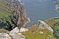
 Rocks at Cape Wrath - geograph.org.uk - 4761538.jpg 2.406 × 1.574; 3,98 MB
-
Royal Air Force Typhoon dropping a Paveway IV precision guided bomb.webm 32 s, 1.920 × 1.080; 4,4 MB
-
 Sea Stack - geograph.org.uk - 821645.jpg 640 × 420; 251 kB
-
 Sgribhis-bheinn - geograph.org.uk - 890614.jpg 640 × 480; 67 kB
-
 Southern slopes of Cnoc a'Gheodha Ruaidh - geograph.org.uk - 1759987.jpg 1.600 × 1.200; 418 kB
-
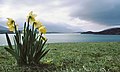 Springtime on the Kyle of Durness - geograph.org.uk - 742724.jpg 640 × 382; 65 kB
-
 Stack Clò Kearvaig - geograph.org.uk - 890311.jpg 640 × 490; 60 kB
-
 Swell washes over rocks to the west of Dunan Beag - geograph.org.uk - 5398477.jpg 1.920 × 1.275; 1,11 MB
-
 The Cape Wrath ferry - geograph.org.uk - 5786483.jpg 3.892 × 2.543; 1,55 MB
-
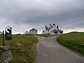
 The Cape Wrath Hotel - geograph.org.uk - 878505.jpg 640 × 452; 75 kB
-
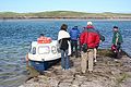 The Keoldale Ferry - geograph.org.uk - 821889.jpg 640 × 427; 260 kB
-
 The road to the Cape - geograph.org.uk - 886321.jpg 640 × 359; 48 kB
-

-
 Beyond the lighthouse - geograph.org.uk - 436771.jpg 640 × 427; 87 kB
-
 Cliffs beside Cape Wrath Lighthouse - geograph.org.uk - 304505.jpg 480 × 640; 82 kB
-
 Cnoc a'Gheodha Ruaidh - geograph.org.uk - 451950.jpg 640 × 427; 80 kB
-
 Junction of tracks - geograph.org.uk - 497647.jpg 640 × 480; 62 kB


_(14596061847).jpg)
_sinking_on_6_January_1916.jpg)


