Category:Caragabal, New South Wales
Jump to navigation
Jump to search
town in New South Wales, Australia  | |||||
| Upload media | |||||
| Instance of | |||||
|---|---|---|---|---|---|
| Location |
| ||||
| Population |
| ||||
| Elevation above sea level |
| ||||
 | |||||
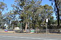
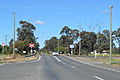
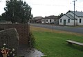
English: Caragabal (pronounced ) is a village and locality in New South Wales 413 kilometers west of Sydney. It is situated on flat country in the Weddin Shire, just beyond where the last slopes of the Great Dividing Range meet the plains of the Central West. The Barbingal Creek runs, after rain, along the south edge of the village parallel to the Mid-Western Highway. (→Caragabal)
Subcategories
This category has the following 4 subcategories, out of 4 total.
Media in category "Caragabal, New South Wales"
The following 18 files are in this category, out of 18 total.
-
 Caragabal Australia Day Sign.JPG 6,016 × 4,000; 12.12 MB
-
 Caragabal BBQ.JPG 6,016 × 4,000; 11.19 MB
-
 Caragabal Bowls Club 001.JPG 6,016 × 4,000; 10.88 MB
-
 Caragabal Bowls Club Gates.JPG 6,016 × 4,000; 10.69 MB
-
 Caragabal Grain Elevators.JPG 5,496 × 3,680; 9.1 MB
-
 Caragabal Hayson Square.JPG 6,016 × 4,000; 11.23 MB
-
 Caragabal Mid Western Highway Sign.JPG 6,016 × 4,000; 12.37 MB
-
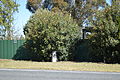 Caragabal Milestone 001.JPG 6,016 × 4,000; 11.19 MB
-
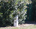
 Caragabal Milestone 002.JPG 6,016 × 4,000; 12.31 MB
-
 Caragabal Milestone 003.JPG 3,424 × 2,776; 4.19 MB
-
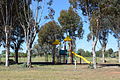 Caragabal Playground 001.JPG 6,016 × 4,000; 11.3 MB
-
 Caragabal Public School 001.JPG 6,016 × 4,000; 11.33 MB
-
 Caragabal Rail Crossing 001.JPG 5,672 × 3,792; 8.29 MB
-
 Caragabal Rail Crossing 002.JPG 6,016 × 4,000; 9.63 MB
-
 Caragabal Railway Line.JPG 6,016 × 4,000; 8.61 MB
-
 Caragabal Town Entry Sign 001.JPG 6,016 × 4,000; 9.97 MB
-
 Caragabal1.jpg 800 × 556; 122 KB
-
 Caragabal2.jpg 411 × 155; 13 KB


