Category:Castlethorpe
Aller à la navigation
Aller à la recherche
English: Castlethorpe is a village and civil parish with a population of about 1000 in the Borough of Milton Keynes (ceremonial Buckinghamshire), England. It lies about three miles north of Stony Stratford, four miles west of Newport Pagnell and seven miles north of Central Milton Keynes. It is separated from the county of Northamptonshire by the River Tove.
Nederlands: Castlethorpe is een plaats in het bestuurlijke gebied Milton Keynes, in het Engelse graafschap Buckinghamshire. De plaats telt ongeveer 1000 inwoners.
Norsk bokmål: Castlethorpe er en landsby i Buckinghamshire, England. Den ligger omkring 5 km nord for Stony Stratford og 7 km vest for Newport Pagnell, og administreres som en del av den enhetlige myndigheten Milton Keynes. Landsbyen ligger helt på grensen til Northamptonshire, som markeres av en liten bekk.
village britannique  | |||||
| Téléverser des médias | |||||
| Nature de l’élément | |||||
|---|---|---|---|---|---|
| Lieu | Milton Keynes (borough), Buckinghamshire, Angleterre du Sud-Est, Angleterre | ||||
| Population |
| ||||
 | |||||
Sous-catégories
Cette catégorie comprend 4 sous-catégories, dont les 4 ci-dessous.
C
- Castlethorpe railway station (3 F)
- Castlethorpe War Memorial (1 F)
Média dans la catégorie « Castlethorpe »
Cette catégorie comprend 189 fichiers, dont les 189 ci-dessous.
-
 A fine mature hedge - geograph.org.uk - 6712285.jpg 1 024 × 575 ; 113 kio
-
 A finger of forest amid the arable - geograph.org.uk - 3493992.jpg 1 600 × 1 070 ; 586 kio
-

-
 A little lake on a Tove tributary - geograph.org.uk - 3494010.jpg 1 600 × 1 067 ; 442 kio
-
 A very big field - geograph.org.uk - 4360350.jpg 640 × 430 ; 53 kio
-
 A very large field - geograph.org.uk - 4853703.jpg 640 × 426 ; 31 kio
-
 Arable landscape - geograph.org.uk - 5366799.jpg 640 × 426 ; 33 kio
-
 Arriving into Castlethorpe from the south - geograph.org.uk - 5387927.jpg 5 202 × 3 465 ; 3,7 Mio
-
 Bridge over the WCML - geograph.org.uk - 3634958.jpg 640 × 392 ; 67 kio
-
 Bridge over the West Coast mainline with assorted masts - geograph.org.uk - 3493974.jpg 1 600 × 1 071 ; 450 kio
-
 Bus heading along Wolverton Road - geograph.org.uk - 4741843.jpg 800 × 545 ; 133 kio
-
 Business Units at Lodge Farm - geograph.org.uk - 4542234.jpg 4 000 × 1 576 ; 1,57 Mio
-
 Carrington Arms - geograph.org.uk - 2953411.jpg 426 × 640 ; 63 kio
-
 Carrington Arms, Castlethorpe - geograph.org.uk - 5387954.jpg 5 202 × 3 465 ; 3,61 Mio
-
 Castle bailey - geograph.org.uk - 4109765.jpg 1 024 × 683 ; 287 kio
-
 Castle motte - geograph.org.uk - 4109760.jpg 1 024 × 683 ; 252 kio
-
 Castlethorpe - geograph.org.uk - 299704.jpg 640 × 438 ; 109 kio
-
 Castlethorpe Cottage - geograph.org.uk - 446366.jpg 640 × 480 ; 82 kio
-
 Castlethorpe Cutting - geograph.org.uk - 3634950.jpg 640 × 342 ; 60 kio
-
 Castlethorpe Cutting - geograph.org.uk - 3634954.jpg 640 × 422 ; 60 kio
-
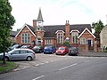
 Castlethorpe First School - geograph.org.uk - 4109778.jpg 1 024 × 683 ; 229 kio
-
 Castlethorpe Mill - geograph.org.uk - 299123.jpg 640 × 393 ; 87 kio
-

-
 Castlethorpe Road Junction - geograph.org.uk - 6336005.jpg 1 600 × 894 ; 428 kio
-
 Castlethorpe School - geograph.org.uk - 446345.jpg 640 × 480 ; 94 kio
-
 Castlethorpe Village Hall - geograph.org.uk - 2382767.jpg 2 272 × 1 704 ; 1,55 Mio
-
 Castlethorpe Village Hall - geograph.org.uk - 6335998.jpg 1 600 × 1 074 ; 529 kio
-
 Castlethorpe village shop - geograph.org.uk - 5387947.jpg 5 202 × 3 465 ; 3,49 Mio
-
 Castlethorpe war memorial - geograph.org.uk - 5387998.jpg 5 202 × 3 465 ; 4,85 Mio
-
 Castlethorpe water tower - geograph.org.uk - 5388040.jpg 5 202 × 3 465 ; 3,21 Mio
-
 Castlethorpe Water Tower - geograph.org.uk - 5708449.jpg 640 × 425 ; 28 kio
-
 Castlethorpe. Green at the junction of Station Rd and North St - geograph.org.uk - 5387937.jpg 5 202 × 3 465 ; 4,73 Mio
-
 Chantry Farm - geograph.org.uk - 2850550.jpg 640 × 430 ; 23 kio
-
 Chantry Farm - geograph.org.uk - 3639996.jpg 640 × 430 ; 40 kio
-
 Chantry Farm - geograph.org.uk - 3872778.jpg 640 × 430 ; 38 kio
-
 Church tower from the earthworks - geograph.org.uk - 2953395.jpg 480 × 640 ; 110 kio
-
 Circular Ride goes by the beef - geograph.org.uk - 3494038.jpg 1 600 × 1 068 ; 556 kio
-
 Country lane to the village of Ashton - geograph.org.uk - 4742750.jpg 800 × 650 ; 162 kio
-
 Countryside by the Mainline - geograph.org.uk - 3872866.jpg 640 × 430 ; 45 kio
-
 Cross paths - geograph.org.uk - 3494023.jpg 1 600 × 1 069 ; 602 kio
-
 Cutting near Castlethorpe - geograph.org.uk - 3634966.jpg 640 × 372 ; 60 kio
-
 Cycle network route 6 at Castlethorpe - geograph.org.uk - 5388009.jpg 5 202 × 3 465 ; 4,42 Mio
-
 Cycle route 6 bridge over the railway near Castlethorpe - geograph.org.uk - 5388024.jpg 5 202 × 3 465 ; 4,06 Mio
-
 Cycle route number 6 - geograph.org.uk - 2953401.jpg 480 × 640 ; 85 kio
-
 Disused bridge under the railway - geograph.org.uk - 5388052.jpg 5 202 × 3 465 ; 5 Mio
-
 Disused water tower - geograph.org.uk - 4109949.jpg 768 × 1 024 ; 196 kio
-
 Drive and footpath to Lower Balney Grounds - geograph.org.uk - 2679085.jpg 640 × 480 ; 42 kio
-
 Extensive farmland - geograph.org.uk - 3872830.jpg 640 × 316 ; 25 kio
-
 Extensive Farmland - geograph.org.uk - 4360347.jpg 640 × 430 ; 51 kio
-
 Fallow field - geograph.org.uk - 4853651.jpg 640 × 426 ; 47 kio
-
 Farming landscape - geograph.org.uk - 3640004.jpg 640 × 363 ; 33 kio
-
 Farmland - geograph.org.uk - 4360359.jpg 640 × 430 ; 50 kio
-
 Farmland - geograph.org.uk - 4916904.jpg 640 × 426 ; 51 kio
-
 Farmland and hedges - geograph.org.uk - 4360363.jpg 640 × 360 ; 38 kio
-
 Farmland by the East Coast Main Line - geograph.org.uk - 4360357.jpg 640 × 430 ; 49 kio
-
 Farmland by the mainline - geograph.org.uk - 3872840.jpg 640 × 365 ; 43 kio
-
 Farmland by the WCML - geograph.org.uk - 3634978.jpg 640 × 387 ; 31 kio
-
 Farmland by the WCML - geograph.org.uk - 3634983.jpg 640 × 531 ; 49 kio
-
 Farmland by the West Coast Main Line - geograph.org.uk - 2738316.jpg 640 × 361 ; 30 kio
-
 Farmland by the West Coast Main Line - geograph.org.uk - 2738332.jpg 640 × 430 ; 39 kio
-
 Farmland by the West Coast Main Line - geograph.org.uk - 2738335.jpg 640 × 311 ; 29 kio
-
 Farmland by the West Coast Main Line - geograph.org.uk - 2738337.jpg 640 × 497 ; 37 kio
-
 Farmland by the West Coast Main Line - geograph.org.uk - 2855074.jpg 640 × 331 ; 26 kio
-
 Farmland by the West Coast Main Line - geograph.org.uk - 4765327.jpg 640 × 426 ; 39 kio
-
 Farmland by the West Coast Main Line - geograph.org.uk - 4853707.jpg 640 × 426 ; 44 kio
-
 Farmland by WCML - geograph.org.uk - 4916886.jpg 640 × 426 ; 48 kio
-
 Farmland by WCML - geograph.org.uk - 4916899.jpg 640 × 426 ; 42 kio
-
 Farmland by WCML - geograph.org.uk - 6502908.jpg 1 024 × 681 ; 81 kio
-
 Farmland by WCML - geograph.org.uk - 6712275.jpg 1 024 × 684 ; 103 kio
-
 Farmland in the River Tove valley - geograph.org.uk - 4742749.jpg 800 × 600 ; 216 kio
-
 Farmland near Castlethorpe - geograph.org.uk - 2738323.jpg 640 × 373 ; 34 kio
-
 Farmland near Castlethorpe - geograph.org.uk - 4853705.jpg 640 × 426 ; 36 kio
-
 Farmland near Lincoln Lodge - geograph.org.uk - 4343720.jpg 640 × 430 ; 34 kio
-
 Farmland near Lodge Farm - geograph.org.uk - 2855059.jpg 640 × 430 ; 36 kio
-
 Farmland near New Farm - geograph.org.uk - 2738338.jpg 640 × 430 ; 31 kio
-
 Farmland on the edge of Castlethorpe - geograph.org.uk - 3872843.jpg 640 × 325 ; 35 kio
-
 Farmland view - geograph.org.uk - 2855072.jpg 640 × 350 ; 34 kio
-
 Farmland, Hungate - geograph.org.uk - 4765322.jpg 640 × 426 ; 54 kio
-
 Farmland, Lincoln Lodge - geograph.org.uk - 2738326.jpg 640 × 362 ; 28 kio
-
 Field near Castlethorpe - geograph.org.uk - 4765320.jpg 640 × 426 ; 51 kio
-
 Fields and Paths by the WCML - geograph.org.uk - 4542241.jpg 3 439 × 2 454 ; 2,1 Mio
-
 Fields south of Hungate End, from the railway - geograph.org.uk - 3343666.jpg 1 024 × 668 ; 51 kio
-
 Flying Scotsman by Lodge Farm business park - geograph.org.uk - 5346726.jpg 1 600 × 1 067 ; 399 kio
-
 Foot tunnel under the west coast main line - geograph.org.uk - 2915070.jpg 640 × 480 ; 147 kio
-
 Footbridge over River Great Ouse. - geograph.org.uk - 5388154.jpg 5 202 × 3 465 ; 4,78 Mio
-
 Footbridge, WCML - geograph.org.uk - 3634972.jpg 640 × 430 ; 69 kio
-
 Footplank on the Cosgrove path - geograph.org.uk - 2915087.jpg 640 × 427 ; 102 kio
-
 Fox Covert Lane - geograph.org.uk - 4109907.jpg 1 024 × 768 ; 303 kio
-
 Gorilla graffiti - geograph.org.uk - 4109956.jpg 1 024 × 768 ; 393 kio
-
 Grange Farm - geograph.org.uk - 2850552.jpg 640 × 365 ; 22 kio
-
 Grange Farm - geograph.org.uk - 4916911.jpg 640 × 344 ; 26 kio
-
 Grange Farm - geograph.org.uk - 4916914.jpg 640 × 352 ; 30 kio
-
 Grange Farm - geograph.org.uk - 6720784.jpg 1 024 × 684 ; 128 kio
-
 Grove of trees by Lincoln Grounds - geograph.org.uk - 3493963.jpg 1 600 × 1 068 ; 551 kio
-
 Hanslope Circular Ride - geograph.org.uk - 3494036.jpg 1 600 × 1 068 ; 778 kio
-
 Happy Campers - geograph.org.uk - 439448.jpg 640 × 480 ; 126 kio
-
 Hedge and headland strip - geograph.org.uk - 4853654.jpg 640 × 426 ; 44 kio
-
 Hedges and strips - geograph.org.uk - 5366800.jpg 640 × 426 ; 29 kio
-
 Home Farm - geograph.org.uk - 439460.jpg 640 × 480 ; 78 kio
-
 Houses on the Haversham road - geograph.org.uk - 2953402.jpg 640 × 427 ; 80 kio
-
 Hungate End Farm - geograph.org.uk - 2850557.jpg 640 × 368 ; 39 kio
-
 Hungate End Farm - geograph.org.uk - 3634985.jpg 640 × 338 ; 30 kio
-
 Hungate End Farm - geograph.org.uk - 3872829.jpg 640 × 430 ; 39 kio
-
 In a cutting, WCML - geograph.org.uk - 4916920.jpg 640 × 426 ; 81 kio
-
 In a cutting, West Coast Main Line - geograph.org.uk - 4853643.jpg 640 × 426 ; 107 kio
-
 In Castlethorpe Cutting - geograph.org.uk - 4916897.jpg 640 × 426 ; 52 kio
-
 Industrial units, Lodge Farm - geograph.org.uk - 2855065.jpg 640 × 289 ; 27 kio
-
 Lake near Chantry Farm - geograph.org.uk - 2850546.jpg 640 × 312 ; 23 kio
-
 Lake near Chantry Farm - geograph.org.uk - 3872776.jpg 640 × 430 ; 45 kio
-
 Large crop field near Lincoln Lodge - geograph.org.uk - 2496306.jpg 640 × 430 ; 48 kio
-
 Large field - geograph.org.uk - 4765318.jpg 640 × 507 ; 37 kio
-
 Large field by the WCML - geograph.org.uk - 3634934.jpg 640 × 372 ; 31 kio
-
 Large field of Oilseed Rape - geograph.org.uk - 2496314.jpg 640 × 430 ; 48 kio
-
 Large Wheat field near Castlethorpe - geograph.org.uk - 2496302.jpg 640 × 430 ; 52 kio
-
 Lincoln Lodge - geograph.org.uk - 4360354.jpg 640 × 430 ; 48 kio
-
 Lincoln Lodge Cottage - geograph.org.uk - 4360355.jpg 640 × 430 ; 50 kio
-
 Lincoln Lodge Farm and business units - geograph.org.uk - 3494003.jpg 1 600 × 1 068 ; 474 kio
-
 Lincoln Lodge Farm from the railway - geograph.org.uk - 5042903.jpg 1 600 × 832 ; 93 kio
-
 Little used footpath - geograph.org.uk - 3494015.jpg 1 600 × 1 067 ; 461 kio
-
 Lodge Farm - geograph.org.uk - 3634941.jpg 640 × 323 ; 46 kio
-
 Lodge Farm Business Park - geograph.org.uk - 4916892.jpg 640 × 317 ; 29 kio
-
 Lodge Farm Business Park - geograph.org.uk - 6502903.jpg 1 024 × 616 ; 74 kio
-
 Lodge Farm Business Park - geograph.org.uk - 6712278.jpg 1 024 × 563 ; 96 kio
-
 Long narrow field - geograph.org.uk - 5708461.jpg 640 × 426 ; 28 kio
-
 Mast by the WCML - geograph.org.uk - 3634938.jpg 640 × 430 ; 56 kio
-
 Mature hedge - geograph.org.uk - 6502904.jpg 1 024 × 388 ; 76 kio
-
 Midlands countryside - geograph.org.uk - 4765325.jpg 640 × 353 ; 38 kio
-
 Midlands farmland - geograph.org.uk - 4765326.jpg 640 × 352 ; 31 kio
-
 Milton Keynes Boundary Walk and the West Coast mainline - geograph.org.uk - 3494030.jpg 1 600 × 1 068 ; 480 kio
-
 Milton Keynes Boundary Walk crossing farmland - geograph.org.uk - 4742736.jpg 800 × 600 ; 185 kio
-
 Milton Keynes Boundary Walk meets the circular ride - geograph.org.uk - 3494026.jpg 1 600 × 1 066 ; 789 kio
-
 Narrow field - geograph.org.uk - 4853653.jpg 640 × 426 ; 52 kio
-
 National Cycle Route 6 - geograph.org.uk - 4761442.jpg 640 × 480 ; 51 kio
-
 National cycle route No 6 - geograph.org.uk - 2677262.jpg 640 × 480 ; 119 kio
-
 NCN route 6 - geograph.org.uk - 4109921.jpg 1 024 × 768 ; 325 kio
-
 New Farm from the Circular Ride - geograph.org.uk - 3494019.jpg 1 600 × 1 067 ; 553 kio
-
 Oilseed Rape near Gordon's Lodge - geograph.org.uk - 2496317.jpg 640 × 430 ; 50 kio
-
 Old Chapel, Castlethorpe - geograph.org.uk - 1038932.jpg 640 × 370 ; 59 kio
-
 Otley Farm - geograph.org.uk - 6502897.jpg 1 024 × 681 ; 83 kio
-
 Path across the fields towards Cosgrove - geograph.org.uk - 2915076.jpg 640 × 427 ; 72 kio
-
 Path from Castlethorpe to Haversham - geograph.org.uk - 5388020.jpg 5 202 × 3 465 ; 4 Mio
-
 Path from Haversham approaching Castlethorpe - geograph.org.uk - 5388015.jpg 5 202 × 3 465 ; 3,36 Mio
-
 Path to Castlethorpe by Upper Balney Grounds - geograph.org.uk - 3122650.jpg 1 600 × 1 067 ; 688 kio
-
 Path to Footbridge, Castlethorpe - geograph.org.uk - 1038938.jpg 640 × 480 ; 107 kio
-
 Path to Lower Balney Grounds - geograph.org.uk - 3122653.jpg 1 600 × 1 068 ; 548 kio
-
 Path to the Medieval fortifications - geograph.org.uk - 2953393.jpg 480 × 640 ; 82 kio
-
 Path to Wolverton - geograph.org.uk - 2953400.jpg 640 × 427 ; 86 kio
-
 Path towards River Tove - geograph.org.uk - 5388048.jpg 5 202 × 3 465 ; 3,95 Mio
-
 Railway Arch - geograph.org.uk - 446406.jpg 640 × 480 ; 128 kio
-
 Railway Bank and Arch - geograph.org.uk - 446414.jpg 640 × 480 ; 121 kio
-
 Railway bridge near Lodge farm - geograph.org.uk - 5388046.jpg 5 202 × 3 465 ; 2,32 Mio
-
 Railway cutting, Pindon Manor Farm - geograph.org.uk - 3639991.jpg 640 × 472 ; 63 kio
-
 Remains of Castlethorpe station with northbound Pendolino - geograph.org.uk - 5387983.jpg 5 202 × 3 465 ; 3,06 Mio
-
 River Tove - geograph.org.uk - 299091.jpg 640 × 455 ; 125 kio
-
 River Tove, Castlethorpe - geograph.org.uk - 6325515.jpg 1 280 × 851 ; 313 kio
-
 Road to Hanslope and the village sign - geograph.org.uk - 2953391.jpg 640 × 427 ; 89 kio
-
 Road towards Milton Leys farm. Part of Hanslope Circular ride. - geograph.org.uk - 5387932.jpg 5 202 × 3 465 ; 3,69 Mio
-
 Rolling farmland - geograph.org.uk - 6720785.jpg 1 024 × 684 ; 78 kio
-
 Route 6 - geograph.org.uk - 437874.jpg 640 × 480 ; 102 kio
-
 Rusty Water Tower - geograph.org.uk - 437871.jpg 480 × 640 ; 70 kio
-
 Seat by the railway bridge near Castlethorpe - geograph.org.uk - 5388029.jpg 5 202 × 3 465 ; 3,99 Mio
-
 Sheep by the railway - geograph.org.uk - 232968.jpg 640 × 480 ; 94 kio
-
 Sheltered corridor for the Circular Ride - geograph.org.uk - 3494041.jpg 1 600 × 1 068 ; 630 kio
-

-
 Snowscene north of Castlethorpe - geograph.org.uk - 2239662.jpg 640 × 374 ; 57 kio
-
 Snowscene south of Lodge Farm - geograph.org.uk - 2245028.jpg 640 × 428 ; 70 kio
-
 South St Castlethorpe, north end - geograph.org.uk - 5388006.jpg 5 202 × 3 465 ; 4,26 Mio
-
 South Street Castlethorpe, western end - geograph.org.uk - 5387964.jpg 5 202 × 3 465 ; 3,63 Mio
-
 South Street. Castlethorpe - geograph.org.uk - 1038921.jpg 640 × 477 ; 61 kio
-
 St Simon and St Judes, Castlethorpe - geograph.org.uk - 5387990.jpg 5 202 × 3 465 ; 3,87 Mio
-
 St.Simon ^ St.Jude's church - geograph.org.uk - 4109745.jpg 1 024 × 683 ; 217 kio
-
 St.Simon ^ St.Jude's church - geograph.org.uk - 4109772.jpg 1 024 × 683 ; 223 kio
-
 Stone bus shelter - geograph.org.uk - 2953397.jpg 640 × 427 ; 93 kio
-
 The drive to Lincoln Lodge - geograph.org.uk - 3494000.jpg 1 600 × 1 067 ; 585 kio
-
 The Great Ouse and Cosgrove Leisure Park - geograph.org.uk - 6014282.jpg 1 600 × 1 066 ; 293 kio
-
 The River Ouse - geograph.org.uk - 446294.jpg 640 × 480 ; 141 kio
-
 Top of Station Road, Castlethorpe - geograph.org.uk - 6326718.jpg 1 280 × 851 ; 388 kio
-
 Track to Grange Farm - geograph.org.uk - 4916909.jpg 640 × 398 ; 44 kio
-
 Track to Higham Cross - geograph.org.uk - 3493967.jpg 1 200 × 1 600 ; 768 kio
-
 View across the River Tove valley - geograph.org.uk - 4742742.jpg 800 × 590 ; 154 kio
-
 View from the WCML - geograph.org.uk - 3634970.jpg 640 × 390 ; 46 kio
-
 Village shop - geograph.org.uk - 2953390.jpg 640 × 426 ; 89 kio
-
 War memorial - geograph.org.uk - 2953396.jpg 480 × 640 ; 148 kio
-

-

-
 West Coast Mainline - geograph.org.uk - 4109915.jpg 1 024 × 768 ; 384 kio
-
 West Coast Mainline - geograph.org.uk - 437879.jpg 640 × 480 ; 87 kio
-
 Wide Track - geograph.org.uk - 439491.jpg 640 × 480 ; 84 kio
-
 Wolverton Road - geograph.org.uk - 2677256.jpg 640 × 480 ; 76 kio


