Category:Buckinghamshire
Jump to navigation
Jump to search
Ceremonial counties of England: Bedfordshire · Berkshire · Buckinghamshire · Cambridgeshire · Cheshire · Cornwall · Cumbria · Derbyshire · Devon · Dorset · Durham · East Riding of Yorkshire · East Sussex · Essex · Gloucestershire · Greater London · Greater Manchester · Hampshire · Herefordshire · Hertfordshire · Isle of Wight · Kent · Lancashire · Leicestershire · Lincolnshire · Merseyside · Norfolk · North Yorkshire · Northamptonshire · Northumberland · Nottinghamshire · Oxfordshire · Rutland · Shropshire · Somerset · South Yorkshire · Staffordshire · Suffolk · Surrey · Tyne and Wear · Warwickshire · West Midlands · West Sussex · West Yorkshire · Wiltshire · Worcestershire
City-counties: Bristol · City of London
Former historic counties: Cumberland · Huntingdonshire · London · Middlesex · North Riding of Yorkshire · Sussex · West Riding of Yorkshire · Westmorland · Yorkshire
Other former counties: Avon · Cambridgeshire and Isle of Ely · Cleveland · East Suffolk · Hereford and Worcester · Hexhamshire · Humberside · Huntingdon and Peterborough · Isle of Ely · Parts of Holland · Parts of Kesteven · Parts of Lindsey · Soke of Peterborough · West Suffolk
ceremonial county in England, UK (use Q21694636 for administrative unitary authority)  Вид города Марлоу     | |||||
| Upload media | |||||
| Instance of |
| ||||
|---|---|---|---|---|---|
| Location |
| ||||
| Capital | |||||
| Population |
| ||||
| Area |
| ||||
| Different from | |||||
| Said to be the same as | Buckinghamshire (historic county of England, ceremonial county of England, 1844) | ||||
| official website | |||||
 | |||||
Subcategories
This category has the following 40 subcategories, out of 40 total.
*
- Valued images of Buckinghamshire (16 F)
- Videos from Buckinghamshire (1 F)
A
- Buckinghamshire in art (10 F)
B
- Borstall Duck Decoy (2 F)
C
- Campsites in Buckinghamshire (5 F)
E
G
H
I
L
M
N
- Night in Buckinghamshire (17 F)
O
P
S
T
V
Media in category "Buckinghamshire"
The following 108 files are in this category, out of 108 total.
-
 Amersham And Wycombe College.jpg 500 × 375; 64 KB
-
 Aylesbury Grammar School.jpg 2,048 × 1,536; 554 KB
-
 Aylesbury Vale 1.jpg 640 × 480; 46 KB
-
 Bray Lock on the Thames river..jpg 2,048 × 1,536; 948 KB
-
 Buckinghamshire Banner.jpg 3,888 × 556; 541 KB
-
 Buckinghamshire Council makeup.svg 360 × 185; 10 KB
-
 Bucks-Beds County Boundary Marker - geograph.org.uk - 1550013.jpg 480 × 640; 177 KB
-
 Canel (92286621).jpg 400 × 267; 42 KB
-
 Cetonia aurata 2018-07-11.jpg 1,200 × 800; 636 KB
-
 Cherrypiecadsden.jpg 800 × 220; 91 KB
-
 CheshamPondParkView.jpg 1,950 × 1,728; 2.03 MB
-
 Chiltern Hills winter view from Coombe Hill.jpg 1,584 × 1,980; 3.56 MB
-
 County Boundary marker Bucks and Oxfordshire at Finmere - geograph.org.uk - 2564174.jpg 1,174 × 1,348; 594 KB
-
 Fenny Poppers Festival, Aylesbury Street, Fenny Stratford.jpg 800 × 533; 519 KB
-
 Francis Hastings, 2nd Earl of Huntingdon.jpg 3,358 × 5,072; 12.06 MB
-
-

-
 Funeral hatchment for Frances Pigot in St Giles' church Stoke Poges Buckinghamshire UK.jpg 3,353 × 3,350; 4.15 MB
-

-
 Funeral hatchment for Granville Penn in St Giles' church Stoke Poges Buckinghamshire UK.jpg 3,402 × 3,093; 4.59 MB
-

-
 Funeral hatchment for John Penn in St Giles' church Stoke Poges Buckinghamshire UK.jpg 3,369 × 3,449; 4.3 MB
-

-

-
 Funeral hatchment for Sophia Gomm in St Giles' church Stoke Poges Buckinghamshire UK.jpg 3,394 × 3,383; 5.2 MB
-
 Funeral hatchment for Thomas Dawson in St Giles' church Stoke Poges Buckinghamshire UK.jpg 3,841 × 3,308; 4.82 MB
-
 Funeral hatchment for Thomas Penn in St Giles' church Stoke Poges Buckinghamshire UK.jpg 3,312 × 3,342; 3.41 MB
-
 Glen Island head (Nancy).JPG 3,456 × 2,592; 3.99 MB
-
 GOC Cholesbury to Chartridge 005 Landscape (43962043652).jpg 4,608 × 3,456; 5.5 MB
-
 GOC Cholesbury to Chartridge 006 Landscape (29073463717).jpg 4,608 × 3,456; 5.58 MB
-
 GOC Cholesbury to Chartridge 007 Landscape (43962039222).jpg 4,608 × 3,456; 5.22 MB
-
 GOC Cholesbury to Chartridge 011 Landscape (29073459387).jpg 4,608 × 3,456; 5.85 MB
-
 GOC Cholesbury to Chartridge 016 Landscape (43563090264).jpg 4,608 × 3,456; 5.4 MB
-
 GOC Cholesbury to Chartridge 017 Landscape (43563086814).jpg 4,608 × 3,456; 5.57 MB
-
 GOC Cholesbury to Chartridge 018 Landscape (42472301850).jpg 4,608 × 3,456; 5.43 MB
-
 GOC Cholesbury to Chartridge 025 Landscape (42494584730).jpg 4,608 × 3,456; 5.45 MB
-
 GOC Cholesbury to Chartridge 027 Which way?! (44302302201).jpg 4,608 × 3,456; 4.65 MB
-
 GOC Cholesbury to Chartridge 031 Landscape (43792546495).jpg 4,608 × 3,456; 5.73 MB
-
 GOC Cholesbury to Chartridge 032 Landscape (43983796404).jpg 4,608 × 3,456; 5.98 MB
-
 GOC Cholesbury to Chartridge 035 Buckland Common (42892216890).jpg 3,746 × 2,811; 3.07 MB
-
 GOC Cholesbury to Chartridge 046 Hawridge (29888226157).jpg 3,465 × 2,601; 2.95 MB
-
 GOC Cholesbury to Chartridge 050 Cholesbury (29905259867).jpg 3,312 × 2,486; 3.1 MB
-
 GOC Tring 058 Buckinghamshire! (8184977755).jpg 4,288 × 3,216; 7.22 MB
-
 Greg Ritchie graph.png 520 × 343; 11 KB
-
 Haleacre.jpg 453 × 604; 35 KB
-
 Hedsor Water re-entering the Thames at Cookham Lock(Nancy).JPG 3,456 × 2,592; 4.19 MB
-
 Iron Age coin , potin of the Cantiaci (obverse) (FindID 642270).jpg 964 × 949; 701 KB
-
 Journey through the Morning of the World (46322179844).jpg 3,020 × 1,980; 1.57 MB
-
 Landing Strip, nr Tingewick - geograph.org.uk - 1046176.jpg 640 × 474; 44 KB
-
 Little Kimble - panoramio.jpg 1,687 × 1,200; 1.25 MB
-
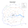
 London Ringway 4 1960s Plan.png 1,871 × 1,871; 460 KB
-
 London Ringways Plan.png 8,858 × 8,858; 1.75 MB
-
 London Ringways Plan.svg 4,486 × 4,189; 223 KB
-
 Lucy Howard funeral hatchment in St Giles' church Stoke Poges Buckinghamshire UK.jpg 3,395 × 3,461; 4.43 MB
-
 Map showing the traditional, geographical county of Buckinghamshire, England.png 4,967 × 4,967; 4.39 MB
-
 Miniature temple (37399603641).jpg 1,600 × 1,164; 1.18 MB
-
 My Garden Shed 2 (92284162).jpg 400 × 253; 42 KB
-
 North Dean Village Hall - geograph.org.uk - 107385.jpg 640 × 480; 103 KB
-
 North Marsden school (2005).jpg 1,795 × 1,196; 484 KB
-
 Offers Accepted for Quick Sale - geograph.org.uk - 1046394.jpg 640 × 480; 91 KB
-
 Old A421 at Finmere - geograph.org.uk - 1046136.jpg 640 × 478; 58 KB
-
 Penn Wood (6185639156).jpg 1,067 × 1,600; 751 KB
-

-
 Ridgeway View - panoramio.jpg 1,600 × 1,200; 711 KB
-
 Sheds nr Gawcott - geograph.org.uk - 1046381.jpg 640 × 480; 49 KB
-
 Stile on the footpath to Bernwood Forest - geograph.org.uk - 1710918.jpg 1,500 × 1,000; 328 KB
-
 The Gateway, Gatehouse Road, Aylesbury.jpg 4,128 × 3,096; 5.3 MB
-
 The playing fields at Henley College - geograph.org.uk - 97333.jpg 640 × 480; 94 KB
-
 View from the Fort - panoramio.jpg 1,600 × 1,200; 504 KB
-
 View of the church from Marlow Bridge - panoramio - fitzyt.jpg 1,920 × 1,080; 816 KB
-
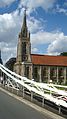 View of the church from Marlow Bridge - panoramio.jpg 1,080 × 1,920; 361 KB
-
 View of the Thames from Marlow Bridge - panoramio.jpg 1,920 × 1,080; 439 KB
-
 Worminghall Road looking North - geograph.org.uk - 1055560.jpg 640 × 327; 55 KB
-
 Abbey House Entrance - geograph.org.uk - 313585.jpg 640 × 480; 93 KB
-
 Across the M40 - geograph.org.uk - 327156.jpg 640 × 478; 132 KB
-
 After the loggers have gone ... - geograph.org.uk - 1187572.jpg 480 × 640; 200 KB
-
 Chiltern Group site, Hughenden Valley - geograph.org.uk - 124500.jpg 640 × 480; 178 KB
-
 Chilterns Vineyard - geograph.org.uk - 61410.jpg 640 × 480; 175 KB
-

-
 England Training Ground Bisham Abbey - geograph.org.uk - 306688.jpg 640 × 480; 113 KB
-
 Evershaw Grange - geograph.org.uk - 313574.jpg 640 × 480; 118 KB
-
 Foot tunnel beneath railway embankment - geograph.org.uk - 96972.jpg 640 × 480; 108 KB
-
 Gallops, Wendover Dean Stables - geograph.org.uk - 232869.jpg 640 × 480; 99 KB
-
 Hay bales near Runt's wood - geograph.org.uk - 714026.jpg 640 × 425; 72 KB
-
 Hedge with hawthorn, near Haddenham - geograph.org.uk - 43185.jpg 640 × 480; 141 KB
-
 Herberts Hole - old hedge, new hedge - geograph.org.uk - 111020.jpg 480 × 640; 171 KB
-
 Hilton Hotel, Milton Keynes - geograph.org.uk - 195343.jpg 640 × 480; 80 KB
-
 Horse Paddock - geograph.org.uk - 211867.jpg 640 × 480; 122 KB
-

-
 Marker and Fence Posts - geograph.org.uk - 181252.jpg 480 × 640; 140 KB
-
 Notice Board - geograph.org.uk - 208761.jpg 640 × 480; 159 KB
-
 Picnic Site, Cockshoots Wood - geograph.org.uk - 167393.jpg 640 × 480; 141 KB
-
 Pond bay near Greatmoor - geograph.org.uk - 485565.jpg 640 × 480; 117 KB
-
 Pond bay near Greatmoor 2 - geograph.org.uk - 485571.jpg 640 × 480; 97 KB
-
 Pond bay near Greatmoor 3 - geograph.org.uk - 486466.jpg 640 × 480; 120 KB
-
 Prestwood Nature Reserve - geograph.org.uk - 124495.jpg 640 × 480; 163 KB
-
 Private road near Westcott - geograph.org.uk - 413261.jpg 640 × 480; 74 KB
-
 Radio Mast in Evershaw Copse - geograph.org.uk - 313610.jpg 480 × 640; 126 KB
-
 Rayners Avenue Mobile Home Park - geograph.org.uk - 82400.jpg 640 × 480; 113 KB
-
 Reconstruction work, Gibraltar, Bucks - geograph.org.uk - 247510.jpg 480 × 640; 101 KB
-
 Reedbed, Aylesbury Arm - geograph.org.uk - 243193.jpg 498 × 640; 111 KB
-
 Sand pit at Hedgerley - geograph.org.uk - 162738.jpg 640 × 480; 377 KB
-
 Shenley Hill Farm Paddock - geograph.org.uk - 208785.jpg 640 × 480; 144 KB
-
 South Heath, Redding Wick Moat - geograph.org.uk - 110245.jpg 640 × 480; 178 KB
-
 Stowe, Lord Cobham's Pillar - geograph.org.uk - 154697.jpg 640 × 480; 87 KB
-
 The Moor, Cookham - geograph.org.uk - 82798.jpg 597 × 400; 67 KB
-
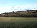 The western edge of High Wycombe - geograph.org.uk - 98252.jpg 640 × 480; 88 KB
-
 Towpath, Aylesbury Arm - geograph.org.uk - 243185.jpg 480 × 640; 139 KB


.jpg)


_in_St_Giles%27_church_Stoke_Poges_Buckinghamshire_UK.jpg)


.JPG)
.jpg)
.jpg)
.jpg)
.jpg)
.jpg)
.jpg)
.jpg)
.jpg)
.jpg)
.jpg)
.jpg)
.jpg)
.jpg)
.jpg)
.jpg)


.JPG)
_(FindID_642270).jpg)
.jpg)


.jpg)
.jpg)

.jpg)


.jpg)


