Category:Central Mexican Matorral Ecoregion
Jump to navigation
Jump to search
ecoregion in Mexico   | |||||
| Upload media | |||||
| Instance of |
| ||||
|---|---|---|---|---|---|
| Location |
| ||||
| Area |
| ||||
| official website | |||||
| |||||
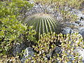
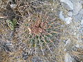
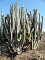
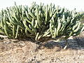
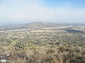
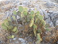
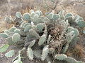
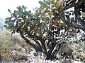
The Central Mexican Matorral Ecoregion is a designated ecoregion by WWF and One Earth. It is classified as a Deserts & Xeric Shrublands Biome. It is one of eight ecoregions in the Sierra Madre Forests & Mexican Drylands Bioregion.
Subcategories
This category has only the following subcategory.
P
- Parque Nacional El Cimatario (8 F)
Media in category "Central Mexican Matorral Ecoregion"
The following 79 files are in this category, out of 79 total.
-
 20 km East from S Luis de La Paz, GTO (5733868339).jpg 3,648 × 2,736; 1.88 MB
-
 20 km East from S Luis de La Paz, GTO (5734044221).jpg 3,648 × 2,736; 1.85 MB
-
 20 km East from S Luis de La Paz, GTO (5734470450).jpg 3,648 × 2,736; 1.9 MB
-
 20 km East from S Luis de La Paz, GTO (5734500658).jpg 3,648 × 2,736; 1.93 MB
-
 Agave scabra (5661240840).jpg 3,648 × 2,736; 2.01 MB
-
 Agave species (5761388478).jpg 2,736 × 3,648; 1.98 MB
-
 Agave species (5761389154).jpg 2,736 × 3,648; 1.93 MB
-
 Agave species (5781136821).jpg 3,648 × 2,736; 2.21 MB
-
 Between Cadereyta and Ezecial del Montes, Queretaro (5760744119).jpg 3,648 × 2,736; 2.02 MB
-
 Between Cadereyta and Ezecial del Montes, Queretaro (5760749865).jpg 3,648 × 2,736; 1.9 MB
-
 Bromelia Species (5733978349).jpg 3,648 × 2,736; 1.94 MB
-
 Cadereyta, Queretaro (5760787903).jpg 3,648 × 2,736; 2.04 MB
-
 Cadereyta, Queretaro (5760820423).jpg 3,648 × 2,736; 2.08 MB
-
 Cadereyta, Queretaro (5761350762).jpg 3,648 × 2,736; 2.08 MB
-
 Calle Mineral de Pozos, Guanajuato.jpg 2,592 × 1,944; 2.38 MB
-
 Calvillo, Aguascalientes (20709355703).jpg 3,504 × 2,336; 3.85 MB
-
 Calvillo, Aguascalientes (21143549229).jpg 3,504 × 2,336; 3.79 MB
-
 Calvillo, Aguascalientes (21304181526).jpg 3,504 × 2,336; 4.34 MB
-
 Calvillo, Aguascalientes (21304195956).jpg 3,504 × 2,336; 3.65 MB
-
 Calvillo, Aguascalientes (21330420025).jpg 3,504 × 2,336; 3.25 MB
-
 Calvillo, Aguascalientes (21338637091).jpg 3,504 × 2,336; 3.07 MB
-
 Calvillo, Aguascalientes (21338679871).jpg 3,325 × 2,046; 3.8 MB
-
 Cerro Pelón (San Luis de la Paz, Guanajuato).jpg 7,316 × 5,487; 13.21 MB
-
 Coryphantha delicata (5661364558).jpg 3,648 × 2,736; 1.96 MB
-
 Desierto Calvillo, Aguascalientes- Calvillo Desert, Aguascalientes (16016415394).jpg 3,474 × 1,734; 2.62 MB
-
 Desierto Calvillo, Aguascalientes- Calvillo Desert, Aguascalientes (16638713425).jpg 3,418 × 2,154; 3.11 MB
-

-

-

-
 Echeveria secunda (1).jpg 3,648 × 2,736; 1.99 MB
-
 Echinocactus platyacanthus (5781925325).jpg 3,648 × 2,736; 2.14 MB
-
 Echinocereus cinerascens (5661459346).jpg 3,648 × 2,736; 2 MB
-
 Ferocactus histrix (5661364582).jpg 3,648 × 2,736; 2.05 MB
-
 Ferocactus histrix (5661406818).jpg 3,648 × 2,736; 1.89 MB
-
 Ferocactus histrix (5661514910).jpg 3,648 × 2,736; 2.05 MB
-
 Ferocactus histrix (5661514916).jpg 3,648 × 2,736; 1.98 MB
-
 Ferocactus latispinus (5660732123).jpg 3,648 × 2,736; 2.09 MB
-
 Fuga-.jpg 2,279 × 1,535; 1.16 MB
-
 Hacienda El Triángulo, Mineral de Pozos B.jpg 2,592 × 1,944; 2.38 MB
-
 Hacienda El Triángulo, Mineral de Pozos, Guanajuato. Imagen Panorámica 1.jpg 5,152 × 3,864; 7.6 MB
-
 Hornos Mineral de Pozos.jpg 5,152 × 3,864; 6.94 MB
-

-
 Isolatocereus dumortieri (5781164571).jpg 2,736 × 3,648; 1.98 MB
-
 Isolatocereus dumortieri.jpg 3,648 × 2,736; 2.06 MB
-
 Iztaccihuatl desde Epazoyucan Hidalgo - panoramio.jpg 5,184 × 3,456; 5.49 MB
-
 Mammillaria petterssonii (5710488706).jpg 3,072 × 2,304; 2.71 MB
-
 Mammillaria petterssonii (5710514996).jpg 3,072 × 2,304; 2.72 MB
-
 Mineral de Pozos Paisaje.jpg 5,152 × 3,864; 7.41 MB
-
 Myrtillocactus geometrizans (5781139893).jpg 3,648 × 2,736; 1.99 MB
-
 Myrtillocactus geometrizans (5781224019).jpg 3,648 × 2,736; 2.12 MB
-
 Myrtillocactus geometrizans (5781426540).jpg 3,648 × 2,736; 2.03 MB
-
 Myrtillocactus geometrizans (5781692192).jpg 3,648 × 2,736; 1.81 MB
-
 Myrtillocactus geometrizans (5781695144).jpg 3,648 × 2,736; 2 MB
-
 Near Calvillo, Aguascalientes (5710483628).jpg 3,072 × 2,304; 2.84 MB
-
 Near Estacion La Ventura, SLP (5661427420).jpg 3,648 × 2,736; 1.8 MB
-
 Near Estacion La Ventura, SLP (5661427430).jpg 3,648 × 2,736; 1.88 MB
-
 Near Estacion La Ventura, SLP (5661427526).jpg 3,648 × 2,736; 1.88 MB
-
 Near Estacion La Ventura, SLP (5661427528).jpg 3,648 × 2,736; 2.03 MB
-
 Near Estacion Ventura, SLP (5660561691).jpg 3,648 × 2,736; 2.02 MB
-
 Near Estacion Ventura, SLP (5660561711).jpg 3,648 × 2,736; 1.82 MB
-
 Near mineral de Pozos, Guanajuato (5740884808).jpg 3,648 × 2,736; 1.94 MB
-
 Opuntia sp. (5660561715).jpg 3,648 × 2,736; 2.02 MB
-
 Opuntia sp. (5661406844).jpg 3,648 × 2,736; 2.11 MB
-
 Opuntia species (5781787484).jpg 3,648 × 2,736; 2.09 MB
-
 Opuntia species (5781801488).jpg 3,648 × 2,736; 2.05 MB
-
 Opuntia stricta (5760814017).jpg 3,648 × 2,736; 2.03 MB
-
 Pachycereus marginatus (5781803884).jpg 3,648 × 2,736; 1.95 MB
-
 Paisaje Mineral de Pozos a.jpg 5,152 × 3,864; 7.41 MB
-
 Paisaje Mineral de Pozos.jpg 2,592 × 1,944; 2.39 MB
-
 Ruinas - Mineral de Pozos, Guanajuato.jpg 4,000 × 3,000; 10 MB
-
 Ruinas de Mineral de Pozos, Guanajuato.jpg 7,157 × 5,368; 11.56 MB
-
 Sedum species (5734489280).jpg 3,648 × 2,736; 2 MB
-
 Stenocactus crispatus (5660732119).jpg 2,736 × 3,648; 1.96 MB
-
 Stenocactus crispatus (5660732135).jpg 3,648 × 2,736; 1.86 MB
-
 Stenocereus montanus (5709918139).jpg 3,072 × 2,304; 2.66 MB
-
 Tequisquiapan, Queretaro (5781641724).jpg 3,648 × 2,736; 2.07 MB
-
 Tezontle (5661406836).jpg 3,648 × 2,736; 2.14 MB
-
 Tuxagni near Lagunilla, Hidalgo (5781893813).jpg 3,648 × 2,736; 1.88 MB
-
 Yucca species (5761382624).jpg 2,736 × 3,648; 1.94 MB
.jpg)
.jpg)
.jpg)
.jpg)
.jpg)
.jpg)
.jpg)
.jpg)
.jpg)
.jpg)
.jpg)
.jpg)
.jpg)
.jpg)

.jpg)
.jpg)
.jpg)
.jpg)
.jpg)
.jpg)
.jpg)
.jpg)
.jpg)
.jpg)
.jpg)
.jpg)
.jpg)
.jpg)
.jpg)
.jpg)
.jpg)
.jpg)
.jpg)
.jpg)
.jpg)
.jpg)


.jpg)
.jpg)


.jpg)
.jpg)

.jpg)
.jpg)
.jpg)
.jpg)
.jpg)
.jpg)
.jpg)
.jpg)
.jpg)
.jpg)
.jpg)
.jpg)
.jpg)
.jpg)
.jpg)
.jpg)
.jpg)
.jpg)
.jpg)


.jpg)
.jpg)
.jpg)
.jpg)
.jpg)
.jpg)
.jpg)
.jpg)