Category:Central Park, Allentown, Pennsylvania
amusement park in the Rittersville section of Allentown, Pennsylvania  | |||||
| Upload media | |||||
| Instance of | |||||
|---|---|---|---|---|---|
| Location | Pennsylvania | ||||
 | |||||
Central Park is a former amusement park the Rittersville section of Allentown, Pennsylvania. It was 44 acres in size, and located on the south side of Hanover Avenue, bordering the Allentown city limits with Bethlehem. Its origins date to 1868 when J. Frank Reichart laid out a race course north of the Allentown-Bethlehem turnpike (Hanover Avenue) which was opened for trotting and pacing from May to August. In 1872 the Rittersville Park Association was organized.
When the Allentown & Bethlehem Rapid Traction Company took ownership of the area from Thomas Ritter in 1894 the facility was rnamed as The Greater Central Park. The park was enlarged to 44 acres and was known as Manhattan Park which professional baseball was played in the early 1900s. The park was accessed primarily by trolley cars running between Allentown and Bethlehem, and was known as a "streetcar park", and was a popular recreation spot for countless families from both Allentown and Bethlehem, as well as beyond.
During the first part of the 20th Century, the park suffered a series of fires, but it kept open. In May 1932, a $50,000 fire destroyed the Mystic Castle, Ye Old Mill, a theater and concession stands. In 1935, an early morning fire consumed most of the cyclone ride and destroyed the skee-ball alleys, a ladies rest room and badly damaged several stands. The dodgem ride building was destroyed in June 1940, and in April 1941, the park's Skating Rink went up in flames. Another fire in May 1944 burned down bowling alleys and the billiard parlor, During Christmas 1950 the Derby Racer roller coaster went up in flames and in August 1951 the main performance stage burned down.
Central Park, however was never a moneymaker for Lehigh Valley Transit, although the park operated at a sight profit, it was more a draw for passengers to use its highly profitable streetcar service in Lehigh and Northampton counties. In 1946, the Pennsylvania Public Utility Commission ordered LVT to divest itself of its non-transportation assets, which included Central Park. In September 1946, the park was sold by LVT to David Moses for $100,000. However, without the deep pockets of LVT, Central Park began to decline under private ownership. Central Park was sold to private developers for its value as developable land and was closed after Labor Day, 1951
In its place, a large shopping center, along with mixed-use housing developments were planned, and demolition of the park began in December 1951. A year later the only remaining structure on the land was the Rainbow Ballroom, an 11,000 square foot structure which was used as a music and dance facility. This, actually being on the north side of Hanover Avenue was sold and the Rainbow Ballroom remained open as a music and dance facility at first, later becoming a roller skating rink, and lastly as a religious meeting hall until it finally closed in 1959 and was subsequently torn down and the land redeveloped.
The developers ran into financial issues and the envisioned shopping and housing project never materialized. The land where Central Park was located was sold off in the early 1960s as individual parcels. Today what was Central Park is home to multiple businesses and some empty land which is still undeveloped. Urban archeologists have found various remains of Central Park in terms of various crumbling concrete foundations and footers.
The large World War I memorial is now located at Cedar Hill Cemetery near the US 22 and Airport Road exit. The Central Park Carousel, was sold and disassembled. It remains in storage in private hands in Florida, still un-assembled.
| Camera location | | View all coordinates using: OpenStreetMap |
|---|
Subcategories
This category has the following 7 subcategories, out of 7 total.
A
Media in category "Central Park, Allentown, Pennsylvania"
The following 34 files are in this category, out of 34 total.
-
 1896 - Central Park Newspaper Ad Allentown PA.jpg 441 × 869; 111 KB
-
 1908 - Lehigh Vakket Transit Company - Allentown PA.jpg 769 × 598; 99 KB
-
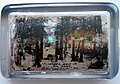 1910 - Paperweight - Central Park - Allentown PA.jpg 1,506 × 1,050; 344 KB
-
 1915 - Rigamarole Ride - Central Park - Allentown PA.jpg 1,500 × 955; 392 KB
-
 1919 - Hanover Township World War I Monument - 17 Nov MC - Allentown PA.jpg 2,035 × 1,939; 724 KB
-
 1927 - Central Park - 12 May MC - Allentown PA.jpg 2,108 × 2,401; 807 KB
-
 1927 - Central Park - 28 Aug MC - Allentown PA.jpg 2,057 × 2,353; 852 KB
-
 1932 - Central Park - Mystic Castle Fire - 16 May MC - Allentown PA.jpg 2,108 × 1,746; 918 KB
-
 1933 - Central Park Ad - 20 May MC - Allentown PA.jpg 940 × 2,760; 525 KB
-
 1935 - Central Park - 25 May MC - Allentown PA.jpg 1,481 × 1,865; 476 KB
-
 1935 - Central Park - Cyclone Coaster Fire - 15 Sep MC - Allentown PA.jpg 2,493 × 1,796; 877 KB
-
 1935 - Cyclone Coaster Fire - Central Park - 15 Sep MC - Allentown PA.jpg 1,388 × 1,223; 376 KB
-
 1936 - Central Park Ad - 2 May MC - Allentown PA.jpg 1,432 × 1,853; 353 KB
-
 1937 - Central Park Ad - 8 May MC - Allentown PA.jpg 1,473 × 1,437; 317 KB
-
 1937 Rittersville - Central Park.jpg 1,000 × 779; 211 KB
-
 1939 - Central Park Pennant - Allentown PA.jpg 4,077 × 1,600; 1.08 MB
-
 1940 - Central Park - Dodgem Fire - 11 Jun MC - Allentown PA.jpg 2,498 × 1,537; 741 KB
-
 1941 - Central Park - Roller Rink Fire - 19 Apr MC - Allentown PA.jpg 2,922 × 1,862; 789 KB
-
 1943 - Allentown Central Park Ride Tickets - Allentown PA.jpg 656 × 1,270; 245 KB
-
 1943 - General Ride Ticket - Central Park - Allentown PA.jpg 673 × 334; 105 KB
-
 1944 - Central Park -Bowling Alley Fire - 19 May MC - Allentown PA.jpg 1,389 × 2,641; 833 KB
-
 1946 - Central Park - 3 Jul MC - Allentown PA.jpg 921 × 1,155; 215 KB
-
 1946 - Central Park Ad - 31 May MC - Allentown PA.jpg 1,340 × 1,437; 354 KB
-
 1947 - Central Park - 11 Jul MC - Allentown PA.jpg 878 × 1,197; 195 KB
-
 1948 - Central Park - 12 Jun MC - Allentown PA.jpg 896 × 1,591; 237 KB
-
 1948 - Central Park - 13 May MC - Allentown PA.jpg 927 × 1,168; 213 KB
-
 1948 - Central Park - 20 Jul MC - Allentown PA.jpg 896 × 1,176; 239 KB
-
 1949 - Central Park - 19 Jun MC - Allentown PA.jpg 871 × 1,161; 186 KB
-
 1949 - Central Park - 4 Dep MC - Allentown PA.jpg 953 × 1,153; 218 KB
-
 1950 - Central Park - Derby Racer Fire - 26 Dec MC - Allentown PA.jpg 3,965 × 3,058; 1.67 MB
-
 1950 - Central Park Last Ad - 9 Sep MC - Allentown PA.jpg 931 × 1,181; 215 KB
-
 1951 - Central Park - Demolition Ad - 16 Dec MC - Allentown PA.jpg 2,401 × 2,252; 1.06 MB
-
 1951 - Central Park - Fire - 3 Aug MC - Allentown PA.jpg 2,396 × 2,089; 703 KB
-
 1952 - Central Park - Sale Ad - 20 Dec MC - Allentown PA.jpg 917 × 908; 262 KB


