Category:Chamoli district
Jump to navigation
Jump to search
district of Uttarakhand, India .svg) | |||||
| Upload media | |||||
| Instance of | |||||
|---|---|---|---|---|---|
| Location |
| ||||
| Capital |
| ||||
| Population |
| ||||
| Area |
| ||||
| official website | |||||
 | |||||
Subcategories
This category has the following 13 subcategories, out of 13 total.
2
- 2021 Nanda Devi glacier disaster (13 F)
B
G
- Govind Group of Temples, Simli (14 F)
- Govindghat (1 F)
H
K
- Kulsari Temple (1 F)
N
- Niti Pass (2 F)
P
- Pushpawati (8 F)
R
- Roopkund (1 P, 23 F)
V
Media in category "Chamoli district"
The following 92 files are in this category, out of 92 total.
-
 ... a view near Ghangaria (7753907620).jpg 4,576 × 2,576; 6.57 MB
-
 ... on way to Hemkund Sahib (7754243660).jpg 4,000 × 2,248; 3.85 MB
-
 ... Tapovan (7753376430).jpg 4,576 × 2,576; 7.09 MB
-
 ... towards Ghangaria (7753913786).jpg 4,576 × 2,576; 6.91 MB
-
 ... waiting at Tangani for landslide repairs (7751688914).jpg 4,000 × 2,248; 4.18 MB
-
 1999Chamoli.png 179 × 159; 19 KB
-
 20140818-Landslide 4511-2.jpg 1,023 × 685; 264 KB
-
 20140820-Didna 4600-2.jpg 777 × 1,024; 192 KB
-
 A hilly village, river and houses in Chamoli district of Uttarakhand, India.jpg 2,252 × 4,000; 3.3 MB
-
-
 A Roopkund dawn - panoramio.jpg 2,876 × 2,000; 1.42 MB
-
 Alakananda-Ghangharia Trek, Uttarakhand, India.jpg 3,072 × 2,304; 2.06 MB
-
 Alkananda river at Hailang - panoramio.jpg 1,485 × 972; 1.39 MB
-
 Alternate windows XP.jpg 3,072 × 1,728; 1.68 MB
-
 Ansuya tempal side view.jpg 4,576 × 3,432; 3.39 MB
-
 Ansuya tempal view.jpg 4,160 × 3,120; 4.22 MB
-
 Ascent to Loharjung, Welcome tranquility - panoramio.jpg 3,043 × 2,131; 1.41 MB
-
 AT Kailubinayak - panoramio.jpg 2,592 × 1,944; 1.98 MB
-
 Atri muni cave.jpg 2,448 × 3,264; 1.21 MB
-
 Badhangarhitemple.jpg 3,264 × 2,448; 2.79 MB
-
 Baidini bugyal - panoramio.jpg 2,592 × 1,944; 2.52 MB
-
 Bedni bugyal - panoramio (1).jpg 2,592 × 1,944; 2.2 MB
-
 Bedni bugyal - panoramio.jpg 2,592 × 1,944; 2.13 MB
-
 Bhyundar Pulna (29336212517).jpg 5,184 × 3,456; 10.02 MB
-
 Blkn.JPG 1,600 × 1,143; 276 KB
-
 Brahm-om parvat.jpg 3,840 × 2,160; 3 MB
-
 Chamoli district.svg 1,250 × 1,125; 137 KB
-
 Chamoli, Uttarakhand, India - panoramio (1).jpg 1,600 × 1,200; 482 KB
-
 Chamoli, Uttarakhand, India - panoramio (3).jpg 1,600 × 1,200; 778 KB
-
 Chamoli, Uttarakhand, India - panoramio (5).jpg 1,600 × 1,200; 1.05 MB
-
 Chamoli, Uttarakhand, India - panoramio (7).jpg 2,048 × 1,536; 602 KB
-
 Chamoli, Uttarakhand, India - panoramio.jpg 1,600 × 1,200; 437 KB
-
 Chandrashila, Tungnath, India (Unsplash).jpg 5,760 × 3,668; 17.31 MB
-
 Chaukhumba Cornerstone - panoramio.jpg 2,882 × 1,970; 2.44 MB
-
 Chowkhamba from Bedni Bugyal - panoramio.jpg 2,592 × 1,944; 2.27 MB
-
 Clouds of Himachal.jpg 3,264 × 2,448; 1.19 MB
-
 Cloudy mountains in Badrinath, Mana, Chamoli, Uttarakhand, India (2012) 1.jpg 4,000 × 2,248; 3.19 MB
-
 Cloudy mountains in Badrinath, Mana, Chamoli, Uttarakhand, India (2012).jpg 4,000 × 2,248; 3.94 MB
-
 Devgram,way to Kalpeswer - panoramio.jpg 1,491 × 688; 915 KB
-
 Dudhatoli 4.jpg 2,048 × 1,295; 743 KB
-
 Gopeshwar.jpg 2,048 × 1,152; 423 KB
-
 Gourmet mineral water - panoramio.jpg 2,024 × 2,024; 1.39 MB
-
 Govind Ghat, Ghangaria, Chamoli, Uttarakhand, India (2012).jpg 4,000 × 2,248; 4.34 MB
-
 Govindghat as seen after crossing from river alaknanda.jpg 653 × 490; 95 KB
-
 Greeted by the sunrays,Roopkund trail - panoramio.jpg 2,592 × 1,944; 2.09 MB
-
 Hathi Parbat.jpg 3,264 × 2,448; 932 KB
-
 Himalayan view from Garhi temple.jpg 2,592 × 1,936; 2.64 MB
-
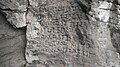 Inscripted rock.jpg 2,048 × 1,152; 305 KB
-
 Joshimath 01.jpg 4,160 × 3,120; 4.16 MB
-
 Joshimath 02.jpg 4,160 × 3,120; 3.96 MB
-
 Joshimath 03.jpg 4,160 × 3,120; 3.25 MB
-
 Joshimath 04.jpg 8,320 × 6,240; 14.91 MB
-
 Joshimath 05.jpg 8,320 × 6,240; 14.8 MB
-
 Joshimath.jpg 3,264 × 2,448; 1.72 MB
-
 Loltivillage.jpg 4,608 × 3,456; 606 KB
-
 Mangal Snaan.jpg 4,608 × 2,592; 5.97 MB
-
 Mehalchauri Station.jpg 4,320 × 3,240; 2.91 MB
-
 Mount Trishul.jpg 5,184 × 3,456; 1.65 MB
-
 My village chamseel.jpg 2,976 × 3,968; 3.38 MB
-
 Nag Tal, Ghastoli in Chamoli district of Uttarakhand, India.jpg 6,000 × 2,605; 3.42 MB
-
 Nagchula.jpg 5,152 × 3,864; 6.16 MB
-
 Nanda Devi Peak from Ranikhet.jpg 1,500 × 804; 699 KB
-
 NandaDevi from Chandrashila Pk.jpg 5,472 × 3,648; 3.58 MB
-
 NandprayagConfluence.JPG 912 × 684; 291 KB
-
 Narsingh Temple.jpg 3,120 × 4,160; 4.1 MB
-
 Neelkanth ^ Chowkhamba from Bedni bugyal - panoramio.jpg 6,923 × 1,707; 583 KB
-
 Ooli.jpg 864 × 1,152; 91 KB
-
 Palace to remember 01.jpg 2,340 × 2,925; 2.31 MB
-
 Palace to remember 02.jpg 3,456 × 5,184; 8.04 MB
-
 Pano baidini wikiVoyage.jpg 2,100 × 300; 154 KB
-
 Path - panoramio (21).jpg 1,600 × 1,200; 664 KB
-
 River view in Chamoli, Uttarakhand.jpg 3,456 × 4,608; 3.58 MB
-
 Roopkund - The Mystery Lake.jpg 6,016 × 4,000; 6.23 MB
-
 Roopkund Hiking Path.jpg 6,016 × 4,000; 6.31 MB
-
 Sleeping Lady, Joshimath.jpg 3,264 × 2,448; 933 KB
-
 Stone temples adjacent to Rudranath temple.jpg 4,224 × 2,368; 3.58 MB
-
 Sunset at the Himalayas.jpg 2,592 × 1,456; 706 KB
-
 Tapovan hot springs 01.jpg 1,920 × 1,080; 772 KB
-
 Tapovan hot springs 02.jpg 1,920 × 1,080; 627 KB
-

-
-

-
 Tirsuli group.jpg 1,691 × 1,159; 862 KB
-
 Trishul Panorama - panoramio.jpg 1,884 × 1,099; 633 KB
-
 Txu-pclmaps-oclc-181831961-badrinath-53-n-1936.jpg 3,631 × 5,023; 2.86 MB
-
 Uttarakhandi Semiyan.jpg 3,490 × 2,734; 1.56 MB
-
 View from naola pass.jpg 1,024 × 679; 321 KB
-
 Viewing Govind Ghat (7751809562).jpg 4,000 × 2,248; 4.4 MB
-
 Viewing landslide affected area at Tangani (7751683370).jpg 4,000 × 3,000; 5.63 MB
-
 Viewing Mana village (7756762296).jpg 4,000 × 2,248; 4.18 MB
-
 Vision of Peace @ Loharjung - panoramio.jpg 3,264 × 2,232; 906 KB
-
 मंदिर के सामने का दृश्य.jpg 4,160 × 3,120; 5.18 MB
.jpg)
.jpg)
.jpg)
.jpg)
.jpg)


.jpg)

.jpg)


.jpg)
.jpg)
.jpg)
.jpg)

.jpg)


_1.jpg)
.jpg)


.jpg)


.jpg)


.jpg)
.jpg)
.jpg)

