Category:Chapelle de la Sodalité Mariale (Vianden)
Jump to navigation
Jump to search
| Object location | | View all coordinates using: OpenStreetMap |
|---|
chapel in Vianden, Luxembourg  | |||||
| Upload media | |||||
| Instance of | |||||
|---|---|---|---|---|---|
| Location | Vianden, Canton of Vianden, Luxembourg | ||||
 | |||||
Media in category "Chapelle de la Sodalité Mariale (Vianden)"
The following 11 files are in this category, out of 11 total.
-
 Chapelle de la sodalité de Vianden 1736.JPG 3,008 × 1,960; 2.88 MB
-
 Chapelle de la sodalité mariale Vianden Cropped.jpg 1,910 × 1,910; 1.65 MB
-
 Chapelle de la sodalité mariale Vianden.jpg 3,072 × 2,304; 1.79 MB
-
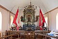
 Intérieur de la chapelle de la sodalité de Vianden.JPG 3,008 × 1,960; 2.6 MB
-
 La chapelle de Sodalité à Vianden Grand-Duché de Luxembourg.JPG 2,448 × 3,264; 1.56 MB
-
 PM 140500 LUX Vianden.jpg 400 × 600; 196 KB
-
 PM 140501 LUX Vianden.jpg 400 × 600; 220 KB
-
 PM 140502 LUX Vianden.jpg 396 × 600; 299 KB
-
 PM 140503 LUX Vianden.jpg 400 × 600; 255 KB
-
 PM 140504 LUX Vianden.jpg 600 × 400; 220 KB
-
 Sodality Chapel Vianden.jpg 2,736 × 3,648; 4.38 MB


