Category:Chapelle de la Vierge (Err)
Jump to navigation
Jump to search
| Object location | | View all coordinates using: OpenStreetMap |
|---|
|
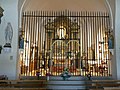
This building is inscrit au titre des monuments historiques de la France. It is indexed in the base Mérimée, a database of architectural heritage maintained by the French Ministry of Culture, under the reference PA00104019
|
church located in Pyrénées-Orientales, in France  | |||||
| Upload media | |||||
| Instance of | |||||
|---|---|---|---|---|---|
| Part of | |||||
| Dedicated to | |||||
| Location | Err, French Cerdagne | ||||
| Architectural style | |||||
| Diocese | |||||
| Has use | |||||
| Heritage designation |
| ||||
| Religion or worldview | |||||
 | |||||
Media in category "Chapelle de la Vierge (Err)"
The following 7 files are in this category, out of 7 total.
-
 Camarill d'Err.jpg 3,688 × 5,248; 3.72 MB
-
 Err chap1.JPG 1,600 × 1,200; 365 KB
-
 Err chap2.JPG 1,600 × 1,200; 484 KB
-
 Err chap3.JPG 1,200 × 1,600; 513 KB
-
 Err chap4.JPG 1,200 × 1,600; 418 KB
-
 Esglèsia de la Mare de Déu d'Er (Alta Cerdanya).jpg 2,048 × 1,536; 1,024 KB
-
 Església de la Mare de Déu d'Err - P1090093.jpg 4,320 × 3,240; 5.6 MB


.jpg)
