Category:Chatham, Kent
Zur Navigation springen
Zur Suche springen
Stadt in Kent, Großbritannien  | |||||
| Medium hochladen | |||||
| Ist ein(e) | |||||
|---|---|---|---|---|---|
| Ort | Borough of Medway, Kent, Südostengland, England | ||||
| Einwohnerzahl |
| ||||
| Verschieden von | |||||
 | |||||
English: Chatham is one of the Medway towns located within the Medway unitary authority, in North Kent, in South East England.
Unterkategorien
Es werden 31 von insgesamt 31 Unterkategorien in dieser Kategorie angezeigt:
In Klammern die Anzahl der enthaltenen Kategorien (K), Seiten (S), Dateien (D)
B
- Bishop of Rochester Academy (1 D)
C
- Capstone Farm Country Park (22 D)
- Capstone Valley (7 D)
D
- Dickens World (4 D)
F
- Fort Pitt, Kent (26 D)
H
L
- Luton, Kent (58 D)
M
- Maps of Chatham, Kent (11 D)
- Medway Council (16 D)
- Medway Tunnel (2 D)
N
- Nashenden Valley (3 D)
P
- Princes Park estate (2 D)
R
- Royal Naval Barracks, Chatham (10 D)
S
- Sun Pier, Chatham (39 D)
T
W
- Wayfield Estate (6 D)
Medien in der Kategorie „Chatham, Kent“
Folgende 200 Dateien sind in dieser Kategorie, von 756 insgesamt.
(vorherige Seite) (nächste Seite)-

-
 "The Bourne" flows into the River Medway, Chatham - geograph.org.uk - 3889467.jpg 3.488 × 2.616; 2,24 MB
-

-
 'Javelin' train approaches Chatham - geograph.org.uk - 3010916.jpg 640 × 480; 171 KB
-
 1, Old Road, Chatham - geograph.org.uk - 6236488.jpg 2.448 × 3.264; 2,27 MB
-
 112, High Street, Chatham - geograph.org.uk - 6232474.jpg 2.440 × 3.165; 1,85 MB
-
 12, Railway Street, Chatham - geograph.org.uk - 6237349.jpg 2.391 × 3.264; 2,02 MB
-
 18, Ordnance Terrace - geograph.org.uk - 5890277.jpg 2.406 × 3.264; 1,99 MB
-
 19, Railway Street, Chatham - geograph.org.uk - 6405713.jpg 2.365 × 3.264; 1,93 MB
-
 22, High Street, Chatham - geograph.org.uk - 6404876.jpg 2.448 × 2.990; 2,03 MB
-
 308sniper, 44, High Street, Chatham - geograph.org.uk - 6409251.jpg 2.448 × 3.264; 1,8 MB
-
 34, High Street, Chatham - geograph.org.uk - 6409256.jpg 2.448 × 3.264; 2,04 MB
-
 343 ^ 345, High Street - geograph.org.uk - 5299951.jpg 2.448 × 3.264; 2,28 MB
-
 36a, High Street, Chatham - geograph.org.uk - 6234486.jpg 2.448 × 3.264; 1,85 MB
-
 378, High Street - geograph.org.uk - 5895476.jpg 2.004 × 3.264; 1,62 MB
-
 380-386, High Street, Rochester - geograph.org.uk - 6234488.jpg 2.448 × 3.264; 2,27 MB
-
 42, High Street, Chatham - geograph.org.uk - 6233629.jpg 2.448 × 3.264; 1,89 MB
-
 58, High Street, Chatham - geograph.org.uk - 6233605.jpg 2.448 × 3.264; 2,14 MB
-
 63, High Street - geograph.org.uk - 5298051.jpg 2.448 × 3.264; 1,67 MB
-
-
 Acre Close, Rochester - geograph.org.uk - 4076009.jpg 3.488 × 2.616; 2,91 MB
-
 Albany Terrace, Chatham - geograph.org.uk - 5634891.jpg 4.032 × 3.024; 3,89 MB
-
 Allotments, Prince Arthur Rd - geograph.org.uk - 1148703.jpg 640 × 430; 74 KB
-
 Alston Ashby Solicitors - geograph.org.uk - 6232487.jpg 2.448 × 3.264; 2,06 MB
-
 Ambrose Hill, Luton - geograph.org.uk - 5861682.jpg 4.032 × 3.024; 3,56 MB
-
 Amherst Road, Rochester - geograph.org.uk - 4912768.jpg 3.264 × 2.448; 1,65 MB
-
 Anchorage House, High Street - geograph.org.uk - 5299036.jpg 3.264 × 2.448; 2,15 MB
-
 Apna Punjab, Church Street, Chatham - geograph.org.uk - 2872652.jpg 3.648 × 2.736; 2,23 MB
-
 Approach to Victoria Gardens - geograph.org.uk - 2521424.jpg 4.000 × 3.000; 4,33 MB
-
 Arches of Fort Pitt, Victoria Gardens, Chatham - geograph.org.uk - 3819288.jpg 3.488 × 2.616; 1,61 MB
-
 Arena, 13, Ordnance Terrace - geograph.org.uk - 5895460.jpg 2.448 × 3.264; 1,87 MB
-
 Arena, 13, Ordnance Terrace - geograph.org.uk - 6228452.jpg 2.409 × 2.475; 1,21 MB
-
 Artwork on Fort Pitt Hill - geograph.org.uk - 1067716.jpg 640 × 481; 48 KB
-
 Asia Express - geograph.org.uk - 6362977.jpg 6.000 × 4.000; 7,15 MB
-

-
 Back of 12, Railway Street, Chatham - geograph.org.uk - 6237351.jpg 2.448 × 3.264; 2,52 MB
-
-
 Balfour Road, Chatham - geograph.org.uk - 3850224.jpg 3.488 × 2.616; 2,06 MB
-
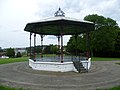 Bandstand at Victoria Gardens - geograph.org.uk - 2519617.jpg 4.000 × 3.000; 4,07 MB
-
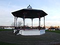 Bandstand, Victoria Gardens, Chatham - geograph.org.uk - 3772274.jpg 3.488 × 2.616; 2,18 MB
-
 Bandstand, Victoria Gardens, Chatham - geograph.org.uk - 5255351.jpg 3.264 × 2.448; 2,35 MB
-
 Barnaby Terrace, Warren Wood - geograph.org.uk - 3972331.jpg 3.488 × 2.616; 1,82 MB
-
 Barrier Ditch - geograph.org.uk - 6406503.jpg 3.264 × 2.448; 3,79 MB
-
 Barrier Road, Chatham - geograph.org.uk - 3782680.jpg 3.488 × 2.616; 2,55 MB
-

-
 Batchelor Street, Chatham - geograph.org.uk - 3772230.jpg 3.488 × 2.616; 2,23 MB
-
 Batchelor Street, Chatham - geograph.org.uk - 5740480.jpg 4.032 × 3.024; 3,18 MB
-
 Beaulieu Rise, Rochester - geograph.org.uk - 3972307.jpg 3.488 × 2.616; 2,13 MB
-
 Before our time, a picture postcard from Claude (NBY 423546).jpg 829 × 525; 80 KB
-
 Beresford Avenue, Rochester - geograph.org.uk - 3850216.jpg 3.488 × 2.616; 2,13 MB
-
 Best Street, Chatham - geograph.org.uk - 1950368.jpg 3.488 × 2.616; 2,08 MB
-
 Blaker Avenue, Rochester - geograph.org.uk - 3720469.jpg 3.488 × 2.616; 2,17 MB
-
 Blenheim Avenue, Chatham - geograph.org.uk - 3890898.jpg 3.462 × 2.439; 2 MB
-
-
 Blue Gate, Sun Pier - geograph.org.uk - 3828690.jpg 4.288 × 3.216; 5,69 MB
-
 Blueberry Park, 5, Military Road - geograph.org.uk - 6230391.jpg 2.448 × 3.264; 1,96 MB
-
 Boarded up shops, Dorrit Way, Rochester - geograph.org.uk - 2099426.jpg 3.152 × 2.088; 1,75 MB
-

-
-
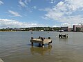
 Boats on the Medway - geograph.org.uk - 1397257.jpg 640 × 480; 56 KB
-
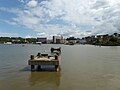
 Boats on the River Medway, Chatham - geograph.org.uk - 3827278.jpg 3.488 × 2.616; 1,91 MB
-
 Bonmarché, 147, High Street, Chatham - geograph.org.uk - 6405725.jpg 2.448 × 2.383; 1,35 MB
-
 Booth Road, Chatham - geograph.org.uk - 4773519.jpg 2.272 × 1.704; 782 KB
-

-
 Boundary Road is closed ahead - geograph.org.uk - 3010954.jpg 640 × 480; 105 KB
-
 Boundary Road, Chatham - geograph.org.uk - 3972296.jpg 3.488 × 2.616; 2,19 MB
-
 Bridge in University of Kent - geograph.org.uk - 1389551.jpg 640 × 480; 64 KB
-
 Bridge over Claremont Way, Chatham - geograph.org.uk - 3406882.jpg 4.268 × 2.844; 3,74 MB
-
 Bridge to the Brook - geograph.org.uk - 2667792.jpg 3.216 × 4.288; 3,55 MB
-
 Britain from the Air Street Art, Chatham High Street - geograph.org.uk - 2873543.jpg 4.288 × 3.216; 5,45 MB
-
 Britain from the Air, Street Art, Chatham High Street (2) - geograph.org.uk - 2873553.jpg 3.982 × 3.216; 6,74 MB
-
 Broken down^ Chatham Historic Dockyard - April 2018 - geograph.org.uk - 5755360.jpg 1.250 × 1.107; 1,19 MB
-
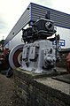 Brook Pumping Station - steam engine - geograph.org.uk - 2765317.jpg 421 × 640; 81 KB
-
 Bulldog Road, Lordswood - geograph.org.uk - 1201788.jpg 640 × 480; 99 KB
-
 Buller Road, Chatham - geograph.org.uk - 4059669.jpg 3.488 × 2.616; 2,45 MB
-
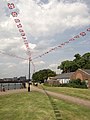 Bunting, Chatham - geograph.org.uk - 2972064.jpg 3.216 × 4.288; 5,01 MB
-
 Bus Stewards, Chatham Bus Station - geograph.org.uk - 2646997.jpg 4.288 × 3.216; 5,81 MB
-
 Buzz Bingo on The Brook, Chatham - geograph.org.uk - 6300713.jpg 1.920 × 1.280; 957 KB
-
 By The Medway - geograph.org.uk - 2835631.jpg 640 × 427; 84 KB
-
 By the River Medway - geograph.org.uk - 2835633.jpg 640 × 427; 90 KB
-
 By the River Medway - geograph.org.uk - 2835634.jpg 640 × 427; 79 KB
-
 Cambridge Terrace, Chatham - geograph.org.uk - 5634900.jpg 4.032 × 3.024; 2,97 MB
-
 Cannons at Gun Wharf, Chatham - geograph.org.uk - 1148198.jpg 640 × 430; 73 KB
-
 Cannons, Chatham Waterfront - geograph.org.uk - 3698124.jpg 3.488 × 2.616; 2,26 MB
-
 Carpeaux Close, Chatham - geograph.org.uk - 1407429.jpg 640 × 480; 93 KB
-
 Carpeaux Close, Chatham - geograph.org.uk - 4075888.jpg 3.488 × 2.616; 2,67 MB
-
 Carton Close, Warren Wood - geograph.org.uk - 3972337.jpg 3.488 × 2.616; 2,18 MB
-
 Cedar of Lebanon, Chatham Cemetery - geograph.org.uk - 3545621.jpg 4.288 × 3.216; 6,84 MB
-
 Central Chatham - geograph.org.uk - 3393764.jpg 640 × 430; 63 KB
-
 Central Chatham - geograph.org.uk - 3393766.jpg 640 × 430; 51 KB
-
 Chalk Pit Hill, Chatham - geograph.org.uk - 4773522.jpg 2.272 × 1.704; 773 KB
-
 Charter Street, Chatham - geograph.org.uk - 4085778.jpg 3.488 × 2.616; 2,71 MB
-
 Chatham (34607582360).jpg 4.000 × 3.000; 2,65 MB
-
 Chatham (England) banner View from Rochester Castle.JPG 2.100 × 300; 109 KB
-
 Chatham 1.jpg 3.260 × 2.047; 1,11 MB
-
 Chatham bus interchange - geograph.org.uk - 2831853.jpg 427 × 640; 62 KB
-
 Chatham bus interchange - geograph.org.uk - 2831855.jpg 640 × 427; 80 KB
-
 Chatham bus interchange - geograph.org.uk - 2831857.jpg 640 × 427; 70 KB
-
 Chatham bus interchange - geograph.org.uk - 2831859.jpg 640 × 427; 70 KB
-
 Chatham bus interchange - geograph.org.uk - 2835637.jpg 640 × 427; 78 KB
-
 Chatham Bus Interchange Facility - geograph.org.uk - 2646964.jpg 4.288 × 3.216; 5,92 MB
-
 Chatham Cemetery - geograph.org.uk - 1147366.jpg 640 × 430; 102 KB
-
 Chatham Cemetery - geograph.org.uk - 2521408.jpg 4.000 × 3.000; 4,04 MB
-
 Chatham Cemetery - geograph.org.uk - 923788.jpg 640 × 480; 106 KB
-
 Chatham Cemetery from the A230 - geograph.org.uk - 3457662.jpg 2.048 × 1.536; 1,44 MB
-
-
 Chatham Docklands YMCA Training Centre - geograph.org.uk - 1715108.jpg 3.072 × 2.304; 1,18 MB
-
 Chatham Docks - geograph.org.uk - 846543.jpg 640 × 480; 41 KB
-
 Chatham from Fort Amherst - geograph.org.uk - 3882459.jpg 640 × 430; 84 KB
-
 Chatham Historic Dockyard - April 2018 - geograph.org.uk - 5755358.jpg 1.250 × 836; 757 KB
-
 Chatham HMSVictoryModel.JPG 2.016 × 1.512; 608 KB
-
 Chatham Maritime (9311468730).jpg 4.608 × 3.072; 3,91 MB
-
-
 Chatham Maritime - Pump House No 5 - geograph.org.uk - 6241880.jpg 1.543 × 1.000; 1,15 MB
-
 Chatham Maritime Marina .jpg 4.215 × 2.646; 1,49 MB
-
 Chatham Market Opening Times - geograph.org.uk - 3955751.jpg 2.448 × 3.264; 2,08 MB
-
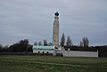 Chatham Naval Memorial - geograph.org.uk - 3393806.jpg 640 × 430; 36 KB
-
 Chatham Naval Memorial - geograph.org.uk - 3889409.jpg 640 × 430; 45 KB
-
 Chatham Panorama - geograph.org.uk - 2588565.jpg 4.848 × 1.312; 1,18 MB
-
 Chatham Railway Station - geograph.org.uk - 5328868.jpg 3.264 × 2.448; 1,37 MB
-
 Chatham Railway Station - geograph.org.uk - 6237355.jpg 3.264 × 2.448; 2,44 MB
-
 Chatham riverfront in Winter - geograph.org.uk - 1671788.jpg 2.580 × 1.932; 1,05 MB
-
 Chatham seen from Rochester - geograph.org.uk - 5875430.jpg 4.000 × 3.000; 4,46 MB
-
 Chatham seen from Rochester - geograph.org.uk - 5875443.jpg 3.812 × 2.859; 1,57 MB
-
 Chatham seen from Rochester - geograph.org.uk - 5875448.jpg 4.000 × 3.000; 4,77 MB
-
 Chatham Star.jpg 1.608 × 911; 376 KB
-
 Chatham Tesco's Carpark - geograph.org.uk - 2312467.jpg 3.072 × 2.304; 1,42 MB
-
 Chatham Town Sign - geograph.org.uk - 1441723.jpg 640 × 480; 91 KB
-
 Chatham under snow - geograph.org.uk - 1024501.jpg 640 × 480; 84 KB
-
 Chatham Viaduct - geograph.org.uk - 1570482.jpg 640 × 480; 62 KB
-
 Chatham Waterfront - geograph.org.uk - 3889799.jpg 3.488 × 2.616; 1,37 MB
-
 Chatham Waterfront Bus Station - geograph.org.uk - 3889567.jpg 640 × 430; 81 KB
-
 Chatham Waterfront Bus Station - geograph.org.uk - 3889575.jpg 640 × 430; 53 KB
-
 Chatham Waterfront Development - geograph.org.uk - 6408196.jpg 3.264 × 2.448; 1,99 MB
-
 Chatham, Bus Interchange Facility (at night) - geograph.org.uk - 2757398.jpg 4.288 × 2.310; 3,53 MB
-
 Chatham, Pentagon Centre and Brook Theatre - geograph.org.uk - 2538464.jpg 3.072 × 2.304; 2,22 MB
-
 Chatham- Medway Tunnel 0120.JPG 4.608 × 3.456; 5,71 MB
-
 ChathamAmherst6708.JPG 2.048 × 1.536; 736 KB
-
 ChathamCapstone3922.JPG 2.016 × 1.512; 713 KB
-
 ChathamDarland3014.JPG 2.016 × 1.512; 899 KB
-
 ChathamDarland3020.JPG 2.016 × 1.512; 771 KB
-
 ChathamDarland3021.JPG 2.016 × 1.512; 930 KB
-
 ChathamDarland3024.JPG 2.016 × 1.512; 882 KB
-
 ChathamDarland3029.JPG 2.016 × 1.512; 1,08 MB
-
 ChathamDarland3030.JPG 2.016 × 1.512; 883 KB
-
 ChathamDarland3044.JPG 2.016 × 1.512; 851 KB
-
 ChathamDarland3053.JPG 2.016 × 1.512; 1,07 MB
-
 ChathamFortAmherst4238.JPG 2.048 × 1.536; 833 KB
-
 ChathamFortAmherst4240.JPG 2.048 × 1.536; 839 KB
-
 ChathamFortPitt2793.JPG 2.016 × 1.512; 854 KB
-
 ChathamFortPitt4247.JPG 2.048 × 1.536; 856 KB
-
 ChathamHill3907.JPG 2.016 × 1.512; 913 KB
-
 ChathamMedway2644.JPG 2.016 × 1.512; 784 KB
-
 ChathamMedway2645.JPG 2.016 × 1.512; 761 KB
-
 ChathamMedway2646.JPG 2.016 × 1.512; 728 KB
-
 ChathamMedway2647.JPG 2.016 × 1.512; 707 KB
-
 ChathamMedway2648.JPG 2.016 × 1.512; 768 KB
-
 ChathamMedway2654.JPG 2.016 × 1.512; 807 KB
-
 ChathamMedway2655.JPG 2.016 × 1.512; 777 KB
-
 ChathamMedway2656.JPG 2.016 × 1.512; 785 KB
-
 ChathamMedway2657.JPG 2.016 × 1.512; 722 KB
-
 ChathamMedway2660.JPG 2.016 × 1.512; 811 KB
-
 ChathamMedway2663.JPG 2.016 × 1.512; 728 KB
-
 ChathamMedwaySwans2669.JPG 2.016 × 1.512; 669 KB
-
 ChathamSunPier4162.JPG 2.048 × 1.536; 787 KB
-
 ChathamSunPier4163.JPG 2.048 × 1.536; 788 KB
-
 ChathamSunPier4164.JPG 2.048 × 1.536; 794 KB
-
 ChathamSunPier4165.JPG 2.048 × 1.536; 780 KB
-
 ChathamSunPier4166.JPG 2.048 × 1.536; 781 KB
-
 ChathamSunPier4167.JPG 2.048 × 1.536; 796 KB
-
 ChathamSunPier4167P.JPG 7.002 × 1.500; 1,91 MB
-
 ChathamSunPier4169.JPG 2.048 × 1.536; 797 KB
-
 ChathamSunPier4170.JPG 2.048 × 1.536; 847 KB
-
 Christopher Rd - geograph.org.uk - 1147328.jpg 640 × 430; 67 KB
-
 Church of St John the Divine, Railway Street - geograph.org.uk - 6228454.jpg 2.448 × 3.264; 2,21 MB
-
 Church Street, Chatham - geograph.org.uk - 3772239.jpg 3.488 × 2.616; 2,18 MB
-
 Church Street, Chatham - geograph.org.uk - 4317352.jpg 2.272 × 1.704; 1,06 MB
-
 Church Street, Chatham - geograph.org.uk - 5490481.jpg 2.448 × 3.264; 1,85 MB
-
 Churchills, Chatham - geograph.org.uk - 5287837.jpg 2.385 × 2.301; 1,16 MB
-
 Churchills, The Brook - geograph.org.uk - 5297966.jpg 2.448 × 3.264; 2,24 MB
-
 Claremont Way, Chatham - geograph.org.uk - 3782696.jpg 3.488 × 2.616; 2,35 MB
-
 Class 395 at Chatham station - September 2017 - geograph.org.uk - 5529353.jpg 1.250 × 727; 950 KB
-
 Cleaning up after an arson attack, Chatham - geograph.org.uk - 2560224.jpg 4.288 × 3.216; 4,51 MB
-
 Close -up for Chatham Town Sign - geograph.org.uk - 1441736.jpg 480 × 640; 53 KB
-
 Closed Globe Lane, Chatham - geograph.org.uk - 2221127.jpg 3.072 × 2.304; 1,65 MB
-
 Clover Street, Chatham - geograph.org.uk - 3772262.jpg 3.488 × 2.616; 2,2 MB
-
 Clover Street, Chatham - geograph.org.uk - 3796422.jpg 3.648 × 2.736; 2,47 MB
-
 CoA of Chatham.svg 541 × 428; 371 KB
-
 Columns and excavator, Sun Pier - geograph.org.uk - 3852377.jpg 4.288 × 3.216; 4,52 MB
-
 Command of the Heights Project - geograph.org.uk - 6230394.jpg 3.264 × 2.448; 3,93 MB
-
 Command of the Heights Project - geograph.org.uk - 6230400.jpg 3.264 × 2.448; 3,93 MB
-
-
-
 Coney Banks - geograph.org.uk - 1040064.jpg 640 × 481; 102 KB
-
 Constructing the new bus station in Chatham (2) - geograph.org.uk - 2312480.jpg 3.072 × 2.304; 1,66 MB
-
 Constructing the new bus station in Chatham - geograph.org.uk - 2312472.jpg 3.072 × 2.304; 1,55 MB
-
 Construction of new Bus Station on Globe Lane - geograph.org.uk - 2538499.jpg 3.072 × 2.304; 1,74 MB
-
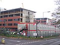 Construction of New Medway Campus - geograph.org.uk - 1033358.jpg 640 × 481; 75 KB
-
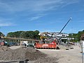 Construction of the new bus station in Chatham (3) - geograph.org.uk - 2396188.jpg 3.072 × 2.304; 2,27 MB
-
 Construction site on Eldon Street - geograph.org.uk - 4452774.jpg 4.608 × 3.456; 4,45 MB


.jpg)


_-_geograph.org.uk_-_2873553.jpg)


.jpg)


.jpg)


_-_geograph.org.uk_-_2757398.jpg)


_-_geograph.org.uk_-_2312480.jpg)


_-_geograph.org.uk_-_2396188.jpg)

_banner_View_from_Rochester_Castle.JPG)