Category:Chaudière-Appalaches
Перейти до навігації
Перейти до пошуку

Français : La région Chaudière-Appalaches est l'une des 17 régions administratives du Québec
administrative region in Quebec, Canada | |||||
| Завантажити медіафайл | |||||
| Є одним із | |||||
|---|---|---|---|---|---|
| Місце розташування | Квебек, Канада | ||||
| Кількість населення |
| ||||
| Площа |
| ||||
| офіційний сайт | |||||
 | |||||
Підкатегорії
Показано 30 підкатегорій із 30.
A
B
C
- Guillaume Couture (5 F)
E
G
I
L
M
- Massif du Sud (7 F)
N
P
R
- Rivière de la Grande Coudée (2 F)
- Rivière du Loup (Chaudière) (1 F)
- Rivière Shenley (2 F)
S
- Saint-Georges Aerodrome (2 F)
T
- Rivière Trois-Saumons (2 F)
Файли в категорії «Chaudière-Appalaches»
Показано 50 файлів цієї категорії (із 50).
-
 Gabriel Elzéar Taschereau.jpg 943 × 1200; 368 КБ
-
 Barrage Grand lac St-Francois.jpg 1281 × 977; 159 КБ
-
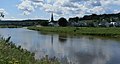 Beauceville-ouest.jpg 3345 × 1778; 656 КБ
-
 BrasSt-Nicolas.jpg 4608 × 3456; 1,16 МБ
-
 Centre CulturelMarie-Fitzbach.jpg 3689 × 2117; 942 КБ
-
 Centre-ville de Montmagny, Rue St-Jean-baptiste est - le 4 juin 2021.jpg 1920 × 1080; 1,43 МБ
-
 Chaudiere-Appalaches Localisation.svg 2000 × 2437; 1,77 МБ
-
 Chaudiere-appalaches.PNG 421 × 483; 15 КБ
-
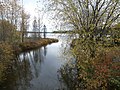
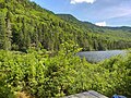
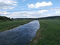
 Paysage Chaudiere-Appalaches.jpg 1023 × 631; 132 КБ
-
 Chaudière-Appalaches topo.png 400 × 505; 350 КБ
-
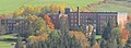
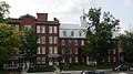 Couvent Saint-Alphonse de Thetford Mines.jpg 3806 × 2139; 880 КБ
-
 DechargelacEtchemin.jpg 4608 × 3456; 2,9 МБ
-
 EmbacleChaudiere.jpg 2592 × 1680; 570 КБ
-
 Frontiere des Appalaches entre Québec et U.S.A. vue du sommet du Mont Mégantic..JPG 2592 × 1944; 1,21 МБ
-
 Icone Chaudiere-Appalaches (QC).svg 512 × 414; 4 КБ
-
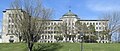
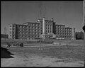 L'Hôpital, Saint-Georges de Beauce, 1954.jpg 1500 × 1196; 260 КБ
-
 Lac-Etchemin.jpg 4255 × 2622; 987 КБ
-
 LacDesAbenaquis.jpg 4504 × 3318; 1,06 МБ
-
 LacEtchemin3.jpg 4608 × 3456; 920 КБ
-
 Le mont Bélanger à l'est du Lac-Emilie.jpg 3612 × 2709; 1,8 МБ
-
 LeGrandSault(riviereChaudiere).jpg 4365 × 2570; 1,36 МБ
-
 Mont-midi.jpg 4582 × 3422; 958 КБ
-
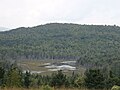 Mud-pond.jpg 4608 × 3456; 1,36 МБ
-
 Pont couvert.jpg 4608 × 3456; 1,49 МБ
-
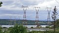 Pylome 735 KW Levis-Ile D'orleans.jpg 1621 × 916; 158 КБ
-
 Quebec MRC Les Appalaches location map.svg 1630 × 2000; 500 КБ
-
 Riviere Metgermette pont route 173.jpg 4608 × 3456; 1,67 МБ
-
 Riviere-au-pin.jpg 4608 × 3456; 2,85 МБ
-
 Riviere-Coulombe.jpg 4608 × 3456; 2,08 МБ
-
 RiviereBrasSaint-Victor.jpg 4576 × 3327; 2,4 МБ
-
 RiviereBrasSt-Victor.jpg 4608 × 3456; 1,27 МБ
-
 RiviereDesFermes.jpg 4608 × 3456; 2,87 МБ
-
 RiviereFamine6.jpg 4608 × 3456; 2,18 МБ
-
 RiviereGilbert.jpg 4608 × 3456; 2,35 МБ
-
 RiviereVeilleux.jpg 4608 × 3456; 1,94 МБ
-
 RivièreALaTruite.jpg 4608 × 3456; 2,02 МБ
-
 RivièreEtchemin.jpg 4608 × 3456; 2,34 МБ
-
 Saint-Benjamin.jpg 4001 × 2765; 961 КБ
-
 Hiver Saint-Georges-de-Beauce.jpg 1023 × 682; 146 КБ
-
 Saint-Martin-Beauce.jpg 3097 × 2001; 656 КБ
-
 SeminaireSaint-Victor.jpg 3978 × 1461; 846 КБ
-
 SeminaireST.Georges.jpg 4885 × 2076; 1,92 МБ
-
 St-Odilon.jpg 3906 × 2696; 1,06 МБ
-
 St-SimonLesMines.jpg 4412 × 2776; 1,17 МБ
-
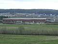
 Quartier Thetford Mines.jpg 1026 × 631; 223 КБ
-
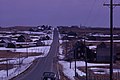
 Thetford Mines 1965.jpg 1023 × 632; 268 КБ
-
 This leaning barn was an award winning 1st prize Canada.jpg 2497 × 1613; 4,89 МБ
-
 Vt 1756 Blanchard&Langdon 1m.jpg 3430 × 3520; 1,16 МБ
-
 École d'arts et métiers Thetford Mines.jpg 1500 × 1190; 150 КБ
-
 École normale de Beauceville, photographie 1953.jpg 1500 × 1200; 886 КБ


.svg)


.jpg)


