Category:Cheaha Mountain
Jump to navigation
Jump to search
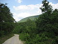
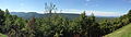
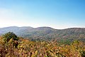
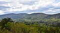
English: Media related to Cheaha Mountain (often called Mount Cheaha), the highest natural point in the U.S. state of Alabama. It is located a few miles north-west of the town of Delta in scenic Cheaha State Park, which contains a lodge, restaurant, and other amenities.
highest point in Alabama, United States  | |||||
| Upload media | |||||
| Instance of | |||||
|---|---|---|---|---|---|
| Located in protected area | |||||
| Location | Cleburne County, Alabama | ||||
| Mountain range | |||||
| Topographic prominence |
| ||||
| Elevation above sea level |
| ||||
 | |||||
Pages in category "Cheaha Mountain"
This category contains only the following page.
Media in category "Cheaha Mountain"
The following 31 files are in this category, out of 31 total.
-
 Alabama4.jpg 1,152 × 864; 582 KB
-
 Alabama8.jpg 1,152 × 864; 583 KB
-
 Bald Rock Cheaha Mountain view.JPG 4,924 × 2,149; 7.81 MB
-
 Cheaha from Kentuck.jpg 2,816 × 2,112; 1.8 MB
-
 Cheaha in the Snow.jpg 2,608 × 1,952; 1.21 MB
-
 Cheaha Lake in the Fall.jpg 2,592 × 1,952; 1.24 MB
-
 Cheaha Mountain 1.JPG 7,365 × 2,107; 13.38 MB
-
 Cheaha Mountain 2.JPG 3,264 × 2,448; 3.27 MB
-
 Cheaha Mountain benchmark.jpg 3,024 × 4,032; 6.76 MB
-
 Cheaha Mountain view 1.JPG 6,823 × 2,095; 9.73 MB
-
 Cheaha Mountain view 2.JPG 6,201 × 2,129; 9.09 MB
-
 Cheaha Mountain view 3.JPG 6,515 × 2,079; 10.67 MB
-
 Cheaha Mountain view 4.JPG 5,816 × 2,107; 9.85 MB
-
 Cheaha Mountain, Alabama - 1501078201.jpg 1,024 × 683; 584 KB
-
 Cheaha Mountain, Alabama - 1501934420.jpg 1,024 × 683; 557 KB
-
 Cheaha Mountain, Alabama.jpg 6,000 × 3,374; 6.78 MB
-
 Cheaha Overlook.jpg 2,608 × 1,952; 1.18 MB
-
 Looking Westward From Parkway.jpg 720 × 480; 47 KB
-
 Mount Cheaha008.jpg 4,928 × 3,264; 11.31 MB
-
 Mount Cheaha010.jpg 4,928 × 3,264; 10.84 MB
-
 Mount Cheaha011.jpg 4,928 × 3,264; 10.27 MB
-
 Observation tower at Cheaha Mountain.jpg 3,024 × 4,032; 5.65 MB
-
 Ola Gay Cotney Cheaha Mtn 1946.jpg 1,895 × 891; 406 KB
-
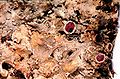
 Pannaria lurida-1.jpg 720 × 472; 66 KB
-
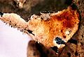
 Pannaria lurida-2.jpg 720 × 475; 80 KB
-
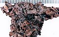
 Pannaria lurida-3.jpg 735 × 501; 66 KB
-
 Pannaria lurida-4.jpg 735 × 503; 51 KB
-
 Pannaria lurida.jpg 720 × 463; 66 KB
-
 Pulpit Rock Looking North.jpg 2,592 × 1,952; 1.3 MB
-
 Sign at Cheaha Mountain.jpg 4,032 × 3,024; 6.14 MB
-
 Walkway View.jpg 720 × 480; 45 KB


