Category:Chelan County, Washington
Vai alla navigazione
Vai alla ricerca
Counties of Washington (state): Adams · Asotin · Benton · Chelan · Clallam · Clark · Columbia · Cowlitz · Douglas · Ferry · Franklin · Garfield · Grant · Grays Harbor · Island · Jefferson · King · Kitsap · Kittitas · Klickitat · Lewis · Lincoln · Mason · Okanogan · Pacific · Pend Oreille · Pierce · San Juan · Skagit · Skamania · Snohomish · Spokane · Stevens · Thurston · Wahkiakum · Walla Walla · Whatcom · Whitman · Yakima
contea statunitense   | |||||
| Carica un file multimediale | |||||
| Istanza di | |||||
|---|---|---|---|---|---|
| Prende il nome da |
| ||||
| Luogo | Washington, Pacifico nordoccidentale, Washington, Stati del Pacifico | ||||
| Capitale | |||||
| Data di fondazione o creazione |
| ||||
| Popolazione |
| ||||
| Superficie |
| ||||
| sito web ufficiale | |||||
 | |||||
Sottocategorie
Questa categoria contiene le 54 sottocategorie indicate di seguito, su un totale di 54.
A
- Argonaut Peak (2 F)
B
C
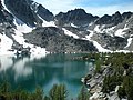
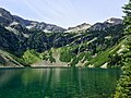
- Colchuck Lake (29 F)
- Coney Lake (3 F)
- Crown Point Mine (8 F)
D
- Domke Lake (1 F)
- Doubtful Lake (14 F)
- Dryden, Washington (9 F)
E
- Eightmile Lake (5 F)
- Entiat River (11 F)
F
- Fern Lake (1 F)
H
I
- Icicle Creek (19 F)
- Icicle Ridge (1 P, 7 F)
K
- Kingsman Mine (1 F)
L
- Lincoln Rock (3 F)
- Lucerne, Washington (7 F)
M
- Manson, Washington (12 F)
- Minotaur Lake (1 P, 11 F)
- Mission Ridge Ski Area (8 F)
- Monitor, Washington (8 F)
P
R
- Rainy Pass (6 F)
S
- Lake Sally Ann (2 F)
- Stehekin River (20 F)
- Stehekin, Washington (12 F)
T
- Telma (16 F)
W
File nella categoria "Chelan County, Washington"
Questa categoria contiene 102 file, indicati di seguito, su un totale di 102.
-
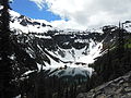 Ann Lake, North Cascades, WA.JPG 4 608 × 3 456; 3,28 MB
-
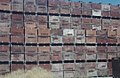 Apple boxes in Leavenworth area, Washington State Highway 2 (1701631067).jpg 1 074 × 701; 120 KB
-

-

-
-
 Azwell WA.jpg 2 651 × 1 894; 2,49 MB
-
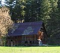 Barn at Chumstick WA.jpg 2 323 × 2 062; 3,53 MB
-
 Between Rainy and Washington Pass (36871032836).jpg 2 048 × 1 536; 2,18 MB
-
 Bridge Creek, a Stehekin River tributary.jpg 276 × 368; 60 KB
-
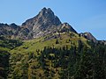
 Cardinal Peak Chelan Mountains.jpg 4 000 × 3 000; 5,77 MB
-
 Chelan County, WA, USA - panoramio - iquanyin moon.jpg 1 008 × 1 600; 415 KB
-
 Cliff Jumping-July 09-LK Chelan - panoramio.jpg 3 264 × 2 448; 1,63 MB
-
 Clouds clearing Indian Head Peak (5037762783).jpg 1 864 × 536; 86 KB
-
 Coney Lake (1).jpg 1 600 × 1 200; 652 KB
-
 Coney Lake.jpg 1 200 × 1 600; 561 KB
-
-
-
 DOMKE FALLS - panoramio.jpg 3 264 × 2 448; 2,96 MB
-
 DOMKE FALLS CAMPGROUND - panoramio.jpg 3 264 × 2 448; 2,58 MB
-
 Entiat Year Rock (9659658874).jpg 4 608 × 3 456; 5,98 MB
-
 Erythranthe guttata in Icicle Canyon, Chelan County Washington 2.jpg 3 968 × 2 232; 3,45 MB
-
 Eyes (140376345).jpeg 1 536 × 2 048; 867 KB
-
 FLICK CREEK CAMPGROUND - panoramio.jpg 3 264 × 2 448; 2,57 MB
-
 FMIB 34428 Dumptkys Lake, Chelan County.jpeg 1 038 × 594; 127 KB
-

-

-
 From The Farside (140376349).jpeg 2 048 × 1 536; 751 KB
-
 Heather Pass WA panorama.tiff 9 190 × 2 988; 78,57 MB
-
 Holden Dining Hall.png 640 × 480; 641 KB
-
 Icy Mountains (Unsplash k7XWLQN-f9g).jpg 6 016 × 3 551; 15,35 MB
-
 Lake Lanham (140376365).jpeg 1 536 × 2 048; 567 KB
-
 Lake Runoff (140376333).jpeg 2 048 × 1 536; 997 KB
-

-
-
 Lodge Two.png 640 × 480; 730 KB
-
 Looking Southwest after crossing Columbia River - Flickr - brewbooks.jpg 4 288 × 2 416; 5,05 MB
-
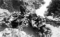
 LST-542.jpg 498 × 303; 22 KB
-
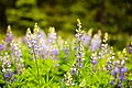
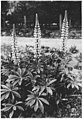 Lupinus, Leavenworth, Wenatchee, Washington, 1920 - NARA - 299126.jpg 2 089 × 3 000; 1,76 MB
-

-
 Map of Washington highlighting Chelan County.svg 5 936 × 3 863; 215 KB
-
 Michael cranking out some breakfast - Flickr - brewbooks.jpg 3 887 × 2 739; 3,86 MB
-
 Mile 4 Pot Peak, Trail 1266 - Flickr - brewbooks.jpg 4 288 × 2 416; 2,61 MB
-
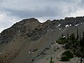
 Mission Ridge in 2010 from Chair 1.jpg 2 272 × 1 704; 1,61 MB
-
 Morning in the Cascades.jpg 3 264 × 2 448; 2,09 MB
-
 Mount Goode seen from Mount Logan, Washington, 1926 (WASTATE 1725).jpg 768 × 599; 112 KB
-
 Mountaineer Creek - Flickr - brewbooks.jpg 4 128 × 3 096; 3,36 MB
-
 Mountains near Lake Chelan, ca 1903-1911 (WASTATE 2445).jpeg 768 × 565; 57 KB
-
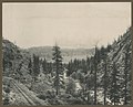 Mountains near Leavenworth, ca. 1900 - DPLA - e5c2e2fcef4d7b2a8f2eb83d560cfc9e.jpg 5 645 × 4 546; 3,62 MB
-
 Mule Deer Showdown ( 1 of 5) - Flickr - brewbooks.jpg 4 288 × 2 416; 3,35 MB
-
 Mule Deer Showdown ( 3 of 5) - Flickr - brewbooks.jpg 3 595 × 1 786; 1,94 MB
-
 Mule Deer Showdown ( 5 of 5) - Flickr - brewbooks.jpg 4 288 × 2 416; 3,28 MB
-

-
 NH 84858 USS CHELAN COUNTY (LST-542).tif 6 242 × 4 822; 28,73 MB
-
 Northern Flicker Red-shafted - Flickr - GregTheBusker (1).jpg 3 072 × 2 304; 1,47 MB
-
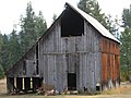 Old Barn Near Plain, WA.jpg 3 264 × 2 448; 3,83 MB
-
 Pass at Lake Ann - Flickr - brewbooks (1).jpg 3 264 × 2 448; 3,44 MB
-
 Pass at Lake Ann - Flickr - brewbooks (2).jpg 3 264 × 2 448; 3,31 MB
-
 Pass at Lake Ann - Flickr - brewbooks (3).jpg 3 264 × 2 448; 3,34 MB
-
 Pass at Lake Ann - Flickr - brewbooks.jpg 3 264 × 2 448; 3,97 MB
-
 Pass at Lake Ann with thunderclouds - Flickr - brewbooks.jpg 3 264 × 2 448; 3,02 MB
-
 Pavement Ends - panoramio.jpg 800 × 600; 580 KB
-
 Percheron Horses - panoramio.jpg 2 048 × 1 536; 1 024 KB
-
 Pete and I on Pot Peak - Flickr - brewbooks.jpg 2 403 × 2 059; 1,57 MB
-
 Pleopsidium - Flickr - brewbooks.jpg 3 264 × 2 448; 4,11 MB
-
 Pot Peak, Trail 1266 - Flickr - brewbooks.jpg 2 416 × 4 288; 2,75 MB
-
 Purple Flowers -2 (22116370105).jpg 5 472 × 3 648; 6,71 MB
-
 Rainbow Falls near Stehekin Washington.JPG 2 304 × 3 072; 2,25 MB
-
 Rainy Lake (19993502541).jpg 2 500 × 1 875; 1,92 MB
-
 Rocks at Lake Ann Pass - Flickr - brewbooks.jpg 3 264 × 2 448; 5,01 MB
-
 Rocks rearranged at Lake Ann Pass - Flickr - brewbooks.jpg 3 264 × 2 448; 4,79 MB
-
 Sandalee Glacier.jpg 2 988 × 1 684; 1,62 MB
-

-
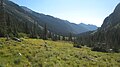 Spider Meadow.jpg 3 072 × 1 728; 2,77 MB
-
 Stehekin in 1989 (1666878653).jpg 948 × 621; 344 KB
-

-
 Stopped by snow on our way to Devil's Backbone - Flickr - brewbooks.jpg 4 288 × 2 416; 3,97 MB
-
 Street Scene, Cashmere, WA (c.1940's).jpg 2 008 × 1 237; 657 KB
-
 Stuart Range view - Flickr - brewbooks (1).jpg 4 128 × 3 096; 3,2 MB
-
 Stuart Range view - Flickr - brewbooks.jpg 4 128 × 3 096; 3,2 MB
-
-
-
-
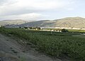
 Sunnyslope, WA 98801, USA - panoramio.jpg 1 440 × 1 080; 551 KB
-
 Sunset - heading west to Chelan - Flickr - brewbooks.jpg 4 288 × 1 982; 2,64 MB
-
 Tall Trees (140376367).jpeg 1 536 × 2 048; 1,27 MB
-
 Tanya and Pete - enjoying the view at Wapato Point - Flickr - brewbooks.jpg 3 512 × 3 165; 3,08 MB
-

-
 The Trail To Lake Lanham (140376389).jpeg 2 048 × 1 536; 814 KB
-
 The Wind Will Blow ^ It Blew Hard - panoramio.jpg 3 264 × 2 448; 1,93 MB
-
 Top of dry gulch earth dam looking west - panoramio.jpg 2 048 × 1 536; 428 KB
-
 Tumwater Canyon (1770332096).jpg 874 × 627; 89 KB
-
 Up Entiat Creek from Entiat (1) (9659663156).jpg 4 608 × 3 456; 5,97 MB
-
 Up Entiat Creek from Entiat (2) (9659665268).jpg 4 608 × 3 456; 5,74 MB
-
 Up Entiat Creek from Entiat (9659661164).jpg 4 608 × 3 456; 6,14 MB
-
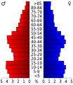 USA Chelan County, Washington age pyramid.svg 520 × 600; 7 KB
-
 Washington - Montesano through Capehorn - DPLA - 994728ec2ee377673660db7ac18358dc.jpg 6 785 × 5 325; 15,86 MB
-
 Washington Pass (1457136893).jpg 1 024 × 768; 702 KB
-
 Waterville, Washington, United States.jpg 800 × 320; 189 KB
-
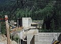
 Wells Dam from Azwell WA.jpg 1 707 × 1 220; 1,18 MB
-
 Wenatchee Confluence.jpg 1 960 × 1 027; 952 KB
-

-
 Winter at Lake Chelan (4557923223).jpg 440 × 584; 65 KB

.jpg)
.jpg)
.jpeg)
.jpeg)


.jpg)


.jpg)

.jpg)
.jpg)


.jpg)

.jpeg)


.jpeg)
.jpg)
.jpeg)

.jpg)
.jpeg)
.jpeg)
.jpg)
.jpg)


.jpeg)


.jpg)

.jpeg)

_-_Flickr_-_brewbooks.jpg)
_-_Flickr_-_brewbooks.jpg)
_-_Flickr_-_brewbooks.jpg)
.jpg)
.jpg)

.jpg)
.jpg)
.jpg)


.jpg)

.jpg)


.jpg)

.jpg)
.jpg)

.jpg)
.jpg)

.jpg)
.jpg)
.jpg)


.jpeg)

.jpg)
.jpeg)


.jpg)
_(9659663156).jpg)
_(9659665268).jpg)
.jpg)


.jpg)


.jpg)
.jpg)
.jpg)